
Daily Sierra Forecast

The Weather Blog

Your daily Truckee and Tahoe forecast, told straight: what today brings, what to do about it, and the day to circle this week. For the construction and climate stories, head to the Blogcast.

Latest Posts

31 posts
Live · Today's Forecast

Writing today's note from live conditions…

Clear, still pre-dawn over the Truckee basin, frost settling in the low ground under a cold pool while wind runs aloft
18 min read
Frost First Thing, Breezy by Lunch

A calm night let cold air pool in the low spots again despite strong wind still blowing overhead, proof the wind has to reach the ground to stir the basin. Monday's freeze forecast holds at 28 to 33 degrees with the footnote on cloud cover shrinking.

0 views
Read more

Forecaster’s Note · Saturday, September 26, 2026

Good morning, Truckee. Our airport sensor read 41.0°F at 4:15 this morning, wind out of the northwest at 3 miles an hour, dewpoint 34, humidity 75 percent, clear skies, ten miles of visibility. That reading is actually the warm end of an eventful night. At 6:49 last evening the airport stood at 60.8 degrees with a south wind blowing 15 miles an hour. The surface wind quit a little after eight o'clock, and by 8:15 the temperature had already fallen to 53.6. By nine it read 50. By 11:15, 44.6. By 1:55 this morning, it bottomed at 35.6, and it sat there until a light northwest drainage breeze stirred it back up to 41 in the last hour. That is eighteen degrees of cooling in six hours. The raw computer forecast had Truckee at 44 degrees at two in the morning. Call it 36 to 40 degrees at seven o'clock this morning. With a dewpoint of 32 to 34 riding right underneath the air temperature, that means frost in the low spots: windshields, the grass edge, the bottom of any drainage swale. This is not a hard freeze, but it is frost.

The paddle has to reach the bottom

Yesterday I told you that wind up around 10,000 feet acts like a paddle stirring the basin, and that with that wind holding 33 to 38 miles an hour overnight, the basin would be only half stirred and the cold pool would struggle to form. I called for 36 to 42 degrees at seven, and I will probably land right in that range. But my reasoning was wrong, and the reasoning is what you use next time, so let me walk through what actually happened.

The wind at that 10,000 foot level blew 37 to 39 miles an hour out of the southwest all night long. It did not matter one bit. The moment the surface wind quit at eight o'clock, the valley floor cut itself off from everything blowing above it, what we call decoupling, and it started bleeding heat straight up into a clear sky, completely indifferent to what was blowing 4,000 feet overhead. Friday morning played out differently for exactly one reason: the southwest wind was on the ground that night, 10 miles an hour gusting to 18 right at the airport, and that ground level wind is what kept the pool from forming. A paddle that never reaches the bottom of the bucket does not stir the bottom of the bucket, no matter how hard you swirl it at the surface.

So here is the rule for this basin going forward: watch the wind at the airport at sunset, not the wind up at the crest. Calm air at the ground by eight o'clock under a clear sky means the pool forms, and historically it has run 8 to 17 degrees colder than the computer grid predicts. The site's own scorecard backs this up: the station's low bias over 65 scored days now sits at 8.9 degrees warm, and the last five mornings have run 13, 13, 17, 4, and, this morning, about 9 degrees under the grid. The one near miss in that stretch was Friday, the one morning with real wind on the ground.

How yesterday's forecast did

The morning low, called 55 to 59 at seven: the airport read 53.6 at 6:50. The wind let go for about ninety minutes right around dawn and the airport slid five degrees before it built back up. That is two degrees under my bottom number, a moderate confidence miss. The afternoon high, called 67 to 69: the airport read 69.8 at 12:49 and again at 2:49, a hair over my range but close enough to call a hit. Humidity, called 28 to 32 percent: the airport read 28 percent at 11:49, a solid hit.

The wind, called 18 to 22 sustained with gusts of 30 to 35. The airport printed 16 knots gusting 28 at 12:49 and 18 knots gusting 30 at 1:47, out of the south-southwest. That is the very bottom of both my sustained range and my gust range. On Friday I told you I was going to stop reading the bottom of the model range on windy days and start reading the top. I did exactly that yesterday, and the wind came in at the bottom anyway. Two days of data, two opposite lessons. The honest read is that the middle of the gust range has actually been the best number to use all week, and that is what I am switching to today. The site's scoring system graded Friday at 91 out of 100, with a low error of only 4 degrees and zero wind error. The Lake Wind Advisory itself verified right at the bottom of its stated range, with gusts reaching 30 miles an hour at the airport.

The big picture

Everything happening around us right now traces back to the same set of ingredients we have been tracking all week: the height of the pressure surface up near 18,000 feet, which tells us whether we sit under a ridge, a lid capping the atmosphere and keeping things calm and dry, or a trough, a dip reaching down out of the jet stream that lets storms and colder air ride in beneath it. We are in the gap between systems this morning, a flattened ridge behind us and a real trough approaching for tomorrow. The lesson from the last two nights is the one to carry forward: whether the cold air pool forms in our basin depends far more on whether the wind actually reaches the ground at sunset than on how hard it is blowing several thousand feet overhead. That single distinction, ground wind versus wind aloft, is going to decide tomorrow morning's temperature too, and I will walk you through exactly how in a moment.

Today: GO, breezy afternoon, no advisory

There is nothing on the board for Truckee this morning. No advisory, no watch, no warning, no Red Flag. The Lake Wind Advisory that covered yesterday expired at eight last night and was not reissued.

The call is GO. Temperature at the airport: 36 to 40 at seven, 57 at nine, 66 at eleven, 68 to 70 from one through three, 67 at four, 63 at six. The range of computer forecasts for today's high reads 66, 67, 68, 69, 69, 69, 69, and 70 degrees, all eight models within four degrees of each other and six of those eight within a single degree, a high confidence read. I am reading 68 to 70. Reno should reach 79, nine to eleven degrees warmer than us, which is about right given the 2,400 feet of elevation difference between the two.

Humidity: 45 percent at eight, 30 percent at ten, 26 to 28 percent from eleven through five. The range of forecasts for today's minimum reads 25, 27, 29, 29, 29, 30, 32, and 33 percent, the American model alone at the dry end with 25. I am reading 26 to 30 percent.

The wind: light southeast drainage flow until nine o'clock, then it swings southwest and fills in. The American model shows 11 miles an hour at ten, 14 at noon, 15 from one through three with gusts of 22 to 24, dropping to 12 by five and down to 3 by seven. The range of gust forecasts reads 24, 25, 27, 29, 30, 34, and 36 miles an hour, the American model at the bottom and the German model at the top. Taking the middle of that range, as I told you I would after yesterday's lesson, I am reading sustained wind of 13 to 16 miles an hour with gusts of 25 to 30, running from eleven this morning through five this evening. Call that a moderate confidence read on the gust.

On the ground: tag lines on picks after ten. Panels and sheet goods on the hook are workable before eleven and after five; in the middle of the day, pick your moments. Tarps strapped down before you leave for lunch. Dust control on the haul roads starting late morning, since nothing has wet them down since the 22nd. Skies are clear at the airport, though the computer grid carries a high cloud sheet across the afternoon, so expect a dim, milky sun. UV runs 6, sunset is 6:50, and pressure is easing down about two millibars through the afternoon ahead of tomorrow's trough.

Fire weather: dry enough to respect, not dry enough to fear

Humidity at 26 to 30 percent with gusts to 30 does not meet Red Flag criteria, and the National Weather Service has nothing posted. The fine fuels are still cured after a week of single digit dewpoints, so the standard rules hold: hot work needs a fire watch and a charged water can, a clear zone downwind, which today means to the northeast of the work, and thirty minutes of eyes on the area after the last spark.

The Floriston Fire is off the board entirely: 622 acres, 100 percent contained, ten days in, and the site drops a fire from the daily watch list once it has held full containment for a week. There is one new start to note: the Goni Fire, found yesterday afternoon 25 miles east-southeast of us near Carson City, 25 acres, containment not yet reported. Today's southwest wind carries its smoke to the northeast, away from our basin. If you see a smoke column over the Carson Range this afternoon, that is where it is coming from. Air quality reads 30 this morning, Good, with fine particulate at 1.6 micrograms, drifting up to about 40 by evening. Clean air today.

Sunday the 27th: the trough, and a windy one

The pressure height near 18,000 feet runs about 5,785 meters this morning and falls to about 5,680 meters by Monday dawn. The air at the 10,000 foot crest level cools from 42 degrees now to 34 degrees by Monday morning. That is the trough working through.

Sunday morning, the wind at that crest level climbs to 42 to 45 miles an hour by dawn, and the computer grid keeps a light wind at the ground overnight, with gusts of 14 to 16 miles an hour. Here is where this morning's lesson comes back into play directly: if that surface wind actually shows up at the ground, Sunday dawn mixes out the way Friday morning did. If it does not reach the ground, it pools the way this morning did. By the very rule I just walked you through, I will not know which outcome we get until I can check the airport wind at sunset tonight. I am reading 38 to 46 degrees for Sunday morning, a moderate confidence call. Check the airport wind reading around eight tonight; calm air there means you should lean toward the bottom of that range.

Sunday afternoon should reach 62 to 65 degrees. The model range reads 61, 62, 63, 64, 64, 64, 65, and 65. Reno should reach 74. The American model shows southwest wind of 17 to 18 miles an hour sustained from noon to three, with a gust range of 25, 27, 27, 28, 30, 32, and 36 miles an hour. I am reading gusts of 28 to 33, which makes Sunday the windiest afternoon of the next ten days. Tag lines from ten, and nothing with sail area on the hook from eleven to four. Humidity runs 29 to 34 percent. The German model squeezes out two hundredths of an inch of rain; no other model shows anything at all. Not enough to settle dust, let alone wet a trench.

Monday the 28th: circle it. The freeze is still on, and the footnote shrank

Sunday evening the wind aloft falls apart: 27 miles an hour at eight, 19 at ten, down to 7 by four Monday morning. The surface wind goes calm by nine Sunday night. Cold air behind the trough, calm at the ground, a basin dried out by three straight windy days. By the rule this morning taught us, that is a pool, and a cold one.

The range of computer forecasts for Monday's low reads 36, 36, 37, 43, 43, 44, 44, and 47 degrees, the American and British models both at the bottom. Applying the roughly 8 to 17 degrees this basin gives back on calm, clear nights, that works out to 28 to 33 degrees at the airport at seven on the morning of the 28th. That call holds steady.

The footnote from yesterday has shrunk. The British model's 0.22 inches of rain is gone; the British model is dry now. What is left is the European model at 0.05 inches, the German at 0.02, the Chinese model at 0.01, and a shower chance of about 18 percent from midnight to four in the morning. The computer grid carries cloud cover from midnight to about two, then clears it out by four. So the real risk is not rain, it is a cloud deck sitting over the basin for the first half of the night, which would hold heat in and shave the bottom off the freeze. If it clears by four, there are still three hours of clear sky radiating heat away before seven, which is enough to get comfortably under 32 degrees in this basin.

Here is what to do about it. Blankets go on Sunday night on anything poured Friday through Sunday. Drain the water truck, the wash out tank, and the trench pump lines Sunday evening. Anything holding water in a low spot freezes first. If you have a pour scheduled Monday morning, push the start time past nine and check the subgrade for frost before the truck shows up. Monday's high should run 64 to 68 degrees, with light wind turning northeast and humidity of 19 to 25 percent. High confidence on a cold morning; moderate confidence on whether it lands at 28 or 33.

The week ahead

Behind Monday's trough, the flow aloft turns northeast that night, running 18 to 30 miles an hour at the crest level. That is offshore flow, dry air sliding downhill off the Great Basin toward us, though at the airport itself it should stay light. Tuesday the 29th dawn: the model range for that low runs 37 to 49 degrees, which works out to 30 to 35 degrees at the airport. I am penciling in a second frost morning. Tuesday's high should reach 71 to 74 degrees, with the American model running warmer at 78. Humidity 13 to 18 percent.

Wednesday the 30th should reach 77 to 82 degrees. Humidity runs 8 to 14 percent, the British model at the dry end with 7. Wind stays light. That is the driest air of this whole stretch, arriving on a calm day rather than a windy one.

Precipitation signals

There is essentially no rain signal on the board through the coming week beyond the small Monday morning shower chance discussed above, which itself has been shrinking model run over model run: the British model's earlier 0.22 inches has vanished entirely, leaving only traces from the European, German, and Chinese models. That shower band matters far more for what it does to Monday's cloud cover, and therefore Monday's freeze, than for any actual water it might put on the ground. Beyond Monday, every model keeps the week completely dry.

Looking further out

October 1st is worth circling in pencil. Highs should run 74 to 81 degrees, with humidity 7 to 16 percent, the European model at the driest end with 7. The American model shows sustained wind of 15 miles an hour that day, and the German model shows gusts to 34, the European model 24. Single digit humidity paired with gusts in the 20s is exactly the combination that makes a spark travel a long way, and while only two of the models show that wind and three do not, and it sits five days out, it is worth flagging now. This is a low confidence read, but if you have hot work planned on an exposed site, plan it for Tuesday or Wednesday instead and keep Thursday flexible.

October 2nd through the 4th brings the ridge back in fully: highs of 72 to 84 degrees, humidity 7 to 22 percent, light wind, with the American model running the warmest at 84 on the 4th.

Here is where it gets genuinely unsettled. Yesterday the American and Japanese models dropped a cold trough into October 3rd and 4th while the European model held the ridge. This morning it is exactly backwards. The American model now runs 75, 77, and 84 degrees for October 2nd through 4th, and the Japanese model runs 72 to 80. The European model is the one dropping a trough now, a day later than the others had it: 80 degrees on the 4th, then 65 on October 5th with 0.12 inches of rain and humidity jumping to 52 percent. When the American and European models trade their entire forecasts from one computer run to the next, that tells you neither one actually has a handle on it yet. There is a trough somewhere in the first week of October; nobody knows which day it lands. This is a low confidence, long range signal only. If you are planning a pour for that weekend, keep watching it, but do not plan around it yet.

Seasonal outlook and climate

Stepping back from the week ahead, it is worth talking about the winter taking shape behind all of this, because Errol's Godzilla El Nino series has been tracking exactly this pattern since June. As of NOAA's Climate Prediction Center update on September 10th, the nation's official forecasting agency has El Nino strengthening, with better than a 90 percent chance of a very strong event developing this fall and winter, and a 75 percent chance it becomes a historic event, stronger than anything on record back to 1950, up from a 69 percent chance in their update a month earlier. The water readings behind that call: the patch of the central Pacific meteorologists watch most closely read 1.8 degrees Celsius above normal on NOAA's newer measuring scale, the region closer to South America read 2.5 degrees above normal, and right along the coast of South America the water ran 3.4 degrees above normal at the surface, with water more than 10 degrees above normal at depth. Westerly wind anomalies near the surface and suppressed rainfall over Indonesia both fit that same picture. Columbia University's monitoring group had that central Pacific reading as high as 3.0 degrees above normal in the middle of September, and every one of the twenty two computer models that group tracks keeps a very strong El Nino running through the entire winter. NOAA's next official update comes October 8th, and I will pass along whatever it says the moment it is out.

What does a very strong El Nino actually mean for us here around Truckee and Lake Tahoe? Historically, it loads the dice, but it does not guarantee a huge winter on its own. The winter of 1982 into 1983 was an all time monster season here during a strong El Nino. But 2015 into 2016 was also a so called super El Nino, and it delivered a decent, but far from record, season in the northern Sierra. Southern California tends to see the more reliable rainfall boost from a strong event; the benefit up here in the northern Sierra is real, but considerably less certain. What a very strong El Nino reliably does supercharge is the subtropical jet stream, the river of fast moving air that steers storm systems into California from the southwest. That tends to mean warmer, wetter storms, a higher chance of what meteorologists call atmospheric river events, higher snow levels at times during those storms, and, worth saying plainly this early in the season, a real risk of rain falling on top of existing snowpack rather than adding to it, especially down near lake level. None of that changes anything about tomorrow's forecast, but it is exactly the backdrop I will keep coming back to as we move deeper into fall and into the heart of ski season.

Circle the date

Circle Monday the 28th. That is the day the cold air that has been building behind this week's wind finally settles all the way to the valley floor with nothing left to stir it, the way cold water settles and pools in the bottom of a bowl once you stop stirring it. Frost first thing, likely 28 to 33 degrees at the airport, and by midday the wind should already be building back in, so plan for a breezy afternoon on the other side of a cold, still morning.

The call

Today is a GO day. Frost sits in the low spots this morning, 36 to 40 degrees at seven, the pool formed the moment the ground wind quit last night even with 38 mile an hour wind still blowing overhead. Today's high reaches 68 to 70 degrees, humidity 26 to 30 percent. Southwest gusts of 25 to 30 run from eleven to five: tag lines after ten, tarps strapped, water the roads. Sunday brings 62 to 65 degrees and the windiest afternoon of the week, gusts 28 to 33. Circle Monday the 28th: 28 to 33 degrees at the airport, frost first thing and breezy again by lunch. Blankets on, and drain the water Sunday evening. Pencil a circle around October 1st too, for a return of dry air and wind together.

From the base of Palisades, that's your weather.

Errol Kerr, Olympic ski racer, excavation foreman, and the guy who checks the sky before the crew shows up.

Wind-stirred clear dawn over the Truckee basin, a high cirrus sheet spreading in from the southwest ahead of a trough
18 min read
The Cold Pool Broke at Midnight: Wind Advisory Through Tonight

A strong southwest wind mixed warm air all the way to the valley floor overnight, breaking the week's cold pool pattern and leaving no frost this morning. A Lake Wind Advisory covers today, and Monday's freeze forecast stays inked with a footnote on cloud cover.

0 views
Read more

Forecaster’s Note · Friday, September 25, 2026

Good morning, Truckee. Our airport sensor read 59.0°F at 4:15 this morning, with a southwest wind blowing 10 miles an hour and gusting to 18, dewpoint 32, humidity 36 percent, clear skies, ten miles of visibility. At 11:55 last night it read 51.8°, dead calm, riding the same slide every night this week has followed. Then at 12:15 the wind arrived, first out of the southeast, then swinging south, and by 12:35 the airport had jumped seven degrees in forty minutes, up to 59. It has sat between 59 and 61 all night since. The cold pool broke at midnight. Call it 55 to 59 degrees at seven o'clock this morning. No frost. The raw computer forecast has Truckee at 52 degrees, so for the first time in more than a week, the airport is running warmer than the computer grid at dawn, not nine degrees colder the way it has been running.

Here is the physics behind it, because it is the whole story of the next four days. The wind up around 10,000 feet has been blowing 40 to 43 miles an hour all night out of the southwest, with the air at that altitude sitting at 43 degrees. Once wind that strong reaches the ground, it stirs the valley basin top to bottom. Bring air that started at 43 degrees down 4,000 feet, and it warms about five and a half degrees for every thousand feet it descends, simple compression, the same reason your ears pop and the air feels warmer as you drive down off a mountain pass. That is how you land on 59 degrees at four in the morning in late September. The cold pool cannot form when the whole basin is being stirred with a paddle.

And a correction, in the other direction this time. Yesterday I called this morning's low at 40 to 45 degrees and flagged it as a moderate confidence read. I was scared of the cold pool after missing Thursday morning on the warm side, so I shaded my number low. The airport is running fourteen degrees over my top number. The cost of a miss like that is some blankets that did not need to stay on, which is the cheap direction to be wrong in, but it is still wrong, and you should know it so you can weigh tonight's number appropriately.

How yesterday's forecast did

The morning low, called 31 to 34 at seven: the airport read 32.0 at 6:35 and 33.8 at 6:50. High confidence hit. The afternoon high, called 77 to 79: the airport read 78.8 at 12:49, 1:48, and 2:49. High confidence hit. Humidity, called 15 to 17 percent: the airport read 17 percent from 11:48 through 2:49. High confidence hit. No thunder, as called, and none came.

The wind, called 15 to 18 sustained with gusts of 25 to 30. The airport read 18 knots out of 220 degrees at 2:49 and 19 knots out of 190 at 4:48, which converts to 21 to 22 miles an hour sustained, three to four miles an hour over my top number. The station printed gust groups of only 18 knots, then 21 miles an hour, and on the hours reading 18 and 19 knots sustained it printed no gust group at all, meaning nothing ran more than ten knots over sustained. So the gusts themselves stayed under 32 miles an hour. Sustained wind ran over my forecast, gusts stayed inside it. That is the third day in four that the airport has run over the computer's raw guidance on sustained wind whenever the wind up around 10,000 feet has been above 20 miles an hour. I told you yesterday I would stop reading the bottom of the model range on those days. Starting today, I am reading the top.

The site's own scoring system graded yesterday 71 out of 100, with a seventeen degree error on the morning low. That is Thursday morning's cold pool measured against a computer grid that was sitting in the high 40s. The station's low bias over 64 scored days is now 9.5 degrees warm, up from 8.3, and the last three mornings have run 13, 13, and 17 degrees under the grid. Autumn is widening this pool night by night. This morning is the exception that proves exactly how it works: the pool is a calm night animal, and last night was anything but calm.

The big picture

Everything about the next several days traces back to one number: the wind blowing at the level of the crest, roughly 10,000 feet up, the altitude where meteorologists track pressure in millibars and watch the height of a surface up near 18,000 feet to tell whether we sit under a ridge, a lid capping the atmosphere and keeping things calm, or a trough, a dip out of the jet stream that lets storm systems and colder air ride in underneath it. We are caught between those two right now, with a trough approaching from the Pacific and wind aloft running strong ahead of it. When that wind is strong enough and reaches all the way to the ground, as it did last night, it acts like a paddle stirring a bowl, mixing warmer air from aloft down into the valley floor and preventing the cold pool from ever forming. When that wind stays up high and the ground goes calm, the valley floor cuts itself off from everything above it, what we call decoupling, and cold air drains downhill and pools in the bottom of our basin the way water finds the low point in a bowl. The difference between last night and every night before it this week was entirely that one variable: wind on the ground, not just wind aloft.

Today: caution on the exposed work, GO on the rest

The National Weather Service has a Lake Wind Advisory up for the greater Lake Tahoe area and the eastern Sierra counties from eight this morning until eight tonight: southwest wind 10 to 20 miles an hour, gusts to 35, waves 1 to 3 feet on the lake itself. That is the only official product on the board. No watches, no warnings, no Red Flag.

Our own call for the crew is CAUTION, and that is the right word for it: dirt work is GO all day, and anything with sail area, height, or water underneath it needs to be built around the wind. Temperature: 55 to 59 at seven, 61 at nine, 65 at eleven, 67 to 68 from one through three, 64 at five, 57 at seven this evening. The range of computer forecasts for today's high reads 67, 67, 68, 68, 68, 68, and 69 degrees, all seven reporting models within a degree and a half of each other. I am reading 67 to 69, ten degrees cooler than yesterday. Reno should reach 75.

Humidity: 39 percent at eight, 30 to 32 percent from ten through two, 35 at three, 41 at five. The forecast range for today's minimum reads 22, 28, 29, 30, 30, 32, and 34 percent, the Japanese model alone at 22. I am reading 28 to 32 percent, a full step wetter than yesterday's 17.

The wind: the American model has it southwest at 12 by nine, 16 at eleven, 17 to 18 sustained from noon through three with gusts of 27 to 30, still 15 sustained gusting 25 by five, down to 7 by seven. The range of gust forecasts reads 30, 31, 34, 35, and 45 miles an hour, the American and French models at the bottom, the British and Canadian in the middle, and the German model standing alone at 45. The National Weather Service itself is calling for 35. Given that the airport ran four miles an hour over the American model's number yesterday with half of today's wind aloft, I am reading 18 to 22 sustained with gusts of 30 to 35, running from nine this morning to six this evening. That is a moderate confidence read on the gust, and the German model's 45 is the number to rig for if you have anything on an exposed ridge.

On the ground: tarps and loose sheeting strapped down before eight. Tag lines on every pick from eight on, and nothing with real sail area on the hook from ten to five, no panels, no forms, no sheets of plywood, no trench boxes coming off a trailer broadside. Dust control all day; the haul roads have not seen rain since the 22nd, and a 30 mile an hour gust off a dry cut will put a visible plume across the highway. Stake down the porta johns. If you have a crew on the water or a barge on Lake Tahoe, get off it before the gusts build and do not plan on the lake this afternoon at all. Pressure is falling: the airport altimeter read 30.23 at nine yesterday morning and 30.11 now, about four millibars down ahead of the trough. Expect a solid deck of high cloud all day, off the jet stream, dimming the sun. UV 6, sunset 6:52.

Fire weather: the wind is up, but so is the humidity

This is the flip side of yesterday. Yesterday had 17 percent humidity and 21 mile an hour sustained wind. Today has 30 percent humidity and gusts to 35. That is not Red Flag weather, and the National Weather Service agrees. But a spark still travels a long way riding a 35 mile an hour gust, so today the rules shift from humidity rules to distance rules: hot work needs a fire watch and a charged water can, plus a wide clear zone downwind, which today means to the northeast of the work. No grinding with a dry grass edge anywhere downwind, and thirty minutes of eyes on the tail after the last spark. The fine fuels are still cured and dry after a week of single digit dewpoints, so none of that caution goes away just because the humidity ticked up.

The Floriston Fire is now 622 acres and 100 percent contained, ten miles east northeast, nine days into it. Today's southwest wind blows from us toward it. It is contained, and a 35 mile an hour gust is exactly the kind of wind that tests a contained line, so crews out there will be walking it today, but it poses no threat to our basin. Pinto, the small new start we were watching yesterday, is off the board entirely. There is no other wildfire burning within a hundred miles of us this morning.

Air quality reads 61 this morning, Moderate, with fine particulate at 7.6 micrograms. Yesterday I told you the southwest flow would push that number to 64 by nine this morning. The model now shows it peaking closer to 74 around nine, then dropping into the 40s by three this afternoon as the afternoon mixing kicks in, and down into the 30s by Saturday. That is haze riding in on the jet stream from west of our crest, not a local fire. If you are sensitive to air quality, save the heavy breathing work for after noon.

Tonight and tomorrow: the wind drops, the pool tries to come back

The surface wind quits sometime between eight and ten tonight. The wind up at the crest level does not: it holds 33 to 38 miles an hour overnight. That is a half stirred basin. Last night ran better than 40 miles an hour aloft, and the pool never had a chance. Thursday morning ran only 22 miles an hour aloft with calm air at the ground, and the pool won by nine degrees. Tonight sits between those two cases. The range of computer forecasts for tomorrow's low reads 40, 44, 44, 47, 48, 53, and 54 degrees, the British model the coldest of the group. I am reading 36 to 42 degrees at the airport at seven tomorrow morning, a moderate confidence call. Put blankets on anything poured today. If the airport is still reading over 45 degrees at midnight, the stirring is winning and it will run warmer than that.

Saturday the 26th should reach 68 to 71 degrees, model range 68, 68, 68, 68, 69, 70, and 71. Reno reaches 78. Southwest wind again, 13 at ten, 15 to 16 from eleven through three with the American model gusting 23 to 25. The gust range reads 25, 25, 29, 30, and 40. Taking the top of the range per today's lesson, I am reading gusts of 28 to 32. Humidity 24 to 30 percent. Breezy, dry, and fully workable. Tag lines after ten.

The week ahead

Sunday the 27th is the bottom of the approaching trough. The pressure height around 18,000 feet falls from 5,800 meters this morning to about 5,665 meters by Monday dawn, and the air at the crest level cools from 43 to 35 degrees. The wind up there runs 47 to 49 miles an hour at dawn Sunday, so Sunday morning should mix out the same way this morning did: read 38 to 44 degrees. Sunday's high reaches 60 to 66 degrees, model range 60, 63, 63, 63, 64, 64, and 66, the British model the coldest. Gusts run 22 to 37 miles an hour, the German model on top. The German and European models squeeze out a trace to five hundredths of an inch, not enough to wet down a trench.

Then Sunday evening the wind aloft collapses: 19 miles an hour at six, 14 at midnight, 1 mile an hour by three Monday morning. Skies clear to 6 percent cloud cover by nine. Cold air, clear sky, no wind, a basin dried out by four straight windy days: that is the recipe for a hard freeze. The range of computer forecasts for Monday's low reads 34, 43, 44, 45, 45, 46, and 46 degrees, the American model alone at the bottom. Applying what this basin has given back on calm nights lately, 9 to 17 degrees, that works out to 28 to 33 degrees at the airport at seven on the morning of the 28th. That call holds.

Here is the footnote, and it matters. The British model puts 0.22 inches of rain on Monday, the European 0.05, the Canadian 0.03, and the raw computer grid carries a 19 percent chance of a shower by six Monday morning. That would be a shower band riding through on the trailing edge of the trough overnight. If it shows up, it brings cloud cover, and cloud in this situation is a lid working the other direction: it holds heat in and kills the freeze. Four of the models keep it bone dry. So the call is a hard freeze on the 28th if the sky stays clear at midnight Sunday, and I want you to look up before you drain anything. Blankets go on Sunday night regardless, on anything poured Friday through Sunday. Drain the water truck, the wash out tank, and the trench pump lines Sunday evening unless you can see stars overhead with no cloud in sight. High confidence on the freeze if the sky is clear; low confidence on whether it stays clear. Monday's high should run 60 to 68 degrees, the British model the cold outlier again at 60 with its rain.

Tuesday the 29th dawn stays just as still and clear. The model range for that morning's low runs 39 to 49 degrees on the grid, which works out to 30 to 35 at the airport. I am penciling in a second freeze morning. Tuesday's high should reach 70 to 74 degrees, with the American model alone running warmer at 79.

Precipitation signals

The only precipitation signal anywhere on the board through the next week is that Monday morning shower band, and it is a genuine split decision among the models: the British model wants 0.22 inches, the European 0.05, the Canadian 0.03, but four other models keep the entire period bone dry. If that shower band shows up, it is a light, brief event tied directly to the back edge of Sunday's trough, and its only real consequence for us is whether it keeps enough cloud in place to blunt Monday's freeze. There is no meaningful rain signal beyond that anywhere in the next ten days.

Looking further out

Wednesday the 30th should reach 76 to 80 degrees, all six reporting models within four degrees of each other, humidity 10 to 17 percent, the American model at the dry end with 10. October 1st looks similar, 72 to 76 degrees, humidity 10 to 25 percent.

Past that, the models stop agreeing with each other entirely. The European model holds the ridge in place: 76 to 77 degrees on October 2nd and 3rd, 72 on the 4th. The American and Japanese models drop a cold trough in instead: the American model goes 67, then 61, then all the way down to 50 degrees on October 4th with a low of 23 degrees. The Japanese model goes 58 and then 46. The Canadian model sits in between the two camps. That is a thirty degree spread by day nine. When the American and Japanese models both find the same cold trough and the European model shows nothing at all, that is worth watching closely, but it is not worth planning around yet. The European model also shows seven hundredths of an inch of rain on the 4th, the first real rain signal anywhere on our board in a week. If you are planning a pour for the first weekend of October, keep an eye on this one.

Seasonal outlook and climate

Stepping back from the day to day pattern, it is worth talking about the winter taking shape behind all of this. As of NOAA's Climate Prediction Center update on September 10th, the country's official forecasting agency has El Nino strengthening, with better than a 90 percent chance of a very strong event developing this fall and winter, and a 75 percent chance it becomes a historic event, stronger than anything on record back to 1950, up from a 69 percent chance in their update a month earlier. The water readings behind that call: the patch of the central Pacific meteorologists watch most closely read 1.8 degrees Celsius above normal on NOAA's newer measuring scale, the region closer to South America read 2.5 degrees above normal, and right along the coast of South America the water ran 3.4 degrees above normal at the surface, with water more than 10 degrees above normal at depth. Westerly wind anomalies near the surface and suppressed rainfall over Indonesia are both consistent with that picture. Columbia University's monitoring group had that central Pacific reading as high as 3.0 degrees above normal in the middle of September, and every one of the twenty two computer models that group tracks keeps a very strong El Nino running through winter. NOAA's next official update comes October 8th.

What does that mean for us here around Truckee and Lake Tahoe? Historically, a very strong El Nino loads the dice but does not guarantee a huge winter. The winter of 1982 into 1983 was an all time monster season here during a strong El Nino. But 2015 into 2016 was also a so called super El Nino, and it delivered a decent, but far from record, season in the northern Sierra. Southern California tends to see the more reliable rainfall boost from a strong event; ours up here is real but less certain. What a very strong El Nino reliably does is supercharge the subtropical jet stream, the river of fast moving air that steers storms into California from the southwest, meaning warmer, wetter storms, a higher chance of what meteorologists call atmospheric river events, higher snow levels at times, and some real risk of rain falling on top of existing snowpack rather than adding to it at lake level. That is the backdrop I will keep returning to as we move deeper into fall.

Circle the date

Circle Monday the 28th. That is the freeze morning, 28 to 33 degrees at the airport, and it hinges entirely on whether the sky stays clear at midnight Sunday. If you have a pour scheduled anywhere near that date, plan your blanket and drain schedule around it now.

The call

Today is CAUTION, eight this morning to eight tonight, for the Lake Wind Advisory. Dig, haul, and compact at full production, and plan picks, sheeting, and anything on the lake around the gusts. No frost this morning, 55 to 59 at seven, the pool broke at midnight, and since I called for 40 to 45, go ahead and take the blankets off. High 67 to 69, ten degrees cooler than yesterday. Humidity 28 to 32 percent, so fire risk steps down a notch, but gusts run 30 to 35: tarps strapped before eight, tag lines all day, nothing with sail area on the hook from ten to five, water the roads, and stay off the lake. Saturday reaches 68 to 71 and stays breezy. The 28th stays inked at 28 to 33 degrees at the airport, if Sunday night stays clear. Drain the water Sunday evening.

From the base of Palisades, that's your weather.

Errol Kerr, Olympic ski racer, excavation foreman, and the guy who checks the sky before the crew shows up.

Frosty clear dawn over the Truckee basin ahead of a dry, gusty southwest afternoon, cirrus from an approaching trough on the horizon
22 min read
Circle Today: Low Humidity Meets Building Wind From Eleven to Six

A stubborn cold pool gave way to a warm morning miss, but today brings the week's sharpest fire weather window as afternoon wind builds into single digit humidity. A hard freeze is still inked in for Monday the 28th.

0 views
Read more

Forecaster’s Note · Thursday, September 24, 2026

Good morning, Truckee. Our airport sensor read 35.6°F at 4:15 this morning, dewpoint 32, humidity 87 percent. The air was dead calm, the sky clear, visibility ten miles, meaning nothing stood in the way of the ground losing heat straight up into space all night. At 9:15 last night that same sensor read 51.8°, a fall of sixteen degrees in seven hours under an open sky, following the same nightly pattern we have watched all week: a saw tooth of overnight lows reading 41, 39.2, 37.4, 39.2, 35.6, 35.6, and 35.6 degrees on the seven nights before this one. Yesterday at this same hour the airport also read 35.6, bottoming at 32.0 at 6:15. This morning's dewpoint is a notch lower, and we still have two and a half hours of darkness left before sunrise at 6:50. Put it together and the call for seven o'clock is 31 to 34 degrees: frost on the windshields, frost on any fresh concrete pad, a skin of ice on anything holding standing water overnight. Blankets on a pour stay on until direct sun is actually hitting that pad, not just until the sky brightens.

Here is a number that matters more than it sounds: the raw computer forecast has Truckee sitting at 44.9 degrees right now, a nine degree gap between what the computer thinks the valley should read and what our airport sensor actually reads. That gap is a cold air pool, and this morning's is the widest we have seen all week. I will walk through why that pool forms in a moment, because understanding it is the key to reading mornings here. For now, Reno, lower and more open to the wider valley, reads 52 degrees at the same hour. Same air mass, same time of night, a twelve degree difference, because Truckee sits in a bowl and Reno does not.

Before we get into today, I owe you a correction, and I want to get it out of the way first because a few of you made decisions off yesterday's forecast that turned out to be wrong. Yesterday I called this morning's low at 38 to 43 degrees. My reasoning was that a wind of 26 miles an hour, blowing about ten thousand feet up in the atmosphere, would be strong enough to mix its way down to the valley floor overnight and stir up the cold pool before it could fully form. That did not happen. The wind at that altitude only reached 22 miles an hour instead of 26, the dewpoint held at 30 instead of dropping toward 20 the way I expected, and the valley floor cut itself off from that wind above it and settled into the same still, cold pattern it has followed every calm night since the 16th of the month. The cold pool won, and my forecast lost. If you pulled the blankets off last night's concrete pour because I told you it would only get down into the 40s, please go look at that pad before you load anything onto it today, because it very likely saw frost.

How yesterday's forecast did

Let's be honest about where we stood and where we didn't, because that is the only way this gets better. There was no thunder yesterday, and I had said there would not be: I told you the lid was on, meaning the atmosphere was too stable up high for storms to build, and sure enough we had scattered high cirrus cloud at 23,000 feet drifting through all afternoon and nothing built underneath it. That one I call a high confidence hit, meaning the observation landed right on top of the forecast.

The morning low, I had called 30 to 33 degrees at seven o'clock. The airport actually read 32.0 at 6:15 and again at 6:35, then 33.8 at 6:47. That is another high confidence hit. The afternoon high, I had called 77 degrees, and the airport peaked at 78.8 at 3:47 in the afternoon. Close enough to call a hit, but a degree and a half on the warm side. The afternoon humidity, I had called 14 percent at noon, and the airport actually bottomed out at 12 percent between 1:47 and 2:47. Another hit, and two points drier than the range of computer models had suggested.

The piece I got wrong was the wind, and there is a lesson in it that applies today. I had called sustained wind of 8 to 10 miles an hour with gusts to 13. The airport read 12 knots at 3:47, then 13 knots out of 270 degrees at 4:49, swinging between 220 and 290. Converted, that is 14 to 15 miles an hour sustained, five over my forecast, out of the west instead of the west-southwest I expected. No separate gust reading printed on top of that, which by how these stations report tells us gusts did not run more than ten knots over sustained. So the real peak yesterday was around 20 miles an hour.

Here is why that matters. This is the second time in three days the wind measured at the airport has run stronger than the raw computer forecast, both times right after three straight days where the airport ran weaker. The pattern: on a day when the wind around 10,000 feet blows better than 20 miles an hour, that energy mixes down to the valley floor and the airport matches or beats the computer's number. On a day with only about 13 miles an hour aloft, it stays up there and the airport reads under. Today the wind at that altitude is forecast at 22 to 24, so I expect the airport to run at or above the computer guidance again.

The site's own scoring system graded yesterday 78 out of 100, almost all of that missed score tracing to a thirteen degree error on the morning low, entirely the cold pool: the system scores the airport against the computer grid, and the grid ran thirteen degrees warm at dawn because it cannot see a pool of cold air sitting in a bowl-shaped valley the way our sensor can. The airport's low has now run an average of 8.3 degrees warmer than the computer predicts over the last 63 scored days, creeping up from 8.1. The high temperature bias is only three tenths of a degree. That is the whole story: the computer does a very good job with our afternoons, and a consistently poor job with our mornings, because mornings are when this valley behaves like the bowl it is.

The big picture

Picture our valley as a mixing bowl sitting inside a much bigger kitchen, the open atmosphere above us. On a calm, clear night, cold air is heavier than warm air, so it slides downhill off the surrounding ridges and pools in the bottom of that bowl, the way water finds the low point in a basin. That is exactly what happened last night, for the eighth night running. The only thing that stops that pool from forming, or stirs it back up once it has formed, is wind strong enough to reach the valley floor and mix the warmer air above the pool down into it, the way you would stir cream into coffee. Last night that wind at 10,000 feet only managed 22 miles an hour, not enough of a paddle to reach the bottom of our bowl.

The other half of today's setup is what is happening at the level of the crest, roughly the altitude of the ridgelines around us near 10,000 feet. Meteorologists track the height of a pressure surface up around 18,000 feet to tell whether we are sitting under a ridge or a trough. A ridge acts like a lid on a pot, capping the atmosphere and keeping things calm and dry. A trough is a dip that reaches down out of the jet stream and lets storms and colder air ride in underneath it. That pressure height is falling now: 5,843 meters at dawn, 5,838 by this afternoon, and near 5,796 by tomorrow morning. A ridge is flattening out as a trough swings through the Pacific Northwest and leans toward us.

The wind up at that crest level is forecast to run 22 to 24 miles an hour out of the southwest today, and then it more than doubles overnight, to 46 or 47 miles an hour. Even with that much wind moving in, the air up there is still fairly warm, 48 degrees, and warm air aloft over cooler air below is a stable setup, the opposite of the recipe for thunderstorms. The technical measure of how much lift and instability is available in the atmosphere runs from plus 2 to plus 10 all day today, which in plain terms means essentially zero potential for storms to build, and the number meteorologists use to describe available thunderstorm fuel, something you may have heard called CAPE, sits at zero. There will be no thunder today. The sheet of high cloud that the American computer model shows arriving around three o'clock this afternoon is cirrus riding out ahead of that approaching trough, up at jet stream level. It will take some of the sharp edge off the afternoon sun and give you a dimmer sky, but it carries no moisture that will reach the ground. It will not rain on you.

Today, hour by hour

All systems are GO for outdoor work today, with fire safety rules kicking in at eleven, detailed below. Temperature at the airport: 31 to 34 at seven, climbing to 56 by nine, 68 by ten, 74 by eleven, 76 at noon, 77 at two, 76 at three, 74 at four, 72 at five, 70 by six. The range of computer forecasts for today's high clusters tightly: 76, 76, 76, 76, 77, 77, and 77, with only the French model a touch warmer at 78, all eight within two degrees, about as much agreement as you will see. Given the airport ran a degree and a half warm on yesterday's similar setup, I am reading 77 to 79 for today's high. Reno reaches 87.

Humidity falls through the morning and bottoms out early afternoon: 44 percent at seven, 36 at nine, 22 at ten, 17 percent from eleven to two, back up to 18 by three, 20 by four, 22 by five, 25 by six. The forecast range for today's minimum reads 17, 17, 17, 18, 18, 18, 19, and 20, eight models within three points, a high confidence read. Given the airport ran two points drier than that range yesterday, I am reading 15 to 17 percent for today's driest stretch.

The wind is the whole story of the day. It stays calm through nine this morning, then swings southwest and builds fast: 12 miles an hour by eleven, 13 to 14 through noon and one, a sustained 15 from two through five with the American model showing gusts of 19 to 22, dropping to 11 by six and nearly calm by seven. The peak gust range is wide: 22, 22, 26, 30, 33, and 44 miles an hour, the American and French models at the bottom, the Canadian at 26, the British at 30, the European at 33, and the German alone at 44. Given how the airport ran ahead of guidance yesterday on strong wind aloft, I am not reading the bottom today. I am calling for sustained wind of 15 to 18 with gusts of 25 to 30, eleven through six, out of the southwest, a moderate confidence read given the unusually wide model spread.

On the ground: strap tarps and loose sheeting before eleven. After that, anything lifted by crane with real sail area needs a tag line, and big panels should move before ten, ahead of the wind. Water the haul road at nine, eleven, one, and three; a southwest wind at 15 on a road with no rain since the 22nd will throw a visible dust plume if it goes dry. UV runs 6, sun sets 6:54, pressure 1011.9 millibars, down half a millibar and still falling ahead of the trough.

Fire weather: the worst combination on the board this week

Today gives us six straight hours of humidity at or below 20 percent paired with a southwest wind running 15 miles an hour and gusting into the high 20s. That does not meet the official criteria for a Red Flag Warning by the book, and the National Weather Service has not issued one. There are no watches, warnings, or advisories in effect for the Truckee zone or our location this morning. But if you are thinking about where a spark could go, today is the worst afternoon of the week for it. Yesterday gave us the low humidity without the wind to carry a spark. Tomorrow will give us plenty of wind without today's dry air. Today has both at once.

From eleven through six this evening: hot work needs to happen before ten, or with a dedicated person on fire watch and a charged water can within arm's reach, watching the work area for a full thirty minutes after the last spark, not the usual fifteen. No grinding upwind of dry grass. Park equipment off the weeds entirely, because a hot catalytic converter sitting on cheatgrass at 17 percent humidity is exactly the kind of small thing that starts a real fire. Nothing should be left smoldering at noon, and nothing at five either, because the wind is still blowing at five.

Here is what is actually burning within a hundred miles of us right now. The Floriston Fire sits ten miles east northeast, has burned 622 acres, and is 96 percent contained after eight days. Today's southwest wind blows from us toward that fire, so any smoke moves away from our basin. At 96 percent, that fire is in mop up mode, but a 28 mile an hour gust can find one last stump still holding heat inside the lines, so those crews stay busy today even though it poses no threat to us.

Here is the one to watch. A new fire called Pinto started yesterday afternoon, 0.1 acres, 80 miles south-southeast. A second, Bowmaiden, also 0.1 acres, started the same afternoon just past the hundred mile mark in that same direction. Two small starts on the first dry, warm afternoon after two days of lightning is a textbook pattern: a strike smolders quietly in forest duff for a day or two, invisible, then flares once the air dries enough to feed it. Neither fire threatens us and both are small enough to be caught. But the lightning on the 21st and 22nd passed over our own crest too. If you see a thin white column over the ridge this afternoon that was not there this morning, note the direction and call it in. With a 25 mile an hour gust behind a new start, the first hour decides whether it stays small.

Air quality reads 48 this morning, Good, with fine particulate at 5 micrograms. The model shows that number climbing to 9 or 10 overnight and into Friday, pushing the overall index to 64 by nine Friday morning, particulate matter riding the southwest flow, still the low end of Moderate. If one of those two holdover fires to the south gets going today, Friday morning is when you would smell it here.

Tonight and the day ahead

Tonight is the first night in a full week where our cold air pool has a real fight on its hands. The wind at the 10,000 foot crest level jumps from 22 miles an hour this afternoon to 47 by five tomorrow morning, and the American model shows the surface wind itself stirring at 6 to 9 miles an hour, gusting 15 to 21, between four and seven. That kind of mixing physically drags warmer air down into the valley bottom. The range of computer forecasts for tomorrow morning's low reads 45, 48, 48, 50, 50, 52, 55, and 55 degrees.

I told you exactly how I got this morning wrong, so here is why tomorrow should play out differently: this morning had 22 miles an hour of wind aloft and dead calm at the surface, and the pool won easily. Tomorrow morning has more than double that wind aloft, plus actual wind at the surface. I am calling for 40 to 45 degrees at the airport at seven tomorrow morning, meaning no frost anywhere except possibly the lowest pocket. Put blankets on anything you pour today anyway, because there is no upside to being wrong on the cold side twice in a row.

Friday the 25th should reach 68 degrees, model range 67, 67, 68, 68, 68, 69, 69, and 70, all eight within three degrees, nine degrees cooler than today. Reno reaches 76. The wind arrives early: southwest at 9 gusting to 25 by eight in the morning, building to 14 to 18 sustained with gusts of 30 to 33 from nine through two, still 15 sustained with gusts to 29 by four, easing after six. The gust range reads 31, 33, 33, 36, 38, and 47, the German model alone at the top. I am reading gusts of 30 to 38 miles an hour, a morning-to-afternoon wind event rather than today's afternoon-only pattern, so tag lines belong on every pick from eight, no loose sheet goods, and dust control all day. Humidity climbs from 21 to 30 percent in the morning to 44 percent by five, so fire danger drops a full step even with the stronger wind, and every model agrees Friday stays completely dry.

Saturday the 26th should reach 70 degrees, model range 69 to 72, calm again at dawn under a clearing sky, so the airport lands 35 to 40 degrees with frost back in the low pockets. Afternoon gusts run 26 to 40 miles an hour, humidity 23 to 32 percent. Breezy, dry, and a fine day to work outside.

The week ahead

Sunday the 27th sits at the bottom of the trough. The pressure height drops to about 5,708 meters by afternoon, the air at the crest level cools to 36 degrees, and the wind there runs 50 miles an hour at dawn. Sunday's high reaches 63 to 66 degrees, model range 61, 63, 63, 65, 65, 66, 66, and 67, the European model the coldest at 61. Reno reaches 73. Gusts run 24 to 36 miles an hour, humidity 19 to 34 percent. Two models, the European and French, squeeze out a hundredth or two of precipitation, a sprinkle at most, nowhere near enough to wet a trench. With 50 miles an hour aloft, Sunday morning should mix out the same way tomorrow morning does, landing near 35 to 40 degrees.

Then on Monday the 28th, the wind simply quits. At dawn, the wind at the crest level drops to 1.4 miles an hour. The air up there is still the coldest reading on the whole board, 36 degrees, with clear skies, no wind, and cold air settling over a basin dried out by three straight windy days: the recipe for a hard freeze. The range of forecasts for Monday's low reads 36, 40, 40, 41, 45, 47, and 48 degrees, the American model alone at the bottom this time, the British and Japanese both at 40, a touch warmer than yesterday's run, which had the British and American both at 33. Applying the roughly eight degrees this basin gives back on a calm, clear night, I am calling for 28 to 32 degrees at the airport at seven on the 28th, two degrees warmer than yesterday but still a hard freeze. That call holds. Blankets on anything poured Sunday night, and drain the water truck, the wash out tank, and the trench pump lines Sunday evening. High confidence it freezes; moderate confidence on the exact number.

Tuesday the 29th looks nearly as still at dawn, wind aloft only 3.6 miles an hour, and the British model has come around to 36 on the raw grid for that morning. I am penciling in 30 to 34 degrees at the airport on the 29th too, two freeze mornings back to back. Tuesday's high recovers to 65 to 71 degrees, gusts 8 to 26.

Precipitation signals

There is essentially no rain signal anywhere on our board for the next several weeks. The two hundredths of an inch the European and French models floated for Sunday the 27th is not a real precipitation event, it is model noise, the kind of number these systems produce when there is a trace of instability nearby but nothing organized enough to actually produce measurable rain. Every single computer model we track agrees that the stretch from Sunday through at least the middle of next week stays bone dry. If that changes, I will tell you immediately, but right now there is nothing to plan a pour delay around.

Looking further out

Beyond the next week, the pattern points to a snap back to a ridge, bone dry and warming. Tuesday the 29th, the pressure height climbs back to 5,851 meters, and the models start splitting: the American and German models jump to 79 or 80 for the high, while the European, Canadian, Japanese, and British sit lower, at 72 to 73. Splitting the difference, I would read 74 to 76 degrees, humidity 11 to 21 percent. Wednesday the 30th looks more unified, 77 to 80 degrees, all five reporting models within three degrees, humidity 10 to 17 percent, the European model driest at 10. Gusts mostly 12 to 18 miles an hour, though the German model alone spikes to 30, close to a single digit humidity afternoon without the wind that usually comes with one.

October 1st through the 3rd should bring highs of 75 to 80 degrees and dry conditions, humidity 7 to 19 percent, the American model as low as 7 percent on the 3rd. The Japanese model keeps insisting on a cooler pattern on the 2nd and 3rd, 65 then 60 degrees, the same call it made yesterday, but no other model follows it, so I am not weighting that outlier. Beyond that, the extended sixteen day guidance shows highs of 77 to 82 degrees every day through October 9th, zero rain any day, humidity down to 7 to 11 percent on several afternoons. A small hint of rain around the 8th in yesterday's run is gone now. I do not put real confidence behind anything past about seven days, this is a trend, not a forecast, but it is worth noting: early October looks like a long, dry, warm stretch with cold mornings, good dirt weather and a real fire weather concern.

Seasonal outlook and climate

Zooming out from the day-to-day pattern, it is worth talking about where we sit for the winter as a whole, because the setup taking shape in the tropical Pacific right now is a big one. As of NOAA's most recent Climate Prediction Center update on September 10th, the country's official forecasting agency has El Nino strengthening, with better than a 90 percent chance of a very strong event developing this fall and winter. They are now putting the odds at 75 percent that this becomes a historic El Nino, stronger than any event on record going back to 1950, and that is up from a 69 percent chance in their previous update just a month earlier. The water readings behind that call are striking: the patch of the central Pacific meteorologists watch most closely closed out at 1.8 degrees Celsius above normal on NOAA's newer measuring scale, the region closer to South America read 2.5 degrees above normal, and right along the coast of South America itself, the water is running 3.4 degrees above normal at the surface, with water more than 10 degrees above normal at depth. There are even early readings from Columbia University's monitoring group in the middle of September putting that central Pacific number as high as 3.0 degrees above normal, and every one of the twenty two computer models that group tracks keeps a very strong El Nino running all the way through winter. NOAA's next official update comes October 8th, and I will pass along whatever it says.

So what does a very strong El Nino mean for the Truckee basin and Lake Tahoe? Historically, it loads the dice, but it does not guarantee a huge winter. 1982 into 1983 was an all time monster season here during a strong El Nino. But 2015 into 2016 was also a so called super El Nino, and it delivered a decent, but far from record, season in the northern Sierra. Southern California tends to see the more reliable boost; ours is real but less certain. What a very strong event reliably does is supercharge the subtropical jet stream, the river of fast moving air that steers storms into California from the southwest, meaning warmer, wetter storms, a higher chance of atmospheric river events, higher snow levels at times, and some real risk of rain falling on existing snowpack at lake level rather than adding to it. That is the backdrop I will keep coming back to as we roll into the season.

Circle the date

The day to circle is today, Thursday, from eleven this morning through six this evening. That is our window of low humidity and building wind together, the single riskiest fire weather combination we will see all week, layered on top of a genuinely productive, fully GO day for every other kind of outdoor work.

The call

It is a GO day for full production across the Truckee basin, fire safety rules in force from eleven through six. Frost this morning at seven, 31 to 34 degrees, blankets stay on any pour until the sun hits the pad, and my apologies again to anyone who pulled blankets last night on my miss. No thunder expected. Circle eleven to six: humidity down to 15 to 17 percent with a southwest wind at 15 gusting 25 to 30. Hot work before ten or with a dedicated fire watch, tarps strapped by eleven, tag lines on every pick after eleven, water the haul road four times, and watch the crest for any thin new smoke, since two new fire starts to our south yesterday say the lightning from earlier in the week left something behind. Friday reaches 68 and turns windy from eight in the morning, gusts 30 to 38. The freeze forecast for Monday the 28th stays inked at 28 to 32 degrees. Drain the water Sunday night ahead of it.

From the base of Palisades, that's your weather.

Errol Kerr, Olympic ski racer, excavation foreman, and the guy who checks the sky before the crew shows up.
Clear, frosty dawn over the Truckee basin under a building ridge, the thunderstorm cloud of the day before gone and a stable, dry afternoon ahead
20 min read
The Lid Is On: No Thunder Today After Two Days of Surprise Storms

A hard freeze grips Truckee again this morning after yesterday's second straight surprise thunderstorm. Today the physics flips and shuts the storms down completely, but Thursday brings the fire weather day of the week.

0 views
Read more

Forecaster’s Note · Wednesday, September 23, 2026

Good morning, Truckee. The airport read 35.6° at 4:15 this morning, dewpoint 33.8°, humidity 93 percent, dead calm, clear, ten miles of visibility. It had already touched 33.8° at 3:35. The trace since two this morning reads 44.6, 42.8, 41, 35.6, 41, 37.4, 35.6, 39.2, 35.6, 37.4, 35.6, 33.8, 35.6, the same drainage sawtooth as yesterday, running about three and a half degrees colder at every step. Yesterday at this hour it read 39.2° and bottomed at 32°. This morning it starts from 35.6°, with a dewpoint almost two degrees lower, and two and a half hours of open sky left before a 6:49 sunrise.

Call it 30° to 33° at seven. Hard frost on everything horizontal, ice on anything that held water overnight, and a real freeze on the shaded pads at the bottom of the basin. Blankets stay on until the sun is on the pad, and check the water truck valves before you roll. The computer forecast has Truckee at 41.9° this minute, which is the same cold pool gap we have seen all week between the model and the airport. Reno is at 51°.

How yesterday's forecast did

I owe you this one first. Yesterday I wrote that I was not going to call the afternoon cloud virga again, and that if anything built over the crest after one you should pull the poly before it got to you. Here is what the airport actually wrote. At 11:50 in the morning, the remark read cumulonimbus in all quadrants. At 1:12 in the afternoon, a corrected special report logged a thunderstorm overhead, light rain, wind out of 320 degrees at 19 knots gusting to 26, which works out to 22 miles an hour gusting to 30 out of the northwest, the opposite direction from the west breeze I told you to expect, two hours earlier than expected, and twice as hard. By the 1:47 report it was over, the wind had gone variable at 3 miles an hour, and the temperature had dropped from 73° to 66° in half an hour. By 4:50 the gradient wind I had actually called showed up out of 250 degrees at 10 miles an hour, and by 5:50 it read 14 miles an hour out of 260.

So call it half credit, and I want to be exact about which half. I told you something might build over the crest. I did not tell you it would sit directly overhead with rain and a 30 mile an hour gust, and here is why that gap matters. The American GFS model had it. Its run yesterday carried enough instability, 380 joules per kilogram of what meteorologists call convective available potential energy, for genuine afternoon thunderstorms, with a measure called the lifted index reading minus 2.4 at three in the afternoon, which means a parcel of air lifted from the surface would end up warmer than its surroundings and keep rising on its own, and mid level cloud coverage up to 86 percent. The European model, by contrast, had only 100 joules of that same instability measure. That is not a large number by the standards of, say, Kansas in summer. But in a dry Sierra afternoon with a surface dewpoint of only 32°, it is enough to punch a thunderstorm cell straight through the capping layer overhead, and when that cell collapses, the falling rain evaporates into the dry air beneath it, cools that air sharply, and drives it to the ground as an outflow gust. That is exactly what hit the airport at 1:12. I had weighted the European model's lower number over the American model's more aggressive one, because the American model had been wet and wrong seven times out of ten lately. Two days running now, the one time the American model was loud about instability, it was right. So here is a new rule for this board: when the American GFS model shows a negative lifted index over the crest in the afternoon, I am calling it a thunderstorm, not harmless afternoon cumulus.

One more honest note. Our own scorecard graded yesterday 80 out of 100 and marked it correct, no rain. That rain grade comes from the model's own precipitation field, not from the airport's actual observations, because the station feed itself does not carry a measured rain total. But the airport's own report explicitly logged light rain. So yesterday was not the clean no rain day our scorecard suggests, and I am not going to quote that 80 as though it were accurate. What I will quote: the high, called 74°, airport 73.4°, a high confidence hit. Humidity, called 21 percent at one, airport 22 percent at 12:50, another high confidence hit. The morning low, called 33° to 36° at seven, airport 35.6° at both 6:35 and 7:47, a third high confidence hit. The station's overnight low bias over the last 62 days is now running eight and one tenth degrees too warm on average, up from seven and a half. Our mornings keep coming in colder than the computer forecast, which is exactly what late September does to a basin sitting at 5,820 feet.

The big picture

Here is why today is a completely different animal from the last two days. This afternoon over Truckee, the American model's lifted index runs plus 4 to plus 7, and its measure of instability drops to zero in both the American and European models from ten in the morning through seven at night. A positive lifted index means a parcel of air lifted from the surface ends up colder than the air around it and sinks right back down, the opposite of what feeds a thunderstorm. Meanwhile the ridge is building in overhead: the pressure height about 18,000 feet up climbs from roughly 5,837 meters at noon to 5,852 meters by nine tonight, the air about 10,000 feet up warms to 48°, up two degrees from yesterday, and the dewpoint drops to 23° to 28° this afternoon, five to ten degrees drier than yesterday. Warmer air riding on top, drier air sitting underneath. That is a lid, and nothing is punching through it today. The American model does draw a band of high cloud at four this afternoon, but that is thin cirrus riding ahead of Thursday's weather pattern. It is not a storm.

Today, hour by hour: all systems GO, and the lid is on

All systems GO for outdoor work. Temperature: the computer forecast has 40° at seven, but read the airport at 30° to 33°. Then 52° at nine, 61° at ten, 72° at eleven, 75° at noon, 77° at two, 76° at three and four, 74° at five, 72° at six, 64° at seven. Across the models the high ranges 76° to 79°, the European AI model at the low end, the French and Japanese models together at the top, all eight within three degrees of each other. I am reading 77°. Reno reaches 85°.

Humidity is the one to watch. It runs 59 percent at seven, 50 at nine, 37 at ten, 21 at eleven, 14 percent at noon, 15 at one and two, 17 at three and four, 18 at five, 23 by seven. Across the models the afternoon minimum ranges 13 to 18 percent, with six of the eight models within two points of each other. That is a high confidence number, and it is the driest afternoon since the twenty first, seven points drier than yesterday.

The wind is lighter than the humidity makes it sound. Dead calm until eleven. At noon it turns west southwest at 8, then 9 to 10 sustained gusting 12 to 13 from one through five, easing to 5 by seven. The gust range across the models runs 13 to 26, the German ICON model alone at that top end, and the wind roughly 10,000 feet up over the crest is only 13 miles an hour all day. Three days running the airport has come in under the grid on a gradient wind, and yesterday a storm ran right over it. Today there is no storm to run over it. I am reading 8 to 10 sustained, 13 to 15 in the gusts, noon to five, out of the west southwest. Strap the light stuff anyway, it costs a strap. The haul road powders by eleven, so plan water truck runs for nine, one, and four. UV reads 6.6. Sunset is 6:55, twelve hours and six minutes of daylight, losing two to three minutes a day. Pressure 1012.4 millibars, up 1.7.

Fire weather: yesterday's lightning is today's smoke watch

Floriston is 622 acres and 96 percent contained this morning. Its containment has climbed all week: 8 percent Wednesday, 25 Friday, 45 Sunday, 65 Monday, 85 Tuesday, 96 today. It is still 10 miles out at a bearing of 61 degrees, and today's west southwest breeze points right at it, but 96 percent containment on a 13 mile an hour gust is a mop up story now. I am retiring it from the lead. Two of the small fires from yesterday's board, Tamarack and Hill, are gone from the national feed. Pleasant is still listed at 0.65 acres, 49 miles south southeast, no containment figure yet.

Now the thing that actually matters today. Two afternoons of thunderstorms passing over a dry lower atmosphere is exactly how holdover fires get started. A lightning strike goes into a dead snag or a root wad, smolders quietly for a day or two in duff that was wet right under the storm cell, and then comes up as a visible smoke column on the first dry, warm afternoon that follows. Today is that afternoon: 14 percent humidity at noon, 77°, a west breeze. If you are anywhere with a view of the crest or the Nevada side after noon and you see a thin white column that was not there this morning, call it in to 911 and note the compass bearing. That is not a hypothetical. It is the single most common way the Sierra gets a brand new fire in late September.

On site, the fire rule at 14 percent humidity is the full rule, no exceptions. Water can within reach of any hot work, fifteen minutes of eyes on the tail end of any cutting or grinding, and nothing left smoldering at noon. The gust is only 13, which is the margin working in our favor. At 14 percent the fuel itself is ready to go. What keeps today a watch day rather than a warning day is that the wind is not cooperating with a fire the way the dry fuel is.

Air quality reads 59 this minute, with the fine particulate reading at 8 micrograms. The model runs the index to 81 by six this evening, and like yesterday that is ozone, with the particulate reading actually dropping to 2 or 3 micrograms in the afternoon, clean air cooked into ozone on a warm, calm day. One thing worth watching: Thursday night into Friday morning, the particulate reading climbs to 11 to 12 micrograms, the highest of the entire three day board. It still registers Good on the health scale, but that is actual smoke particulate, not ozone, and it lines up with the southwest flow arriving Thursday. If a holdover fire does come up today somewhere west of the crest, Friday morning is when you would likely smell it.

Tonight and Thursday: circle Thursday afternoon

Tonight the surface wind stays light, 3 to 4 miles an hour, but the wind roughly 10,000 feet up comes up hard, to 26 to 28 miles an hour out of the southwest by dawn. The dewpoint drops to 20°, the driest overnight air of the entire month. Dry air cools fast on its own, and wind aloft stirs up the atmosphere at the same time, so those two forces are working against each other tonight. The computer forecast has the airport at 50° at six Thursday morning, with a model range of 43° to 54°, the European and UK models on the cold side. After a week like this one, I am not taking the warm side of anything. I am reading 38° to 43° at the airport at seven Thursday morning, with frost only in the very lowest pockets of the basin. Blankets are optional on anything already three days cured. On anything poured today, leave the blankets on. I am treating that as a moderate confidence call given how dry air and wind aloft are pulling in opposite directions.

Thursday the 24th comes in at 76°, with all eight models within two degrees of each other, 75° to 77°. Reno reaches 85°. This is the fire weather day of the week, and here is why. The humidity floor is 18 to 19 percent, with a model range of 17 to 22, a touch wetter than today. But the wind does not wait for noon this time. It runs southwest at 10 by ten in the morning, 14 gusting 22 by eleven, 15 to 16 gusting 22 from one through four, still 14 gusting 22 at five, then easing down after six. The gust range across the models runs 22 to 43, the German ICON model alone at that top end. Seven straight hours of humidity under 20 percent with gusts over 20 miles an hour is exactly the combination that turns a stray spark into a running fire. Circle Thursday, ten in the morning to five in the afternoon. Get hot work done before ten. Strap tarps and sheeting before lunch, and keep any crane work on a tag line after eleven. High cloud goes to 100 percent late morning, thin cirrus. The lifted index is still positive, plus 1 to plus 3, drier and more stable than yesterday but closer to the thunderstorm threshold than today. I am treating any chance of thunder Thursday as a moderate confidence call, and I will look again tomorrow morning.

The week ahead

Friday the 25th comes in at 68°, with all eight models within three degrees of each other even three days out, 67° to 69°. That is an eight degree drop from Thursday. The trough passes by to our north: the pressure height drops to about 5,800 meters, the air roughly 10,000 feet up cools to 42°, and the wind at that level reaches 34 miles an hour out of the southwest. At the surface, the gust range across the models runs 29 to 52, the American model at the bottom, the European, Canadian, and UK models sitting together at 37 to 38, the German model alone at 52. I am reading 30 to 38 in the gusts. Humidity runs 21 to 31 percent, the wettest afternoon of the run, and every single model keeps it completely dry. Friday is a cool, windy, dry day. The rules: tag lines on all picks, no loose sheet goods anywhere, and dust control on the haul road all day. Reno reaches 78°.

Saturday the 26th comes in at 70°, with a model range of 69° to 73°. Gusts run 24 to 36, humidity 23 to 32 percent. Still breezy, a little warmer, still dry. Saturday morning's low mixes out under the wind, with a model range of 40° to 56°, so the airport should read 36° to 40°.

Precipitation signals

Sunday the 27th sits at the bottom of the trough, with the pressure height at 5,740 meters, up from yesterday's forecast of 5,707, which means a shallower dip than the previous run had shown. The air roughly 10,000 feet up is 39°, and the wind at that level reaches 35 miles an hour. The high runs 66°, with a model range of 63° to 68°, the UK model the cold outlier. Reno reaches 75°. Gusts range 29 to 37 across every model, humidity 19 to 29 percent. Cold, windy, and dry. Sunday morning's low is essentially a coin flip under all that wind: the American model reads 34°, every other model reads 41° to 51°. I am calling the airport 33° to 38° and not counting on a frost. I am treating Sunday's high as a moderate confidence call and the morning low as low confidence given that spread.

Looking further out: the ink holds on the 28th, and it gets drier still after that

Then the wind quits entirely. Monday the 28th, the wind roughly 10,000 feet up falls from 35 miles an hour on Sunday down to just 5.5. The pressure height sits at its lowest point of the whole run, 5,719 meters, and the air at that level is 38.8°, the coldest air aloft anywhere on the board. Cold, still air settling onto a clear basin after a dry, windy day is exactly the setup that produces our hardest mornings. The model range for Monday's low runs 33° to 49°, with the UK and American models sitting together at the bottom around 32.6° to 32.8°, down from a blended reading of 37.6° just yesterday. Taking the eight degree correction this basin has been giving back on every calm night this week, the airport lands in the high 20s, 26° to 30° at seven on the morning of the 28th. That is two degrees colder than I told you yesterday, and every one of the last six computer runs has moved it in that same direction. I am calling that inked. Anything poured Friday through Sunday needs blankets on Sunday night. Drain anything holding water: the water truck, the wash out tank, the lines on the trench pump. That morning is a high confidence call on the freeze itself, and a moderate confidence call on the exact number. Monday's high recovers to about 68°, with a model range of 64° to 72°, and gusts only running 8 to 23.

Tuesday the 29th jumps back to 76° to 78° as the ridge snaps back in, with the pressure height at 5,836 meters. Humidity runs 9 to 16 percent, the American model at the dry end. One model, the German ICON, puts half an inch of rain on the 29th with a high of only 66°, but the other six models are bone dry at 75° to 78°, so I am treating that single wet outlier as noise. Wednesday the 30th runs 75° to 79°, humidity 9 to 13 percent, with gusts of 19 to 25 as the next wave leans in, a single digit humidity afternoon with a real gust behind it. That is day seven out, so it gets no ink yet, but it earns a pencil mark. October 1st looks similar, 72° to 78° with gusts of 25 to 28. The Japanese model alone goes wet and cold on October 2nd, with over half an inch of rain and a high of only 56°, but that model has been the outlier all week and nothing else follows it. Past that, the computer forecast shows the first October ridge peaking around the 4th near 84°, humidity 9 to 14 percent every afternoon from the 29th onward, and a sixteenth day hint of 0.15 inches of rain on October 8th. My rule from yesterday still holds: nothing past day seven gets inked, and nothing past day ten gets circled. The 8th is day sixteen. It is a sketch, nothing more.

Seasonal outlook and climate

Stepping back to the winter ahead, the federal Climate Prediction Center's numbers keep getting more dramatic. As of their September 10th update, El Nino is strengthening, with better than a 90 percent chance of a very strong event developing this fall and winter, and a 75 percent chance it becomes a historic event, stronger than anything on record back to 1950, up from 69 percent in their previous update in August. The ocean readings behind that forecast are striking. The benchmark patch of water in the central Pacific read 1.8 degrees Celsius above normal in that update, a patch closer to South America read 2.5 degrees above normal, and the patch right off the South American coast read 3.4 degrees above normal. Surface water across the entire eastern Pacific sits more than 3 degrees above normal, and at depth some of that water runs more than 10 degrees Celsius warmer than a typical year. Westerly wind anomalies are developing near the ocean surface out there, and rainfall over Indonesia, normally soaked by trade winds pushing warm water that direction, is running suppressed, both classic signatures of a strengthening El Nino. The Center's next update is due October 8th. Columbia University reported in mid September that their own benchmark reading in the central Pacific was already approaching 3.0 degrees Celsius above normal, and every one of the 22 individual computer models they track keeps a very strong El Nino locked in through the entire winter.

What does that mean for us here in Tahoe? History offers a useful but humbling lesson. The winter of 1982 into 1983, during a monster El Nino, was one of the biggest snow winters this basin has ever seen. But the winter of 2015 into 2016, another so called super El Nino by the numbers, delivered a decent but far from record winter here in the northern Sierra. Big El Nino winters load the dice in California's favor, but they do not guarantee a huge winter specifically for Tahoe, and Southern California tends to get the more reliable rainfall boost out of a strong event like this one. What a very strong El Nino reliably does is supercharge the subtropical jet stream, the river of fast moving air that steers Pacific storms into California. That typically means warmer, wetter storm systems, a better chance of the atmospheric river events that can drop feet of precipitation in a matter of days, higher snow levels at times during those warm storms, and a real risk of rain falling on top of existing snowpack down at lake level rather than adding to it. I have been tracking this story on the blog under the title Godzilla El Nino, and the water temperature and wind numbers keep pointing the same direction: pay close attention this winter, but plan for a season of real variability rather than assuming every storm arrives as deep, cold powder.

Circle the date

The day that matters most on the board right now is the morning of Monday the 28th. Six computer runs in a row have now moved the same direction on that date, cold air sitting still under a wind column that has dropped to nearly nothing, and this morning's run pushed the number two degrees colder than what I gave you yesterday. That points to the airport bottoming out at 26° to 30°, a hard freeze. Anything poured Friday through Sunday needs blankets on Sunday night, and anything holding water needs to be drained before then. Build your week around that morning.

Sign-off

The call for today: GO, full production across the Truckee basin. Frost at seven, 30° to 33°, blankets on until the sun is on the pad, and check the water lines before you roll. No thunder today. The lid is on, and I am saying that plainly after two days of not saying storms plainly enough. Fourteen percent humidity at noon with a west southwest breeze at 10 sustained gusting 13: water can at hot work, nothing smoldering at noon, and keep an eye on the crest for any smoke from yesterday's lightning strikes. Water the haul road at nine, one, and four. Circle Thursday, ten in the morning to five in the afternoon: 18 percent humidity with gusts to 22, hot work before ten, tarps strapped by lunch. Friday is 68° and windy, gusts 30 to 38, and dry. Ink the morning of the 28th: 26° to 30° at the airport. Blankets Sunday night, drain the water. Use today. It is the best one on the board.

Errol Kerr, Olympic ski racer, excavation foreman, and the guy who checks the sky before the crew shows up.

Clear, dead-calm dawn over the Truckee basin with frost on the pads, the afternoon cumulus of the day before gone, a light west breeze due after lunch
22 min read
Frost This Morning, and the Thunderstorm I Missed Yesterday

A dead calm night drops Truckee into the low 30s again, and we walk through the surprise afternoon thunderstorm the models never called. Today turns quiet and warm, but a real cold snap is on the way by the weekend.

0 views
Read more

Forecaster’s Note · Tuesday, September 22, 2026

Good morning, Truckee. The airport read 39.2° at 4:15 this morning, dewpoint 35.6°, wind dead calm, sky clear, ten miles of visibility. In the hour before that, the temperature touched 35.6° twice, at 3:35 and 3:55, and when the dewpoint sits right on top of the air temperature like that, it means the basin is done cooling for the moment and about to make frost instead. The trace since midnight reads 44.6, 41, 37.4, 42.8, 37.4, 39.2, 35.6, 39.2, a sawtooth of four to six degrees every twenty minutes. That pattern is what a dead calm drainage night looks like, cold air sloshing around the airport rather than settling and sitting on it.

Sunrise is 6:48, two and a half hours of open sky and no wind left to work with. Call it 33° to 36° at seven, frost on every horizontal surface, and a freeze on the shaded pads at the bottom of the basin. Leave concrete blankets on until the sun is actually on the pad. The computer forecast has Truckee at 44.5° this minute with a low of 42°, running about five degrees too warm right now and about eight degrees too warm by seven. Reno is at 55°.

How yesterday's forecast did

I told you yesterday it would land 34° to 37° and that the blankets were not optional. That verified well. The rest of yesterday I need to walk you through, because the airport's official record shows a thunderstorm I did not call, and if you were on a site yesterday afternoon, you were standing under it.

I told you a weak disturbance aloft would, at most, produce a light shower over the crest around four that evaporates before touching a job site. Here is what the airport logged. The 3:47 report carries a remark that a thunderstorm began at 2:45, with a 20.8 mile an hour gust on that report, and the next report notes the storm ended at 3:25. Temperature fell from 75.2° at 2:50 to 71.6° at 3:47 to 68° by 4:47. The dewpoint jumped from 24.8° to 37.4° in that hour, a twelve degree rise, which is what happens when falling rain evaporates into dry desert air. By 6:47 the remark still noted thunderstorm clouds distant to the southeast, a line that passed mostly on the Nevada side, not one cell. The hourly report carries no measured rain total, so I cannot confirm the airport itself got wet, but the dewpoint jump says something fell close by. A forty minute thunderstorm with a 21 mile an hour outflow gust is not a harmless shower, and if you had a crane boom up or loose poly at a quarter to three, you found that out before I did.

Here is what I got right, so you know how much weight to put on. The high: called 75°, airport held 75.2° from 12:47 through 2:50, a high confidence hit. Humidity: called 13 percent at two, airport read 15 at 2:50 and 16 at 1:47, close enough to plan around. The morning low: called 38° to 41° at seven, airport read 41.0°, another high confidence hit. Our verification system scored the computer forecast 86 out of 100: three degrees off the high, seven off the low, no rain recorded, wind within two miles an hour, the go or no go call correct. Over the last 61 days the overnight low has run about seven and a half degrees too warm on average, up slightly from seven, and the rate of calling for rain that never arrives sits at 69 percent. Yesterday, on the one afternoon it actually had a signal, I was the one who talked you out of it.

Then there is the wind, which has fooled us three days running. It called for a west wind at four, 13.7 sustained gusting to 20. The airport measured 11.4 out of the south southwest at 5:47, 5.8 out of the west southwest at 6:47, and that 20.8 gust at 3:47 belonged to the storm's outflow, not the everyday afternoon wind, showing up an hour late, from a different direction, at roughly half the gust and about the sustained speed forecast, half credit. The lesson from three straight days is that on a day with a weak disturbance aloft, the wind forecast gives a reasonable direction and rough timing, but the number worth planning around runs closer to 60 percent of what the machine prints. I am applying that discount.

The big picture

Today is quieter. Think of the pressure pattern roughly 18,000 feet up as the lid on a pot: a high lid means a ridge overhead, sinking, drying air; a low lid is a trough that lets storms in underneath. That height reads 5,790 meters at noon, up from yesterday's low of 5,781, climbing to 5,830 by midnight, meaning yesterday's disturbance is sliding out and the lid is coming back down. The wind roughly 10,000 feet up over the crest is down to 7 miles an hour at noon, the lightest of the week. A rising lid and calm air aloft argue for a calm, uneventful day.

Today, hour by hour: all systems GO, and the board is quieter

All systems GO on the crew page. The hourly shower chance never climbs above 4 percent all day and sustained wind never climbs above 14, so nothing flips that status, and unlike yesterday there is no afternoon spike waiting to turn the board yellow.

Temperature through the day: 42° at seven, 45° at eight, 54° at nine, 62° at ten, 68° at eleven, 72° at noon, 75° at one, 74° at two, 72° at three and four, 70° at five, 68° at six, 62° by seven. Across the models the high ranges 73° to 77°, the European AI model at the low end, the French model at the top, six models within two degrees of each other, and the blended forecast at 74.8°. I am reading 74°. Reno reaches 82°.

Humidity is the good news. It runs 62 percent at seven, 52 at nine, 39 at ten, 30 at eleven, 23 at noon, 21 at one, 24 at two, 25 at three, 27 at four, 31 by six, the dewpoint holding 32° to 36° all afternoon, ten degrees wetter than yesterday because yesterday's storm left its moisture behind. Across the models the afternoon minimum ranges 18 to 27 percent. Twenty one percent is the number to carry today, the first afternoon since the sixteenth the floor has stayed above 20, the difference between a spark that sits and one that runs. Not a day off from the fire rule, a day with margin in it.

Wind, with the 60 percent discount applied. The computer forecast has it dead calm until one, under 2.5 miles an hour, gusts of 4 to 6, then at two, two hours earlier than yesterday, turning west: 11.7 sustained gusting 14, 12.2 gusting 16 at three, 13.5 gusting 18 at four, 12.3 gusting 17 at five, 9.6 gusting 15 at six, down to 4 by seven. The sustained range across models runs 3 to 14, the American GFS model alone at the top with 14, the blended forecast at 13.5. Gusts range 12 to 24. Reading the airport's recent track record into it, I have 8 sustained and 14 in the gusts, two to six, out of the west. Strap the light stuff anyway, it costs a minute with a ratchet strap, and yesterday you got 21 out of a sky I told you was harmless.

Cloud cover: mid level cloud runs 100 percent at one, 63 at two, 89 at three, 39 at four, gone by five, nothing overnight. Four of the eight models carry a trace of rain with that cloud, the European model at three thousandths, the Canadian and European AI models at four thousandths each, the other five dry. The European model is the outlier on any measurable rain today at 63 percent, while the other four signaling anything at all put it at zero to 10 percent. Weighted by how many models agree, the number that belongs on the board is under 10 percent, not 63. I am not calling this virga again after yesterday, I am calling it a repeat of yesterday's buildup with roughly a third of the moisture aloft. If anything builds over the crest to the southeast after one, pull your poly down before it reaches you, not after. The haul road starts kicking up dust by eleven, so plan water truck runs for nine, one, and four. UV reads 6.6. Sunrise 6:48, sunset 6:57, twelve hours nine minutes of daylight, losing about three minutes a day now. Pressure 1010.7 millibars, down eight tenths.

Fire weather: Floriston at 85 percent, and the smoke number is not smoke

Floriston holds at 622 acres, 85 percent contained this morning, climbing steadily: 8 percent Wednesday, 25 Friday, 45 Sunday, 65 Monday, 85 today. The wind event I had flagged arrived yesterday around eleven from the south southwest and the line held. It remains 10 miles out at a bearing of 61 degrees. Today's west wind, gusting to 14, still points up canyon toward it, but 85 percent with a 14 mile an hour gust beats 65 percent with a 22, and 21 percent humidity instead of 13 is the bigger factor in our favor. Watch it one more morning; at 90 or better tomorrow this becomes a mop up story.

Two fires from yesterday's board, one at a tenth of an acre and one at three acres, are off the national feed, what happens when a crew steps on a small fire. Two new small ones replace them: Tamarack, a tenth of an acre, 32 miles northwest at a bearing of 308, discovered yesterday at 4:31, and Hill, a hundredth of an acre, 55 miles southwest at 221, discovered yesterday at 12:18, neither with containment yet, both upwind of today's breeze. Pleasant remains at 0.65 acres, 49 miles south southeast, unchanged. Cotton 2 has grown to 40 acres, 112 miles west southwest, new last night at 2:14, no containment yet.

I owe you a correction on air quality. Yesterday I said the index would climb to 77 tomorrow evening with something to our west likely smoking. This morning's model pushes that higher, to 81 this evening and 86 tomorrow. But the fine particulate reading underneath it, the actual measure of smoke, holds at 5 to 8 micrograms all three days, cleaner air than the haze we saw Saturday morning. What is driving the index up is ozone: a warm, calm, sunny afternoon over a basin with a highway through it cooks vehicle exhaust into ozone, peaking in early evening once the day's chemistry finishes. It is real, Moderate on the health scale, and it is not smoke, more a scratch in a sensitive throat by day's end than a grey sky. I read the wrong line of the table yesterday. The particulate reading is the one that tells you about smoke, and it is fine.

The fire rule today: at 21 percent humidity with a 14 mile an hour gust arriving around four, a spark that lands has time to be noticed and stepped on, the whole difference from yesterday. Keep a water can within reach of hot work, eyes on the tail of it for fifteen minutes, nothing smoldering by one when the breeze arrives, same rule as always with a little breathing room built in today.

Tonight: blankets again, and the wind aloft comes up

Clear all night, no cloud after five this evening. At the surface, wind picks up to 3 to 6 miles an hour out of the south and southeast between eight and ten, the nightly drainage flow, then drops under 3 out of the west from midnight to dawn. The dewpoint falls to 26° to 27° by two in the morning, the driest overnight air of the week. The wind roughly 10,000 feet up climbs to 15 to 18 southwest after three, the ridge building in with warmer air moving above us, though it will not reach the surface, the valley floor cutting itself off from that wind above.

Across the models, Wednesday morning's low ranges 39° to 51°, the UK Met Office alone at the coldest, 38.7°, the blended forecast at 44°. With clear skies, calm wind and a 27° dewpoint, I am taking the full seven and a half degree correction off that number, which puts the airport at 34° to 37° by seven, 34° if the dewpoint gets all the way down. Frost everywhere, freeze on the shaded pads. Whatever gets poured today needs blankets tonight, the third night running, and tonight is drier than the last two.

The week ahead

Wednesday brings the top of the ridge, the driest air of the week. The high runs 77°, model range 76° to 80°, the Japanese model warm at 79.5°, the European AI model cool at 76°, blended 76.9°. I am reading 77°, Reno 86°. The pressure height peaks at 5,854 meters tomorrow afternoon, the highest of the outlook. Humidity runs 52 percent at seven, 44 at nine, 32 at ten, 17 at eleven, 14 at noon and one, 15 at two, 16 at three, 18 at five, dewpoint 23° to 26° noon to four. The afternoon minimum ranges 12 to 18 percent, the UK model driest at 12, the driest afternoon on the board through the weekend.

Wednesday's wind takes a different shape, arriving from the southwest at 11 by eleven in the morning, holding 11 to 13 sustained with gusts of 15 to 17 from noon through six, wind aloft 18 to 21 southwest all day, gust range 14 to 25. I am reading 9 sustained, 15 in the gusts, eleven to six, a steady breeze rather than today's sudden switch. High cloud arrives at six at 100 percent, the leading edge of Thursday's pattern. Thursday morning's low reads 48° under that cloud, range 42° to 54°, so the airport likely reads 41° to 44° with probably no frost. Wednesday is the fire watch afternoon of the week: 14 percent from noon to one with a 15 mile an hour gust and no leftover storm moisture to help this time. Hot work in the morning, nothing smoldering after eleven.

Thursday and Friday bring back cold I had written off. Yesterday I said the 25th had backed away from a cold front to a merely breezy, cool day, height 5,803 meters, temperature aloft 42° to 47°; this morning's run put some of that front back. Thursday the 24th comes in at 76°, tight range 75° to 78°, humidity down to 20 percent, wind building through the afternoon to 15.5 sustained gusting 24 by six, wind aloft 26, gusts ranging 23 to 37 with the German ICON model alone at that top end, high cloud 100 percent all day. Treat Thursday as a work day with a real breeze building from two onward, 20 to 25 in the gusts. Strap down Thursday morning for Friday. Reno reaches 85°.

Friday the 25th comes in at 67°, tight range 67° to 72°, the French model alone warm, seven of eight models within two degrees even four days out, the tightest cool day agreement on the board, a ten degree drop from Thursday. Height falls to 5,800 meters, temperature aloft drops to 42°, wind at that level 34 out of 222 degrees, the strongest wind aloft of the week. At the surface the forecast calls for 16 sustained out of the south southwest gusting 28, gusts 28 to 49, the German model alone at 49, the European and UK models both around 40. Humidity reaches 36 percent, the wettest afternoon of the outlook, and every model keeps it dry. Friday is a cool, windy, dry day: 67°, gusts 28 to 40 depending on the model, humidity in the 30s, not a front with rain but a front with wind. Keep crane work on a tag line Friday, strap tarps Thursday night, leave nothing tall and light standing. Saturday morning's low reads 43°, range 39° to 51°, mixed by the wind, so the airport reads 38° to 41°, frost unlikely. Reno reaches 76°.

Saturday the 26th comes in at 70°, tight range 69° to 71°, all seven models within two degrees, gusts reading 27, range 24 to 40, humidity at 27 percent. Still breezy and dry, a touch warmer. Reno reaches 79°.

Precipitation signals

Circle Sunday the 27th, where the cold air has finally landed. The trough that had been wandering around the forecast for the 25th all week has settled there instead, the pressure height bottoming out at 5,707 meters, the lowest of the sixteen day outlook by a wide margin. Temperature aloft drops to 36°, down from 42° on Friday, the coldest air of the run over the crest, wind at 28 out of the southwest. At the surface, the forecast calls for a high of 62°, model range 62° to 72°, the American and Canadian models at the cold bottom, the German, European AI, and European models bunched around 68°, the UK model alone warm at 72°. I am reading 66°, leaning colder if Friday verifies cool. Reno reaches only 70°, its coldest afternoon since spring.

Sunday morning's low is uncertain. The forecast calls for 33.7°, but the model range spreads a full eighteen degrees, 34° to 52°, the American model alone at the cold end, a coin flip between hard frost and mild depending on how much cloud the trough drags in. Sunday afternoon's humidity clusters around 18 to 19 percent among the American, UK, and Japanese models, the European model wetter at 25, the wettest models 30 to 34. Gusts read 24, the European model at 32, the German model at 37. The American model alone puts a trace of rain, 0.024 inches, on Sunday, the first measurable precipitation any model has shown since the 22nd. Cold air aloft, 18 percent humidity, gusts of 24 to 37, one model hinting at a shower: a cold, windy, dry day with a chance of a shower over the crest, though I have been wrong about a crest shower once this week. I am treating Sunday's temperature and wind as moderate confidence, humidity as low confidence this far out.

Looking further out: the 28th holds, and October changes shape

Behind Sunday, the ridge snaps right back. The pressure height climbs to 5,787 meters by Monday noon and 5,821 by midnight, and the wind aloft drops to 4 miles an hour, essentially a dead atmosphere, and under it this basin does exactly what it always does. Monday the 28th shows a low of 37.6°, range 37° to 48°, the Japanese and American models together at 37° to 38°, the European model warm at 44°. Surface gusts that day only reach 6.7. Clear, dead calm, the driest air since Wednesday, sitting on the coldest air mass of the outlook. Taking the same correction off the number, the airport lands at 29° to 31° on the morning of the 28th. Five mornings running this outcome has shown up within a degree of itself, and this morning's run adds the calmest wind column of the outlook on top of it, a high confidence call at six days out, which I do not say often. Anything poured Friday through Sunday needs blankets Sunday night, anything holding water needs draining. The afternoon warms back to 70°, range 66° to 70°, humidity around 21 percent.

Tuesday the 29th comes in at 74.5° and 14 percent humidity, the Japanese model drier at 10. Wednesday the 30th reads 74° and 13 percent, the Japanese model again at 10, the European and Canadian models at 12, and the European model puts a 33 mile an hour gust on the 30th as the next system leans in, two more dry afternoons under 15 percent before October 1st, which I need to revise.

Two things I had been carrying for a week got erased this morning. First the rain. Yesterday the American model had 0.26 inches on October 2nd, the European 0.11, both down from three inches the day before, and I called a quarter inch a real chance. This morning: American 0.00, European 0.00, European AI 0.00, Japanese 0.00, the only wet number past Sunday the European AI model alone with 0.031 inches on October 1st. The cutoff low that was going to park over the state tracked up the coast instead, leaving us dry. October 1st is still cool, 62° with the American, European AI, and European models at 62° to 64°, the Japanese model much warmer at 77°, a low of 36°, humidity back to 23, height dipping to 5,809 meters, a cool, dry day between two warm ones now.

Then the third of October. Four runs in a row had shown a height of 5,753 meters, temperature aloft 37°, wind aloft 49, and I put real confidence behind that date yesterday. This morning: height 5,844 meters, temperature aloft 52°, high 77°, humidity 9 percent. The trough is not late, it is gone. The ridge replacing it runs 5,838 meters on the 2nd, 5,844 on the 3rd, 5,862 on the 4th, 5,859 on the 5th, the highest heights on the board. The single digit humidity afternoons moved with it: 9 percent on the 3rd, 11 on the 4th with the European model at 9, 14 on the 5th with the European model at 8, 7 on the 6th with a 31 mile an hour gust as the next system leans in. The first week of October is now a warm ridge, the driest afternoon air of the year, and a windy day on the 6th to close it out. The 5th, yesterday the lowest height on the board at 5,712 meters, now shows the highest at 5,859, a 150 meter swing at day thirteen, telling you how much confidence to put in anything that far out: essentially none.

I owe you a straight word about forecasting this far ahead. In four days I have moved the 25th from a cold front to a breeze and back to a cool front, moved the cold air from the 25th to the 27th, moved three inches of rain to a quarter inch and then to nothing, and put confidence behind a trough on the third that has since evaporated. None were bad reads of the data at the time, they reflect the models changing run to run, which at ten to sixteen days out is what they do. My rule: nothing past day seven gets treated as confident, nothing past day ten gets circled. Day seven from today is the 28th, and the freeze forecast for that morning stays inside that line. Everything beyond it is a sketch.

Seasonal outlook and climate

The numbers from the federal Climate Prediction Center keep getting more dramatic. As of their September 10th update, El Nino is strengthening, with better than a 90 percent chance of a very strong event this fall and winter, now a 75 percent chance it becomes historic, stronger than anything on record back to 1950, up from 69 percent in August. The ocean readings are striking: the benchmark patch of water in the central Pacific read 1.8 degrees Celsius above normal, a patch closer to South America 2.5 above normal, the patch off the South American coast 3.4 above normal. Surface water across the eastern Pacific sits more than 3 degrees above normal, and at depth some of it runs more than 10 degrees warmer than typical. Westerly wind anomalies are developing near the surface, and rainfall over Indonesia, normally soaked by trade winds, is running suppressed, classic signs of a strengthening El Nino. The next update is due October 8th. Columbia University reported in mid September their own central Pacific reading was near 3.0 degrees above normal, and all 22 of the computer models they track keep a very strong El Nino locked in through winter.

What does that mean here in Tahoe? History is a humbling lesson. The winter of 1982 into 1983, a monster El Nino, was one of the biggest snow winters this basin has seen, but 2015 into 2016, another super El Nino by the numbers, delivered a decent but far from record winter in the northern Sierra. Big El Nino winters load the dice in California's favor but do not guarantee a huge Tahoe winter, and Southern California tends to get the more reliable boost. A very strong El Nino supercharges the subtropical jet stream, the river of fast moving air steering Pacific storms into California, meaning warmer, wetter storms, more atmospheric river potential dropping feet of precipitation in days, higher snow levels at times, and a real risk of rain falling on existing snowpack at lake level rather than adding to it. I have been tracking this on the blog under the title Godzilla El Nino: pay attention this winter, and plan for real variability rather than assuming every storm arrives as deep, cold powder.

Circle the date

The single day ahead that matters most is the morning of Monday the 28th. Five mornings running the models have shown the same outcome within a degree of each other, and this morning's run adds the calmest, driest wind column of the whole outlook on top of it, pointing to the airport bottoming out at 29° to 31°, a hard freeze. Anything poured between now and Sunday needs blankets that night, anything holding water needs draining before then. Build your week around that date.

Sign-off

The call for today: GO, full production across the Truckee basin, fire rule with a little margin built in. Thirty three to 36 at seven, blankets on until the sun is on the pad, water the haul road at nine, one, and four. Twenty one percent humidity at one with a west breeze to 8 sustained and 14 in the gusts by two: water can within reach, nothing smoldering by one, and if anything builds over the crest to the southeast after lunch, pull poly before it gets to you, not after. Strap the light stuff down before you leave, yesterday it was 21 out of a sky that looked harmless. Blankets go back on tonight, 34° to 37°, drier than last night. Wednesday is the top of the ridge, 77° and 14 percent, the fire watch afternoon of the week, hot work before eleven. Strap Thursday morning for Friday's wind. Friday is 67°, windy with gusts of 28 to 40, and dry. Circle Sunday the 27th for the cold, ink the morning of the 28th at 29° to 31° under that dead calm column, blankets Sunday night, water lines drained. The rain forecast for October 2nd is gone, the trough for October 3rd is gone, and nothing past the 28th is worth moving a pour for yet. Use the three good days in front of you. From the base of Palisades, that is your weather.

Errol Kerr, Olympic ski racer, excavation foreman, and the guy who checks the sky before the crew shows up.
Clear dawn over the Truckee basin after a cloudy night, a thin sheet of mid-level cloud arriving over the ridge by afternoon, blankets stacked by a fresh pour
23 min read
The Warmest Morning of the Week, Then Blankets Back On Tonight

A cloud deck kept the airport from falling below 42.8 degrees overnight, the warmest morning of the week, but that deck clears out today and the frost comes roaring back tonight. Floriston is up to 65 percent contained, and two new fires have appeared to the west.

0 views
Read more

Forecaster’s Note · Monday, September 21, 2026

The Warmest Morning of the Week, With a Catch

Good morning, Truckee. We finally got a break from the overnight cold, and it came from exactly the direction I told you to expect it.

Good Morning, Truckee

The Truckee airport read 42.8°F at 4:15 this morning, dewpoint 32°F, calm, clear, ten miles of visibility. That is the warmest 4:15 reading of the entire week, and it is the mid level cloud deck doing exactly what I said it would do last night. The airport never fell below 42.8°F all night. It read 50°F at midnight, 46°F at one, held near 44.6°F through three o'clock, and has been sitting on 42.8°F since about a quarter to four. The haze that showed up yesterday morning is gone as well, ten miles of visibility all night with no smoke remark, because the west wind that would normally push the canyon's smoke toward town never showed up, and the overnight drainage flow had nothing to carry. That is two things working in your favor before you have finished your coffee.

Here is the catch. The cloud deck has already left. The base forecast has mid level cloud down to 3 percent at five this morning and 1 percent by six, and the airport confirms clear skies. Sunrise is 6:47. That leaves two and a half hours of open sky, dead calm air, and a dewpoint of 32°F, and this basin knows exactly what to do with that combination. It will not have time to reach a full freeze from 42.8°F in two hours, but it will slide. Call it 38 to 41°F at seven o'clock, frost on the windshields and the shaded pads at the colder end of that range, but nothing on the concrete. The base forecast has the basin at 48°F this minute with a low of 47°F for the day, five to nine degrees warm, the same gap as nearly every morning this stretch. Reno reads 54°F. If you put blankets on yesterday's concrete despite my advice that you did not need them, you spent a little extra time and nothing more. If you did not, you are fine.

How Yesterday's Forecast Did

I called yesterday's morning low at 33 to 34°F. The airport bottomed at 32.0°F at 6:35, with readings of 33.8°F on either side of that, which counts as a high confidence call landing right on target. I called the high at 75°F, and the airport hit 73.4°F at 2:47, holding through 4:49, a degree and a half under my number. The overnight computer snapshot had said 77°F and 45°F against an actual 73°F and 32°F, and the station scored the day 78 out of 100, four points off on the high and thirteen off on the low. Across 60 station days now, the computer's low bias sits at 7.1°F warm, the high bias at three tenths of a degree, the wind bias six tenths under. The number moving is the low, and yesterday it moved in the wrong direction for the computer model.

The wind is where I need to own a miss, and it is worth explaining how it happened. I told you a west wind would arrive at six o'clock, 11 miles per hour gusting to 18. What the airport actually recorded was 10.3 miles per hour out of 110 degrees at 12:48, 8.1 at 1:48, 6.9 at 2:47, all out of the east southeast, and by 6:47 in the evening only 4.7 miles per hour under a cloudy sky. The day's wind arrived at noon from the southeast, and the six o'clock west wind never turned up. The cloud deck moved in early and sat on top of it, suppressing the shift I was forecasting. That is the identical shape as Saturday: the base forecast wrote a west wind at six, the upper ridge never actually moved past us, and the basin ran its own local afternoon breeze instead. Two days running now, and the base forecast has that same evening west wind on the board again today, so read the next section knowing I have been wrong about this exact shift twice.

The Big Picture

Last night's warmth was a textbook example of how a cloud deck changes the physics of a cold night in this basin. Think of the mid level deck as a blanket pulled over the valley: it traps the heat the ground radiated up during the day and reflects some of it back down, which is exactly why the airport parked at 42.8°F instead of sliding the way it has every other night this week. Once that blanket is pulled back, as it has been since five this morning, the ground goes right back to radiating its heat away to open space, and the cold air starts draining downhill and pooling in the bowl of this valley again, the same process I have described the last several mornings. Above the valley, the pressure pattern is transitioning. The 18,000 foot pressure height, our gauge for ridge versus trough, bottoms out today at 5,781 meters, the lowest point of the shortwave dip that has been working across the ridge since Sunday. That means today marks the floor of this disturbance rather than its approach, and the wind up around 10,000 feet over the crest climbs to 17 miles per hour out of the north by this evening, up from just 3 miles per hour yesterday. That is meaningfully different from the last two days, and it is the argument for today's forecast wind shift finally verifying, even though I have been burned twice already.

Today, Hour by Hour: Caution on the Board, for the Fire

The crew status calls for caution this morning, driven by a 52 percent shower chance at five o'clock and 13 percent humidity paired with a 22 mile per hour gust. Read this as a full production day with the fire safety rule fully engaged, not a day to hold work back. The caution is about the fire risk, not about whether it is safe to work, and I will explain the shower number below because it is smaller than it sounds.

Temperatures run 47°F at seven, 49°F at eight, 58°F at nine, 65°F at ten, 71°F at eleven, 74°F at noon, 76°F at one, 77°F at two, easing to 75°F at three, 72°F at four, 71°F at five, 67°F at six, and 63°F at seven this evening. Across the models, today's high ranges from 72 to 78°F, with the European AI model at the bottom, the French model alone at the top, and the base forecast at 77°F. Four separate models cluster at 75°F, so read 75. The airport has come in under my forecast two days running, so if you need one number to bet on, make it 74°F. Reno reaches 83°F.

Humidity starts at 40 percent at seven, 38 at eight, 32 at nine, 26 at ten, 22 at eleven, 19 at noon, then drops to 14 percent at one and 13 percent at two, before jumping back to 26 percent at four when the wind turns and mid level cloud moves back in, 29 percent at five, 35 percent at six. The surface dewpoint runs 22 to 24°F from one to three. Thirteen percent is today's number, the lowest of the entire run so far, and the fifth afternoon running with desert dry air sitting on the forest floor. Across the models, the minimum humidity ranges narrowly from 13 to 25 percent, with most models bunched between 13 and 17, so there is little disagreement about how dry today gets.

The wind is the same story as yesterday, with the caveat I just gave you above. The base forecast has sustained wind under 5 miles per hour until three o'clock, gusts of 8 at eleven, 5 at noon, nothing you would notice. Then at four it turns: 13.7 miles per hour sustained out of 275 degrees, gusting to 20, 17 miles per hour at five, 21 at six, 21.5 at seven, 15 at eight, and it settles down by nine. Across the models, sustained wind for that window ranges from 3 to 14 miles per hour, with the American GFS alone at 14 and the base forecast at 13.7, meaning the deterministic computer run sits at the top of that range rather than in the middle. Gusts across the models range from 15 to 28 miles per hour, with the European model at 28 on the high end. Read 9 miles per hour sustained and 22 in the gusts for planning purposes, four to seven o'clock, and remember the airport recorded only 4.7 miles per hour last night at the exact hour the base forecast said 18. Two things are different today that argue for the wind actually showing up this time: the 18,000 foot pressure height bottoms out today rather than approaching its low point, meaning we are sitting at the floor of the disturbance, and the wind around 10,000 feet over the crest climbs to 17 miles per hour by evening, where yesterday it had dropped to just 3. The disturbance has arrived. That is the case for trusting today's forecast wind more than yesterday's. Strap the light stuff before you leave. It costs you a strap either way.

Cloud cover today comes from the shortwave itself, with high cloud reaching 100 percent at noon and one o'clock, mid level cloud running 80 to 100 percent from two through six, then clearing out after eight for an open sky overnight. Four of the models show a trace of precipitation: the Canadian model at seven hundredths of an inch, the European AI model at four hundredths, the European model at three hundredths, the German ICON model at two hundredths, while the American GFS, French model, UK Met Office, and Japanese model all stay dry. The forecast page's headline chance will read somewhere between 45 and 65 percent depending on which panel you check, because that reflects the high side of the four models that publish a probability at all, and the shortwave genuinely is passing directly overhead. The hourly base forecast itself never exceeds 7 percent. Read the actual amounts rather than the odds: seven hundredths of an inch at the top of that range is virga, rain that evaporates before reaching the ground, over the crest around four in the afternoon. It will not touch a grading job. On dust, the road powders by ten o'clock at 13 percent humidity with a calm morning, so water it at nine, one, and four. UV index today is 6.2. Sunrise 6:47, sunset 6:59, twelve hours and twelve minutes of daylight. Barometric pressure reads 1011.5 millibars, down two from the same hour yesterday.

What the Computer Models Are Saying

Today's models line up closely on temperature and on the shape of the afternoon humidity crash, with only minor spread in either direction. The real disagreement sits in the evening wind, exactly as it did yesterday, though for a better reason this time. Yesterday the base forecast's wind call was contradicted by the physical setup, the upper level winds simply were not there to support it, and it verified wrong. Today the physical ingredients, a bottoming pressure trough and strengthening upper level wind, actually support the base forecast's number, which is why I am willing to trust the top end of the range today even after getting burned twice.

Fire Weather: Sixty Five Percent, and Two New Ones to the West

The Floriston fire is now 622 acres and 65 percent contained. It was 8 percent Wednesday, 25 percent Friday, 45 percent Sunday, 65 percent this morning. The upwind push I warned about last night never arrived, since the wind never arrived, and crews picked up a fourth calm day out of it. The fire remains 10 miles out at a bearing of 61 degrees. Today is the day I circled for the real test: 13 percent humidity at two, then a west wind at four gusting to 20 or 22, pointed straight up the canyon. That stays just under the National Weather Service's red flag criteria of sustained winds of 25 or gusts of 35 with humidity under 15 percent, and the humidity is not under by much. The wind is where the real margin sits. If a 22 mile per hour gust shows up at 65 percent containment, the line should hold. If the European model's 28 shows up instead, the northeast flank gets tested between four and seven, visible from town as a column leaning east. Watch the containment number tomorrow morning.

Two new fires have appeared since yesterday, both on the other side of us. The Arctic fire, a tenth of an acre, 29 miles due west at a bearing of 275 degrees. The Mineral fire, 3 acres, 43 miles west southwest at 248 degrees. Neither has a containment figure yet, and both are small, but 29 miles is not especially far. Today's breeze runs from 275 degrees, straight from Arctic toward Truckee, so if it smokes this afternoon, it comes here. The smoke model has air quality at 41 this minute, Good, climbing to 46 at noon, 49 at three, 61 at six, Moderate, then easing to 56 at nine and 50 overnight. Tomorrow it climbs further: 58 at six in the morning, 68 at three, 77 at six in the evening, a bigger number than Floriston has produced. Something to the west is expected to smoke, arriving tomorrow afternoon. If you have a crew member with sensitive lungs, tomorrow is the day for that conversation, not today.

Today's fire rule carries forward from the last four mornings, with an addition from last night that actually matters this time. At 13 percent humidity, a spark that lands is a spark that grows. Until four o'clock there is no wind to move it, so it grows right where you are standing. Water can within arm's reach, fifteen minutes of eyes on the tail of any hot work. Nothing left smoldering at three o'clock, because at four the wind is scheduled to arrive, and if it has been late twice this week, today may be the day it is on time. Nobody is calling a no burn day. The air is critical from one to three o'clock, and the wind is booked for the hour right after.

Tonight: Blankets Back On

Last night was the exception. Tonight is back to the rule. The mid level cloud clears by eight, the high cloud by nine, and from then until sunrise the sky sits open, calm, 1 to 3 miles per hour of wind, dewpoint 28 to 30°F. The wind around 10,000 feet over the crest runs 11 to 15 miles per hour out of the north northeast all night, a dry, sinking flow, and the surface goes essentially dead calm. That is a radiating night with nothing standing in its way. Across the models, tomorrow morning's low ranges from 41 to 50°F, with the European model and UK Met Office on the cold end at 41°F, the German ICON model and French model on the warm end, and the base forecast at 43.8°F. On a clear, calm night like tonight, subtract eight degrees. The airport should land 34 to 37°F at seven, and if the dewpoint drops to 28°F the way the base forecast paints it, 34°F is the number. Expect frost on everything horizontal and a freeze on the shaded pads. Whatever gets poured today needs blankets tonight. One night off was all you got.

The Week Ahead

Tuesday reaches 76°F, with the model range running 72 to 77°F and most of the models clustered at 76 to 77. Humidity bottoms at 15 percent at one o'clock, the same shape as today once the cloud sheet clears, and the west wind returns for the fourth day in a row, 13.6 miles per hour sustained gusting to 18 at four and five. Reno reaches 83°F. The evening smoke number is the thing to watch, 77 at six as described above. Otherwise, a clean, warm, dry day.

Wednesday reaches 78°F. The pressure height fills to 5,834 meters, the top of the ridge, and the wind around 10,000 feet swings around to the south southwest at 19 miles per hour as the next system begins leaning on it, while at the surface it is the calmest day of the week, with gusts of only 12. The model range for Wednesday's high runs 76 to 80°F, with the Japanese model at the top at 80. Reno reaches 85°F. Humidity is the number to watch: the base forecast says 17 percent, while the model range runs 12 to 19 percent, with the Canadian and French models both at 12 and the UK Met Office at 13. Wednesday afternoon is probably the driest air of the week, drier than today, and with no wind either to carry a spark or to warn you it is coming. The low reads 48°F on the base forecast, but the model range runs 39 to 52°F with the UK Met Office at 39, so the real airport number is likely around 40°F. Tuesday and Wednesday are the two clean days to get anything done before the pattern changes Thursday, though not quite the way I described yesterday.

Precipitation Signals

Yesterday the American GFS model had written 1.22 inches on October 1st and 2.09 inches on October 2nd, three point three inches total, a cutoff low parked over the state. I told you it was one model, twelve days out, not something to move a pour for. This morning that same model has revised the 2nd down to 0.26 inches. The European model, which had those days dry, now shows 0.11 inches. The European AI model stays dry. The two big models moved toward each other and landed near a quarter inch, and that earlier three inch number was exactly what a single model's single run looks like at twelve days out. There is still a real system there: the pressure height dips to 5,770 meters on the 30th, humidity climbs to 48 percent on the 2nd with a low of 54°F, and mid and high cloud both reach 100 percent on both days. A quarter inch of warm rain on the 2nd is a real possibility now, the first signal with two models agreeing. It is not three inches, and it will not be until it actually is.

Looking Further Out, Eight to Sixteen Days

Friday the 25th backed off overnight, and I owe you a correction. Yesterday I called it a real cold front: pressure height of 5,755 meters, temperature at 10,000 feet of 36.7°F, wind of 48 miles per hour over the crest, gusts to 39. This morning's run has softened all of that. The pressure height now reads 5,803 to 5,829 meters. The temperature at 10,000 feet reads 42 to 47°F, not 36.7°F, so what looked like a thirteen degree cold plunge is now a five degree cool dip. The wind is still there, 44 miles per hour out of 218 degrees, and stays elevated Thursday at 42, Saturday at 42, Sunday at 40. What looked like a single cold front on the 25th is now four days of strong southwesterly flow aloft, with the coldest air staying north of us. The trough did not disappear. It flattened out and spread across more days.

Here is what that means at the surface, day by day. Thursday the 24th reaches 76°F, a tight spread of 75 to 77°F, humidity at 21 percent, wind building ahead of the flow: 16 miles per hour sustained out of the south southwest, gusting to 25 by six, the gust range running 22 to 35 with the German ICON model at 35. High cloud reaches 100 percent. Thursday is a work day with an afternoon breeze. Strap Thursday morning. Friday the 25th itself reads 70°F on the base forecast, model range 68 to 74°F, read 72°F. The American GFS has pulled its gust forecast back from 39 to 22, but the European model has taken over the high end at 40, with the German ICON model at 36, UK Met Office at 29, GFS at 22, Canadian model at 21. Sustained wind runs 5 to 15 miles per hour. Humidity holds at 25 percent, removing the critical fire weather concern. All seven models keep Friday dry. It is a breezy, cool, dry day, gusts somewhere between 22 and 40 depending on which model you trust, and it is no longer the cold day I described yesterday. Tarps and sheeting get strapped, crane on a tag line if the European model still looks strong by Thursday. The low reads 45°F, airport likely running 37 to 40°F.

Saturday the 26th reaches 71°F, with the gust forecast the widest of the week, ranging 20 to 48 miles per hour, the German ICON model alone at 48, the European model at 35, UK Met Office at 36. The low reads 44°F. Sunday the 27th is where the cold air actually ends up. The base forecast high is 66°F, a tight spread of 65 to 70°F, six models within five degrees of each other, the pressure height back down to 5,781 meters, temperature at 10,000 feet 42°F, wind at that level 40 miles per hour. The low reads 39°F, which, applying the current bias, likely means a hard frost at the airport heading into Monday the 28th. Humidity on Sunday shows real disagreement: the base forecast, American GFS, and Japanese model all say 11 to 12 percent, but the European model says 23 and the German ICON model says 33. The drier models pair that low humidity with a gust of 21 to 45 miles per hour, and if that verifies it would be the closest thing to a genuine red flag day on the board. Circle Sunday the 27th as a fire weather watch day, low confidence on the humidity, moderate confidence on the temperature.

Behind Sunday's cool day, the ridge snaps back hard. The pressure height climbs to 5,851 meters Monday and Tuesday, the highest of the run, wind at 10,000 feet drops to 17 miles per hour, surface gusts fall to just 7. That sets up the coldest morning on the board. Monday the 28th shows a base forecast low of 37.6°F, with the European model, American GFS, and Japanese model clustering at 38 to 39°F. Clear, dead calm, driest air of the run. Applying the current bias, the airport lands in the upper 20s on the morning of the 28th, a real freeze on anything poured over the weekend, and the first time three models have agreed on a specific cold morning a week out. The afternoon that follows reaches 78°F, and humidity falls to 7 percent. Tuesday the 29th reaches 81°F at 7 percent, Wednesday the 30th reaches 81°F at 8 percent. Three afternoons in the single digits for humidity, calm, over a basin with no rain since these notes began, and that number has moved from one model's outlier to the base forecast's own reading, with the European model now agreeing at 7 percent on the 29th. Plan hot work for the mornings that week, not the afternoons.

Seasonal Outlook and Climate

Zooming all the way out, the season shaping up behind this week's pattern is one of the most significant on record. NOAA's Climate Prediction Center, in its update issued September 10th, reported El Nino strengthening, with greater than a 90 percent chance of a very strong event this fall and winter, and a 75 percent chance it becomes a historic event, stronger than any recorded since 1950, up from 69 percent in August. The weekly ocean readings show the central Pacific benchmark region running 1.8°C above normal, the region off South America 2.5°C above normal, and the immediate coastal waters off South America a striking 3.4°C above normal, with water more than 10°C above normal at depth. Rainfall has been suppressed over Indonesia, a classic fingerprint of a strong El Nino pattern. Columbia University's climate institute reported the central Pacific benchmark near 3.0°C above normal in mid September, with all 22 models it tracks keeping a very strong El Nino alive through winter. NOAA's next update is due October 8th.

What does history say a very strong El Nino means for a Tahoe winter? The answer is genuinely mixed. The famous 1982 into 1983 winter, itself a monster El Nino year, buried this region in snow. The 2015 into 2016 season, another so called super El Nino, delivered only a decent winter for the northern Sierra, not a record breaking one. A very strong El Nino loads the dice in California's favor without guaranteeing a huge Tahoe winter specifically, and Southern California tends to be the more reliable beneficiary. What it reliably does is supercharge the subtropical jet stream, the river of fast moving air that channels tropical moisture into California, meaning warmer, wetter storms, more atmospheric river potential, higher snow levels at times, and a real risk of rain falling on existing snow right at lake level. As this pattern builds through the fall, I will keep folding NOAA's latest numbers into this section.

Circle the Date

Circle the morning of Monday the 28th. Three separate computer models now agree on a cold, calm, dry morning that week, the kind that produces a real freeze on anything left uncovered over the weekend, followed by three straight afternoons with humidity in the single digits. That combination, a hard freeze followed by the driest stretch of afternoons I have tracked all season, deserves attention now while there is still time to plan around it.

The Board

No National Weather Service watches, warnings, or advisories are in effect for the Truckee zone. Four fires burn within a hundred miles: Floriston, 10 miles out, 622 acres, 65 percent contained, five days in, facing its wind test today; the Arctic fire, a tenth of an acre, 29 miles west, discovered last night, upwind of us; the Mineral fire, 3 acres, 43 miles west southwest, discovered yesterday, also upwind; and the Pleasant fire, 0.65 acres, 49 miles south southeast. Air quality reads 41 this morning, Good, peaking at 61 this evening and 77 tomorrow evening. The airport was clear at first light, ten miles of visibility.

Here is the call. Caution is on the crew page, and the caution is about the fire, not the work. Full production across the Truckee basin. Thirty eight to 41°F at seven this morning, no blankets to pull because none went on last night. Water the road at nine, one, and four. Thirteen percent humidity at two with a west wind gusting to 22 booked for four o'clock: nothing left smoldering at three, water can within reach, and strap the light stuff before you leave, because if the wind is on time today, it is on time while you are still driving home. Watch Floriston's containment number in the morning and watch the sky to the west tomorrow afternoon. Blankets go back on tonight, 34 to 37°F. Tuesday and Wednesday are the two best days of the week, and Wednesday is the driest. Strap Thursday for Friday. Friday is a breezy day now, not a cold one. Circle the morning of the 28th for a hard freeze, and the three afternoons after it running under 10 percent humidity. The rain penciled in for the 2nd is down to a quarter inch, with two models now agreeing on it. Use the week.

From the base of Palisades, that's your weather.

Errol Kerr, Olympic ski racer, excavation foreman, and the guy who checks the sky before the crew shows up.

Hazy dawn over the Truckee basin under a full cirrus sheet, smoke pooled low along the river, a west wind building over the ridge by evening
22 min read
Smoke Settles at Dawn, a Sixty Percent Wind Push Toward Floriston Tonight

Haze crept into the basin overnight for the first time this stretch as smoke pooled with the cold air, but the afternoon stays dry and calm until a west wind arrives at six and turns Truckee upwind of the Floriston fire. Sunday's forecast graded honestly, plus the two best days of the week ahead.

0 views
Read more

Forecaster’s Note · Sunday, September 20, 2026

Haze at Dawn, a Wind Shift Tonight

Good morning, Truckee. Something different showed up in the basin overnight, and it is worth understanding before you head out the door.

Good Morning, Truckee

The Truckee airport read 35.6°F at 4:15 this morning, calm winds, dewpoint 28°F. For the first time this stretch, the observation was not simply clear. It was haze, with visibility down to five miles. Temperature and dewpoint sitting seven degrees apart rules out fog, which needs the air to be nearly saturated. This is smoke, and it settled into the bottom of the basin overnight the same way cold, heavy air does, pooling low while the rest of the atmosphere stayed clear above it. The airport's own sensor is the first instrument to notice it. The regional smoke forecast model has the basin's fine particle level at 5.4 and an air quality index of 42 this minute, which is Good, and I believe that model about how the afternoon will look and the airport about how right now looks. Five miles of visibility does not require a mask for most people, but if you have a crew member whose lungs are sensitive, this is the morning to have that conversation before they climb out of the truck.

The number worth holding next to that 35.6°F is yesterday's reading of 32.0°F at 4:35, nearly the same clock minute. This morning is three and a half degrees warmer, and the difference is the cirrus cloud sheet I told you about last night. It arrived right on schedule. The airport will keep reporting clear skies all morning, because the airport's own ceiling sensor only reaches about 12,000 feet, while a cirrus sheet lives above 20,000 feet, well out of its view. The base forecast has high cloud at 100 percent coverage from five this morning straight through the evening, so the sky over the ridge at first light looks like milk, even though the official observation says clear. That cirrus sheet is the blanket I promised, and it is a thin one. Yesterday the airport bottomed between 30.2°F and 30.2 to 32°F from about 6:35 to 6:55, after reading 32°F at 4:35. Run that same slide off this morning's 35.6°F and you land around 33 to 34°F at seven, frost on the windshields and the shaded pads, not a freeze. If you put blankets on yesterday's concrete pour, they held against nothing worse than that, and you can pull them this morning. Sunrise is 6:46, and remember, the coldest minute is still after it, not before. The base forecast has the basin at 42.8°F this minute with a low of 41°F for the day, seven degrees warm at the airport, the same gap as this same hour yesterday. Reno reads 49°F.

How Yesterday's Forecast Did

I called yesterday's morning low at 26 to 28°F. The airport bottomed at 30.2°F, meaning I was two to four degrees too cold, while the computer's overnight forecast was twelve degrees too warm. The honest read is that I overcorrected after Friday's harder freeze of 24.8°F. The rule I gave you was to subtract eight to ten degrees from the computer low on a clear, calm night. Subtract eight, not ten. Ten was the right number for Friday specifically, because Friday had ground fog, and fog beats even a clear sky for radiating heat away. The high I called at 75°F, and the airport hit 75.2°F at 3:48, dead on for the second day running. On wind, I read 7 miles per hour sustained and told you to rig for a 20 mile per hour gust because two of six gust models were showing a push in the afternoon. The airport's top reading for the day was 12.7 miles per hour sustained out of the southeast at two in the afternoon, with no gust reported at all, and neither the 22 nor the 26 mile per hour numbers from those two models ever showed up. Rigging for 20 anyway cost you one strap and nothing else, and I would make that same call again. The station scored the day 52 out of 100 against the midnight snapshot, and every point that came off traces back to the low. Across 59 station days now, the low bias sits at 6.7°F warm, the high bias at zero, and the wind bias six tenths of a mile per hour under. The computer model understands this basin's afternoon. It does not understand the night, and it is not going to learn to, because the reason is the shape of the ground here, not something a model corrects for over time.

The Big Picture

What we are watching this morning is two separate things stacking on top of each other in the same bowl shaped valley. Cold air behaves like water, draining downhill after dark and pooling at the lowest points. Smoke behaves the same way overnight, riding along with that draining cold air and settling wherever the cold settles, which is exactly why the airport, sitting low in the basin, picked up haze this morning while locations higher on the surrounding slopes likely stayed clearer. Above that pooling layer, the broader pattern remains the flat, quiet ridge I described yesterday, though it is already starting to erode. The barometric pressure reads 1013.6 millibars this minute, down 3.7 from the same hour yesterday, a steady fall that tracks with the 18,000 foot pressure height dropping from 5,830 meters today to 5,807 tomorrow and 5,797 Tuesday. Remember that a ridge acts like a lid on a pot, keeping weather dry and settled, while a trough is a dip in that lid that lets a disturbance ride in underneath it. The shortwave disturbance I flagged yesterday as arriving Monday is now arriving a day earlier than expected and cutting a little deeper into the ridge than first modeled. None of this changes today's forecast, but it explains why the wind behaves differently this evening than it has the last several days.

Today, Hour by Hour: All Systems GO

Full production day. Temperatures run 41°F at seven, 43°F at eight, 52°F at nine, 59°F at ten, 66°F at eleven, 72°F at noon, 75°F at one, 76°F at two, 77°F at three, easing to 76°F at four, 75°F at five, 70°F at six, 64°F at seven, 61°F at eight, and down to 56°F by eleven tonight. The range across the computer models for today's high runs from 72 to 77°F, with the European AI model on the cool end at 72°F and the base computer forecast alone on the warm end at 77°F. Read 75°F, and take 77 if that cirrus sheet thins out more than expected. Reno hits 80°F. With the sun sitting under that cirrus sheet all day, the UV index drops to 5.3 from yesterday's 6.7, and the afternoon will feel a degree softer than the thermometer says, which is the only benefit that thin cloud provides between nine and five.

Humidity runs 44 percent at seven and eight this morning, 38 percent at nine, 29 percent at ten, 22 percent at eleven, 18 percent at noon, down to 15 percent at one and two, back up slightly to 16 percent through three, four, and five, then 25 percent by six and 31 percent by eight tonight. Fifteen percent is the critical fire weather line, and today's air sits right on it for two hours. The surface dewpoint runs 21 to 27°F through the afternoon. That makes today the fourth afternoon running with desert dry air sitting directly on the forest floor, and the fuels around this basin are one day drier than yesterday, which was itself one day drier than the day before.

The wind is today's real story, and it arrives late. The base forecast has sustained wind under 2 miles per hour until ten this morning, 3 at eleven, 4 at noon, 7 at one, 6 through two and three, 6 at four, 5 at five, with gusts of 10 at eleven and 8 to 9 through the middle of the day. Then at six this evening it turns: 11 miles per hour sustained out of the west southwest, gusting to 18, with gusts of 16 at seven, 10 at eight, before it lies down by nine. The wind up around 10,000 feet over the crest is southerly this morning at 7 to 13 miles per hour, backs around to the west by two in the afternoon, and drops to just 3 to 6 miles per hour, so this evening's push is not something mixing down from above. It is the ridge itself moving past us. Across the models, sustained wind for the evening ranges from 2 up to 11 miles per hour, with the base forecast at the top end at 11. I lean toward the upper end of that range, so read 10 miles per hour sustained and 18 in the gusts for the six o'clock hour. That is not a problem for work, but strap the light stuff before you leave, because it picks up after you are gone. On dust, the road powders by ten o'clock at 15 percent humidity with a calm morning, so water it at nine, one, and four. UV today is 5.3. Sunrise 6:46, sunset 7:00, twelve hours and fourteen minutes of daylight.

What the Computer Models Are Saying

The models agree closely on today's temperature and morning wind, and the disagreement shows up specifically around this evening's wind shift. The base computer forecast is the outlier on the high end for both temperature, at 77°F versus a crowd around 75, and for the evening sustained wind, at 11 miles per hour versus a range mostly in the low single digits to high single digits. That pattern, where the deterministic run of a single model sits at the edge of the ensemble spread, is worth flagging rather than ignoring, because it usually means that model is picking up on a real feature, in this case the shortwave disturbance, a bit more aggressively than the others. Given that the upper level winds are genuinely shifting today, unlike yesterday's false alarm, I am inclined to trust the higher end of the wind numbers this time.

Fire Weather: Upwind

The Floriston fire is now 622 acres and 45 percent contained. It was 8 percent Wednesday morning, 25 percent Friday morning, and 45 percent this morning. Three calm days in a row and containment nearly doubled twice, exactly what that calm weather was for. It remains 10 miles down the canyon at a bearing of 61 degrees, and the geometry changes this evening. Every afternoon since the fire started, the basin's breeze has run out of the north northeast or the southeast, and light, which has kept the canyon either upwind of town or beside it. Tonight at six, the wind runs out of 237 degrees at 11 miles per hour, gusting to 18. That points from town straight up the canyon toward the fire. For the first time since Wednesday, Truckee will be upwind of Floriston, and the fire gets a push. Eighteen miles per hour is not a big push, but it is enough to test the containment line on the northeast flank, and crews down there already know it is coming. What it means for us here in town: after the wind quits around nine tonight and the overnight drainage flow sets up again, smoke will drift back up the canyon toward Truckee, the same mechanism that produced this morning's haze. The smoke model has air quality peaking at 57 at six this evening, Moderate, then easing to 50 by nine and back into the mid 40s overnight.

The haze at the airport this morning is that same mechanism working from the other direction. Last night was dead calm, so the drainage flow carried what the fire produced overnight down to the bottom of the basin, where it sat trapped under the inversion until the sun starts working on it, which should happen by around nine o'clock. The smoke model missed this particular detail because it works off a broad regional grid, while the airport sits in a specific low point, the same lesson as the temperature forecast.

Today's fire rule is yesterday's rule with one addition. At 15 percent humidity, a spark that lands is a spark that grows, and until six o'clock there is no wind to carry it, so it grows right where you are standing. Torch work, grinding, cutting, a hot exhaust in cheatgrass: water can within arm's reach, fifteen minutes of eyes on the tail of the job after shutdown. The addition: do not leave anything smoldering at five o'clock, because at six the wind arrives and will find it. Nobody is calling a no burn day. The air is critical for about two hours this afternoon, and the wind shows up right after most crews have gone home.

One new fire to note, and it is small. The Pleasant fire, 0.65 acres, 49 miles out, discovered yesterday, with no containment figure yet reported. Nothing that affects the basin, but worth knowing before you hear about it secondhand.

Tonight: A Real Deck, Blankets Off

Tonight looks different from the last three nights, and different in your favor. The cirrus sheet lingers until about ten, but underneath it a mid level cloud deck fills to 100 percent coverage by six this evening and holds between 70 and 100 percent all night, then both high and mid cloud together run 100 percent from three in the morning through nine. That is not a thin sheet, that is a genuine deck, moisture riding in on the front side of Monday's disturbance, and a mid level deck is what actually shuts down radiational cooling. The wind up around 10,000 feet runs 3 to 6 miles per hour all night, surface wind 3 to 5 out of the south, dewpoint 25°F, so the air is still dry and will try to radiate through any gaps in the cloud. Across the models, tomorrow morning's low ranges from 43 to 52°F, with the UK Met Office on the cold end at 43°F for the third night in a row, and the base forecast at 48.5°F. I have been subtracting eight degrees on clear nights and four on cirrus nights. Under a genuine mid level deck, I am subtracting five and hedging: the airport should land 40 to 44°F, no frost worth the name, and if the deck comes in thinner than modeled, maybe 37°F. Whatever gets poured today does not need blankets tonight, the first night since Wednesday I can say that.

The Week Ahead

Monday is worth circling, and circling for the fire, not the work. The grid calls for 78°F, with the model range running 70 to 78°F and read 75°F. Low 48°F under the cloud deck, which burns off by mid morning. Then two numbers matter: humidity bottoms at 12 percent in the afternoon, the driest air of this entire run, and the west wind comes in earlier and harder than today, 16 miles per hour sustained out of 262 degrees, gusting to 22, from mid afternoon into the evening. Twelve percent humidity with a 22 mile per hour gust out of the west does not technically meet the National Weather Service's red flag criteria, which requires sustained winds of 25 or gusts of 35 with humidity under 15 percent. But it is the closest this stretch has come, and it points directly up the canyon at a fire that is 45 percent contained. If Floriston is going to make a run at that containment line, Monday afternoon is when. Watch the containment number Tuesday morning, and watch the sky to the east northeast after three o'clock.

Monday also carries the shortwave disturbance, and for the record the precipitation numbers show the Canadian model at seven hundredths of an inch, the European AI model at three and a half hundredths, the European model at one hundredth, the UK Met Office under one hundredth, and the American GFS, German ICON, French model, and Japanese model all dry. The forecast page's headline chance shows 57 percent, the high side of the four models that publish a probability at all, while the single best matching model run says 9 percent. Read the amounts, not the odds. Seven hundredths of an inch at the top of that range is cloud, not rain, and nothing that affects a grade. Expect a milky, gusty, bone dry Monday afternoon. Full work day, but keep the water can closer.

Tuesday and Wednesday bring the two best days of the week. Both reach 78°F, with the pressure heights filling back to 5,836 meters by Wednesday, wind under 12 miles per hour both days, and humidity at 17 and 19 percent, noticeably higher than the critical range. Tuesday's model spread runs 70 to 79°F, with the UK Met Office alone on the cool end and the rest of the models around 77°F, so read 77. The grid's lows of 47 and 48°F translate to a real airport reading of 40 to 42°F on clear nights, and I do not expect frost either night. Reno runs 83°F and 81°F, then 84°F. These are the two cleanest, warmest, driest days of the week, worth using for anything that needs doing before the pattern changes Thursday.

Thursday the 24th is the front edge of that change. The high slips to 72°F, humidity climbs to 22 percent, and wind picks up ahead of the approaching trough: 17 miles per hour sustained out of the south southwest, gusting to 24, with the wind around 10,000 feet over the crest reaching 42 miles per hour by afternoon. Thursday's model spread for the high runs 72 to 78°F, with the American GFS alone at the low end. Thursday is a work day with a breeze. Get the tarps and light sheeting strapped Thursday morning, because Friday is not a breeze.

Precipitation Signals

Beyond Monday's negligible shortwave moisture, described above, the next real signal on the board is well past the ten day mark. Yesterday the European model wrote a quarter inch of rain for the 30th of September. This morning that same model has walked it back to completely dry at 74°F, which is exactly what one model's single computer run looks like at eleven days out, and exactly why I told you to notice it and not move for it. Past that thin group of remaining models, one of them, the American GFS, has begun writing something worth reading twice: 1.22 inches of rain on October 1st and 2.09 inches on October 2nd, three point three inches total, with highs of 67 then 56°F, lows of 54 and 53°F, humidity climbing to 93 percent, and wind swinging around to the northeast. That is not a passing shower, that is the signature of a cutoff low pressure system parking over the state and pulling moisture up from the south, and it would be the first real rain on this basin since these notes began. The European model has both of those days dry at 70 and 67°F. The European AI model has them dry at 74 and 78°F. Three models reach that far out, and only one of them has written three inches of rain. This is an old, low confidence read from a single model twelve days out. I would not move a concrete pour for it, and I would not schedule one around it either. What I would do is look at every open trench and unfinished grade on the calendar for the 28th and ask what three inches of rain would do to it, because if that number is still on the board by the 25th, it stops being a curiosity and starts being a plan.

Looking Further Out, Eight to Sixteen Days

Friday the 25th remains a real trough on the models, and I am not moving it again this week. The 18,000 foot pressure height drops from 5,823 meters Thursday to 5,755 Friday to 5,756 Saturday, seventy meters of drop in a single day. The temperature at 10,000 feet over the crest falls from 49.5°F Wednesday to 47°F Thursday to 36.7°F Friday, a thirteen degree drop in forty eight hours, which is the signature of an actual cold front rather than a minor dip. The wind at that same level reaches 48 miles per hour on Friday out of the southwest, the strongest of the entire sixteen day forecast period. At the surface, the base forecast gives Friday a high of 59°F, a low of 38°F, and gusts to 39 miles per hour out of 222 degrees. That base forecast is the outlier on temperature, since the range across models runs from 59 to 72°F, with the American GFS and Japanese models running cold and the other five models sitting at 69 to 72°F. On sustained wind, the range runs 6 to 16 miles per hour, with the base forecast at the top again. Read the wind as high confidence and the temperature as low confidence. Every model that reaches that far agrees on the trough itself, they simply disagree on how far down the mountain the cold air actually reaches. Friday is a wind day either way, gusts likely 30 to 39 miles per hour, and humidity climbs to 33 percent on the warm model and 25 percent on the crowd, which takes the critical fire weather concern off the table. Get the tarps down, sheeting strapped, and the crane on a tag line or parked. Dust control becomes a losing fight that day, and you do it anyway. All eight models keep Friday dry: a cold, windy, dry front, the kind that tests every unfinished box on every fire in the range, Floriston included, whatever containment percentage it has reached by then.

Saturday the 26th is the morning after. The base forecast's low is 36°F, the Japanese model says 38°F, and the other four models say 45 to 53°F, so the frost either comes back hard or does not come back at all, depending on which model you trust. If the American GFS is right about Friday's cold, it is likely right about Saturday morning too, and the blankets come back out. Highs run 71°F Saturday and 70°F Sunday, a tight model spread of 70 to 72°F both days. Call Saturday's low low confidence and the highs moderate confidence.

Seasonal Outlook and Climate

Stepping back from the day to day pattern, the bigger story remains the historic El Nino building in the Pacific. NOAA's Climate Prediction Center, in its September 10th update, reported El Nino strengthening, with greater than a 90 percent chance of a very strong event this fall and winter and a 75 percent chance it becomes a historic event, stronger than any recorded since 1950, up from 69 percent when NOAA last checked in back in August. The latest weekly ocean readings behind that outlook show the central Pacific benchmark region running 1.8°C above normal, the region off South America 2.5°C above normal, and the immediate coastal waters off South America a striking 3.4°C above normal, with the surface across the eastern Pacific more than 3°C above normal and water more than 10°C above normal at depth. Rainfall has been suppressed over Indonesia, another classic fingerprint of a strong event. Columbia University's climate institute reported the central Pacific benchmark near 3.0°C above normal in mid September, and every one of the 22 models it tracks keeps a very strong El Nino alive through the entire winter. NOAA's next official update lands October 8th.

History gives us a mixed read on what that means specifically for Tahoe. The 1982 into 1983 winter, a monster El Nino year, buried this region in snow. The 2015 into 2016 season, another so called super El Nino, delivered only a decent winter for the northern Sierra, not a record one. A very strong El Nino loads the dice in California's favor without guaranteeing a huge Tahoe winter specifically, and Southern California tends to be the more reliable beneficiary. What a very strong El Nino does reliably is supercharge the subtropical jet stream, the river of fast moving air that channels tropical moisture into California, which tends to mean warmer, wetter storms, an increased chance of atmospheric rivers, higher snow levels at times, and a real risk of rain falling on top of existing snow right at lake level. I will keep updating this outlook as NOAA releases new numbers through the fall, because a season with this much potential building in the ocean deserves close tracking.

Circle the Date

Circle Monday for the fire watch, and circle Friday the 25th for the work. Monday afternoon's combination of 12 percent humidity and a west wind gusting to 22 miles per hour, aimed straight up the canyon at a 45 percent contained fire, is the single biggest fire weather test on the board this week. Friday the 25th is the wind day, gusts likely running 30 to 39 miles per hour, worth strapping tarps and sheeting well ahead of time.

The Board

No National Weather Service watches, warnings, or advisories are in effect for the Truckee zone. Two fires burn within a hundred miles: Floriston, 10 miles out, 622 acres, 45 percent contained, four days in, facing its first upwind push tonight, and the new Pleasant fire, 0.65 acres, 49 miles out, discovered yesterday. Air quality reads 42 this morning, Good, peaking at 57 this evening. Haze sat at the airport at first light, five miles of visibility.

Here is the call. It is a GO for the Truckee basin. Pull the blankets this morning, it is only 33 to 34°F at seven, nothing worse. Water the road at nine, one, and four. Two hours at 15 percent humidity this afternoon with no wind, then a west wind at six that arrives after most crews have left: strap the light stuff and put out anything smoldering before five. Tonight you are off blanket duty for the first time since Wednesday. Monday is the fire watch afternoon, 12 percent humidity and gusts to 22 miles per hour, aimed straight up the canyon. Tuesday and Wednesday are the two best days of the week. Strap Thursday for Friday. Friday the 25th is a wind day, 30 to 39 miles per hour, and possibly a cold one. And somewhere out past the ten day mark, one computer model has three inches of rain penciled in for October 1st and 2nd. Use the week.

From the base of Palisades, that's your weather.

Errol Kerr, Olympic ski racer, excavation foreman, and the guy who checks the sky before the crew shows up.
Hard-frost dawn over the Truckee basin under a fat Sierra ridge, a thin sheet of cirrus arriving from the west, wildfire smoke faint in the Truckee River canyon
23 min read
Hard Freeze at Dawn, Then the Driest Air of the Month

The airport plunged to a hard freeze a full half hour after sunrise, ten degrees colder than the overnight computer forecast. Today brings the driest afternoon air of the month, calm winds, and a thin cirrus blanket tonight that should finally cut the region a break.

0 views
Read more

Forecaster’s Note · Saturday, September 19, 2026

Frost at Sunup, Bone Dry by Afternoon

Good morning, Truckee. Let's start with the number that mattered most in this valley in the last twenty four hours, because it is also the lesson of the week.

Good Morning, Truckee

Yesterday afternoon, writing this note at 4:15, I told you to expect a first frost of 30.2°F. The airport kept falling well past that. It read 28.4°F at 6:15, 26.6°F at 6:35, back up slightly to 28.4°F at 6:50, and then bottomed at 24.8°F at 7:18 in the morning, in fog, a full thirty four minutes after the sun had cleared the ridge. That is not a frost. At that reading, with ice forming solid rather than a light crystal on the glass, that is a hard freeze, seven degrees colder than what I told you at the time I wrote it, and ten degrees colder than the overnight computer forecast, which had penciled in 35°F at midnight. Only the United Kingdom's Met Office model was even in the neighborhood, with a forecast low of 28°F. If you had a charged hose sitting on a pump yesterday morning, you already found out the hard way. If you had a fresh concrete pour tucked under blankets, those blankets earned every penny between six and eight o'clock, which is exactly the window when most of a crew is standing around the truck with coffee, assuming the worst of the cold is behind them.

So here is the lesson, and it is the entire reason I am writing this note today. In this basin, the coldest minute of the morning comes after the sun is already up, not before it. The sun clears the ridge at 6:45. By then the ground has been radiating its heat away to a clear sky all night long, the air sitting right at the surface has become as dense and heavy as it is going to get, and there is a window, roughly a half hour long, where the sun is technically up and the temperature is still falling. Yesterday, that half hour dragged the reading from 28 down to 25 degrees. So when you check the frost at five in the morning and it looks survivable, do not stop there. Check it again at seven.

This morning is setting up the same way. The Truckee airport read 32.0°F at 4:35, dewpoint 30.2°F, calm, clear, ten miles of visibility, after already touching 32°F once at 3:55. Compare that to yesterday: at 4:35 the airport read 30.2°F and went on to bottom at 24.8°F. This morning is two full degrees warmer at that same minute, under the identical dead calm, clear sky. Run that same overnight slide and you land around 26 to 28°F at the airport by about 7:15, with the low pads at the jobsite a degree or two colder still. The computer's base forecast has the basin at 43.7°F this minute with a low of only 41.9°F for the day, already eleven degrees too warm for what the airport shows right now, and I would not trust it at seven either. Reno sits at 50°F, eighteen degrees warmer than Truckee at the same moment, which tells you everything about how cold pools in our bowl of a valley while the desert floor stays free of it.

How Yesterday's Forecast Did

Let's be honest about the numbers, because that is the only way this gets more accurate over time. Yesterday's forecast scored 55 out of 100 against what the airport actually measured, and every missing point traces back to that one overnight cold pool. The high temperature was called at 70°F from the overnight computer run, and the airport hit 69.8°F at 3:47 in the afternoon. That is dead on, about as good as a forecast gets. The low was called at 35°F. The airport bottomed at 24.8°F, a miss of ten full degrees, and I have already told you why. The wind was called at 10 miles per hour sustained, and the airport actually measured 14, with the afternoon shift in wind direction arriving at 4:50, right on schedule but a few miles per hour stronger than expected and turning slightly more out of the northwest than forecast. No precipitation was called, and none fell, so that part checked out clean. As for the crew status, the morning snapshot had called a GO on the freeze risk, and the actual conditions came in at CAUTION, which is the correct call in hindsight. Any morning that bottoms out at 24.8°F is a caution morning if you have water sitting in anything on site.

Zooming out, across the last 58 days of keeping score, the computer's base forecast runs warm on the overnight low by an average of 6.3°F, while its high temperature forecast is off by only two tenths of a degree and its wind forecast by a tenth of a mile per hour. The model understands this basin's afternoon about as well as anyone could ask. It does not understand the night, and that gap is not closing, because the reason is the shape of the ground in this bowl, not something a model tunes out over time. My rule of thumb has been to subtract six degrees from the computer's overnight low on a clear, calm night. Yesterday, six was not nearly enough, by four more degrees. Going forward, on a clear calm night here, subtract eight to ten degrees from the computer low. On a cirrus night like tonight, subtract four instead, since that thin high cloud puts a partial lid on the cooling.

The Big Picture

To understand why this basin behaves the way it does at night, it helps to picture the valley as a bowl. Cold, heavy air behaves like water. It drains downhill after sunset and pools at the lowest points, the same way water would if you poured it into that bowl. That is why the airport and the low pads at a jobsite can sit ten, fifteen, even twenty degrees colder than a location just a few hundred feet higher on the surrounding slopes, and it is why a forecast built for the region as a whole, rather than for this specific low spot, is going to run warm on the coldest nights, exactly as we saw yesterday.

Up above that bowl, the broader pattern is about as quiet as it gets. The ridge of high pressure that has been sitting over the region crested last night and is now flattening out. Picture a ridge as a lid on a pot: while it sits overhead, it suppresses clouds, blocks storms, and keeps weather dry and stable underneath it. The atmosphere's pressure surface at roughly 18,000 feet up, the level we use to read whether a ridge or a trough is in charge, is essentially flat this week. At the surface, the barometric pressure reads 1017.1 millibars this minute, down 2.4 from the same hour yesterday, confirming the ridge's peak has already slid past overnight. That flat, quiet pattern defines the entire week ahead, right up until a weak dip in the jet stream, called a trough, a place where the jet buckles downward and lets cooler air ride in underneath it, tries to work across the ridge on Monday.

Today, Hour by Hour: All Systems GO

Today is a full production day across the Truckee basin, GO across the board, and it is shaping up to be the driest afternoon of the month. Skies stay clear until the middle of the afternoon, when a thin sheet of high cirrus cloud rolls in over the ridge around four o'clock. That cloud matters for tonight, not for today, so keep it in the back of your mind.

Temperatures climb steadily through the morning: 42°F at seven, 45°F at eight, 54°F at nine, 60°F at ten, 66°F at eleven, and 70°F right at noon. The afternoon holds in the low seventies: 72°F at one, 73°F at two, 75°F at three and again at four, then easing back to 74°F at five, 72°F at six, 65°F at seven, 59°F at eight, and down to 53°F by eleven tonight. Reno will run considerably warmer, topping out at 79°F. Across the various computer models, the range of afternoon high temperatures runs from 72°F to 75°F, a tight three degree spread, with the Japanese model on the cool end at 71.5°F and the American GFS model on the warm end. I am comfortable reading 75°F and not thinking about it any further.

Humidity is the number that matters most today, because it crosses a threshold I pay close attention to. It starts at 54 percent at seven this morning, falls to 42 percent by nine, 33 percent by ten, 24 percent by eleven, and 19 percent right at noon. From there it keeps dropping: 17 percent at one, 16 percent at two, and it holds at 14 percent from three o'clock through six o'clock this evening, before climbing back to 23 percent by eight tonight. Fourteen percent is below the fifteen percent line I consider the threshold for critical fire weather conditions, so that word applies to this afternoon. The forest fuels around this basin are drier this afternoon than they were on Wednesday morning, which is when the Floriston fire first ignited, and they are drier than they were even yesterday afternoon, when 19 percent humidity was already worth flagging. The dewpoint at the surface, which is a measure of how much moisture is actually available in the air near the ground, sits at only 22 to 24°F through the afternoon. Picture desert air sitting directly on top of a pine forest, and you have today's atmosphere in one image.

What keeps today from being a red flag fire weather day is the wind, and there essentially is none. The base forecast has sustained wind running 3 miles per hour at seven this morning, dropping to 1 by nine, back up to 3 at ten and eleven, 2 at noon, briefly 7 at one, then 4, 3, 4, and 6 through the mid afternoon hours, before it lies down for the evening. The direction tells the real story: northeast to north northeast at ten and eleven this morning, then swinging to southeast at noon and one, then back around to northeast from three o'clock onward. That kind of back and forth pattern is the basin breathing on its own, an up slope, local terrain circulation, not a real large scale pressure gradient pushing air through. The wind up around 10,000 feet above the ridge line, which normally tells us whether anything stronger is likely to mix down to the surface, is running only 9 miles per hour at eight this morning, dropping to 4 by noon, essentially calm at 1 mile per hour by two, and 2 miles per hour by four. With nothing meaningful moving up there, there is nothing above us that could mix down and stir up the surface winds. Across the various models, the range for today's sustained wind runs from 2 up to 8 miles per hour, with the base forecast landing at 7.

One honest wrinkle, for the fair read of the board: wind gusts across six models that publish a gust forecast run from 8 up to 26 miles per hour, the American GFS at the bottom with 8, the European model and German ICON near the top at 22 and 26. The hourly base forecast never goes above 8. Two of six models call for a 20 plus gust this afternoon, the other four say no, and neither the light wind at 10,000 feet nor the pressure trend supports the outliers. My read is 8 miles per hour, but I am telling crews to rig as though 20 is coming: strap anything light before one o'clock. If the stronger gust shows around three, it finds nothing left to move. Anything already secured under a hook works outdoors all day.

On a day this dry, dust is a bigger enemy than wind. At 14 percent humidity with a calm morning, an unwatered haul road will start powdering by around ten o'clock. Water it at nine, again at one, and again at four if trucks are still moving. The UV index today reaches 6.7. Sunrise is at 6:45, sunset at 7:02, giving us twelve hours and seventeen minutes of daylight.

What the Computer Models Are Saying

Today the major computer models, the European model, the American GFS, the Canadian model, the German ICON, the Japanese model, the UK Met Office, the European AI model, and the French model, are all bunched tightly together on temperature, humidity, and daytime wind. The one place they scatter is the afternoon wind gust, where a couple of models paint a stronger push that the light upper level winds and flat pressure pattern do not obviously support. When models split on a detail that will not change your day's plan either way, lean on the tighter cluster and rig for the outlier as cheap insurance, which is exactly what today calls for.

Fire Weather: What the Calm Bought Floriston

The Floriston fire is now mapped at 622 acres and 25 percent contained, as of a CAL FIRE update issued at 9:40 last night. Yesterday morning it was 640 acres and only 8 percent contained. The acreage figure came down 18 acres once crews remapped the perimeter more precisely, and containment tripled overnight, on the calm day the fire crews badly needed. That is the best line in today's report. The fire remains 9.6 miles down the canyon from town, at a bearing of 61 degrees, to our east southeast. This afternoon's light breeze should run north northeast at 4 to 6 miles per hour between three and six o'clock, inside the range that can carry smoke toward town, similar to yesterday's pattern but lighter. Yesterday I expected roughly 10 miles per hour out of the north northeast during that turnaround, and the airport measured 13.9 sustained out of 340 degrees, essentially north northwest, at 4:50 and 5:48. The timing was on schedule, the speed came in stronger, and the direction shifted further west, which is exactly why the sunset stayed clean: wind out of 340 degrees runs past the mouth of the canyon rather than up it. Today's breeze is forecast from 41 to 53 degrees, pointing more directly up the canyon's axis, but at half yesterday's speed, so the smoke model is not concerned by it.

That smoke model has the basin's air quality at a fine particle level of 5.2 and an air quality index of 44 this morning, climbing to 51 by six tonight, the peak for the day, staying in the Good category throughout. If the sunset turns orange again tonight, that is high cirrus cloud catching light off toward the canyon, not smoke building into a wall over town.

The rule for anyone doing hot work today: at 14 percent humidity, a spark that lands is a spark that grows, and with essentially no wind today to blow it out or carry it away, it grows right where it landed, next to whoever is standing there. Torch work, grinding, cutting, a hot exhaust in dry cheatgrass: keep a water can within arm's reach, and watch the tail end of any job site for fifteen minutes after shutdown. Nobody is calling today a no burn day. The air is as dry as it gets this month, and the only thing standing between a normal afternoon and a bad one is the crew's own discipline.

Tonight: The Blanket

This is the call that matters most if you are pouring concrete today. High cloud builds to 100 percent coverage by eleven tonight and holds there until nine o'clock tomorrow morning. This is not a thick deck of cloud. It is a thin cirrus sheet, the leading edge of some mid level moisture riding in ahead of Monday's weak system. It will not produce rain, and it will not produce fog, but it is enough to put a partial lid on the radiational cooling that has beaten the computer's forecast low by six degrees, then by ten degrees, on each of the last two nights.

Across the models, the range for tomorrow, Sunday, morning's low temperature runs from 38°F up to 49°F, with the UK Met Office again on the cold end at 38°F and the base computer forecast sitting at 45.6°F. The wind up around 10,000 feet stays light all night, running 5 to 6 miles per hour, surface winds run 2 to 4 miles per hour, and the dewpoint sits at a bone dry 17 to 19°F, which means the air itself radiates heat away efficiently regardless of whether that cirrus sheet is overhead or not. So I am not telling you the frost risk is over. I am telling you it is a different kind of night. Underneath that thin cloud sheet, I expect the airport to land somewhere between 36 and 40°F, enough for frost on the shaded side of the low pads and on windshields, but not a hard freeze. If that cirrus sheet arrives later than forecast, or turns out thinner than the models are painting it, take that number down toward 32°F instead. Blankets on today's fresh concrete remain cheap insurance, and I would use them for the third night running. After tonight, you should be able to set the blankets aside for about a week.

The Week Ahead

Sunday climbs to 78°F, the model spread running 72 to 78°F but mostly clustered in the mid seventies. Afternoon humidity bottoms at 13 percent by three. The difference from today is the wind: a westerly picks up at three, 11 miles per hour out of 259 degrees, easing to 10 through four, five, and six, gusts building from 12 to 15 by seven in the evening. Mid level cloud fills in through the afternoon. That west wind blows from town toward the fire rather than the other way, so Sunday afternoon Truckee sits upwind of Floriston for the first time in three days, and the fire gets its first real test since the blaze started Wednesday. Watch the containment number Monday morning. The smoke model has air quality climbing to 67 to 71, Moderate, between six and ten Sunday evening, from regional transport rather than the canyon fire directly. Sunday night turns cloudy, low 48°F, the warmest night of the stretch.

Monday, the 21st, is the stray in this pattern, the closest thing to a wrinkle in an otherwise flat week. The 18,000 foot pressure height, our best gauge of ridge versus trough, reads 5,849 meters this afternoon, 5,838 Sunday, then dips to 5,799 Monday, a fifty meter dent from a weak disturbance sliding over the ridge, before rebuilding to 5,808 Tuesday and 5,843 Wednesday. Monday reads 79°F on the base forecast, mid level cloud from two in the morning through ten, low 48.5°F. On precipitation, the European model shows a 29 percent chance with eight thousandths of an inch, the Canadian model 15 percent with seven hundredths, the European AI model three hundredths, the UK Met Office one hundredth, and the American GFS, German ICON, French, and Japanese models all dry. That 29 percent headline number comes from a single model at the high end, and even the wettest amount, seven hundredths of an inch, will not affect grading work. Monday brings extra cloud and an afternoon that feels more humid than 13 percent suggests, without actually being humid. Not a work problem, but not a fire weather break either.

Tuesday, the 22nd, reaches 81°F, and Wednesday, the 23rd, reaches 79°F. Tuesday's model spread runs 73 to 81°F, GFS the lone model at 81 while the rest sit at 76 to 78. Read 78°F as the safer bet, take 81 if it verifies. Reno runs 83, 82, 83, and 87°F Sunday through Wednesday. Humidity holds 13 to 15 percent every afternoon, gusts under 12 through Tuesday. Five straight afternoons under 15 percent humidity, with a fire still burning ten miles away and only a quarter contained, gives those crews a full week of calm, dry weather to close the lines.

Precipitation Signals

The nearest real precipitation signal on the board sits with Monday's weak disturbance, and as described above, it tops out around seven hundredths of an inch on the wettest single model, which is not enough to call a wetting rain by any measure. Beyond that, the next flicker on the radar of possibility comes with Friday the 25th, where two of four models that reach that far show a trace, four hundredths of an inch from the European model and two hundredths from the German ICON model, while the rest stay dry. None of that changes any plans for that day. The one number worth genuinely watching, even at this distance, is the European model's forecast of 0.24 inches of rain on the 30th of September, the first quarter inch any model has printed on this basin since these notes began. That is one model, one computer run, eleven days out, and at that range it deserves to be noticed rather than planned around.

Looking Further Out, Eight to Sixteen Days

Friday the 25th has been a moving target all week, and this morning it is back on the board in a smaller form. I circled it Wednesday for a 36 mile per hour gust, uncircled it Thursday when the disturbance backed up four days, and now it has returned, weaker than first described. The 18,000 foot pressure heights for the 24th, 25th, and 26th read 5,838, 5,797, and 5,787 meters, a real dip. The wind around 10,000 feet over the crest reaches 26 miles per hour Thursday afternoon, 33 on Friday the 25th, and 30 on Saturday, out of the south southwest. At the surface, the base forecast's gust for the 25th is 18.6, while the four models that reach that far range from 19 up to 30, GFS low, the European and Canadian models at 30. I lean toward the upper end on wind, so read 30 for Friday the 25th, a breezy day rather than a true wind event. Tarps and light sheeting get strapped down, the crane's hook works with a tag line, no need to send it home.

Beyond that, the models have swapped their story on the following days for a third time this week. The European model has the ridge breaking down by the 26th, high of only 64°F, low 46°F, then 67°F on the 27th before warming back to 74°F by the 28th. The American GFS model holds the ridge together instead, calling for 72, 77, and 82°F, with that 82°F on the 28th standing as the warmest day of the run if it verifies. The Japanese model has gone furthest off the reservation, calling for only 58°F on both the 27th and 28th with a low of 36°F, a trough far deeper than any other model carries. On precipitation for the 25th, the European model shows four hundredths of an inch and the German ICON model shows two hundredths, with every other model dry. Call the temperature outlook for that stretch low confidence, and the wind outlook moderate confidence.

Seasonal Outlook and Climate

Zooming out from the day to day pattern, the bigger story this fall is unfolding in the Pacific Ocean. As of NOAA's Climate Prediction Center update on September 10th, El Nino is strengthening, with greater than a 90 percent chance of a very strong event this fall and winter, and a 75 percent chance it becomes a historic event, stronger than anything recorded since 1950. That is up from 69 percent when NOAA last updated in August. The latest weekly ocean readings show the central Pacific benchmark region running 1.8°C above normal, the region off South America 2.5°C above normal, and the immediate coastal waters off South America a striking 3.4°C above normal, with water more than 10°C above normal at depth. Rainfall has also been suppressed over Indonesia, another classic fingerprint of a strong El Nino. Columbia University's climate institute reported the central Pacific benchmark near 3.0°C above normal in mid September, with every one of the 22 models it tracks keeping a very strong El Nino alive through winter. NOAA's next official update is due October 8th.

What does a very strong El Nino mean for a winter in Tahoe? History gives a mixed but useful answer. The famous 1982 into 1983 winter, a monster El Nino year, buried this region in snow. But 2015 into 2016, another so called super El Nino, delivered only a decent winter for the northern Sierra, not a record one. A big El Nino loads the dice in California's favor, but does not guarantee a huge winter specifically for Tahoe, and Southern California tends to be the more reliable beneficiary. What a very strong El Nino reliably does is supercharge the subtropical jet stream, the river of fast moving air that channels tropical moisture into California, meaning warmer, wetter storms, more atmospheric river potential, higher snow levels at times, and a real risk of rain falling on existing snow right down at lake level.

Circle the Date

If you only mark one day on the calendar out of everything in today's report, make it Friday the 25th. It is the first real wind day on the horizon after a week of calm, and while the exact gust number is still bouncing between the models, everything points to a breezy, dry day that deserves tarps strapped down and a tag line on the crane hook well ahead of time.

The Board

There are no National Weather Service watches, warnings, or advisories in effect for the Truckee zone. There is one wildfire burning within a hundred miles: the Floriston fire, 9.6 miles from town, 622 acres, 25 percent contained, three days old, heading into a stretch of calm weather followed by a westerly wind test on Sunday. The Bonetti fire has dropped off the active incident list overnight. Air quality reads 44 this morning, in the Good category, and is expected to peak at 51 this evening.

Here is the call for today. It is a GO for the entire Truckee basin. Check the frost again at seven o'clock, not just at five. Water the haul road at nine, one, and four. Keep a water can within reach of anything that can throw a spark, because it is 14 percent humidity out there this afternoon and there is no wind either to spread a fire or to help put one out. Strap down the light stuff before one o'clock and expect nothing to actually move. Put the blankets back on tonight's fresh concrete one more time. That cirrus sheet buys you a warmer night, not a warm one. After that, expect a week running from 78 to 81°F and dry, a breezy day on the 25th, and the first real system of the fall penciled in, lightly, for October 3rd. Use this week while it is here.

From the base of Palisades, that's your weather.

Errol Kerr, Olympic ski racer, excavation foreman, and the guy who checks the sky before the crew shows up.
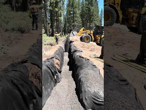
Frosty clear dawn over the Truckee basin under a building Sierra ridge, thin wildfire smoke in the Truckee River canyon to the northeast
22 min read
First Freeze of the Fall Hits 30 Degrees, Then Truckee's Best Working Day of the Week

The season's first hard freeze touched the airport before dawn, but today turns into the calmest, driest working day in weeks. A brief afternoon wind shift makes Truckee downwind of the Floriston Fire for the first time.

0 views
Read more

Forecaster’s Note · Friday, September 18, 2026

Good morning, Truckee. The season turned a page overnight. The airport at Truckee Tahoe read 30.2 degrees at four fifteen this morning, with fog and mist at one hundred percent humidity, which is frost forming on absolutely everything that sat still overnight. That is the first freeze of the fall at Truckee Tahoe, and it landed on exactly the night I told you it would. The airport touched thirty two degrees at five minutes to one this morning and held at or below that mark for three and a half hours straight. Our grid forecast had called for thirty six degrees, and the range across our eight computer models last night ran twenty eight to forty one, with the UK Met Office model alone at the cold end at twenty eight. I told you yesterday that the airport would beat thirty six, and that whether it also beat twenty eight would come down to whether smoke from the Floriston Fire settled over the basin. It beat thirty six by six degrees and did not quite reach twenty eight. The UK Met Office model, which had been ten degrees too warm the morning before, turned out to be the single closest model on the entire board last night, by a wide margin. This is the cold air pool doing exactly what it does on a calm, clear night: the wind at ten thousand feet died down to just seven miles an hour, the surface wind never rose above three miles an hour all night, and the basin quietly drained its coldest air straight down onto the airport. If you had blankets on yesterday's concrete pour, you are in good shape. If you left a hose charged on a pump overnight, go check it before you start that pump up this morning.

For comparison, Reno read 44.9 degrees at that same minute, fifteen degrees warmer than Truckee despite being only about three thousand feet lower in elevation and having no bowl shaped terrain to trap cold air the way we do. Our grid forecast this morning reads 36.3 degrees for the basin, with fifty nine percent humidity, dead calm wind, and pressure at 1019.5 millibars, up another four millibars from this same hour yesterday. That continued pressure rise is the ridge fully arriving, and it is going to define the entire week ahead.

Today: the turnaround

Today is a full GO, all systems, and it is the calmest, cleanest working day you are going to get all month. Temperatures build steadily and hold well into the afternoon: thirty four degrees at seven this morning, thirty nine at eight, forty six at nine, fifty three at ten, fifty nine at eleven, sixty three at noon, sixty six at one, and a high near 69 degrees holding from two through four this afternoon, before easing back to sixty eight at five, sixty six at six, sixty one at seven, fifty six at eight, and fifty by eleven tonight. Reno reaches seventy four degrees today.

Humidity is the number that deserves real attention today, because it crosses a threshold worth understanding. It reads sixty two percent at seven this morning, fifty percent by nine, forty percent by ten, thirty percent by eleven, twenty five percent at noon, twenty three percent at one, then twenty percent at two, nineteen percent at three, back up to twenty percent at four and five, and recovering to twenty seven percent by seven tonight. That nineteen percent reading is the first time all week that humidity has dropped below twenty percent, and it is worth calling out specifically. It is not yet a critical fire danger reading, and it is not down at fifteen percent, but the same fuels that carried the Floriston Fire on Wednesday are measurably drier today than they were on Wednesday, and they will be drier still tomorrow. That trend matters even when no single day crosses into genuine Red Flag territory.

Wind today follows exactly the pattern I told you to expect yesterday. It stays calm through one o'clock this afternoon, with a light one to four mile an hour breeze wandering without a fixed direction. Then, right at two o'clock, it turns around completely: the wind swings to the north northeast, blowing out of a compass heading of seven to twenty degrees, at seven miles an hour at two, ten miles an hour at three and four, nine at five, ten at six, with gusts reading nine, twelve, thirteen, eleven, thirteen, and a fourteen mile an hour gust at seven this evening before it lies back down at nine. Here is why that specific wind direction matters. The Floriston Fire sits at a compass bearing of sixty one degrees from the basin, roughly northeast, about ten miles down the river canyon. A wind blowing out of the north northeast at around ten miles an hour is coming from almost exactly that direction, which means it is inside the arc that can carry whatever is still smoldering down there up the canyon and into town. This is the first afternoon since the fire started that we sit downwind of it. The good news is that it is a genuinely light wind. It will not push the fire itself anywhere it wants to go, and that is the favorable half of today's story: the fire crews working that fire get their calm day today, twenty percent humidity and only a thirteen mile an hour gust, which is exactly the kind of day you use to get containment line around six hundred forty acres if you are ever going to.

The model range on today's high reads sixty eight, sixty eight, sixty nine, sixty nine, seventy, seventy, seventy one, and seventy two degrees, four degrees of spread, with our grid at sixty nine, the Japanese and UK Met Office models on the cold side, and the French model warmest. Read sixty nine with confidence. On the sustained wind, the model range reads two, five, six, seven, seven, eight, eight, and ten miles an hour, with our grid at the top at ten. After two days running of the airport beating the grid on wind, I would still call today a genuinely calm day, because the wind at ten thousand feet over the crest reads only eight miles an hour at eight this morning, seven at two this afternoon, and thirteen by nine tonight. There is simply nothing of substance up there to mix down to the surface today. Anything riding a crane hook can work all day without restriction. Anything with a tarp on it can work all day. Your problem today is dust, not wind: with humidity down at nineteen percent and a calm morning, the haul road will powder up by ten o'clock, so water it at nine and again at one, and remember that this afternoon's northeast breeze will carry that dust toward whoever is working to the southwest of you. UV index reads 6.7. Sunrise is at 6:44, sunset at 7:03, for twelve hours and nineteen minutes of daylight.

Smoke, and the number to watch tonight

Fine particulate matter at the basin reads 15.2 micrograms per cubic meter this morning, up from 8.7 yesterday and 4.9 the day before that, with an overall AQI of forty five. That climbing trend is the overnight drainage wind carrying last night's smoke up the river and pooling it under the morning inversion, the same layer of trapped cold air that gave us this morning's frost. It remains in the range officially classified as Good on the air quality scale. Our smoke model shows that number dropping down to an AQI of about five by noon as the sun warms the ground and the trapped layer lifts and mixes out, then climbing back up through this afternoon's northeast breeze to a range of sixty two to sixty six by six to ten tonight, which is Moderate, before the overnight drainage pattern flips again and repeats itself. Tomorrow morning is expected to read eight to nine. In short: today is a clear working day with a smoky evening ahead of it. If you have anyone on your crew who carries an inhaler for their breathing, the window they need to be aware of is after five o'clock this evening, and it is a window, not a wall, meaning it passes rather than persists. Nobody needs to stop working over an air quality reading of sixty two. I am simply telling you the shape of it now so that nobody is caught off guard when the sunset turns orange tonight.

Tonight: frost again, but lighter

The model range on tomorrow, Saturday, morning's low reads thirty five, forty, forty two, forty three, forty four, forty five, forty five, and forty seven degrees, with the UK Met Office model again at the cold end at thirty five and our grid at forty two. The setup tonight is essentially identical to last night's: the wind at ten thousand feet running six to eight miles an hour all night, the surface wind at two to four miles an hour, clear skies, and humidity between forty five and fifty six percent. It is the same cold air pooling mechanism, just starting from a slightly warmer base temperature than last night had. Last night, the airport beat our grid forecast by six degrees. Apply that same six degree adjustment to tonight's grid number of forty two and you land around thirty six degrees at the airport, which means frost again on the low pads and on the shaded side of any concrete pour, but not a full freeze down at the station level itself. If you have concrete curing from today's work, insulating blankets are inexpensive and I would put them on regardless. If you have nothing curing tonight, the only real cost of tonight's cold is a windshield that needs scraping at six tomorrow morning.

Saturday through Wednesday: the ridge, and twelve percent

The pressure surface height above us reads 5,817 meters this afternoon, climbing to 5,851 meters Saturday, which marks the top of this particular ridge and matches the same number I gave you yesterday for that same peak. It then eases slightly to 5,817, 5,796, and 5,821 meters before building back to 5,850 meters again by Wednesday the twenty third. That is a flat, well fed September ridge with two separate high points on it and essentially nothing underneath it to disturb the pattern. Saturday's grid forecast reads seventy five degrees, with the American and French models sitting at the top of a range that also includes seventy two, seventy four, seventy four, seventy five, seventy five, and seventy eight; read seventy five and be glad if you see seventy eight instead. Humidity that day bottoms at thirteen percent at four in the afternoon, with a gust to eight miles an hour, and the wind at ten thousand feet reads just three miles an hour, about as still as the free atmosphere ever gets around here. Reno reaches seventy nine degrees Saturday.

Sunday brings seventy seven degrees, Monday seventy seven, Tuesday the twenty second eighty, and Wednesday the twenty third eighty one, with the model range on Wednesday reading seventy seven, seventy eight, seventy nine, eighty, eighty, eighty one, and eighty one, a genuinely tight range. Overnight lows through that stretch run forty eight to fifty one degrees. Humidity holds twelve to fifteen percent every single afternoon from Saturday through Wednesday, and wind gusts stay under eleven miles an hour through Tuesday. That is five consecutive afternoons at twelve to fifteen percent humidity, sitting on top of a fire burning ten miles away that will still be carrying heat, with no wind to move that heat anywhere. That last point, the absence of wind, is the one that matters most right now. Dry fuel and low humidity are two legs of the classic fire weather triangle, and this ridge is giving us both of those legs in full. The third leg is what comes after the ridge finally breaks, and that is exactly where our computer models have been arguing with each other for three days running. I will walk through that argument in detail in a moment.

One small flag worth mentioning on the twenty first: the German model shows a fifteen percent chance of rain with six hundredths of an inch, and the Canadian model shows fourteen percent, while every other model reads completely dry. That is a stray, weak disturbance that no other model is picking up on, and it is nowhere near enough moisture to meaningfully wet the ground even if it verified. I am filing that in the same drawer as the American model's showers on the twenty seventh and twenty eighth that I mentioned yesterday, both of which have since disappeared from every model entirely.

Precipitation signals

There is no meaningful rain signal anywhere within this seven day window. The only precipitation of any kind on the sixteen day board is that weak, single model signal on the twenty first, which does not rise to the level of a real forecast concern. This entire stretch from today through Wednesday the twenty third is a dry, ridge dominated run, and the story worth tracking is not rain, it is exactly how and when that ridge finally breaks down, which is the subject of the next two sections.

Uncircle the twenty fifth

Yesterday, I told you to circle the twenty fifth as a genuine wind risk day, based on a grid gust of thirty six miles an hour, three separate computer models carrying that wind, and the wind at ten thousand feet reading thirty nine to forty three miles an hour around that time. That threat has essentially evaporated overnight. The pressure surface heights on the twenty fourth through twenty sixth, which yesterday read 5,815, 5,713, and 5,680 meters, have shifted overnight to 5,818, 5,815, and 5,793 meters. The trough that was going to drop down through our area on the twenty fifth now barely dents the ridge at all, and the grid's gust forecast for the twenty fifth has fallen from thirty six miles an hour all the way down to seventeen. The twenty fourth now reads a gust of eighteen. On the sustained wind, the model range for the twenty fourth reads five, seven, nine, ten, thirteen, and fifteen miles an hour, and for the twenty fifth, five, six, eight, twelve, and thirteen. The wind at ten thousand feet runs twenty to twenty four miles an hour on the twenty fourth and nineteen to twenty two on the twenty fifth, which describes a breezy pair of afternoons with humidity climbing back up to twenty and twenty two percent, not the shape of a genuine Red Flag event. I flagged this as a real known risk yesterday specifically because three separate models were carrying that wind number, and I told you at the time that three models agreeing was what had moved it up from a distant possibility to something worth circling. Three models dropped that same forecast in a single overnight cycle. That tells you plainly what an eight day out wind forecast is genuinely worth, and I said clearly yesterday that it was eight days out; I am not going to pretend now that yesterday's circle was a sure thing when it plainly was not. The twenty fourth and twenty fifth are simply breezy days now, worth strapping your tarps down for, and nothing more dramatic than that.

Looking further out: circle the twenty ninth, in pencil

The trough itself did not vanish, it backed up roughly four days on the calendar and, in the process, got noticeably deeper. The pressure surface height reads 5,808 meters on the twenty eighth, then drops to 5,689 meters on the twenty ninth and 5,688 meters on the thirtieth, which is actually a lower, colder reading than yesterday's forecast for the twenty eighth, meaning our models now show a colder, later system than they did just one day ago. The wind at ten thousand feet climbs to forty three miles an hour on the night of the twenty eighth, thirty nine miles an hour at two in the afternoon on the twenty ninth, and thirty one miles an hour on the night of the thirtieth. Our grid shows a gust of thirty two miles an hour on the twenty ninth. The grid's high and low for the twenty ninth read sixty two and twenty nine degrees; for the thirtieth, fifty three and twenty six; and for the first of next month, fifty nine and twenty six. Humidity climbs to thirty nine percent on the twenty ninth behind that wind, then drops back to seventeen percent by the first. The whole system stays completely dry the entire way through. A thirty two mile an hour gust arriving after eleven straight days at twelve percent humidity is still a pattern that deserves respect, and a low of twenty six degrees is a hard freeze, not simply a frost. But read the next part carefully before you plan around any of these specific numbers.

The two flagship models have swapped their positions with each other again. Yesterday, the American model broke the ridge early and the European model held it late. This morning, it has reversed: the European model now breaks the ridge on the twenty eighth, reading sixty two degrees with a low of forty, then rebounds sharply to seventy and seventy one degrees on the twenty ninth and thirtieth with only a light six mile an hour wind. The American model, meanwhile, now holds the ridge through the twenty eighth at seventy five degrees and breaks it on the twenty ninth and thirtieth instead, dropping to sixty two and then fifty three, with lows of twenty nine and then twenty six, carrying that thirty two mile an hour gust, before rebuilding to sixty five degrees by the second of next month. The specialized AI model holds the ridge the longest of all three, staying in the seventy four to seventy nine degree range through the twenty ninth, and only dipping to sixty five on the thirtieth, with lows of forty seven to fifty three. That means the model range on the twenty ninth's high spans sixty two, seventy, and seventy four degrees, and on the thirtieth, fifty three, sixty five, and seventy one, an eighteen degree spread between two models that have now flipped which one is running colder, twice, in the span of two days. What all of them agree on is that some kind of trough passes through somewhere between the twenty eighth and the thirtieth, and that it arrives dry. What they do not agree on is which specific day, how cold it gets, or whether it carries a thirty two mile an hour wind or only a six mile an hour breeze. My honest read is to circle the twenty ninth, in pencil rather than pen, and to widen the window I am watching to the twenty eighth through the first of next month. Anything that wants dry ground and calm air has a full ten days of exactly that starting right now. Anything that specifically cannot afford a hard freeze wants to be finished by the twenty eighth.

Seasonal outlook and climate

Zooming all the way out to the season ahead, the biggest weather story in the country continues to be the historic El Nino building in the tropical Pacific Ocean, and the numbers keep sharpening in the same direction. El Nino describes a periodic warming of ocean water across the central and eastern Pacific, and when that warming runs unusually strong, it reshapes storm tracks across the entire globe, including the one that eventually reaches California. The federal Climate Prediction Center's most recent full update, issued September 10th, stated that El Nino is strengthening, with a greater than ninety percent chance of a very strong event this fall and winter, and put the odds at seventy five percent that this becomes a historic event, stronger than any El Nino on record dating back to 1950. That figure is up meaningfully from sixty nine percent in the agency's prior update from mid August. More recently, Columbia University's International Research Institute reported in mid September that the benchmark central Pacific ocean region was running near three degrees Celsius above normal, and all twenty two individual forecast models feeding into their combined seasonal outlook agree on keeping a very strong El Nino locked in place all the way through winter. Agreement across all twenty two of those models is a genuinely rare and significant signal.

The broader ocean data behind this event remains extraordinary. In the Climate Prediction Center's September update, one benchmark region near South America read 2.5 degrees Celsius above normal, and another, right along the coast, read 3.4 degrees above normal. Surface temperatures further east in the Pacific were running more than three degrees Celsius above normal, and water more than ten degrees Celsius warmer than usual had been found well below the surface in the eastern Pacific. Forecasters have also tracked unusual westerly winds near the ocean surface and suppressed rainfall over Indonesia, both classic signatures of a major El Nino fully taking shape. The Climate Prediction Center's next scheduled update is due October 8th.

What does a very strong El Nino actually mean for us here in Tahoe? History offers an honest, if imperfect, answer. The legendary 1982 to 1983 winter, a genuine monster season in Tahoe, was driven by a very strong El Nino. But the 2015 to 2016 season, also a so called super El Nino and one of the strongest ever measured at the time, delivered only a decent, unspectacular winter in the northern Sierra. What holds up reliably across these events is that a very strong El Nino supercharges the subtropical jet stream, the branch of the jet that draws moisture up out of the tropics, typically bringing warmer, wetter storms with greater potential for what is called an atmospheric river, a narrow, concentrated ribbon of tropical moisture streaming across the Pacific, higher snow levels within individual storms, and a real risk of rain falling directly onto existing snowpack right at lake level. Big El Nino winters load the dice for California overall, with Southern California typically getting the more reliable rainfall boost of the two ends of the state. The honest takeaway for those of us up here is that the odds favor an active, wet winter without any guarantee of one. We will keep watching these ocean numbers closely as the season builds toward the first real storms of the fall.

The backcheck

Yesterday's forecast scored ninety four out of one hundred against the airport's actual readings, the best score of the week. The high was called at sixty two degrees; the airport read 64.4 at 2:49 in the afternoon, two degrees under. The low was called at thirty nine degrees using our midnight forecast snapshot; the airport read 35.6 at 11:35 last night, three degrees warm. The wind was called at fourteen miles an hour sustained, and the airport read exactly fourteen, dead on, though the gust I called at twenty five miles an hour actually came in at twenty nine on two separate occasions, at 9:50 in the morning and 12:47 in the afternoon. The dry call was correct and the GO call was correct. This is graded against the actual airport station readings rather than our model grid, which makes it a harder test than our broader Field Intel accuracy figure, currently sitting at 95.2 percent over the last eighty four days measured against the grid. Our rolling low temperature bias against the station now stands at plus 5.4 degrees over the last fifty seven nights, and that number moved up a full degree overnight for a specific, worthwhile reason: the station's overnight record had been cutting off at five in the evening each day, which meant six nights in our historical record were missing their coldest hour entirely, and last night's forecast had been built on a bias figure calculated from lows that were actually two to five degrees warmer than they should have been. That has now been fixed, and the historical record has been corrected. In plain terms, the basin runs about one degree colder at night than I had been telling you. I am building that correction directly into the frost calls I made earlier in this note.

The board

There are no National Weather Service alerts in effect for the Truckee basin. We are tracking two fires. The Floriston Fire sits ten miles out, now six hundred forty acres, eight percent contained as of Cal Fire's update at ten minutes to six last night, two days old, and it caught the calm day it needed today. The Bonetti Fire sits forty six miles out, size still unreported, now twelve days old, with nothing to smell from it. Westbound Interstate 80 at the state line was closed yesterday; the highway patrol and Caltrans will tell you this morning whether it has reopened, not this note, and the NV Energy transmission line running through the fire area remains the reason to keep your generators fueled.

Circle the date

Today's confidence is high, and it is a genuinely clean read. Tonight's frost is certain to occur, with only its exact depth still uncertain. The ridge holding through Wednesday the twenty third is also high confidence. The twenty fourth and twenty fifth have been downgraded from a real wind risk down to simply a breezy pair of days. Everything from the twenty eighth through the first of next month remains genuinely uncertain, with two contractors' worth of disagreement between our flagship models, and they have now traded their positions with each other twice in two days. I will treat the twenty ninth as a real forecast once it comes inside five days out and the spread on the wind number narrows to under ten miles an hour across the models.

From the base of Palisades, that is your weather. This is a GO for the entire Truckee basin, and it is the best working day of the week. Water the road at nine and again at one, run the hook all day without restriction, strap down anything light before that two o'clock breeze arrives, expect a smoky sunset this evening, put blankets on today's concrete pour, and plan to scrape your windshield at six tomorrow morning. Ten dry days start right here. Put them to good use, and I will see you back here tomorrow.

Errol Kerr, Olympic ski racer, excavation foreman, and the guy who checks the sky before the crew shows up.

Clear cold dawn over the Truckee basin behind a dry Sierra trough, wildfire smoke down the Truckee River canyon to the northeast
21 min read
Floriston Fire Grows to 610 Acres Overnight as Wind Turns, I-80 Closed at the State Line

A trough driven wind pushed a new fire nine miles northeast of Truckee to six hundred ten acres overnight, closing I-80 westbound at the state line. Truckee stays upwind today, but Friday and Saturday bring the first smoke windows.

0 views
Read more

Forecaster’s Note · Thursday, September 17, 2026

Good morning, Truckee. Before we get to the forecast, there is a fire to talk about, because it changes how several of you need to plan your day. The Floriston Fire started at 10:01 yesterday morning at the intersection of Interstate 80 and Floriston Way, about nine miles northeast of Truckee, and by dark it had grown to six hundred ten acres with four percent containment. That growth is exactly what a strong trough wind does to a new fire, and it is the same wind event I described in detail in yesterday's forecast. The airport recorded a sustained wind of eighteen miles an hour out of two hundred ten degrees, essentially southwest, with humidity down at twenty one percent at two forty seven in the afternoon, and a gust to twenty four miles an hour an hour before that. That southwest wind pushed a fire that started on the west side of the highway straight up the Truckee River canyon toward Verdi, a canyon that acts like a chimney flue for wind and fire alike. Cal Fire's incident log described it as wind driven and pushing east, with long range spotting, meaning embers jumping well ahead of the main fire, reported by 11:23 in the morning. The fire grew from twenty acres to three hundred acres in just four hours.

Here is what this means practically for anyone working in that corridor. Westbound Interstate 80 is closed at the Nevada state line with no estimated reopening time given yet. An evacuation warning, one step below a mandatory evacuation order, is in effect for the zone west of the interstate out to Boca Road, and two campgrounds in that area have already been cleared of visitors. The response is being jointly managed by Cal Fire's Nevada, Yuba and Placer unit and the Tahoe National Forest, and as of the last update the assigned resources included twenty fire engines, two bulldozers, five hand crews, and two helicopters, with more resources on order. If your work is anywhere on that Interstate 80 corridor, you are not getting through the state line westbound today, and if your job is east of Boca Road, check with fire incident command before you mobilize any equipment or crew out there.

There is also a utility concern worth flagging clearly. The Truckee Donner Public Utility District has stated plainly that this fire does not threaten the town of Truckee itself, but NV Energy's transmission line runs directly through the fire area, and if that line gets de energized as a precaution, Truckee could lose power with no advance notice. My advice today is straightforward: fuel your generators now, charge your equipment batteries, and do not leave a dewatering pump running on shore power overnight without a backup plan for the morning it might not be there.

Where the smoke goes, and when it comes back

Understanding the geometry here matters as much as the fire statistics themselves. The fire sits at a compass bearing of sixty one degrees from the basin, which is east northeast, about ten miles out and roughly a thousand feet lower in elevation than Truckee. Today, the wind is blowing out of the southwest again, sustained at twelve to fourteen miles an hour and gusting to twenty five from nine this morning through five this afternoon. That wind blows the smoke away from us, down the canyon toward Verdi and Reno, and unfortunately it blows the fire in that same direction, which is the less favorable half of that sentence for the firefighting effort. Truckee sits upwind of the fire for every hour of today's forecast. The airport's automated system reported simply cloudy at 3:55 and 4:15 this morning with no temperature reading included, even though our grid forecast shows zero cloud cover for that hour. I cannot tell you with certainty whether that sensor was reading actual cloud or smoke at four in the morning, but I do know there was an active fire ten miles away last night, and I know the overnight drainage wind in this canyon flows the opposite direction from today's daytime wind. Air quality reads an AQI of forty nine this morning, with fine particulate matter at 8.7 micrograms per cubic meter, nearly double yesterday's 4.9. That is still in the moderate, breathable range, a number worth watching rather than a number to act on today.

Friday afternoon, the wind pattern flips, and this is the window to actually watch closely. As the ridge slides in and the broader pressure gradient weakens, the surface wind from two to six in the afternoon turns to the north northeast at six to nine miles an hour, which is an up canyon breeze, blowing directly from the fire toward town. Saturday morning, the wind goes light and easterly at two to three miles an hour. That is a gentle wind, but it is one capable of carrying whatever is still smoldering on the far side of the state line right up the river and into the basin, and it will be the first time since the fire started that Truckee sits downwind of it. Friday afternoon and Saturday morning are your smoke windows, and if you have anyone on your crew who monitors air quality for health reasons, that is the specific window to watch closely. There is a genuine silver lining buried in this, though. The same calm conditions that will carry smoke up the canyon toward us are exactly the conditions the firefighting crews need to get containment lines around the fire. A six hundred ten acre fire burning at four percent containment with a twenty five mile an hour gust on it today, like we have, is a fundamentally different, more dangerous animal than that same fire sitting under dead calm winds and twenty eight percent humidity on Friday. Friday is the day the fire crews get their best chance to catch it, if they are going to.

Right now, and how last night's frost call held up

Our grid forecast has the basin at 40.9 degrees this morning, with sixty five percent humidity, a light two mile an hour breath out of the northwest, clear skies, and pressure at 1015.4 millibars, up four millibars from this same hour yesterday. That rise is the ridge finally arriving behind this whole wind event. The airport itself bottomed out at 41.0 degrees at two o'clock this morning and held there again at three, never dropping any lower. Yesterday I told you that with the wind at ten thousand feet still blowing thirty eight miles an hour all night, the basin would not be able to form its usual cold air pool, and I predicted the airport would read close to the grid's number or a touch under it, calling for something like thirty eight degrees rather than thirty. It actually came in at forty one against a grid low of forty. This is the first morning in three that the airport did not beat even the coldest computer model on the board. The UK Met Office model had called for thirty one degrees and was ten degrees off, because that model simply does not account for what a thirty eight mile an hour wind at ten thousand feet does to a cold air pool sitting in a valley below it. The pattern I have been calling the no pool rule held again perfectly: no cold pooling on the windy nights, real pooling on the calm ones. Reno read 51.5 degrees at that same minute this morning.

Today: the cool day, and the last of the wind

Temperatures today build slowly and top out lower than earlier in the week, the coolest day of this whole stretch: forty degrees at seven this morning, forty six at eight, fifty four at nine, fifty seven at ten, sixty one at noon, holding near 62 degrees from one through three this afternoon, then falling back to fifty eight by six and fifty by eight tonight. Humidity is noticeably better than yesterday: sixty six percent at seven this morning, fifty one at nine, forty three at ten, thirty four percent at noon, bottoming at thirty two percent from one through three, recovering to thirty seven by six and fifty two percent by ten tonight. That is meaningfully better moisture than yesterday's twenty four percent bottom.

Wind today has an unusual shape to it. The gust track reads twenty one miles an hour at eight this morning, twenty four at nine, peaking at twenty five at ten, then easing to twenty three at eleven, nineteen at noon, eighteen at one, seventeen at three, sixteen at five, and ten by seven this evening. The sustained wind runs twelve to fourteen miles an hour out of the southwest from nine this morning through five this afternoon, but the morning is actually the windiest part of today, not the afternoon the way it usually runs, with an eight o'clock gust out of the northeast at twenty one miles an hour before the southwest wind takes over completely by nine. Reno reaches seventy three degrees today, with Truckee running eleven degrees cooler, matching yesterday's gap.

Above us, the pressure surface height reads 5,747 meters this afternoon, just two meters off yesterday's bottom, and the wind at ten thousand feet over the crest runs thirty nine miles an hour at eight this morning, easing to twenty by two this afternoon, twelve by ten tonight, and just seven by dawn tomorrow. That is the trough finally leaving and the door shutting behind it. Whatever wind reaches the ground today gets there before noon, so keep tag lines on anything riding a crane hook until about two o'clock this afternoon, after which it becomes an entirely normal, calm working day. Water the haul road by eight this morning rather than waiting for nine, because the wind is already active by nine. UV index reads 6.6. Sunrise is at 6:43, sunset at 7:05, for twelve hours and twenty two minutes of daylight, and we continue losing about three minutes of daylight every day.

What the computer models are saying, today and tonight

On today's high, the eight model range runs a tight sixty one to sixty four degrees, with the specialized European AI model and the UK Met Office model both at the cold end at sixty one, the Japanese model warmest at sixty four, and our grid forecast at sixty two. Read sixty two with confidence. On the sustained wind, the model range reads five, five, nine, ten, eleven, eleven, eleven, and fourteen miles an hour, with our grid sitting at the top at fourteen. Given that the airport has beaten the grid's wind estimate two days running now, the right call is to rig for fourteen miles an hour sustained with a twenty five mile an hour gust. Same lesson as yesterday: trust the top of the range on a day like this.

Tonight is this week's genuine frost event, and it is worth walking through carefully. The model range on tomorrow morning's low reads twenty eight, thirty four, thirty six, thirty eight, thirty eight, thirty nine, forty, and forty one degrees, with the UK Met Office model at the cold end at twenty eight and our grid at thirty six. The wind at ten thousand feet drops to just seven miles an hour by dawn, and the surface wind holds one to three miles an hour all night under clear skies with fifty two percent humidity. That is the full cold air pool setup, exactly the pattern I told you was coming, and it has arrived. The airport will very likely beat thirty six degrees. Whether it also beats the coldest model reading of twenty eight depends on one specific wildcard: whether smoke from the Floriston Fire settles over the basin overnight, because a layer of smoke traps heat near the surface in much the same way a layer of cloud does, and that is the only factor on the board tonight arguing for a warmer outcome. I would not bet on that happening. Any concrete poured today needs blankets on it tonight. Disconnect hoses from pumps. Anything holding water that cannot be drained should be drained by four this afternoon. This is very likely the first hard freeze of the season on the low pads around the basin.

Friday through the twenty fourth: the ridge, and eleven percent humidity

Friday brings a high of sixty nine degrees, with the tightest model range of the entire week, sixty eight, sixty eight, sixty eight, sixty eight, seventy, seventy, seventy one, and seventy one degrees. Winds stay calm with a gust to thirteen, and humidity bottoms at twenty eight percent. The pressure surface height jumps to 5,819 meters Friday and 5,847 meters Saturday, which is a proper September ridge settling in with real strength behind it. Saturday's grid reads eighty one degrees, but that is the American GFS model alone at the top of a range that otherwise reads seventy two, seventy three, seventy four, seventy four, seventy five, seventy five, and seventy six; the honest read is seventy five, and seventy eight would be a pleasant surprise. Humidity that day bottoms at twelve percent under calm winds with a nine mile an hour gust. Sunday climbs to seventy eight, Monday seventy seven, Tuesday the twenty second seventy seven, Wednesday eighty, and Thursday the twenty fourth seventy seven. Humidity runs fourteen to seventeen percent every afternoon from Sunday through Thursday, overnight lows sit between forty five and forty nine degrees, and wind gusts stay under thirteen miles an hour through Tuesday.

On Tuesday the twenty second, which I flagged yesterday based on the European and German models both carrying a thirty mile an hour gust, both of those models have come down significantly overnight, now reading twenty two and twenty three miles an hour, with the UK Met Office model at twenty seven and the American model at just ten. I am downgrading that day from a genuine known risk to simply a breezy Tuesday. Do not, however, downgrade what comes after it. We now have six days running at eleven to seventeen percent humidity under a solid ridge, with a six hundred ten acre fire burning just ten miles out that will still be holding heat by then. The fuels across our area were already at their driest point of the year before this stretch even started. What they have been waiting for is wind, and the forecast now shows that wind arriving on the twenty fourth and twenty fifth.

Precipitation signals

There is no measurable rain anywhere on the seven day board, and this entire stretch through the twenty fourth is dry. The story worth watching is not rain, it is the fire weather setup building on the far side of that dry stretch, which I will lay out in detail now.

Looking further out: circle the twenty fifth

The pressure surface height falls off a genuine cliff beyond the twenty fourth: 5,815 meters on the twenty fourth, 5,713 meters on the twenty fifth, 5,680 meters on the twenty sixth, and 5,646 meters by the twenty eighth. That is a real, deep trough, deeper than what I described yesterday, and the wind racing ahead of it is the headline. On the twenty fourth, our grid shows a gust to twenty three miles an hour, with the Canadian model reading thirty five, the European model twenty six, and the American model twenty three, alongside seventeen percent humidity. On the twenty fifth, the grid gust jumps to thirty six miles an hour, with the wind at ten thousand feet reading thirty nine miles an hour at two in the afternoon and forty three miles an hour by ten that night. The European model shows thirty five, the American model thirty six, and the Canadian model twenty eight, with humidity down at twenty percent and some cloud cover. On the twenty sixth, humidity drops to just nine percent, the lowest number anywhere on our sixteen day board, sitting right behind the trough's axis. A thirty six mile an hour gust arriving at the tail end of a week spent at twelve percent humidity, with an active fire already burning in the canyon below us, is the textbook shape of a genuine Red Flag day, and this time three separate models are carrying that wind number rather than just two, which raises my confidence in it. It remains eight days out, which is still enough time for it to shift, but I am circling the twenty fifth on the calendar today. Anything that needs a week of completely dry ground and still air should be finished by the twenty fourth. Anything that needs a tarp on it does not want to be sitting outside on the twenty fifth.

On temperature, the models are still arguing the way they were yesterday, just about different specific days now. The model range on the twenty fifth's high reads fifty nine, seventy one, seventy five, seventy six, and seventy nine degrees, spanning the Canadian model at fifty nine, the American model at seventy one, the European model at seventy six, and the Japanese model at seventy nine, a twenty degree spread on a single afternoon. The American model breaks the ridge on the twenty fifth and twenty sixth, dropping to seventy one and then sixty two, with a low of thirty five on the twenty seventh, staying dry, before rebuilding all the way back to eighty five degrees by the thirtieth. The European model holds the ridge instead, reading seventy six on both the twenty fifth and twenty sixth, then breaking late with a high of sixty three and a forty five mile an hour gust on the thirtieth, along with a trace of rain. The American model also shows a twenty eight percent chance of showers on the twenty seventh and twenty four percent on the twenty eighth, while the European model reads only two to nine percent and essentially dry. So the same two flagship models are running the same disagreement they have all week, the American model early and dry, the European model late and windy. The one thing they now agree on, which they did not agree on yesterday, is that the twenty fifth itself is a wind day. I am taking that agreement at face value and setting the rest of the disagreement aside for now. The window to watch remains the twenty fifth through the twenty ninth.

Seasonal outlook and climate

Zooming out to the season ahead, the biggest weather story in the country remains the historic El Nino building in the tropical Pacific, and the picture keeps sharpening as we get more data. El Nino describes a periodic warming of ocean water across the central and eastern Pacific, and when it runs unusually strong, it reshapes storm tracks around the entire globe, including the one that eventually reaches California. The federal Climate Prediction Center's most recent full update, issued September 10th, stated that El Nino is strengthening, with a greater than ninety percent chance of a very strong event this fall and winter, and put the odds at seventy five percent that this becomes a historic event, stronger than anything on record dating back to 1950, up from sixty nine percent in their prior update from mid August. Since that update, Columbia University's International Research Institute reported in mid September that the benchmark central Pacific ocean region was running near three degrees Celsius above normal, and all twenty two individual forecast models in their combined outlook agree on keeping a very strong El Nino in place all the way through winter. That kind of unanimous agreement across twenty two separate models is genuinely rare and speaks to how locked in this event has become.

The broader ocean data behind all of this remains remarkable. Closer to South America, one benchmark region was already reading 2.5 degrees Celsius above normal in the Climate Prediction Center's September update, and another, right along the coast, read 3.4 degrees above normal. Surface temperatures further east in the Pacific were running more than three degrees Celsius above normal, and water more than ten degrees Celsius warmer than usual had been detected well below the surface in the eastern Pacific. Forecasters have also been tracking unusual westerly winds near the ocean surface and suppressed rainfall over Indonesia, both classic signatures of a major El Nino taking full shape. The Climate Prediction Center's next scheduled update is due October 8th.

What does this mean for a winter here in Tahoe? The historical record gives an honest, if imperfect, answer. The legendary 1982 to 1983 season, a genuine monster winter in Tahoe, was driven by a very strong El Nino. But the 2015 to 2016 season, also a so called super El Nino and one of the strongest ever measured at the time, produced only a decent, unspectacular winter in the northern Sierra. What does hold up reliably across these events is that a very strong El Nino supercharges the subtropical jet stream, the branch of the jet that draws moisture up out of the tropics, typically delivering warmer, wetter storms with more potential for what is called an atmospheric river, a narrow, concentrated ribbon of tropical moisture streaming across the Pacific, higher snow levels within individual storms, and real risk of rain falling directly onto existing snowpack right at lake level. Big El Nino winters load the dice for California overall, with Southern California typically getting the more reliable rainfall boost of the two ends of the state. The honest read for us up here is that the odds favor an active, wet winter, without any guarantee of one. We will keep tracking these ocean numbers closely as the season builds toward the first real storms.

The backcheck

Yesterday's forecast scored eighty two out of one hundred against the airport's actual readings. The high was called at sixty eight degrees; the airport read seventy two, four degrees under. That is the trough day running warmer than our grid forecast expected on the downslope side of the mountains, a common pattern when descending air compresses and warms as it comes down the lee side of the Sierra. The low was called at forty one degrees; the airport read thirty two at 3:55 in the morning, nine degrees warm, though that reading was taken twenty minutes before the wind arrived and pushed the temperature up to forty three, which is essentially the timing quirk of when the scoring snapshot gets taken relative to a fast moving change. Wind was called two miles an hour under what actually happened, the dry call was correct, and the production call of GO was correct. This is graded against the actual airport station readings rather than our model grid, which makes it a harder test than our broader Field Intel accuracy figure, currently sitting at 95.2 percent over the last eighty three days measured against the grid. Our rolling low temperature bias against the station now stands at plus 4.1 degrees over the last fifty six nights. Two honest scores, from two different truth sources, and the gap between them continues to come down to the basin's own local behavior. I will also note that yesterday's wind call, fourteen to fifteen miles an hour sustained, came in at eighteen again, the second day running that the airport has beaten our grid's wind estimate by four miles an hour on a trough afternoon. I am adjusting my own mental model to bump the grid's wind number up a notch on any day when the wind at ten thousand feet runs over thirty miles an hour, and I am telling you so you can make the same adjustment.

The board

There are no National Weather Service alerts in effect for the Truckee basin itself. We are tracking two fires. The Floriston Fire, the subject of most of today's note, sits ten miles out, six hundred ten acres, four percent contained, one day old. The Bonetti Fire sits forty six miles out, size still unreported, now eleven days old, with nothing to smell from it. The Floriston acreage number reflects the National Interagency Fire Center's update as of six o'clock last night; this morning's update will move that number, and which direction it moves depends heavily on the wind behavior I have described throughout this note.

Circle the date

Today's confidence is high, essentially known ground. Tonight's frost is known to occur, with the smoke question being the one real wildcard on how deep it gets. The ridge holding through the twenty fourth is also high confidence. The wind risk on the twenty fifth has moved up from a distant possibility to a genuine known risk now that three separate models carry it, up from just two yesterday. The temperature question from the twenty fifth onward remains genuinely uncertain, with neither flagship model changing its position from yesterday. If there is one day to circle right now, it is the twenty fifth, eight days out but sharpening fast.

From the base of Palisades, that is your weather. This is a GO day for the Truckee basin, with wind on the front half of the day and the season's first real hard frost likely tonight. Water the road by eight, keep tag lines on until two, strap down anything light before you leave the site, get blankets on any concrete you pour today, and make sure your generators are fueled. If your job is anywhere on the Floriston corridor, remember that the incident command and the highway patrol decide whether you are working today, not this note. I will see you back here tomorrow.

Errol Kerr, Olympic ski racer, excavation foreman, and the guy who checks the sky before the crew shows up.

Clear windy dawn over the Truckee basin as a dry Sierra trough crosses the crest, mid-September
18 min read
A Ten Degree Jump Before Dawn as Midweek Trough Mixes Out the Cold Pool

A twenty minute wind burst broke up this morning's frost, and a breezy, dry trough moves through today. The ridge and a possible fire weather setup build back in by the weekend.

0 views
Read more

Forecaster’s Note · Wednesday, September 16, 2026

Good morning, Truckee. This morning gave us a lesson in exactly how fast this valley's weather can turn, and it happened right on the clock. The airport at Truckee Tahoe read thirty two degrees at three fifty five this morning, with humidity at eighty percent and a five mile an hour breeze already stirring the air. Twenty minutes later, at four fifteen, it read 42.8 degrees, with the wind now blowing ten miles an hour. That is a ten degree jump in twenty minutes, and it was not the sun, which would not clear the ridge for another two and a half hours. What actually happened is that the strong wind riding over the crest at around ten thousand feet, part of the trough I told you was coming, finally reached all the way down to the valley floor and physically stirred the cold, dense air pool out of the basin, the way you would stir a settled bucket of slurry until it is uniform again.

I told you yesterday that the nights with no cold air pooling at all this summer have consistently been the windy ones, and that if last night's breeze held, the airport would likely read closer to forty degrees than thirty two. It did exactly both things, in order. The cold pool formed first, taking the airport down to thirty two, and then the wind arrived and broke it apart. If you had anyone on a low pad at four this morning, they had frost; by five o'clock, they did not. For comparison, Reno read fifty degrees at that same minute and never pooled at all overnight, because Reno sits on flatter ground without a bowl to trap cold air in the first place.

Yesterday's forecast needs a real correction. The airport actually topped out at 73.4 degrees between two and four in the afternoon with humidity at fourteen percent, and the southwest breeze I had called at eleven to twelve miles an hour sustained came in stronger, eighteen miles an hour sustained at two o'clock. That is a six mile an hour undercall on the sustained wind. Interestingly, the gust number I called at sixteen miles an hour was much closer to correct than the sustained figure was, and that points to a specific, recurring blind spot in our computer models: the grid forecast tends to see the basin as flatter and smoother than it actually is, which means it consistently underestimates how much the terrain around the Sierra crest accelerates and channels the wind at ground level.

The big picture: the trough arrives on schedule

The pressure and wind story above us today is the payoff of what I have been describing for two days running. The dip in the jet stream, the trough, that I told you was approaching has now arrived and is passing directly overhead. The height of the pressure surface around eighteen thousand feet bottoms out at 5,749 meters this afternoon, which marks the exact axis of the trough passing through. Above the crest, the wind at about ten thousand feet reads twenty four miles an hour at two this afternoon and jumps to thirty eight miles an hour by ten tonight as the strongest part of the disturbance crosses. Some of that wind is going to reach all the way to the ground on the exposed ridgelines after dark tonight, so anything light sitting on a roof or a tailgate should be secured or brought inside by six this evening. This is a useful moment to explain why we watch that ten thousand foot wind number so closely in the first place. On most calm nights, the air near the ground is essentially cut off from the stronger winds racing along higher up, the way a lake bottom is undisturbed even when there are whitecaps on the surface. But when the wind aloft gets strong enough, as it will tonight, it can punch all the way down to the surface, especially on exposed terrain like ridgelines and canyon mouths. That is exactly the mechanism that broke apart this morning's cold air pool in twenty minutes flat, and it is the same mechanism that will likely keep tonight's low from getting as cold as it otherwise would.

Today: the trough, dry and windy

Today is a GO, but it comes with a genuine breeze attached, and this is the trough day I flagged for you yesterday arriving right on schedule, and arriving dry. There are no National Weather Service alerts for the basin, every one of our eight models reads zero for rain, and skies stay clear all day, with the strongest part of the disturbance crossing the crest overnight while nobody is on site to feel it. Temperatures build through the morning: forty degrees at seven, forty four at eight, fifty six at nine, sixty two at ten, sixty five at eleven, sixty six at noon, and a high near 67 degrees holding from one through three this afternoon. Humidity falls from forty seven percent at seven this morning to thirty three percent by nine, twenty six percent by ten, and bottoms at twenty four to twenty five percent from noon through three, before climbing back to twenty eight percent by four, thirty five percent by six, and sixty percent by eleven tonight as the trough's moisture moves in behind it.

Wind is the story of the day. It stays calm until eight this morning, then the gust track climbs steadily: ten miles an hour at eight, sixteen at nine, nineteen at ten, twenty one at eleven, holding twenty one to twenty two from noon through three, twenty at four, nineteen at five, sixteen at six, and back down to ten by seven this evening. The sustained wind runs fourteen to fifteen miles an hour out of the southwest from ten this morning through four this afternoon. Twenty four percent humidity with a twenty one mile an hour gust is still not a fire weather day by our criteria, but it is absolutely a tarp day and a dust day, and that dust is going to carry east of the haul road starting around ten o'clock this morning. Water the road before ten, not at noon, to stay ahead of it.

For crane work today, treat a twenty one mile an hour gust as a tag line day rather than a full stop, and if you have a pick that genuinely wants still air, your calm window is between seven and nine this morning before the wind ramps up. Reno reaches seventy eight degrees today, with Truckee running eleven degrees cooler, one degree more than our usual gap, because the trough is sitting directly over the crest rather than out over the flatter Truckee Meadows to our east. UV index reads 6.8. Sunrise is at 6:42, sunset at 7:07, for twelve hours and twenty five minutes of daylight. Air quality reads a moderate AQI of fifty nine this morning, with fine particulate matter at 4.9 micrograms per cubic meter, and that is dust being kicked up by the wind, not smoke.

What the computer models are saying

On today's high, our eight models range from sixty six to seventy degrees, just four degrees of spread. The specialized European AI model sits at the cold end at sixty six, the Japanese model runs warmest at seventy, and our grid forecast reads sixty seven, right at the low end of that range. Read sixty seven with confidence. On the sustained wind, the model range runs four, five, six, eleven, twelve, twelve, fifteen, and fifteen miles an hour, with our grid forecast sitting right at the top of that range at fifteen. Given that the airport beat the grid's wind estimate by six miles an hour just yesterday, leaning toward the top of the model range is exactly the right call today. Plan for fifteen miles an hour sustained and a twenty one mile an hour gust, and do not second guess it.

Tonight's low reads thirty four, forty, forty, forty three, forty four, forty four, forty five, and forty nine degrees across the models, with our grid at forty and the UK Met Office model at the cold outlier of thirty four. Here is the important wrinkle for tonight, though. The wind at ten thousand feet is still blowing thirty eight miles an hour at ten tonight and remains at twelve miles an hour even at dawn, with the surface wind holding four to five miles an hour all night behind the trough's axis. That is precisely the setup that prevents a cold air pool from forming in the first place. I would expect the airport tonight to read close to the grid's number, or slightly under it, something like thirty eight degrees rather than thirty. This would be the first morning in three that the airport does not beat even the coldest model on the board. I would not bet the farm on it, but that is my honest read of the setup.

Thursday: the cool day, then the ridge slides in

Thursday brings a high of sixty two degrees, the coolest day of this entire stretch, with another southwest breeze sustained at fourteen miles an hour, gusting to twenty one again in the afternoon, and humidity bottoming at a noticeably better thirty four percent, an improvement over today's twenty four. On Thursday's high, the model range is tight, sixty to sixty six degrees, with nothing wet in any of the eight models, and the blended probability of measurable rain sits at just five percent. The pressure surface height starts climbing back Thursday, to 5,767 meters, then jumps to 5,832 meters Friday and 5,858 meters Saturday. The wind at ten thousand feet drops from twenty miles an hour Thursday afternoon to just six miles an hour Friday, which is the ridge sliding back in overhead and shutting the door on this whole disturbance.

Precipitation signals

There is no meaningful rain signal anywhere on the seven day board. Today reads zero across every model. Thursday carries only that five percent blended probability, essentially statistical noise rather than a real signal. This entire event, from today's wind through Thursday's cool afternoon, is passing through completely dry, which is unusual in one sense and entirely typical in another. It is unusual because a genuine trough crossing the crest, one strong enough to mix out an overnight cold air pool the way this one did, often carries at least some moisture with it. It is entirely typical of this particular pattern, though, because we are deep in a dry September airmass, and even a real dip in the jet stream passing through it simply does not have enough available moisture to wring out. The only precipitation related item worth watching is what comes after this stretch entirely, out beyond the seven day window, and I will get to that in a moment.

Thursday night's frost, and the ridge through the weekend

Thursday night into Friday morning is this week's frost event, and it is the pool setup in its purest form: calm air, clear sky, low humidity, and a fresh mass of cold air settling into the basin right behind this trough. Friday morning's low reads thirty, thirty seven, thirty seven, thirty seven, thirty eight, forty, forty, and forty four degrees, with the UK Met Office model at thirty and our grid at thirty seven. The airport is very likely to beat thirty seven, and it may well beat even the coldest model reading of thirty. If you have concrete going in on Thursday, put blankets on it. Anything holding water that cannot be drained needs to be drained Thursday afternoon, and pumps should have their hoses disconnected before the cold arrives.

Friday itself climbs to seventy three degrees under calm winds with a seven mile an hour gust and seventeen percent humidity. The model range is the tightest of the week, sixty nine to seventy three degrees, with our grid sitting at the top again; read seventy one. Saturday's grid forecast reads eighty, but that is the American GFS model alone at the top of a range that otherwise reads seventy three, seventy three, seventy five, seventy six, seventy six, seventy six, and seventy eight; the honest read is seventy six, and I would be pleased to see seventy eight. Humidity that day bottoms at twelve percent. Sunday reaches seventy seven, Monday eighty, Tuesday the twenty second eighty one, Wednesday eighty one, and Thursday the twenty fourth eighty one as well. Humidity runs eleven to fifteen percent every one of those afternoons from Saturday through Wednesday, overnight lows sit in the upper forties to low fifties, and wind gusts stay under fifteen miles an hour. Six straight dry days at eleven percent humidity under a solid ridge is exactly the kind of stretch that dries fuels out completely, and the only ingredient still missing for real fire weather concern is wind. There is one day worth marking inside that stretch: Tuesday the twenty second, where the European and German models both carry a gust of twenty nine to thirty three miles an hour, while the American model reads only fifteen. Two models agreeing on thirty miles an hour with humidity at eleven percent is the shape of a genuine Red Flag day, but it sits six days out, which makes it a known risk of uncertain depth rather than a locked in forecast. We will look at it again Saturday with fresher model data.

Looking further out: the two contractors swap handwriting

Yesterday, I described an argument between the European and American models over exactly when the ridge finally breaks apart in the back half of next week, with the European model breaking it earlier and the American model holding it longer. Overnight, those two models essentially traded positions. The European model now holds the ridge through the twenty fifth at seventy eight degrees and finally breaks it on the twenty ninth, dropping to a high of forty six degrees with 0.29 of an inch of rain and gusts to thirty six miles an hour. The American model, meanwhile, now breaks the ridge earlier, on the twenty fifth, at sixty seven degrees, and drops further to sixty two on the twenty sixth, staying completely dry with gusts of sixteen to twenty miles an hour, before rebuilding back to seventy seven degrees by the twenty ninth. That 0.40 of an inch of rain the American model was showing for the twenty sixth yesterday has vanished entirely; it now reads a flat zero. So here is where that leaves us: the two flagship models still agree that this settled pattern breaks apart sometime in the back half of next week, they still disagree by about four days on exactly when, and now they have swapped which one is cold and which one is wet. When two of your most trusted computer models trade positions with each other overnight like that, it tells you neither one has genuine confidence yet. That is not a forecast you can hang your hat on, it is closer to a coin they keep flipping back and forth. My honest read is to circle the twenty fifth through the twenty ninth as the window to watch. Anything that needs a full week of dry ground should be finished by the twenty fourth, and I would not schedule a concrete pour against either model's specific numbers past that date.

Seasonal outlook and climate

Stepping back to the season ahead, the biggest weather story in the country continues to be the historic El Nino building out in the tropical Pacific Ocean. El Nino describes a periodic warming of ocean water across the central and eastern Pacific, and when that warming runs unusually strong, it reshapes storm tracks around the entire globe, including the one that eventually reaches California. The federal Climate Prediction Center's most recent update, issued September 10th, states that El Nino is strengthening, with a greater than ninety percent chance of a very strong event this fall and winter, and the agency now puts the odds at seventy five percent that this becomes a historic event, stronger than anything on record dating back to 1950, up from a sixty nine percent chance in their prior update from mid August.

The ocean data supporting that outlook is remarkable. In the key central Pacific benchmark region, water is running about 1.8 degrees Celsius above normal on the agency's newest measurement scale. Closer to South America, one benchmark region reads 2.5 degrees above normal, and another, right along the coast, reads 3.4 degrees above normal. Surface temperatures further east in the Pacific run more than three degrees Celsius above normal, and water more than ten degrees Celsius warmer than usual has been detected well below the surface in the eastern Pacific. Forecasters are also tracking unusual westerly winds near the ocean surface and suppressed rainfall over Indonesia, both classic signatures of a major El Nino event taking full shape. The agency's next scheduled update is due October 8th.

What does this mean for us here in Tahoe? The historical record gives an honest, if imperfect, guide. The legendary 1982 to 1983 season, a genuine monster winter in Tahoe, was driven by a very strong El Nino. But the 2015 to 2016 season, also a so called super El Nino and one of the strongest ever measured, produced only a decent, unspectacular winter in the northern Sierra. What does hold up reliably across these events is that a very strong El Nino supercharges the subtropical jet stream, the branch of the jet that draws moisture up out of the tropics, typically delivering warmer, wetter storms with more potential for what is called an atmospheric river, a narrow, concentrated ribbon of tropical moisture streaming across the Pacific, higher snow levels within individual storms, and real risk of rain falling directly on existing snowpack at lake level. Big El Nino winters load the dice for California overall, with Southern California typically getting the more reliable rainfall boost of the two ends of the state. The honest takeaway for us up here is that the odds favor an active winter, without any guarantee of one. We will keep tracking these ocean numbers as the season builds toward the first real storms.

The backcheck

Yesterday's forecast scored fifty one out of one hundred against the airport's actual readings, the lowest score of the month. The high came in within three degrees and the dry call was correct, but the overnight low ran eight degrees warmer than called, and the wind came in seven miles an hour under what actually happened. Both of those misses trace back to the same root cause from two different directions: our grid forecast smooths out the terrain. It does not see the cold air pool that drops the airport to twenty eight degrees on a calm night, and it does not see the gap wind effect that pushes eighteen miles an hour sustained through the airport on a trough afternoon. This scoring is done against the actual station readings rather than the model grid, which makes it a harder test than our broader Field Intel accuracy figure, which currently sits at 95.2 percent over the last eighty two days measured against the grid forecast itself. Our rolling low temperature bias against the station now stands at plus 3.4 degrees over the last fifty five nights, now that our verification recordkeeping has been corrected to grade each forecast against its proper day. Two honest scores, from two different truth sources, and the entire gap between them comes down to the basin's own local behavior.

Fire weather and air quality

There are no National Weather Service alerts in effect for the basin. We are tracking two wildfires within range today, and neither has a reported size yet. The Clementine Fire burns about fifty miles out, now three days old. The Bonetti Fire burns about forty six miles out, now ten days old. There is nothing to smell in Truckee today with the wind blowing out of the southwest, since both fires sit to our north and east of the basin. If the wind direction backs around toward the north or east at any point, that is worth watching for a change in the morning air quality, though nothing in today's forecast points to that happening.

Circle the date

Confidence today and Thursday is high, essentially known ground. Friday morning's frost is known to occur, though its exact depth carries some uncertainty. The ridge holding through the twenty fourth is also high confidence. The wind risk on the twenty second is a known risk with uncertain depth, worth another look on Saturday. Everything from the twenty fifth onward is genuinely uncertain, with two of our most trusted models disagreeing and having just swapped their positions overnight. If there is one day to circle right now, it is Thursday night into Friday morning, this week's real frost event, with blankets on any concrete poured Thursday.

From the base of Palisades, that is your weather. Water the road early today, keep tag lines on anything over the hook, and get ready for one more frosty morning behind this trough. I will see you back here tomorrow.

Errol Kerr, Olympic ski racer, excavation foreman, and the guy who checks the sky before the crew shows up.

Clear cold dawn over the Truckee basin ahead of a dry Sierra trough, mid-September
17 min read
Frost Again This Morning, A Breezy Trough Arrives Midweek

A second straight morning of frost gives way to a warm, dry afternoon with a building breeze. A weak trough brushes through midweek before the ridge, and the fire risk, builds back in.

0 views
Read more

Forecaster’s Note · Tuesday, September 15, 2026

Good morning, Truckee. If yesterday morning felt cold, this morning argued with you about it. The airport at Truckee Tahoe held at thirty two degrees from three fifty five until four fifteen, then ticked up slightly to 33.8 degrees by four fifty five, with humidity at eighty percent, calm wind, and clear skies. That is frost again on the low ground, the second morning running.

Our blended grid forecast for the basin read thirty nine degrees at that hour, feeling like thirty four, with humidity at forty eight percent and a leftover deck of high cloud covering eighty two percent of the sky, cloud that the forecast says will burn off by six this morning. Pressure read 1009.1 millibars, down three millibars from this same hour yesterday, and that drop is meaningful: it is the midweek trough, the dip in the jet stream I told you about yesterday, leaning in on the Sierra crest from the northwest. The grid and the airport disagreed by seven degrees this morning, which is the same cold air pooling story as yesterday playing out under the identical clear sky. Low ground had frost again, anything left charged in a hose overnight will be stiff, and the first couple of hours of grading work on a shaded pad are going to fight you again this morning. For a sense of scale, Reno read forty seven degrees at that same minute. A fifteen degree gap between two airports only thirty miles apart tells you this is the basin talking, a purely local effect, not a broad shift in the regional weather pattern.

Yesterday's forecast held up well. The airport topped out at 71.6 degrees at ten minutes to five in the afternoon, with humidity at seventeen percent and a ten mile an hour westerly breeze moving through at dinnertime. Our grid forecast had called for seventy four degrees, close enough to call a solid hit. The high, thin cloud deck I flagged yesterday afternoon showed up right on schedule as partly cloudy skies at the airport and amounted to nothing more than that.

The big picture

Before we get into the hour by hour, it helps to understand what is steering this whole stretch of weather from high above us. Picture the jet stream as a fast moving river of wind several miles up in the atmosphere, and the shape of that river decides almost everything that happens underneath it. A ridge is a bulge of high pressure pushing up into that river, like a boulder diverting a stream around it, and it is what has kept us dry and settled through this whole run of quiet weather. A trough is the opposite, a dip in that same river that lets colder air and disturbed weather slide down into our area. Right now we are caught between the two. The three millibar pressure drop I mentioned a moment ago is the leading edge of a trough sliding toward us from the northwest, and it is going to nudge across the Sierra crest by Wednesday night. It is a weak, dry disturbance, nothing more, but it is enough to bring a genuine breeze into the forecast today and tomorrow before the ridge reasserts itself hard by the weekend.

Today: dry, warm, and a breeze arrives at noon

Today is another GO for full production. There is nothing on the board to slow you down, no alerts of any kind for the basin, every one of our eight computer models reads a flat zero for rain, there is zero instability in the atmosphere for thunderstorm development, and skies run clear from the moment the sun clears the ridge. Temperatures build quickly: thirty nine degrees at seven this morning, fifty two by nine, sixty by ten, seventy by eleven, seventy two at noon, and a high near 73.3 degrees holding through one and two in the afternoon. Humidity falls the mirror image of that climb: forty eight percent at seven, thirty seven percent at nine, twenty seven percent at ten, fifteen percent at eleven, bottoming at twelve percent from noon through one, ticking to thirteen at two and sixteen at four, and it will not climb back above twenty percent until six this evening.

Wind is the one change from yesterday, and it is worth planning around. Nothing moves until eleven this morning, then an easterly puff to nine miles an hour shows up in the ten o'clock hour, before the wind swings around out of the southwest and holds steady at eleven to twelve miles an hour, gusting fourteen to sixteen from noon through six this evening, dropping off by seven. Twelve percent humidity with a sixteen mile an hour gust still does not meet the threshold for a Red Flag day, but it is a dust day with real teeth in it, because that breeze will carry dust off the haul road and drop it directly on whoever is working downwind, to the east of it. Water the road before eleven this morning, not at two, so you are ahead of the breeze rather than fighting it.

For context on the broader pattern, Reno reaches eighty three degrees today, with Truckee running ten degrees cooler, which is the normal difference you would expect for our roughly three thousand feet of additional elevation. The UV index reads 6.8, meaning moderately strong exposure risk during peak hours. Sunrise comes at 6:42 this morning, sunset at 7:08 tonight, for twelve hours and twenty six minutes of daylight. We have lost three minutes of daylight since yesterday, and that trend continues from here through the fall.

What the computer models are saying

On today's high, the full range across our eight independent computer models runs seventy one to seventy four degrees, just four degrees of spread. The specialized European AI model is the cold outlier at seventy one, the Japanese model runs warmest at seventy four, and our grid forecast sits right at seventy three, in the thick of the model range. When the models bunch up this tightly, the right move is simply to read the middle number with confidence, seventy three, and not overthink it.

Tonight's low is more interesting. The model range runs thirty five, forty, forty one, forty four, forty four, forty five, forty five, and forty eight degrees, with our grid sitting at forty one. The UK Met Office model is again the outlier on the cold side at thirty five, and it has earned real credibility, because it has been the only model within ten degrees of what the airport actually recorded on each of the last two mornings. There is a genuine wrinkle in tonight's forecast, though. A light southerly breeze of four to eight miles an hour is expected to hold through most of the night ahead of the approaching trough, and this summer, the nights that saw no cold air pooling at all were consistently the windiest ones. If that breeze holds through the night, I would expect the airport to read closer to forty degrees than thirty two tomorrow morning. If the wind lies down around two in the morning, it will be frost again. My advice is to plan for frost, and be pleasantly surprised if the breeze saves you from it.

Wednesday and Thursday: the trough brushes through

The height of the pressure surface around eighteen thousand feet, our proxy for ridge versus trough, reads 5,791 meters this afternoon, slips to 5,760 meters Wednesday, and bottoms out at 5,754 meters Thursday, before rebuilding hard to 5,829 meters Friday and 5,861 meters Saturday. The wind at about ten thousand feet over the crest tells the same story in real time: fifteen miles an hour today, twenty two to twenty four miles an hour Wednesday afternoon, and a sharp spike to forty five miles an hour Wednesday night between nine and eleven as the trough's leading edge crosses the crest. That spike is essentially the entire event: a dry disturbance passing through overnight, while nobody is on site to feel it.

Wednesday brings a high of sixty seven degrees, with a southwest wind sustained at thirteen miles an hour from nine in the morning, gusting eighteen to twenty from nine through five in the afternoon, and humidity bottoming at twenty five percent under clear skies all day. Twenty five percent humidity with a twenty mile an hour gust is still not a fire weather day by our criteria, but it is absolutely a tarp securing day, and anything riding on a crane hook in wind over eighteen miles an hour needs a tag line attached to control it. Wednesday night, humidity recovers sharply to eighty percent by eleven, the first real moisture recovery we have seen in a week, though it will not produce any rain.

Thursday cools to sixty four degrees, the coolest day of this stretch, with gusts to twenty four and humidity at twenty four percent. On Thursday's high, the model range is tight, sixty to sixty five degrees, with the specialized European AI model again the cold outlier at sixty, and again the only model carrying any measurable precipitation, a scant 0.067 of an inch, against readings of just 0.008 of an inch from the flagship European and Chinese models and flat zeros from the remaining five. The overall probability of any measurable rain that day, blending all the models together, works out to just six percent. That is not something worth planning your week around. Check the radar Thursday morning as a precaution, and go to work as scheduled.

Friday's frost morning, and the ridge rebuilding

Friday morning is the frost morning to circle this week. Thursday night's low reads thirty one, thirty eight, thirty eight, thirty eight, thirty eight, thirty nine, forty, and forty two degrees across our eight models, with the UK Met Office model at thirty one and the grid at thirty eight, all under clear skies with the wind gone completely calm. The airport is very likely to beat even the coldest number on that list, exactly as it has all week. If you have concrete going in on Thursday, get your insulating blankets ready. If you have any equipment holding water that cannot easily be drained, drain it Thursday afternoon before the cold sets in.

Friday itself rebounds to seventy one degrees under calm winds and thirteen percent humidity. Our grid forecast reads a warmer seventy seven, but that number is the American GFS model sitting alone at the very top of a range that otherwise reads sixty nine, seventy, seventy, seventy one, seventy one, seventy one, and seventy two degrees. The honest read there is seventy one, not seventy seven. Saturday tells the same story: a grid reading of seventy five with the American model again the lone outlier at eighty one, against a cluster of seventy three, seventy three, seventy three, seventy four, seventy five, seventy five, and seventy six. Humidity that day bottoms at twelve percent with a nine mile an hour gust. Sunday climbs to seventy seven, Monday to seventy nine, and Tuesday the twenty second reaches eighty degrees, with humidity running eleven to fourteen percent and winds staying calm throughout. That is six consecutive dry days in a row under a ridge, each one sitting near fifteen percent afternoon humidity.

Precipitation signals and the coming argument over the ridge

Let's be precise about rain chances through this window: outside of Thursday's very low six percent signal, there is no measurable precipitation anywhere on the seven day board. This is a dry stretch, full stop. But there is something worth watching past that window. By the middle of next week, the fuels across our area are going to be as dry as they get all year under that stretch of six consecutive fifteen percent humidity days, and the only ingredient still missing for genuine fire weather concern is sustained wind. Keep that fact in your head, because the computer models are now starting to argue about exactly when that missing ingredient shows up.

Here is that argument in full. Looking out to Wednesday the twenty third, the range of model readings on the high temperature spans sixty two, seventy, seventy two, seventy three, and eighty four degrees, with the European model sitting at sixty two and the American model sitting at eighty four, twenty two degrees apart on the very same afternoon. On the twenty fourth, that gap widens even further, to thirty two degrees between the two flagship models. The European model digs a trough directly into the ridge on the twenty third and drops the basin into the low sixties with an overnight low near thirty eight. The American model, by contrast, holds the ridge firmly through the twenty fourth at eighty four degrees with humidity down at nine percent, then crashes that ridge on the twenty sixth, dropping to a high of just forty nine degrees, with 0.40 of an inch of rain and gusts to thirty three miles an hour. Both model runs agree that the settled pattern breaks apart in the back half of next week. They disagree by roughly three days on exactly when, and on whether that break arrives with rain or simply with cold, dry air. My honest read is to circle the twenty third through the twenty sixth as a window to watch, not a single day to plan around, and I would not schedule concrete work against either model's specific numbers yet. What I would do right now is get anything that genuinely needs a full week of dry ground finished by the twenty second, because once we pass that date, the models stop agreeing with each other, right at the same time the fuels will be at their driest point of the entire year, just as the wind that could break the ridge shows up.

Looking further out

Beyond that argument over the twenty third through the twenty sixth, confidence naturally thins out further. What I can tell you with real confidence is the shape of the pattern rather than a specific number: this entire stretch, from now through roughly the twenty second, sits under an increasingly dry, sinking air mass, the classic signature of a stubborn September ridge. Every additional day under that ridge without rain lowers the fuel moisture a little further, which is exactly why the argument over how and when it finally breaks matters so much, even at ten days out. An extended dry, low humidity stretch like this one is very likely to end with either a wind event, a cooling trend, or both, sometime in that window between the twenty third and the twenty sixth, and I will keep tightening this forecast day by day as we get closer and the models start to agree with each other again.

The backcheck, an honest accounting

Yesterday's forecast scored sixty one out of one hundred graded against the airport's actual readings. The high came in within one degree, the call for dry weather was correct, and the wind estimate was within two miles an hour, all strong marks. But the overnight low ran five degrees warmer than I called it, and the overall production call missed. I had called yesterday a full GO; the forecast record graded yesterday morning as a CAUTION based on that twenty eight degree reading the airport recorded at four thirty five. That is the cold air pooling effect landing squarely in the scorecard, and it is the correct grade, because a foreman who walked onto a low, shaded pad at seven in the morning found frost that my forecast simply did not call. Our rolling low temperature bias against the station now sits at plus 5.2 degrees over the last forty two nights, meaning our forecasts have been running about five degrees too warm on overnight lows across that stretch. That is precisely why I keep telling you to trust the airport over even the coldest model reading on a calm, clear night. Graded purely against the grid forecast rather than the actual station readings, our broader accuracy figure sits at 95.2 percent over the last eighty one days. Two honest scores, from two different truth sources, and the gap between them is entirely explained by the basin's own local cold air behavior.

Fire weather and air quality

There are no National Weather Service alerts in effect for the basin today. We are tracking one wildfire within range, the Clementine Fire, still burning about forty nine miles out, now two days old, with its size and containment still unreported by fire officials. There is nothing to smell from it here in Truckee this morning, and today's southwest breeze is not the kind of wind direction that would change that. Air quality at the basin reads a healthy AQI of forty one this morning, comfortably inside the range considered good, and that number should hold through the day given the light winds we expect.

Seasonal outlook and climate

Let's zoom all the way out to the season ahead, because the biggest weather story in the country right now is unfolding far from Truckee, out in the tropical Pacific Ocean. El Nino is a periodic warming of ocean water across the central and eastern tropical Pacific, and when it runs unusually strong, it reshapes storm tracks across the globe, including the one that eventually reaches California. The federal Climate Prediction Center's latest update, issued September 10th, states plainly that El Nino is strengthening, with a greater than ninety percent chance of a very strong event this fall and winter, and the agency now puts the odds at seventy five percent that this becomes a historic event, stronger than any El Nino on record dating back to 1950. That is a meaningful jump from the sixty nine percent figure in their prior update from mid August.

The ocean data behind that outlook is remarkable. In the benchmark central Pacific region, water is running about 1.8 degrees Celsius above normal on the agency's newest measurement scale. Closer to South America, one benchmark region reads 2.5 degrees above normal, and another, right along the coast, reads 3.4 degrees above normal. Surface temperatures further east in the Pacific are running more than three degrees Celsius above normal, and water more than ten degrees Celsius warmer than usual has been detected well below the surface in the eastern Pacific. Forecasters are also tracking unusual westerly winds near the ocean surface and suppressed rainfall over Indonesia, both classic signatures of a major El Nino event. The agency's next scheduled update is due October 8th.

What does that actually mean for a winter here in Tahoe? History gives an honest, and honestly mixed, answer. The legendary 1982 to 1983 winter, a genuine monster season in Tahoe, was driven by a very strong El Nino. But the 2015 to 2016 season, also a so called super El Nino and one of the strongest ever measured at the time, delivered only a decent, unspectacular winter in the northern Sierra. The pattern that does hold up reliably across these events is that a very strong El Nino supercharges the subtropical jet stream, the branch of the jet that draws moisture up out of the tropics, typically bringing warmer, wetter storms with more potential for what is called an atmospheric river, a narrow, concentrated ribbon of tropical moisture crossing the Pacific, higher snow levels within individual storms, and real risk of rain falling on existing snowpack right at lake level. Big El Nino winters tend to load the dice for California overall, with Southern California historically getting the more reliable rainfall boost of the two ends of the state. The honest read for us up here is that the odds favor an active, wet winter, but nothing in the historical record makes that any kind of sure thing. We will keep tracking these ocean numbers closely as the season builds toward winter.

Circle the date

Confidence today and tomorrow is high, meaning we know essentially exactly where things stand. Thursday's small rain trace and Friday's frost are more of a known location with an uncertain depth, meaning we know the risk exists but not precisely how strong it will be. Everything from the twenty third onward is what I would call an old survey drawing with two different surveyors' handwriting on it, meaning two credible sources disagree and we are watching to see which one proves right. If there is one day to circle on the calendar today, it is the twenty second, your last clean, fully dry day before that model disagreement kicks in. Get any work that needs a long dry stretch finished by then.

From the base of Palisades, that is your weather. Stay ahead of the dust this afternoon, plan for one more frosty morning behind Wednesday's trough, and I will see you back here tomorrow.

Errol Kerr, Olympic ski racer, excavation foreman, and the guy who checks the sky before the crew shows up.

Frost-cold clear dawn over the Truckee basin, mid-September
18 min read
A Hard Frost This Morning, Then Wide Open Skies Through the Week

Truckee woke up to twenty eight degrees and a hard frost this morning, but a rebuilding ridge means a calm, dry stretch is on the way. A very strong El Nino continues to strengthen out in the Pacific.

0 views
Read more

Forecaster’s Note · Monday, September 14, 2026

Good morning, Truckee. If you stepped outside early today, you felt it before you saw the thermometer: a hard, biting cold that had nothing to do with any storm. The airport at Truckee Tahoe read twenty eight degrees at four thirty five this morning, with humidity at seventy four percent, calm wind, and ten miles of clear visibility. That is a genuine hard frost, and if you left anything wet in a line overnight, it woke up stiff.

Here is what is interesting, and it is the first lesson of the day. The computer model that blends all our sensor data into a single gridded estimate for the valley, what I will call the grid forecast, had the basin at thirty six degrees at that same hour, feeling like thirty with the wind chill, with humidity at fifty percent under clear skies. The barometric pressure was 1012.4 millibars, and it had risen two and a half millibars in the twenty four hours since the same time yesterday. That rise matters. It tells us the area of high pressure, the ridge, that broke down under Saturday's wind is rebuilding itself overnight, like a lid settling back down on a pot.

But the grid said thirty six, and the airport read twenty eight. Eight degrees colder, and that gap is not a forecasting miss, it is basin physics. Truckee sits in a bowl, and on a calm, clear night with no wind to stir the air, the coldest, heaviest air in that bowl sinks to the lowest ground and just sits there, the way water pools in the bottom of a basin. Meteorologists call this a cold air pool, or a temperature inversion. There was no wind at all to mix that cold air back out, the sky was clear all night so the ground radiated its heat straight up into space with nothing to trap it, and the cold air drained down off the hillsides and settled onto the flats along the river. The airport sits in exactly that kind of low ground, which is why it ran so far below the broader valley estimate. Between one in the morning and sunrise, the airport bounced between twenty eight and thirty two degrees. If your site sits on low ground like that, you had a hard frost, and anything left charged with water overnight needs a look before you put weight on it. First light broke at six forty one this morning, the sun sets tonight at seven ten, and we are down to twelve hours and twenty nine minutes of daylight.

How yesterday's forecast held up

Let's hold ourselves accountable, because that is the only way a forecast means anything over time. Yesterday's high came in at 69.8 degrees at the airport, with a wind gust to thirty miles an hour, the tail end of Saturday's advisory level wind event. Saturday itself peaked at a 35.8 mile an hour gust at the airport. Ahead of that Saturday wind, the official forecast office called for gusts to fifty five miles an hour below seven thousand feet, our own model blend called for thirty one, and the airport, which sits where wind funnels hard out of the canyon, split the difference and leaned toward the lower number. I told you at the time to rig and secure for fifty five anyway, and I would give you that same advice again today, because the cost of guessing low and being wrong is a roof panel in the Truckee River. When the safety margin is that lopsided, you plan for the bigger number every time.

Grading yesterday's full forecast against what the airport actually recorded, we scored ninety five out of a possible one hundred. The high came in within one degree, the low within three, the call for dry weather was correct, and the wind estimate was within a single mile an hour. That is about as clean a forecast as you will see.

Now, a correction, because a forecaster who will not admit a mistake is not worth listening to. We found an error in how our verification system, the internal process that grades each day's forecast against what actually happened, was filing its records. Every forecast is logged with a timestamp, and that logging process had been using the wrong calendar day for any forecast saved in the evening. In practice, that meant a forecast checked in the late afternoon or evening was sometimes getting filed and graded as if it belonged to the following day instead of the day it was actually written for. When we audited the full record this morning, sixty nine of the last ninety three saved forecasts had been misfiled under the wrong date, and sixty seven of the last ninety two scores were the result of grading a forecast against the wrong day's actual weather. I want to be clear about what did not go wrong: the recorded weather itself, what the airport and the sensors actually measured, was always accurate. Only the bookkeeping on which forecast to compare it against was broken.

That has been corrected as of this morning. Every forecast is now filed and locked to its correct calendar day, the system rejects any record that does not match its intended date, and we have pulled the misfiled records from our accuracy history rather than trying to rescore them, because grading a forecast written for a day that was already mostly over would flatter the number rather than test it honestly. That means our rolling accuracy figure is going to move around for a while as it rebuilds on a shorter, cleaner record. I would rather show you an honest number with less history behind it than a polished number built on a bookkeeping mistake.

The big picture: a ridge rebuilding overhead

Step back from the thermometer for a second and look at the whole atmosphere above us, because that is what actually drives everything below it. Think of the jet stream as a river of fast wind five to seven miles up, and the shape of that river is what decides whether we get sunny and settled weather or storms. A ridge is a bulge of high pressure in that river, a hump that pushes the stormy part of the pattern up and around us, the way a rock diverts a stream. Right now we are sitting under exactly that kind of ridge, rebuilding itself after Saturday's windstorm knocked it flat.

The pressure reading I mentioned earlier, up two and a half millibars from yesterday at this hour, is the fingerprint of that rebuild. High pressure builds, the air above us sinks and warms and dries out as it comes down, and that sinking air is exactly why today's humidity is going to crater and exactly why there is nothing but clear sky and calm air on the board. We will talk more in a moment about a weak dip in that same jet stream pattern, called a trough, that is going to brush past us midweek, but for today the story is simple: the lid is going back on the pot, and underneath it, the air is calm, dry and clear.

Today, hour by hour

Today is a full GO for outdoor and field work. There is nothing on the board to slow you down. Temperatures climb steadily: thirty five degrees at seven this morning, forty eight by nine, sixty by eleven, sixty nine by one in the afternoon, and a high near 73.8 degrees at four o'clock. Humidity is the other half of the story, and it falls hard: fifty five percent at seven this morning, thirty two percent by ten, nineteen percent at noon, thirteen percent at two, and it bottoms out at twelve percent by four this afternoon. It will not climb back above twenty percent until eight tonight.

Wind is essentially a non factor today. There is an easterly puff to nine miles an hour in the ten o'clock hour, then a light three to five mile an hour breeze holds through the afternoon, backing around to the west by evening. Here is an important distinction for anyone weighing fire risk: twelve percent humidity with no meaningful wind behind it is not what we call a Red Flag day, the term for the combination of low humidity and strong, sustained wind that meaningfully elevates fire danger. What today actually is, is a dust day. If you are running equipment on a haul road, water it down before your crew or subcontractor arrives on site, and water it again around two o'clock when the humidity bottoms out.

The one thing worth watching today is the sky. The computer forecast brings in an overcast deck of high, thin cloud from two o'clock through seven this evening, running out ahead of that weak midweek trough I mentioned. That high cloud will not produce any rain, the moisture reading at the level of the atmosphere around ten thousand feet is only twenty four percent at two this afternoon, which tells us there is essentially nothing in that cloud to wring out. What it will do is take a little edge off the strength of the afternoon sun, and it will help keep tonight a few degrees warmer than last night was.

What the computer models are saying

Every day, we run today's forecast against a full slate of eight independent computer weather models built by different national weather agencies around the world, including the American GFS model, the European model, the Canadian model, the German model, the Japanese model, the UK Met Office model, and a couple of specialized short range and AI-driven forecasts. When they agree closely, we have high confidence. When they scatter, that scatter itself tells us something about how uncertain the atmosphere really is.

On today's high temperature, the full range across those eight models runs from seventy to seventy five degrees, only five degrees of spread. The Japanese model is the cold outlier at seventy, the UK Met Office model runs warmest at seventy five, and our own blended grid forecast sits at seventy four, near the top of that range. When the spread is this tight, the smart play is to read the middle of the model range rather than chase either edge, and that middle lands at seventy three degrees.

Tonight's low is a more interesting case. The range across the models runs from thirty six all the way to forty nine degrees, with most of them clustered between forty three and forty six. The UK Met Office model is the clear outlier on the cold side at thirty six, and normally an outlier that far from the rest of the models would be the one you discount. Here, it is the one to trust, because these computer models are describing a single representative point on a grid, and that grid point has no way of knowing about the basin's cold air pooling that we talked about earlier. The airport has beaten even the coldest model reading on the board for two nights running now, by seven degrees just last night, so tonight I would expect the same story to repeat itself.

Fire weather and air quality

There are no National Weather Service alerts of any kind in effect for the Truckee basin today, and with humidity bottoming near twelve percent but wind staying essentially calm, this does not meet the criteria for what is called a Red Flag Warning, the alert issued when low humidity combines with sustained, strong wind to seriously elevate fire spread risk. We are tracking one wildfire within range of the basin today, the Clementine Fire, burning about forty nine miles out and first reported yesterday morning. Its size and containment have not yet been reported by fire officials. There is nothing to smell from it in Truckee today. Air quality at the basin reads a healthy AQI of forty four this morning, well within the range considered good.

Tonight and the week ahead: a brush of wind, then the ridge rebuilds

Let's look at the upper atmosphere over the next several days, because it tells the whole story of the week in one picture. Meteorologists track the height, in meters above sea level, of the atmospheric pressure surface at about eighteen thousand feet, the five hundred millibar level. Where that surface sits low, it usually means a trough and unsettled weather; where it sits high, it usually means a ridge and quiet weather. This afternoon that height reads 5,803 meters, up off Saturday's low point of 5,778 meters as the ridge rebuilds. It then slips back down to 5,785 meters on Wednesday and bottoms out at 5,749 meters Thursday morning, which is that weak trough finally brushing across the Sierra crest. After that, it rebuilds hard: 5,845 meters by Friday and 5,856 meters by Saturday.

The wind at about ten thousand feet, over the crest itself, tells the identical story in a different set of numbers: a light five miles an hour today, climbing to thirty one miles an hour over the crest Wednesday morning as the trough approaches, peaking at forty six miles an hour Thursday morning as it crosses, then dropping right back down to five miles an hour by Friday as the ridge reasserts itself.

Day by day: Tuesday brings a high near seventy two degrees, humidity at sixteen percent, and a gust to seventeen miles an hour, essentially today's weather with a bit more breeze mixed in. Wednesday cools slightly to sixty nine degrees with a gust to twenty three and humidity at nineteen percent. Thursday is the coolest day of the stretch at sixty five degrees, with a gust to twenty six and humidity climbing to twenty five percent. On Thursday's high, the model spread runs fifty nine to sixty seven degrees, and the specialized European AI model is both the coldest reading at fifty nine and the only one of the eight carrying any measurable rain at all, a mere 0.075 of an inch against seven flat zeros from every other model. One model out of eight showing less than a tenth of an inch of rain is not something you build a schedule around. It is simply a note to glance at the radar Thursday morning before you get moving, and then go to work as planned.

Friday rebounds to seventy five degrees and calm winds, and Saturday climbs further to eighty two degrees with humidity at just ten percent and light winds. Beyond that, we settle into a run of upper seventy degree afternoons, though the models begin to fan out noticeably by the twenty third, with the American model running hot and the European model running cool across a range of seventy to eighty three degrees. That kind of disagreement at ten days out is the ordinary give and take of long range forecasting, and it is not worth planning around until we are inside five days.

The frost mornings deserve their own mention this week, because they will matter for concrete work. Tonight's low bottoms at thirty six degrees. Wednesday night repeats at thirty six. Thursday night is colder, thirty one degrees on the UK Met Office model with the broader range running thirty one to forty three, and Friday morning, right behind this week's trough, is the coldest morning of the stretch. If you have concrete going in on Thursday, plan now to have insulating blankets ready. Remember that the airport itself will very likely read colder than any of these modeled numbers on a calm, clear night, exactly the way it has all week.

Precipitation signals

Let's be precise about what little precipitation signal exists on the board this week, because precision here matters more than optimism. The only wet number anywhere in the seven day forecast is that 0.075 of an inch carried by a single model, the specialized European AI model, valid for Thursday. Every other model among the eight we track, including the two flagship American and European models, shows a flat zero for that same day. When seven out of eight independent forecasts agree on zero and only one shows a trace, the honest read is that there is no real signal for rain this week, just a single model's noise. What I would do with that information is simple: glance at the radar Thursday morning before your crew mobilizes, purely as a sanity check, and then proceed with your day as planned. This is not a rain week. It is a dry week with one weak, cool trough passing through without moisture behind it.

Looking further out, eight to sixteen days

Beyond this seven day window, confidence naturally drops, and I want to be upfront about that rather than pretend otherwise. The pattern beyond Saturday continues to look like a run of warm, dry, ridge dominated days in the upper seventies, but by the time we reach the twenty third of the month, the models begin to disagree meaningfully, with the American model trending toward the hot end of the range and the European model trending cooler, spreading the possible high temperature that day anywhere from seventy to eighty three degrees. That thirteen degree spread at ten days out is entirely normal for long range forecasting and should be read as a signal of genuine atmospheric uncertainty rather than a forecasting failure. Treat it as a trend to watch, not a number to plan a specific day around. I will keep tightening this picture as we get closer, and by the time we are inside five days, I expect that spread to close considerably.

Seasonal outlook and climate

Zooming out from this week to the season ahead, the biggest story in American weather right now is the strength of the El Nino event building in the tropical Pacific, and it is worth understanding what that means for us here in Tahoe. El Nino describes a periodic warming of ocean water across the central and eastern tropical Pacific, and when that warming is unusually strong, it reshapes storm tracks across the entire globe, including the one that reaches California. The federal Climate Prediction Center's most recent update, issued September 10th, states that El Nino is strengthening, with a greater than ninety percent chance of a very strong event this fall and winter, and now puts the odds at seventy five percent that this will be a historic event, stronger than anything recorded since record keeping began in 1950. That is up from a sixty nine percent chance in the agency's prior update from mid August.

The ocean temperature readings behind that forecast are genuinely striking. In the key central Pacific benchmark region, water temperatures are running about 1.8 degrees Celsius above normal on the agency's newest index. Closer to South America, the numbers are even more extreme, with one benchmark region running 2.5 degrees above normal and another, right off the coast, running 3.4 degrees above normal. At the ocean surface further east, temperatures are running more than three degrees Celsius above normal, and remarkably, water more than ten degrees Celsius warmer than usual has been found well below the surface in the eastern Pacific. Alongside that warm water, forecasters are also tracking unusual westerly winds near the ocean surface and suppressed rainfall over Indonesia, both classic fingerprints of a major El Nino event taking shape. The agency's next scheduled update comes October 8th.

So what does a very strong El Nino actually mean for a winter in Tahoe? History gives us a useful, honest answer, and honest is the key word, because it is not a guarantee of a monster winter. The famous 1982 to 1983 season was a genuine monster winter here in Tahoe, driven by a very strong El Nino. But the 2015 to 2016 season was also a so called super El Nino, one of the strongest on record at the time, and it produced only a decent, unspectacular winter in the northern Sierra. The pattern that does hold up reliably is that a very strong El Nino supercharges what is called the subtropical jet stream, the branch of the jet stream that draws moisture up out of the tropics. That typically means warmer, wetter storms arriving with more potential for what is called an atmospheric river, essentially a narrow, concentrated ribbon of tropical moisture streaming across the Pacific, higher snow levels at times within individual storms, and a real risk of rain falling on top of existing snowpack right down at lake level. Big El Nino winters tend to load the dice in California's favor overall, with Southern California typically getting the more reliable rainfall boost of the two ends of the state. For us here at the north end of the Sierra, the honest takeaway is that the odds are tilted toward an active, wet winter, but nothing in the historical record makes that a sure thing. We will keep tracking these numbers as the season builds.

Circle the date

If there is one day on the board worth circling right now, it is Thursday. It is the coolest day of this stretch, it carries the only meaningful, if very low probability, chance of measurable rain in the entire seven day picture, and Thursday night into Friday morning brings the coldest overnight low of the week. If you have concrete work planned for Thursday, get your insulating blankets staged now rather than scrambling for them that afternoon.

From the base of Palisades, that is your weather. Bundle up for one more cold morning, enjoy a wide open, dry stretch through the week, and I will see you back here tomorrow.

Errol Kerr, Olympic ski racer, excavation foreman, and the guy who checks the sky before the crew shows up.

Clear dawn over the Truckee basin ahead of a Sierra wind event, September
20 min read
National Weather Service Posts a Wind Advisory as Saturday's Fire Wind Becomes Official

Today is the driest working afternoon of the week, but the wind event we have been tracking all week is now an official Wind Advisory from the National Weather Service, calling for gusts to 55 miles an hour and even higher over the ridgetops. Week two also reversed course again, and the rain signal we saw yesterday has completely disappeared.

0 views
Read more

Forecaster’s Note · Friday, September 11, 2026

Good Morning, Truckee

Good morning. Today is a GO, with a high of 78 degrees, the driest afternoon of the entire week at 14 percent humidity, and a southwest wind that shows up around nine this morning and builds to gusts of 25 by four this afternoon. It is a full working day, but I want you to make two adjustments to your routine. First, finish hot work by ten o'clock rather than eleven, because the humidity is going to fall an hour earlier today than it did yesterday. Second, whatever is not strapped down by quitting time tonight is going to leave your site tomorrow, no exceptions.

Here is why that second point matters so much today. The wind event I have been telling you to expect all week is no longer just a forecast model's opinion. Overnight, the National Weather Service office in Reno issued an official Wind Advisory for the greater Lake Tahoe area, effective from 11 in the morning Saturday through 2 in the morning Sunday: southwest wind sustained at 25 to 35 miles an hour, with gusts up to 55 miles an hour below 7,000 feet, and ridgetop gusts topping 80 miles an hour. The circle I put on the 12th is no longer just mine. It belongs to the forecast office now, and that changes how seriously we all need to treat it.

Right now, our computer model has the basin at 52.7 degrees, 50 percent humidity, clear skies, wind under 2 miles an hour, and pressure at 1011.0 millibars and falling. That is nearly four millibars lower than this same hour yesterday, which is the trough announcing its arrival. But the airport instrument is telling a noticeably different story this morning: the actual reading at Truckee airport at five o'clock was 46 degrees and 87 percent humidity. That is six and a half degrees colder and considerably wetter than our computer model's estimate, and it happened under a completely clear, calm sky. That is the basin cold pool doing exactly what it always does, and it is the same reason the two accuracy scores on this page disagree on overnight lows. If you were standing on a low lying site at first light this morning, it was the airport's number you actually felt on your skin, not the model's. First light broke at 6:38 this morning, and the sun sets at 7:15 tonight, twelve hours and thirty seven minutes of daylight.

How Yesterday's Forecast Did

Yesterday's forecast scored a 94. We called a high of 80.6 degrees and the actual came in at 81.3, a close miss. We called the overnight low at 56.1 and it landed at 50.9, five degrees colder than our call, and that miss belongs to the valley wide model, not the airport station. We called zero precipitation, and the official archive logged 0.4 millimeters, which stays under the one millimeter threshold that keeps a day classified as dry on the books, but it is exactly the kind of trace amount that has been this page's one recurring blind spot all summer. Noted, not alarmed. That keeps our running total at 77 days scored at 95 percent overall, with clear days running 96.9 percent across 60 of 61 such days, and rain still under warned on 5 of 8 occasions.

The cold pool showed its hand again this morning, with the valley wide model reading 52.7 degrees against the airport station's actual 46. On Monday morning coming up, that exact gap is going to be the difference between issuing a frost advisory and simply shrugging it off, and the station reading is the one that will turn out to be right. The live summary at the top of this page grades against the station number. I quote the valley wide model in my own write up. Neither one is broken. Read both, and lean toward the station on a calm, clear night like the one coming Sunday into Monday.

The Big Picture

The trough bottoms out Sunday, and the wind itself peaks Saturday night. Here is how that is unfolding in the numbers that actually drive it. The height of the pressure surface roughly 18,000 feet up, our measure of whether a ridge or a trough is running the show, reads 5,852 meters this afternoon, down from 5,913 yesterday afternoon. It continues falling to 5,824 Saturday and bottoms out at 5,787 Sunday afternoon, about 125 meters of height loss over forty eight hours. This trough remains right on its forecast schedule, and it remains bone dry.

The wind roughly 10,000 feet up, right over the crest, is the clock that tells you exactly when this event actually arrives. It runs 24 to 28 miles an hour through today. On Saturday it climbs to 39 miles an hour by 9 in the morning, 48 by three in the afternoon, and peaks at 56 miles an hour at 8 o'clock Saturday night. I want you to read that last figure twice, because it is the single most important timing detail in this entire forecast: the wind aloft peaks after dark. The National Weather Service's own advisory text says the same thing, that the strongest winds are expected Saturday evening. This is not an afternoon wind event that quits at dinnertime. It runs all the way through to two in the morning.

I owe you one correction from yesterday. I told you the dry slot in the mid level atmosphere would bottom out this morning between 16 and 21 percent. It did not. The humidity roughly 10,000 feet up is actually sitting at 31 to 37 percent this morning and does not get properly dry until Sunday, when it finally drops to 8 percent. The surface did not care about that miss aloft, though, because today's surface humidity is drier than yesterday's anyway, thanks to stronger afternoon mixing pulling drier air down to the ground. Aloft, I was wrong by about a day. On the ground, the call still holds.

Today, Hour by Hour

Humidity: 44 percent at seven this morning, 26 percent at nine, 21 percent at ten, 17 by noon, 15 by two, and 14 by three this afternoon, not climbing back above 20 percent until six tonight. Yesterday's afternoon floor was 21 percent. Today it is 14. That makes today the driest working afternoon of the entire week, and it is exactly why hot work needs to move up an hour earlier. Finish all grinding, cutting, and welding by ten, put water on the area, and have someone watch it for thirty minutes afterward.

Temperature: 52 degrees at seven, 69 by nine, 73 by ten, 77 by noon, and 77.7 by two this afternoon. That is a seventeen degree climb between seven and nine in the morning, then it flattens out. Reno is forecast to hit 86 today on 12 percent humidity. The UV index reads 7.1.

Wind stays calm through eight this morning. At nine it flips southwest and jumps to 9 miles an hour sustained with gusts to 17 within the hour, then 12 sustained with gusts over 18 at ten, 15 with gusts over 21 at noon, 16 with gusts over 23 at two, 16 with gusts over 25 at four, and 13 with gusts over 23 at six, backing off after seven tonight. The National Weather Service also has a Lake Wind Advisory posted on Lake Tahoe itself from two to eight this afternoon, with gusts of 30 to 35 miles an hour on the open water and waves running one to three feet. It is the same wind pattern, just twelve hundred feet lower with nothing in the way to slow it down. Up here it is a day that moves visqueen, insulation board, empty drums, and the unstrapped corner of every tarp on site. Treat this afternoon as your strap down window, because starting tomorrow there is no such thing as a loose item that stays put.

Let's do the actual arithmetic on fire weather danger for a moment. Today we have four hours of 14 to 17 percent humidity with gusts of 21 to 25 miles an hour. The Reno forecast office's own criteria for issuing a Red Flag Warning, in round numbers, calls for 15 percent humidity paired with sustained wind of 20 miles an hour or gusts past 35 for a period of several hours. We are running short of that wind threshold today and sitting right on the humidity line. No fire weather product is posted for Truckee today, and none should be. But we are one gust short of meeting that formula, and the fuels on the ground do not know or care about the difference. Keep water and an extinguisher within reach, and stop any spark producing work after ten this morning.

Tonight, high cloud rolls in ahead of the approaching trough, climbing to 77 percent cover by eight and going fully overcast by nine, and the overnight low holds in the low 50s according to our computer model. That cloud deck is going to take the edge off the usual cold pool tonight, which means tomorrow morning will be the one mild start we get in the next four mornings.

Saturday: The Wind Advisory Explained

Here is the full advisory language, because I want you reading exactly what the forecast office wrote rather than just my summary of it. Southwest winds of 25 to 35 miles an hour with gusts up to 55 miles an hour below 7,000 feet, and ridgetop winds gusting over 80 miles an hour at times. Gusty winds will blow around unsecured objects. Tree limbs could be blown down and a few power outages may result. Winds will increase Saturday morning and afternoon, with the strongest winds expected Saturday evening. The advisory runs from eleven in the morning Saturday until two o'clock Sunday morning.

Now let's look at what our own computer model says, because there is an important gap to walk through here. The model has Saturday at 71 degrees, minimum humidity of 16 percent at one o'clock, sustained wind of 16 miles an hour, with gusts of 26 at eight in the morning, 27 to 28 through lunch, 30 to 31 from three to five in the afternoon, and 30 again at nine at night. Its own daily maximum gust reads 31 miles an hour. Yesterday that same model said 41. The day before it said 50. It has been walking its own gust number steadily downward across three straight forecast runs, while the National Weather Service has been walking its number upward, all the way to 55.

Those two numbers cannot both be right, and this is not actually a close call. Our computer model works off a grid roughly 25 kilometers across, which averages the crest terrain into the surrounding basin and smooths out exactly the kind of terrain driven acceleration that produces the strongest gusts. The forecast office has the actual terrain, decades of local climate history, and the last twenty comparable wind events in this valley in their institutional memory. When a computer model and the local forecast office disagree by a factor of two on a wind forecast, plan for the forecast office's number every time.

The broader ensemble of models actually agrees with the forecast office more closely than our own primary model does: the gust forecasts across that group read 35, 38, 39, 43, 49, and 71 miles an hour, with the upper end of that range, where three out of four forecasts fall below, sitting at 49. The Italian ICON model is out by itself again at 71, and I still do not believe that number specifically, but the official 55 sits right between that upper mark and the outlier, which is exactly where a good forecaster places a number when the evidence is split like this. Rig for 55. In practice that means: nothing left on site Saturday that is not bolted down, buried, or locked inside a trailer. Forms need to be braced for lateral load, not just checked for plumb. Scaffold planks come off and get stacked. Portable toilets get tied down or laid flat. Signs and barricades go flat on the ground. Anything sitting under pine trees is now a falling limb hazard, which the advisory specifically calls out. And since the advisory itself warns that a few power outages may result, charge whatever needs charging Friday night, and fuel up the generator ahead of time.

Fire weather on Saturday turns out to be a zone by zone story. The Fire Weather Watch that NWS Reno posted is actually for the Sierra Front zone, covering Carson, Douglas, Storey, southern Washoe, Alpine, and northern Mono counties, built around 13 percent humidity and gusts to 45, with 55 to 65 mile an hour gusts along Highway 395. Truckee's own zone received the Wind Advisory instead of a Fire Weather Watch, and the difference between the two comes down to humidity. Our model's Saturday minimum humidity runs 16 to 20 percent, and the broader eight model range runs 18 to 26 percent, which sits above the 15 percent line that the fire weather product specifically keys on. So, officially, Saturday is classified as a wind event rather than a fire weather event for our zone. I am not going to split that particular hair on an actual job site, though. There is no hot work happening Saturday. A 55 mile an hour gust moving across fully cured fuel does not stop to check the humidity reading before it carries an ember somewhere it should not go.

Down in Reno, Saturday brings a High Wind Watch, with gusts to 55 miles an hour in town and 60 to 70 along Interstate 580, Highway 395, and the east slopes of the Carson Range. Our own computer model says Reno only gusts to 24 on Saturday. Same lesson as above, just a bigger gap between model and reality. Anybody with a crew or a load moving along 395 Saturday afternoon needs to know the real number down there is 70, not 24.

Sunday: The Wind Quits At Dusk

Sunday the 13th comes in at 67 degrees, the coolest afternoon since the 6th of the month. The leftover wind from Saturday's event runs 14 miles an hour sustained with gusts of 20 to 22 from nine in the morning through four in the afternoon, and then it drops off a cliff: 8 miles an hour by six, 4 by seven, 2 by eight, and just 1 mile an hour by nine at night. Minimum humidity bottoms at 12 percent at one and two in the afternoon, and the air aloft finally reaches its own dry slot at 8 percent. That is classic post frontal Sierra weather: cool, brilliant, clear, and drier than any afternoon we have seen all summer. Sunday is a fine working day if you have a crew scheduled, but keep the same discipline as today: hot work early, water on any cut area, and walk the site before you leave.

Sunday morning itself brings a low of 40.6 degrees on both the valley wide model and at Palisades, with a light 5 to 6 mile an hour south wind still stirring the basin overnight. That wind is actually what keeps this from turning into a hard frost. The cold pool cannot fully set up and settle while the air above it is still moving. Low spots on your site, yes, expect frost there. Most sites will come close but not quite freeze.

Monday Morning Is The Frost

Yesterday I had Sunday marked as this week's frost morning. The trough has since slowed by about half a day, which pushes that frost morning to Monday the 14th instead. Sunday night the wind drops to 1 mile an hour by nine and stays there, pressure climbs to 1016 millibars, and the sky runs completely clear. The valley wide model puts the low at 37.0 degrees, Palisades at 39.2, and the broader model range reads 35, 36, 37, 42, 42, 42, 43, and 45 degrees. Apply this morning's lesson about the airport running six and a half degrees under the model on a calm, clear night: take that 37 degree number, subtract the basin's cold pool effect, and any low lying site in this valley is sitting in the upper 20s at first light Monday. Cover anything that cares about frost Sunday night. Drain your hoses completely, leave nothing standing in the lines. Concrete that went in Friday is already cured enough to handle it fine. Concrete you are thinking about pouring Monday morning wants either a protective blanket or a shift to an afternoon pour instead.

Monday through Thursday after that run 77, 76, 82, and 83 degrees, with humidity minimums of 10, 11, 8, and 10 percent, and gusts staying under 11 miles an hour. That is exactly what I told you yesterday. Calm, single digit humidity is a smolder problem rather than a run problem: the spark that would have died out on a 30 percent afternoon instead sits quietly in the duff for a couple of hours and lights up after everyone has already left the site. Same rule applies for four straight days running. It is not optional.

Precipitation Signals: Week Two Flipped Back

Yesterday I told you I would wait for a third forecast run before fully believing either of the first two. Here is that third run, and I want to be straightforward about what it shows. The rain is gone. Across eight models and sixteen days, the wettest number anywhere in the entire file is now just 0.004 inches, from the European model's artificial intelligence run on the 17th. The 0.87 inches that the ECMWF model printed on the 22nd yesterday has dropped to 0.00 today. The American GFS model's 0.35 inches on the 23rd is also 0.00 today. Every single model is back at zero. I told you yesterday that the models had noticed a pattern change out there and were arguing about the details. As of this morning, they have stopped arguing entirely, and the answer they landed on is dry. Dry through the 26th of the month. Keep the water trucks on the schedule.

Temperature is still very much a fight, and honestly a bigger one than it was yesterday. The American GFS model has the 23rd through the 26th running 82, 86, 87, and 85 degrees. The European ECMWF model has 73 and 75 degrees for those same days. The European artificial intelligence run has the range down at 62 to 70 degrees. Those are spreads of fifteen to twenty degrees, ten days out. That is not a usable forecast in any practical sense, that is three entirely different versions of late September. The honest read right now: cooler than the first week of this month, and dry, and I am not going to tell you whether the 24th is a shorts day or a hoodie day until this group of models tightens up to something under eight degrees of spread.

The Week Ahead

Saturday the 12th: 71 degrees per our model, but plan around the official Wind Advisory instead, covered fully above.

Sunday the 13th: 67 degrees, the coolest afternoon since the 6th, 12 percent humidity, wind quitting after four this afternoon.

Monday the 14th: the frost morning, low of 37.0 on the model, upper 20s on low lying sites, then a high of 77 degrees.

Tuesday the 15th through Thursday the 17th: 76, 82, and 83 degrees, humidity minimums of 11, 8, and 10 percent, gusts staying under 11 miles an hour, with the smolder discipline described above holding for the entire stretch.

Looking Further Out

Past that four day stretch, we move into the 23rd through the 26th, where, as described above, the rain signal that appeared briefly yesterday has fully retracted across all eight models, leaving a dry outlook, but a temperature forecast that is genuinely unsettled, spreading fifteen to twenty degrees between the American, European, and artificial intelligence model runs. I want to be honest about the limits of confidence this far out: the direction on precipitation, dry, is now backed by two of three consecutive runs and the one wet run has fully walked itself back, so I trust that signal. The exact temperature that far out, I do not trust yet, and I am not going to schedule anything heat sensitive or cold sensitive off it until the model range agrees with itself more closely.

Seasonal Outlook and Climate

Stepping back to the broader picture in the tropical Pacific, the latest numbers continue pointing toward what could be a historic winter. The National Weather Service Climate Prediction Center's most recent monthly update, issued September 10th, has El Niño strengthening, with forecasters now putting a greater than 90 percent chance on a very strong El Niño developing this fall and winter, and a 75 percent chance this particular event turns out to be the strongest on record dating back to 1950, up from 69 percent just one month earlier in August.

The weekly ocean temperature readings behind that update remain remarkable. The benchmark Niño 3.4 region of the central Pacific reads 1.8 degrees Celsius above normal on the agency's newly adjusted relative index, the Niño 3 region reads 2.5 degrees above normal, and the Niño 1+2 region closer to South America reads 3.4 degrees above normal. Surface temperatures across the entire eastern Pacific are running more than 3 degrees Celsius above average, and water at depth remains more than 10 degrees Celsius warmer than normal. Forecasters are also watching westerly wind anomalies developing near the ocean surface and suppressed rainfall over Indonesia, both classic fingerprints of a strengthening El Niño. The Climate Prediction Center's next scheduled update comes October 8th, and I will bring you those numbers the day they publish.

What does a very strong El Niño actually mean for a winter here in Tahoe? History offers two very different case studies worth keeping in mind. The winter of 1982 and 1983 was an absolute monster winter here, driven directly by a powerful El Niño pattern. But the winter of 2015 and 2016, another so called super El Niño by ocean temperature standards, only delivered a decent, unremarkable winter for the northern Sierra specifically. The lesson from those two very different outcomes: a very strong El Niño loads the dice in California's favor as a whole, but it does not guarantee a huge winter specifically here in Tahoe. Southern California is typically the more reliable beneficiary when El Niño runs this strong.

What a very strong El Niño reliably does deliver is a supercharged subtropical jet stream, the river of fast moving air aloft that often taps directly into deep tropical moisture. That tends to produce warmer, wetter storms, a greater chance of what forecasters call atmospheric rivers, those long plumes of tropical moisture capable of dropping enormous rain and snow totals in a short window, higher snow levels at times during those storms, and a real risk of rain falling on top of existing snowpack right down at lake level. I have been tracking this developing pattern in my seasonal columns since late June, and I have taken to calling it the Godzilla El Niño given how far outside the historical record these ocean numbers keep running. Today's update, with the odds of a historic event climbing again, only strengthens that case. We remain months away from the season's first real test, but the ingredients keep stacking toward a winter worth watching closely.

Circle The Date

Circle Saturday the 12th, and circle it as an official National Weather Service Wind Advisory now, not just a forecaster's opinion. Sustained wind of 25 to 35 miles an hour, gusts to 55, ridgetops over 80, running from eleven in the morning Saturday until two Sunday morning, with the strongest winds arriving after dark Saturday evening. Rig everything for 55 miles an hour, not our own model's lower 31. No hot work anywhere on Saturday. Plan the entire day as though the site is effectively closed from eleven in the morning onward.

Sign-off

That is your Friday morning outlook heading into a genuinely dangerous wind event this weekend. Strap it all down tonight, watch that ten o'clock cutoff on hot work today, and stay off the site tomorrow afternoon and evening if you do not need to be there. I will have the very latest first thing tomorrow morning. From the base of Palisades, that is your weather.

Errol Kerr, Olympic ski racer, excavation foreman, and the guy who checks the sky before the crew shows up.

Clear morning over the Truckee basin ahead of a dry Sierra trough, September
19 min read
Saturday's Wind Event Backs Off a Notch While a Wetter Pattern Appears Two Weeks Out

Today is a full working day, five degrees cooler than yesterday with a west wind arriving late morning. Saturday's fire wind event eased slightly overnight while the second week of September flipped from a hot dry repeat to the first hint of real rain in two weeks.

0 views
Read more

Forecaster’s Note · Thursday, September 10, 2026

Good Morning, Truckee

Good morning, Truckee. Today is a GO, with a high of 81 degrees, humidity bottoming out at 21 percent, and a west wind that arrives around eleven this morning and builds to gusts of 23 by late afternoon. That is five degrees cooler than yesterday and a bit breezier, but it remains a full working day. The one change to your routine today: anything that was flapping loose but staying put yesterday afternoon is going to actually move today after lunch, once that west wind fills in.

Two bigger things changed overnight in the broader forecast file, and neither one of them is today. Saturday's wind event backed off a notch. And the second week of September flipped completely, from a repeat of this hot, dry stretch to the first real hint of rain we have seen in two weeks. Let's take them in order, starting with what is happening right now.

The basin is reading 52.7 degrees this morning, with humidity at 43 percent, a light 2 mile an hour wind out of the north northwest, 17 percent high cloud overhead, and pressure at 1015.5 millibars and falling, down three millibars from this same time yesterday. That falling pressure is the first real sign that our ridge is finished. First light broke at 6:37 and we lose the sun at 7:16 tonight, twelve hours and thirty nine minutes of daylight.

This morning's humidity of 43 percent is up three points from yesterday's 40, but still well short of the 60s we were waking up to at the start of this week. The basin is recovering a little bit of moisture overnight, just not very much, and that is going to be the pattern from here on out until something wet actually shows up, which, as of this morning, is not expected for another twelve days.

How Yesterday's Forecast Did

Yesterday's forecast scored a perfect 100 out of 100 again. We called a high of 85.4 degrees and the actual reading landed at 84.3. We called the overnight low at 51.6 and it came in at 51.5, which is about as close as this forecast system ever gets. We called zero precipitation, and zero fell. That keeps our running total at 76 days scored, 95 percent overall accuracy, with clear days specifically running 96.9 percent across 60 of those days.

The standing caveat remains the same one I have given you every day this month: 60 of those 76 scored days are clear days, and the one documented weakness in this forecasting system is rain, which gets under warned about 80 percent of the time. The specific miss pattern is a light rain forecast under one millimeter, at a low probability, that ends up raining anyway. For the first time in two weeks, that particular weakness is about to become relevant again, because as you will see below, the forecast file now actually has rain in it, and the near term probabilities on those specific days are running 6 to 13 percent, which is exactly the band where this forecasting system has historically been wrong most often. When we get closer to the 20th, I want you to weight the wetter models more heavily than this page's own stated percentage.

The two score reminder, since it bears repeating on a week like this one: the live summary at the top of this page grades against the airport station, known as KTRK, and I quote the valley wide gridded number in my own write up. On a clear, still night those two can disagree by ten degrees or more on the overnight low, because the airport sits in the cold pool at the bottom of the basin, and the gridded model simply averages across the whole valley and cannot see that localized puddle of cold air. Neither number is broken. Sunday morning coming up is exactly the kind of night where the station number is going to be the more honest one.

The Big Picture

The ridge peaked yesterday, and the trough arrives Friday night. Here is how that is unfolding in the numbers. The height of the pressure surface roughly 18,000 feet up, the figure that tells us whether a ridge or a trough is running the show, read 5,932 meters this morning, down from yesterday's peak of 5,951. It falls to 5,886 by this evening, 5,841 by Friday afternoon, and 5,799 by Saturday afternoon, a drop of about 130 meters over sixty hours. This is the same trough I have been writing about since Monday, arriving right on schedule, and it remains completely dry.

The wind roughly 10,000 feet up, right over the crest, tells you exactly when this system actually arrives. That wind is running just 10 miles an hour right now. It jumps to 39 miles an hour by four o'clock Friday morning, holds in the high 20s through the rest of Friday, and peaks at 51 miles an hour Saturday afternoon. Meanwhile the humidity at that same altitude bottoms out Friday morning, between seven and nine, at 16 to 21 percent. That is the dry slot, and it arrives a full day ahead of the wind we actually feel at the surface. In practical terms, that means Friday is drier up in the sky than it feels standing on the ground, and Saturday is going to feel windier than it seems at breakfast, because the wind builds through the day.

Yesterday's forecast run had that crest level wind at 64 miles an hour on Saturday. Today's run has it at 51. That thirteen mile an hour reduction aloft is the entire reason the surface gust forecast below came down as well. It is the same trough, just running slightly less aggressively than yesterday's forecast suggested.

Today, Hour by Hour

Humidity follows the same mid morning collapse it did yesterday: 42 percent right now, 35 percent at nine, 26 percent at ten, and 21 percent by eleven. Then it levels off. It holds between 23 and 26 percent all afternoon and never gets back down to yesterday's 15 percent floor. That makes for a slightly less hostile afternoon for hot work than yesterday, same discipline required, just a bit more margin built in.

Temperature: 53 degrees right now, 65 by nine, 75 by ten, and 81 by eleven, where it holds through about two this afternoon. That is a twenty eight degree climb in six hours, then a flat top from eleven onward. Reno is forecast to hit 90 today. The UV index reads 7.2.

Wind is the real change today. It stays dead calm through ten in the morning. At 11 it flips out of the west and jumps to 10 miles an hour sustained inside a single hour, with gusts of 13 at eleven, 17 at one, 20 at three, and 23 by five, staying above 20 miles an hour all the way until nine tonight. That is not a dangerous wind, but it is a wind that will move visqueen, empty buckets, insulation board, and the corner of any tarp that is not tied down on all four sides. If you did not strap it down yesterday, get it done before lunch today.

There is a small amount of atmospheric instability building in the column between one and three this afternoon, about 30 joules per kilogram, which is essentially nothing. It is worth exactly what I told you yesterday: one glance up at the sky over the crest, and nothing more than that. Not worth building a plan around.

What The Computer Models Are Saying

Today's high across the model range: 80, 80, 81, 81, 82, 82, 83, and 84 degrees, a four degree spread. Tomorrow narrows dramatically: 76, 77, 77, 77, 77, 77, 77, and 78 degrees, just a two degree spread with six of eight models sitting right on 77. That is the tightest cluster I have seen all month. Saturday's high spreads to 68, 70, 71, 72, 72, 73, 74, and 74 degrees, a six degree range, and I want you to notice that yesterday's ten degree argument on Saturday's high has collapsed to six degrees overnight, which is exactly what should happen as a weather feature gets closer and the models sharpen their focus on it. Sunday spreads seven degrees: 66, 67, 67, 68, 69, 70, 72, and 73.

Sunday's overnight low remains the real fight in this forecast: 36, 39, 42, 45, 47, 48, 49, and 56 degrees, a twenty degree spread. The American GFS model is calling for frost. The Canadian model is calling for 56 degrees and a light jacket evening. My primary forecast model agrees with the American model at 35.6 degrees, and so do I, given the calm, clear conditions, 93 percent overnight humidity, and the fact that this is the first genuinely cold air mass of the fall. That combination is a textbook frost recipe, and the warmer models in this group are the same ones that have been running warm on overnight lows all summer long.

Saturday's gust forecast across the models reads 33, 37, 41, 43, 50, and 69 miles an hour. The upper end of that range, where three out of four forecasts fall below, sits at 50. My own primary model reads 41, sitting below that upper mark, so the same rule applies as yesterday: rig for 50, not 41. The Italian ICON model is out by itself at 69, and I do not believe that number, but I also do not need to in order to make the right call here. On a strap down decision, you take the higher end of the range and stop trying to be clever about it. Ten minutes of over strapping this afternoon beats chasing plywood down the access road tomorrow.

Fire Weather

Nothing is posted for Truckee this morning. I told you yesterday to expect the Reno forecast office to post a Fire Weather Watch on Saturday within a day or two. As of this morning, they have not done so. What did post overnight is a Fire Weather Watch out of the Elko office, covering central and eastern Nevada for Saturday from 11 in the morning to 8 at night. That is the same trough, simply drawn where the office downstream of us expects the worst impacts to land. It confirms the dry passage is real and being taken seriously by forecasters, but it does not necessarily mean Reno agrees it clears their specific criteria for our zone. California, meanwhile, remains entirely focused on heat: twelve Extreme Heat Warnings, four Heat Advisories, and zero fire weather products anywhere in the state.

Saturday the 12th today reads 71 degrees, minimum humidity of 22 percent, sustained wind of 23 miles an hour, and gusts to 41. Yesterday's forecast had it at 16 percent humidity with gusts to 50. Humidity came up six points in the safer direction and the gust forecast dropped nine miles an hour. That is a real step down, not statistical noise, and it lines up with the weaker crest level wind I described above.

Do not un-circle this day. Twenty two percent humidity with 40 mile an hour gusts is still a dry, windy afternoon sitting on top of fully cured fuels, and the hour by hour buildup follows the same shape as before: gusts of 13 at eight in the morning, 23 at nine, 27 at ten, 30 by eleven, 36 at two, and 39 at four. Everything I told you about Saturday still stands, just with the volume turned down one notch: no hot work Saturday, strap everything down Friday afternoon, and nothing left parked in tall grass. What has changed is the framing. Yesterday this was a fire day with a capital F. Today it is a hard wind day with fire discipline layered on top of it, and if this trend holds for one more forecast run, I will tell you Red Flag territory is officially off the table. That is one more run, not this one.

Here is the piece that moved the most overnight. Yesterday I made a point of Truckee out gusting Reno on Saturday, 50 to 45. Today's forecast run has Reno gusting 45 on Friday, when we only gust to 26, and 35 on Saturday, when we gust to 41. So the valley floor gets its wind a full day before we get ours up here. That is the more typical arrangement between the two locations, and it is one more sign that this trough is behaving in a conventional way rather than doing something unusual.

Friday the 11th reads 76 degrees, minimum humidity of 16 percent, sustained wind of 17 miles an hour, and gusts to 26. Notice that humidity number: Friday is now drier than Saturday. Sixteen percent with a steady 17 mile an hour westerly wind is the driest working afternoon of the entire week, and it is the day everyone will be tempted to treat as the calm before Saturday's wind. Treat it instead as your strap down afternoon, and finish hot work by eleven on Friday, same as today.

Tonight, And Sunday's Frost

Sunday the 13th is the number that made me sit up and take notice this morning. The wind quits entirely, dropping to 9 miles an hour sustained with a few leftover gusts to 29 early in the day and then nothing after that, and the afternoon minimum humidity reads just 7 percent. Seven. Monday follows at 9 percent, Tuesday and Wednesday at 10 percent each, and Thursday the 17th at 10 percent as well. That is five straight days of single digit adjacent humidity sitting right behind this trough.

Without wind attached to it, single digit humidity is not technically a Red Flag day. It is something quieter, and honestly easier to get wrong: it is the exact condition where a spark that would have died out on a 30 percent humidity afternoon instead smolders quietly in the duff on the forest floor for two hours and flares up after everyone has already left the site. The rule about walking the cut area before you leave is not optional from Sunday through Thursday. Put water on any grinding location, and keep the fire extinguisher within actual reach, not sitting in the truck.

And Sunday morning brings the frost. The valley wide model puts the low at 35.6 degrees, with Palisades reading 36.1, and humidity recovering all the way to 93 percent overnight under calm air, which is a textbook radiational cooling night, the kind where clear skies let heat radiate straight up and out with nothing to trap it. Apply the basin correction, and the low spots on any job site in this valley are going to be sitting in the high 20s. Cover anything that cares about frost. Monday morning follows the same story at 37 degrees.

The Week Ahead

Friday the 11th: 76 degrees, 16 percent humidity, gusts to 26, your driest working afternoon of the week and your strap down day for Saturday.

Saturday the 12th: 71 degrees, 22 percent humidity, sustained 23, gusts to 41, covered in full detail above.

Sunday the 13th: the frost morning at 35.6 degrees on the grid, followed by an afternoon at 7 percent humidity, described above.

Monday the 14th through Thursday the 17th: single digit and low double digit humidity minimums continue, 9, 10, 10, and 10 percent, with the smolder risk described above running the whole stretch.

Precipitation Signals: Week Two Flipped

This is the part of today's forecast I want to be completely plain about, because I wrote the exact opposite of this yesterday, and you deserve to know when the picture changes, not just when it stays the same.

Yesterday's forecast run had the 19th through the 23rd running 77, 84, 88, 90, and 90 degrees, with humidity minimums of 9 to 11 percent. I told you that was a second summer, hot and dry. Today's run has those same five days running 78, 75, 77, 79, and 78 degrees, with humidity minimums of 23 to 27 percent. The 90s are gone entirely. The file now shows nothing above 83 degrees anywhere in it, and yesterday's forecast high of 84 may turn out to be the last mid 80s afternoon of the year in this basin.

And there is rain in the file now, for the first time in two weeks. Yesterday, the wettest number across eight models and sixteen days was 0.016 inches. This morning, the European ECMWF model puts 0.87 inches on Tuesday the 22nd, plus another 0.21 inches on the 23rd, 1.2 inches total over that week. The American GFS model puts 0.35 inches on the 23rd. The European model's artificial intelligence run and the Canadian GEM model both show a few hundredths of an inch scattered across the 16th through the 24th. The German ICON, Japanese, and Chinese models are all still sitting at a flat zero. So the models on the back half of this file reads: three models dry, two showing a trace, one at a third of an inch, and one over a full inch. That is not a forecast you can hang a schedule on. That is the models noticing there is a genuine pattern change out there somewhere and disagreeing with each other about almost everything except the fact that it exists.

What to actually do with that information: nothing yet, except stop planning around a hot, dry back half of September. If you have fill that needs moisture for density and you were planning to keep trucking water through the 25th, there is now a real chance the sky does some of that work for you around the 22nd. If you have a pour or a moisture sensitive grade scheduled for the 22nd or 23rd, pencil it in rather than inking it. I will have a much better read on this by Monday.

Looking Further Out

Beyond this week, confidence drops considerably, exactly as it should this far out. The temperature signal for the 19th through the 23rd has already reversed itself once between yesterday and today, which tells you the shape of that stretch is still very much unsettled. What I can say with more confidence is the direction of travel: this run points cooler and potentially wetter than yesterday's run did, and the idea of a second summer arriving in the third week of September is, for the moment, off the table. I will keep tracking this closely and let you know the moment a second model run confirms or contradicts today's shift.

Seasonal Outlook and Climate

Zooming out to the bigger picture in the tropical Pacific, we have a fresh number to bring you today. The National Weather Service Climate Prediction Center issued its latest monthly update this morning, September 10th, and the headline is that El Niño is strengthening. Forecasters now put a greater than 90 percent chance on a very strong El Niño developing this fall and winter, and a 75 percent chance this event turns out to be historic, stronger than anything on record since 1950. That is up from the 69 percent figure the same office gave us back in August.

The weekly ocean readings behind that update are just as striking. The benchmark Niño 3.4 region of the central Pacific reads 1.8 degrees Celsius above normal on the agency's newly adjusted relative index, the Niño 3 region reads 2.5 degrees above normal, and the Niño 1+2 region closer to South America reads a remarkable 3.4 degrees above normal. Surface temperatures across the entire eastern Pacific are running above 3 degrees Celsius warmer than average, and water at depth remains more than 10 degrees Celsius above normal. Forecasters are also tracking westerly wind anomalies near the ocean surface and suppressed rainfall over Indonesia, both classic signatures of a strengthening El Niño pattern. The Climate Prediction Center's next scheduled update comes October 8th.

What does this mean practically for us here in Tahoe? History gives two very different examples worth remembering. The winter of 1982 and 1983 was an absolute monster winter here, driven by a powerful El Niño. But the winter of 2015 and 2016, another so called super El Niño by ocean temperature standards, only delivered a decent, unremarkable winter for the northern Sierra specifically. The lesson: a very strong El Niño loads the dice for California as a whole, but it does not guarantee a huge winter here in Tahoe specifically. Southern California is typically the more reliable beneficiary when El Niño runs this strong.

What a very strong El Niño reliably does is supercharge the subtropical jet stream, the river of fast moving air aloft that often taps directly into tropical moisture. That tends to produce warmer, wetter storms, a greater chance of atmospheric rivers, those long plumes of moisture capable of dropping enormous rain and snow totals in a short window, higher snow levels at times during those storms, and a real risk of rain falling on existing snowpack right down at lake level. I have been tracking this pattern in my seasonal columns since late June and have been calling it the Godzilla El Niño given how far outside the historical record these numbers keep running. Today's update from the Climate Prediction Center only strengthens that case, with the odds of a historic event climbing six points in a single month.

Circle The Date

Circle Saturday the 12th still, even though it eased back a notch overnight: 22 percent humidity, sustained wind of 23 miles an hour, and gusts to 41. No hot work, everything strapped by Friday afternoon, and rig for 50 miles an hour on gusts rather than the lower deterministic number. And keep an eye on the 22nd and 23rd developing two weeks out, where the first real rain signal of the fall has just shown up in one model run. That date deserves a second look once another run confirms or denies it.

Sign-off

That is your Thursday morning outlook. Get your strapping done before lunch today, and I will be back tomorrow with the very latest on Saturday's wind and whatever the models decide to do next with that rain signal two weeks out. From the base of Palisades, that is your weather.

Errol Kerr, Olympic ski racer, excavation foreman, and the guy who checks the sky before the crew shows up.

Clear hot high-pressure afternoon over the Truckee basin, Sierra Nevada, early September
18 min read
The Hottest Day Left This Month Arrives Today, and Saturday's Wind Event Grows

Today brings the top of the ridge and the warmest afternoon left on the calendar, a full go day if you finish spark producing work before eleven. Saturday's wind event held its place on the calendar overnight and actually intensified, with gusts now forecast near 50 miles an hour over a bone dry crest.

0 views
Read more

Forecaster’s Note · Wednesday, September 9, 2026

Good Morning, Truckee

Good morning. Today is a full GO, and it is the hottest day left on the calendar this month, so let's get right into it. We are looking at a high of 86 degrees, humidity bottoming out at 15 percent, and gusts that never climb past 16 miles an hour. Completely dead calm air, fuels that are as cured as they get, and the very top of our ridge all landing on the same afternoon. Dig it, pour it, grade it, get after it. Just do not put a grinder to bare steel at three in the afternoon without a real plan sitting behind it.

And here is the update you have been waiting on. The wind event I moved onto Saturday yesterday held its place on the calendar overnight. It also got windier.

Right now, the basin is reading 49.1 degrees, with humidity at 40 percent, wind barely moving at 1 mile an hour out of the north, and 16 percent cloud cover overhead that will burn off well before sunrise finishes. Barometric pressure sits at 1018.8 millibars. First light broke at 6:36 this morning, and we lose the sun at 7:18 tonight, which works out to twelve hours and forty two minutes of daylight, running about two and a half minutes shorter every day now as we head toward fall.

I want you to notice the morning humidity number specifically. Yesterday morning you woke up to 63 percent. This morning it is 40 percent. The basin did not recover overnight the way it did on each of the previous three nights, and that detail matters more than the afternoon low number does, because a drier start to the day almost always means a drier bottom by the time the afternoon arrives.

How Yesterday's Forecast Did

Yesterday's forecast scored a perfect 100 out of 100. We called a high of 78.7 degrees and the actual came in at 77.9. We called the overnight low at 43.4 and it landed at 44.8. We called zero precipitation, and zero fell. That brings our running total to 75 days scored at 94.8 percent overall accuracy, and if you isolate just the clear days, which is every day we have had recently, that number climbs to 96.8 percent across 59 of those 75 days.

I want to add an honest caveat to that number, because a forecaster who only tells you the good news is not doing the job. This entire accuracy record is built almost entirely on clear, settled weather, 59 out of 75 days scored. The one documented weakness in our forecasting on this page is rain, which we under warn about 80 percent of the time. The specific miss pattern is a light rain forecast, something under one millimeter with a 15 to 30 percent chance attached to it, that ends up raining anyway. There is no rain anywhere in this current file to miss, so that particular weakness simply is not in play this week. But please do not read 94.8 percent as some kind of claim that we have gotten better at forecasting a genuine pattern change, because we have not had to test that muscle in a while.

The other thing worth explaining again, because it matters more the longer this dry, clear stretch continues, is that this page tracks two different accuracy scores, and they are graded against two different truths. The number I just gave you is scored against the gridded, valley wide analysis. The separate live scorecard at the top of this page grades against a single fixed weather station, the automated instrument at the Truckee airport known as KTRK, and that scorecard reads yesterday's grade as 76, not 100, and says so plainly in its own words.

Neither one is broken, and I am not going to rescore either one to force them to match, because they are measuring genuinely different things. On a clear, calm night, the two can disagree by as much as thirteen degrees on the overnight low, because this basin drains cold air downhill and pools it right at the airport, the lowest point around, and a gridded computer model averaged across an entire mountain valley simply cannot see a puddle that localized. The station based number grades harder precisely because it sits in that cold pool, and that is exactly the point of keeping it around as a separate check on our own work.

The practical version, unchanged from yesterday: if the page says 40 degrees on a clear, still night, the low spot on your actual job site is sitting in the low thirties. And if you want the more conservative, more pessimistic read on how well this forecast performs, look at the station number, not mine.

The Big Picture

Today is the peak, plain and simple. The height of the pressure surface roughly 18,000 feet above us, the number that tells forecasters whether a ridge or a trough is in charge, reads 5,951 meters this morning. That is the top of this ridge. It is not going to get any stronger than this, and for the second week of September, that is a genuinely impressive number. It is the reason Reno is forecast to hit 91 degrees today, and it is the reason the entire southern half of California is sitting under twelve separate Extreme Heat Warnings and ten Heat Advisories as of this morning.

Then it comes apart, and it comes apart on a clear schedule. By Thursday evening that height has dropped to 5,898 meters. By Friday afternoon it is down to 5,836. By Saturday evening it bottoms out at 5,752 meters. That works out to 199 meters of height loss over three days, and a drop that size is not a ridge simply relaxing back to normal. That is a trough actively digging into the back side of a collapsing ridge, and it is going to bring wind with it.

Here is the number that actually decides what kind of day Saturday turns into: the wind roughly 10,000 feet up, right over the top of the crest, goes from a gentle 5 miles an hour this afternoon all the way up to 64 miles an hour by Saturday evening, all of it blowing out of the southwest. And the humidity at that same altitude runs between 22 and 30 percent through the entire passage of this system. Sixty four miles an hour of wind at crest level, with dry air riding right along with it, aimed directly at the top of the Sierra, in September. I told you yesterday that a wet trough is a work delay and a dry trough is a fire day. Today's forecast run said that same thing, only louder.

Today, Hour by Hour

Watch the clock on humidity today, because it falls out from under you fast, and earlier than you might expect. You are at 40 percent right now in the dark. By 9 in the morning that has fallen to 35 percent. By 10 it is down to 26. By 11 it has dropped to 21 percent. It bottoms out at 15 percent by 3 in the afternoon and does not climb back above 20 percent until 7 tonight.

That is a fourteen point drop packed into just two hours mid morning. If you are running hot work today and you have been planning your schedule around the afternoon humidity number, you are already behind before lunch, because the air finishes drying out by eleven in the morning, not two in the afternoon.

Temperature runs the opposite ramp and runs it aggressively: 49 degrees right now, 60 by nine, 69 by ten, 76 by eleven, 81 by noon, topping out at 86 degrees around three this afternoon. That is a thirty seven degree swing across nine hours. You will be shedding layers before your morning coffee has finished cooling. The UV index reaches 7.0 at just over 5,800 feet of elevation with no cloud cover anywhere in the sky, which means a real sunburn by lunchtime, not something you can shrug off.

Wind is a complete non event today. It stays under 5 miles an hour until the middle of the afternoon and peaks at just 12 miles an hour sustained with gusts to 15 around 5 o'clock this evening. Nothing lightweight is moving anywhere today. If you have tarps, forms, insulation board, or visqueen that need genuinely still air to set or stay in place, today and tomorrow are the last two calm days you get before Saturday takes that option away from you.

What The Computer Models Are Saying

Here is the full spread across the eight models we track for today's high: 82, 83, 83, 83, 84, 84, 85, and 86 degrees, a four degree spread. Tomorrow's spread reads 79, 81, 82, 82, 82, 83, 83, and 84 degrees, a five degree range. Friday narrows back down to 76, 76, 77, 77, 78, 79, 79, and 80 degrees, four degrees again. Three days running inside a five degree spread is about as settled as this basin's forecast ever gets.

Then Saturday blows the agreement wide open: 64, 66, 70, 70, 70, 70, 72, and 74 degrees, a ten degree spread, with the British forecast model sitting all the way down at 64 and the French model up at 74, and a four model cluster parked right on 70 in between. Put simply, nobody agrees on how cold the air mass behind that trough actually turns out to be.

The overnight lows are the real argument, though. Sunday morning's forecast lows across the models read 29, 36, 39, 39, 39, 49, and 51 degrees, a twenty two degree spread on the single number that decides whether or not you cover material overnight. The British model is calling for a hard freeze. The Canadian model is calling for shirtsleeve weather. That is not simple error bars sitting around one forecast. That is two entirely different mornings, each one fully signed off on by a different model.

On Saturday's wind, the sustained wind forecasts across the models run 6 to 23 miles an hour, with the upper end of that range, the point where three out of four forecasts fall below, sitting at 22 miles an hour, and our own primary forecast model also reads 22. That is dead on the upper mark, neither underselling it nor sitting out as the highest outlier. When your most detailed model and the broader ensemble agree that closely on a wind day, take the number at face value and rig for the gusts, because gusts are what actually move material.

On that gust number specifically, this page is going to show you two different figures, and I want to explain both rather than let you wonder which one to trust. The live summary at the top of the page reads 44 miles an hour. I have been writing 50. Both numbers are honest. Mine comes from a single, highly detailed forecast model. The live summary blends all eight models together, and averaging always pulls the peak number down toward the middle. Rig for 50 and be pleasantly surprised if you only get 44. On a strap down decision, you take the higher number and stop trying to be clever about it. Over strapping costs you ten minutes. Under strapping costs you chasing plywood down the access road.

On precipitation, there is functionally nothing left to argue about. Across eight models and sixteen days, five of them produce a flat 0.00 inches and three produce nothing more than a trace on Thursday. The single wettest number anywhere in the entire file is 0.016 inches. That is not rain. That is a rounding artifact with ambition.

Fire Weather

Nothing is posted this morning. There is no watch, no warning, no advisory anywhere in the Truckee zone, and zero fire weather products active anywhere in California as of this morning. The only thing the state has posted at all is heat. Our side of the mountain has a clean board.

Fifteen percent humidity with gusts under 16 miles an hour is spark discipline, not a stand down. The fuels are as cured as they get this time of year. A spark that lands in 15 percent humidity air at three in the afternoon has everything it needs to take hold. What it does not have today is anything to carry it once it starts. That absence of wind is the entire difference. So: get your grinding, cutting, welding, and chain work finished in the morning while the air is still sitting in the 30s, keep water and a fire extinguisher within arm's reach of any spark producing task after eleven in the morning, and walk the cut area before you pull off site for the day. Same discipline as any hot, dry September day up here.

Saturday the 12th is the day to plan around, and it deepened again overnight. Yesterday I gave you 11 percent humidity with gusts to 41. Today's forecast reads 16 percent humidity, sustained wind of 22 miles an hour, and gusts to 50. The humidity call backed off five points in the safer direction, but the wind call jumped nine miles an hour in the more dangerous one. Take that trade seriously: 16 percent humidity is still deep into Red Flag territory, and 50 miles an hour is the number that moves material, spreads dust, and can carry a spark three ridges over.

Here is a detail worth carrying with you: Truckee is forecast to be windier than Reno on Saturday, 50 miles an hour up here against 45 down there. That almost never happens. Reno is normally the windier location in this comparison. When our basin out gusts the valley floor, it means the wind flow is coming directly over the top of the crest rather than funneling up into it, and the crest is exactly where wind accelerates the most. Palisades is forecast to see the same 50 mile an hour figure.

My call for Saturday, three days out now: no hot work of any kind. No grinding, no cutting, no welding. Nothing parked in tall, cured grass. Anything that can be dragged, lifted, or tipped over gets strapped down Friday afternoon before you leave, because Saturday morning is going to be too late, and you will end up doing it in twenty mile an hour wind. If your crew is not already scheduled for Saturday, do not add it. And expect the Reno forecast office to post a Fire Weather Watch today or tomorrow if this trend holds, which lines up with their normal 24 to 72 hour lead time on a system like this.

Tonight

With the ridge sitting at its peak overhead, expect another clear, calm night tonight, with skies staying essentially cloud free through sunrise tomorrow. There is no frost concern tonight given how warm this air mass is running, but keep an eye on the cold pool dynamic we talked about above: a calm, clear night like tonight is exactly the setup that drains cold air into the low spots and can put your job site several degrees below whatever this page reports for the valley average.

The Week Ahead

Thursday the 10th eases back to 83 degrees, with humidity at 21 percent and gusts to 20 miles an hour. Still a good working day. A light breeze arrives in the afternoon, and there is the faintest whiff of atmospheric instability riding along with it, about 30 joules per kilogram of available energy around 2 in the afternoon. That is a technical way of saying there is just enough instability in the air to be worth a glance at the sky, and nowhere near enough to build an actual thunderstorm. It is not worth building a plan around.

Friday the 11th comes in at 78 degrees, 20 percent humidity, and gusts to 23 miles an hour. Breezy and dry, but entirely workable. This is your strap down afternoon ahead of Saturday.

Saturday the 12th is the day covered in detail above: 70 degrees, 16 percent humidity, and gusts to 50, a full sixteen degrees cooler than today's peak.

Sunday the 13th is the whiplash day. The wind vanishes completely, with gusts only reaching 7 miles an hour, the calmest day in the entire sixteen day file, and the valley wide model puts the overnight low at 35.9 degrees. Apply the basin correction, and that reads as a frost morning on the low ground, the third of the season. Cover anything that cares about a hard freeze. Humidity only recovers to 13 percent even with the calm air.

Monday the 14th and Tuesday the 15th settle into the mid seventies, with humidity minimums dropping to 11 and 10 percent respectively. Tuesday brings the wind back up to 25 miles an hour in gusts. Single digit adjacent humidity paired with meaningful wind is the same combination we are watching for Saturday, just in a smaller package, so treat Tuesday the 15th as a soft repeat of this weekend's pattern.

Precipitation Signals

On precipitation there is functionally nothing to argue about right now. Across the eight models we track and the full sixteen day outlook, five models show a flat 0.00 inches, three show only a trace on Thursday, and the single wettest number anywhere in the entire file, from any model, is 0.016 inches. That is not a rain forecast in any meaningful sense. It is a rounding artifact. If your schedule depends on natural moisture for fill compaction or dust control, there is nothing coming from the sky to rely on through the entire forecast window.

Looking Further Out

Past the two week mark, the ridge is forecast to rebuild, and it means business when it does. The 19th through the 23rd is currently forecast to run 77, 84, 88, 90, and 90 degrees, with humidity minimums of 9, 10, 10, 9, and 11 percent across those same five days. That is a genuine second summer arriving in the third week of September, landing on top of fuels that are already fully cured, with no moisture anywhere in the file to slow any of it down. I am not going to ask you to circle anything specific from that stretch yet, because that far out a forecast is a shape, not a schedule you can plan a workday against. But it is worth knowing now that the shape ahead of us is hot and dry.

Seasonal Outlook and Climate

Let's step back to the bigger picture in the tropical Pacific, because it continues to point toward a winter worth watching closely. The most recent update from the National Weather Service Climate Prediction Center, issued August 13th, keeps an El Niño Advisory in effect, with a 95 percent chance of a very strong El Niño developing for the October through December window, and a 69 percent chance this particular event ends up exceeding every El Niño on record dating back to 1950.

The ocean temperature readings behind those numbers remain striking. The Niño 3.4 region of the central Pacific, the benchmark area forecasters watch most closely, closed out July running 1.4 degrees Celsius above normal. The Niño 1+2 region closer to South America ran even hotter at 2.9 degrees above normal, and at depth in the eastern Pacific, water temperatures are running as much as 10 degrees Celsius warmer than average, which is an extraordinary anomaly. The Climate Prediction Center's next scheduled update comes out September 10th, and I will bring you those fresh numbers the moment they are public.

What does a very strong El Niño actually mean for us here in Tahoe? History gives two very different case studies. The winter of 1982 and 1983 was an all time monster winter here, driven directly by a powerful El Niño pattern. But the winter of 2015 and 2016, another so called super El Niño by ocean temperature standards, only produced a decent, unremarkable winter for the northern Sierra. The takeaway: a big El Niño loads the dice in California's favor as a whole, but it does not guarantee a huge winter specifically here in Tahoe. Southern California is typically the more reliable beneficiary when El Niño is strong.

What a very strong El Niño reliably does deliver is a supercharged subtropical jet stream, the river of fast moving air aloft that often taps straight into deep tropical moisture. That tends to mean warmer, wetter storms, a higher chance of what forecasters call atmospheric rivers, those long plumes of moisture capable of dropping enormous rain and snow totals in a short window, higher snow levels during those storms at times, and a real risk of rain falling on existing snowpack right down at lake level. I have been tracking this pattern in my seasonal columns since late June, and I have taken to calling it the Godzilla El Niño given how far outside the historical record these ocean numbers are running. We are still months out from the season's first real test, but the ingredients continue building toward a winter worth paying very close attention to.

Circle The Date

Circle Saturday the 12th, and circle it harder than you did yesterday. This is the day that deepened overnight rather than backing off: 16 percent humidity, sustained wind of 22 miles an hour, and gusts now forecast to 50. Strap everything Friday afternoon, plan for no hot work Saturday, and watch for a Fire Weather Watch to post from the Reno forecast office as soon as today or tomorrow if this trend holds through one more model run.

Sign-off

That is your outlook for the hottest day left this month. Get your hot work done early, watch that eleven o'clock cutoff on humidity, and I will have the latest on Saturday's wind event for you tomorrow morning. From the base of Palisades, that is your weather.

Errol Kerr, Olympic ski racer, excavation foreman, and the guy who checks the sky before the crew shows up.

Clear high-pressure morning over the Truckee basin, Sierra Nevada, early September
20 min read
Ridge Peaks Wednesday, Then a Dry Wind Event Builds for Saturday

Today is a clean, calm working day as a strong late season ridge tops out, but the fire danger circle has moved off Friday and onto Saturday, when a bone dry trough brings the most dangerous wind and humidity combination in the two week outlook. There is still no rain anywhere in the forecast.

0 views
Read more

Forecaster’s Note · Tuesday, September 8, 2026

Good Morning, Truckee

Good morning. Before we get into today, which is about as clean a work day as you will find this month, I need to walk back something I told you yesterday, because the atmosphere changed its mind overnight and I am not going to let an old number sit on the page pretending it is still true.

Yesterday I circled Friday the 11th as the day to watch, on 13 percent humidity paired with wind gusts to 26 miles an hour, which was the only combination in the next ten days that met the criteria fire weather forecasters use to write a Red Flag Warning. Overnight the computer models moved that threat, and when a threat like this is still six days out, it tends to move in a very specific way: it slides later on the calendar, and it gets stronger while it slides. That is exactly what happened here.

Friday the 11th now looks like 18 percent humidity with gusts to 22 miles an hour. That is a breezy, dry day, the kind we get a dozen times a fall. It is not a dangerous day, and you can work right through it.

Saturday the 12th is the new day to circle, and it is a serious one. The forecast calls for the humidity to bottom out at 11 percent, with sustained wind of 24 miles an hour and gusts to 41. The high temperature falls 19 degrees off Wednesday's peak, which tells you a very different air mass is moving in behind it. Put those pieces together, the dry falling air and the wind, and you get what this basin produces almost every September: a dry, fast moving disturbance in the upper atmosphere with no moisture attached to it at all. Of everything sitting in our two week outlook right now, this is the single most dangerous combination of dry fuel and wind we are carrying.

I want to be plain about why the number changed, because it is not a mistake and it is not something to be defensive about. A weather system six days out sliding by a full day between one morning's computer run and the next is completely normal behavior. The atmosphere simply is not pinned down that far in advance. What I am not willing to do is leave yesterday's number standing on this page once today's information disagrees with it. So here is the practical guidance: if you already strapped down equipment expecting Friday to be the rough day, leave it strapped. Just understand in your head that the real load, the wind that can actually move material and carry an ember, arrives Saturday, not Friday.

Now, this morning. The basin is reading 41.2 degrees, with the air holding 63 percent moisture, wind at a mild 2 miles an hour, and not a single cloud anywhere overhead. Barometric pressure, which is simply how hard the air above us is pressing down, sits at 1015.3 millibars and is on the rise, which is one more sign that fair, settled weather is firmly in charge this morning. First light broke at 6:35, and we will lose the sun at 7:20 tonight. It is a cold, still, completely clear September morning, and by early afternoon it is going to feel like a different season entirely.

How Yesterday's Forecast Did

Accountability first, every day, before I ask you to trust today's numbers. Yesterday's forecast scored 97 out of 100 on our internal accuracy scale. We called a high of 72.3 degrees and the actual reading came in at 70.4, a miss of less than two degrees. That keeps our running total at 74 days of forecasts scored, averaging 94.7 percent accuracy overall, and it is the fourth straight day above 95 percent under this stretch of clear, settled weather.

But I owe you an explanation of the number itself, because this page actually tracks two different accuracy scores and they do not always agree with each other, and if you have ever wondered why, here is the honest answer. The 97 I just gave you is scored against what meteorologists call the gridded analysis, which is essentially a computer generated best estimate of the weather across the whole valley, built by blending model output with the observations we do have. The separate scorecard you will see on the crew page grades against a single fixed instrument, the automated weather station at the Truckee airport, which goes by the identifier KTRK.

On an ordinary day those two numbers track closely. On a night like the one we just had, Sunday into Monday, they can diverge badly. The valley wide analysis has that night's low at 40.9 degrees. The airport instrument recorded 30.2. That is a ten and a half degree gap, same night, same basin, and neither reading is wrong.

What is happening is something every one of you who has worked a cold, still morning up here already knows in your bones, even if you have never had a name for it. On a clear, calm night, this valley cuts itself off from the wind and warmer air moving above it. Cold air is heavier than warm air, so it sinks, drains downhill off the surrounding terrain, and pools at the lowest points in the basin the same way water collects in the bottom of a bowl. The airport sits in one of those low spots. A gridded computer model, built to represent an average across a whole mountain valley, simply cannot see a puddle that small and that localized. It smooths right over it.

Across our full archive of station data, that gap between the valley average and the airport reading runs about six degrees on a typical night, tops out near thirteen degrees on the coldest, calmest nights, and shrinks to essentially nothing on windy nights, when the wind mixes the cold pool back into the rest of the atmosphere and breaks it up. So when I tell you to read an overnight low forecast on the cold side, understand that is not me hedging my bets. It is a measured, repeatable, physically explainable feature of the specific hole in the ground you are working in every day.

Here is the practical version I want you to carry into every cold, clear night this fall: if the number on this page says 40 degrees, and the night is clear and calm, the low spot on your actual job site is going to read somewhere in the low thirties. Plan your concrete blankets and your frost protection off that number, not the page number.

The Big Picture

Let's talk about what is actually driving this week, because understanding the shape of the atmosphere above us tells you far more than any single number can. Think of the upper atmosphere the way you would think of a river. When that river bulges upward into a dome of high pressure, we call it a ridge, and a ridge behaves like a lid on a pot: it holds the atmosphere down, keeps clouds from forming, and lets the sun bake the ground underneath it day after day. When that same river dips downward into a trough, it is like a dip carved into the riverbed that lets storms and cooler, more turbulent air spill through. Ridges bring us the hot, dry, stable stretches. Troughs bring us change, sometimes wet, sometimes dry, and this week we are riding both, back to back.

The way forecasters measure the strength of that ridge or trough is by tracking the height of a specific pressure surface roughly 18,000 feet above sea level. When that height number goes up, the ridge is building and strengthening. When it comes down, the ridge is collapsing and a trough is digging in behind it. Sunday morning, that height over our basin read 5,762 meters. As of this morning it has climbed to 5,875 meters. By tomorrow morning it is forecast to hit 5,954 meters, which for the second week of September is a genuinely strong, late season ridge. That single number is why Reno is forecast to hit 92 degrees tomorrow.

Then the whole thing falls apart, and it falls apart fast. Thursday, that height number starts sliding. By Saturday midday, it has dropped all the way back down to 5,799 meters. That is a loss of about 155 meters of height in three days, and when you see a drop that size that quickly, what you are looking at is a trough digging aggressively in behind the collapsing ridge. The wind we are going to feel on Saturday is that trough physically scraping across the top of the Sierra crest as it moves through.

Here is the piece that matters most for fire danger, and I want to say it plainly because it is the single most important fact in this entire forecast: every computer model we track has this trough arriving completely dry. Nine separate forecast models, spanning sixteen days of output, and every one of them shows 0.00 inches of precipitation with this system. You are getting the full pressure difference that drives the wind, and none of the moisture that normally rides along with a system like this. There is an old rule of thumb in this business that a wet trough is simply a work delay, an inconvenience you plan around. A dry trough is a fire day. This one, unanimously, is dry.

Today, Hour by Hour

Today is a full GO, and it is genuinely one of the cleanest work days you will get all month. Here is how the day unfolds hour by hour so you can plan your schedule around it rather than reacting to it.

Watch the humidity, because it falls hard today, dropping 47 points between this morning and quitting time. We are sitting at 63 percent in the dark right now. By 10 in the morning that number has fallen to 34 percent. By 11 it is down to 24 percent. It bottoms out at 16 percent between roughly 3 and 5 in the afternoon, and it does not climb back above 20 percent until after 7 tonight.

Temperature runs the exact opposite direction, and runs it just as hard. We are at 41 degrees right now, 63 degrees by 10 in the morning, 75 degrees by noon, and we top out at 78.6 degrees around 3 in the afternoon. The UV index reaches 7.2, and at a mile plus of elevation with completely clear skies, that is a real, fast sunburn on exposed skin, not a footnote you can skip past.

Wind is a complete non-factor today. It peaks at 9 miles an hour sustained with gusts to 11 in the middle of the afternoon, and that is the entire story on wind. Nothing lightweight is moving anywhere today. If you have tarps to lay, forms to set, insulation board to place, or visqueen to roll out, anything at all that needs a truly calm day to set properly, today is that day, and it is the last day like it you are going to see until Sunday.

What The Computer Models Are Saying

I want to walk you through where the different computer forecast models agree and where they start to argue, because that spread tells you exactly how much confidence to put in each day.

On today's high temperature, the full range across all nine models we track reads 78, 78, 78, 78, 79, 79, 79, 79, and 80 degrees. That is a two degree spread across nine independent forecasts, and honestly you do not see nine models sign the same forecast that tightly very often. Tomorrow's range is nearly as tidy: 82, 84, 84, 84, 84, 84, 85, 85, and 86 degrees, a four degree spread, still a very tight cluster.

Then the agreement starts to fray. Thursday's spread widens to four degrees, Friday's to five. Saturday is where it really opens up: the range of high temperature forecasts spreads across a full twelve degrees, from 67 to 79, with one warm outlier arguing against a cluster of models sitting in the high sixties. Sunday is worse still, spreading fourteen degrees, from 64 to 78. The overnight low forecasts are even messier. Saturday night spreads sixteen degrees, and Sunday night spreads a full twenty five degrees, from 32 up to 57. When you see spreads that wide, understand you are not looking at one forecast with a little bit of natural error built in. You are looking at two genuinely different possible weather patterns, each one fully worked out and submitted by a different model.

On Saturday's wind specifically, the sustained wind forecasts across the model range run from 7 to 24 miles an hour. Statisticians would describe the upper end of that range, the number that three out of every four model forecasts fall below, as sitting at 21 miles an hour. Our own primary forecast model sits at 24, meaning it is actually sitting above the upper end of the broader range rather than below it, which is unusual, because our model does not typically run hot on wind days. When your most detailed, most trusted forecast is already the highest number in the group, the right move is to take it at face value rather than talk yourself into something gentler. Rig for the gusts, because the gust number is what actually moves material and carries an ember, and Saturday's gust forecast reads 41 miles an hour.

Fire Weather

Nothing is posted this morning. There is no Red Flag Warning, no Fire Weather Watch, and no fire weather advisory anywhere in the Truckee zone, and in fact there are zero fire weather products active anywhere in the state of California as of this morning. The board is completely clean.

That said, today still calls for real discipline, even with nothing posted. At 16 percent humidity with gusts staying under 12 miles an hour, this is normal, early September spark discipline, not a stand down day. The fuels around us, the grass and brush that have been drying all summer, are as cured as they get this time of year. Here is the guidance: get your grinding, cutting, welding, and chain work done in the morning while humidity is still sitting up in the 40s. After noon, keep water and a fire extinguisher within arm's reach of any spark producing work, and walk the cut area before you leave the site for the day. A spark that lands at 3 in the afternoon in 16 percent humidity air has everything it needs to ignite. What it does not have today is any meaningful wind to carry it and spread it. That absence of wind is the entire difference between ordinary discipline and an actual stand down.

Saturday is where the wind shows up, and 11 percent humidity paired with 41 mile an hour gusts is exactly the combination that gets a Red Flag Warning written by the National Weather Service office in Reno. That office typically issues a Fire Weather Watch somewhere between 24 and 72 hours ahead of an event like this. If that watch is coming, based on the usual timing, expect it to post Wednesday or Thursday. For reference, conditions down in Reno are even worse than ours on the same day: 9 percent humidity with gusts to 38 miles an hour.

My recommendation for Saturday, six days out and still subject to change as the models sharpen up: no hot work of any kind, no grinding, and nothing left parked in tall, cured grass. Anything on site that can be dragged, lifted, or tipped over needs to be strapped down Friday afternoon before anyone leaves for the day. And if your crew is not already scheduled to work Saturday, do not add it to the calendar.

The Week Ahead

Wednesday the 9th is the hot one, and the top of this ridge. Expect 86 degrees, with humidity falling to 17 percent and gusts to 17 miles an hour. This is a heat discipline day rather than a fire discipline day: push water, use the shade, and do not schedule your trench bottom work for two in the afternoon when the heat is at its worst.

Thursday the 10th eases off slightly, with a high of 81 degrees, humidity at 23 percent, and gusts to 16. This is the most forgiving day of the week on the fire weather side of things, and it remains a full GO.

Friday the 11th, the day I originally circled and then moved off of, now looks like 78 degrees, 18 percent humidity, and gusts to 22 miles an hour. Breezy, but entirely workable. Strap down anything lightweight before you leave Friday afternoon, since you will be strapping for Saturday's wind anyway.

Saturday the 12th is the day described in detail above: 11 percent humidity, sustained wind of 24 miles an hour, gusts to 41, and a high temperature that falls 19 degrees off Wednesday's peak.

Sunday the 13th is the strange one in this run of days. The wind disappears almost entirely, with gusts only reaching 9 miles an hour, making it the calmest day in the entire outlook. But the humidity stays pinned at 11 percent, and the overnight low crashes to 34.7 degrees on the valley wide model. Apply the basin correction we talked about earlier, the six to thirteen degree gap between the valley average and the low spots on an actual job site, and that reading points toward a real frost morning on the lowest ground in the valley, the second one of the season.

Beyond that stretch, the outlook holds remarkably steady: temperatures running 70 to 84 degrees all the way through the 23rd, humidity minimums sitting in the single digits and low teens the entire way, and still not a single model producing any measurable precipitation. Nine models, sixteen days, and the number stays at zero.

Precipitation Signals

There is simply nothing to report here, and I want to say that plainly rather than pad it out. Across every model we track, spanning the full sixteen day outlook, the forecast precipitation total sits at exactly 0.00 inches. This is one of the more unanimous signals you will see in any forecast: nine independent computer models, all agreeing there is no meaningful moisture anywhere in the pipeline. If you have concrete fill or compaction work that depends on getting moisture from the sky rather than a water truck, plan on the truck. There is nothing coming from above.

Looking Further Out

Pushing out past the one week mark and into the eight to sixteen day range, the signal holds the same shape it has all week: warm, dry, and quiet. The model guidance keeps highs bouncing between 70 and 84 degrees clear through the 23rd of the month, with afternoon humidity minimums staying stuck in the single digits and low teens for that entire stretch. As I mentioned above, there is still no measurable precipitation anywhere in that window across any of the nine models. I want to flag, honestly, that confidence this far out is lower than it is for the coming week, simply because the atmosphere has more time and more room to change its mind between now and then. But the dry signal itself, unlike the exact day to day temperatures, has been remarkably consistent run after run, and that consistency is worth paying attention to even at this range.

Seasonal Outlook and Climate

Let's zoom all the way out, because what is happening in the tropical Pacific Ocean right now is going to shape our entire coming winter, and it is worth understanding well before the first storm ever arrives.

As of the National Weather Service Climate Prediction Center's most recent update, issued August 13th, an El Niño Advisory is in effect, and the numbers behind it are striking. Forecasters are putting a 95 percent chance on a very strong El Niño developing for the October through December period, and a 69 percent chance that this particular event ends up exceeding every single El Niño on record going all the way back to 1950. That is not ordinary seasonal language. That is forecasters telling us we may be looking at a historic event.

The numbers behind that confidence come from ocean temperature readings across the tropical Pacific. The benchmark region meteorologists watch most closely, an area of the central Pacific known by the shorthand Niño 3.4, closed out July running 1.4 degrees Celsius above normal. Closer to South America, in a region called Niño 1+2, the reading was even more extreme at 2.9 degrees above normal, and at depth in the eastern Pacific, water temperatures are running as much as 10 degrees Celsius warmer than average. Those are not small anomalies. The Climate Prediction Center's next update is due out September 10th, and I will bring you the latest numbers the moment they publish.

So what does a very strong El Niño actually mean for us here in Tahoe, practically speaking? History gives us two very different examples, and both are worth knowing. The winter of 1982 and 1983 was an absolute monster winter here in Tahoe, with El Niño loading the atmosphere with moisture and delivering storm after storm. But the winter of 2015 and 2016, another so called super El Niño by ocean temperature standards, only delivered a decent, unremarkable winter here in the northern Sierra. The lesson from those two winters is important: a big El Niño loads the dice in California's favor, but it does not guarantee a huge winter specifically for Tahoe. Southern California is typically the more reliable beneficiary of a strong El Niño pattern.

What a very strong El Niño reliably does is supercharge what is called the subtropical jet stream, the river of fast moving air in the upper atmosphere that often taps directly into tropical moisture. That tends to produce warmer, wetter storms, a greater chance of what forecasters call atmospheric rivers, those long plumes of tropical moisture that can deliver enormous rainfall and snowfall totals in a short window, higher snow levels at times during those storms, and a real risk of rain falling on top of existing snowpack right down at lake level. I have been tracking this developing pattern in my seasonal columns since late June, and regular readers know I have taken to calling it the Godzilla El Niño, simply because of how far outside the historical record these ocean temperatures are running. We are still months from the first real test of this pattern, but the ingredients are lining up for a winter worth paying close attention to.

Circle The Date

Circle Saturday the 12th. That is the day that matters most in this entire outlook, not because of the temperature, which is genuinely uncertain, but because of the combination of 11 percent humidity and gusts to 41 miles an hour arriving on top of fuels that have been curing all summer. It is the single most dangerous fuel and wind combination sitting anywhere in our sixteen day file right now. Strap everything down Friday afternoon, plan on no hot work Saturday, and watch for a Fire Weather Watch to post from the Reno office as soon as Wednesday or Thursday if this trend holds through the next couple of model runs.

Sign-off

That is where we stand this morning. Get after today, it is as good a work day as this month is going to give you, and I will be back tomorrow with the next look at how that ridge is holding up and whether Saturday's wind event has sharpened or softened. From the base of Palisades, that is your weather.

Errol Kerr, Olympic ski racer, excavation foreman, and the guy who checks the sky before the crew shows up.

Clear frost-cold dawn over the Truckee basin, Sierra Nevada, early September
19 min read
First Frost of the Season, Then the Cleanest Work Day of the Month

Truckee touched 32 degrees overnight for the season's first frost after an advisory ended early and the wind died before midnight. Today is a full GO at 72 degrees with barely a breeze, but Friday the 11th lines up as the real Red Flag day to watch this week.

0 views
Read more

Forecaster’s Note · Monday, September 7, 2026

Good Morning, Truckee

Today is a full GO, and it is the easiest forecast this page has published all month. 72 degrees, no wind worth the word, not a cloud anywhere in the column, and eight models sitting within two degrees of each other. Dig it, pour it, grade it, backfill it. Nothing in the atmosphere is going to argue with you before dark.

But I owe you a different first paragraph before I get to any of that, because something happened while everybody was asleep last night, and this page got it wrong.

Thirty-Two

The Truckee airport recorded 32.0 degrees at 1:55 this morning, and again at 3:55. Humidity at the same minute read 100 percent. Air temperature and dew point sitting right on top of each other at the freezing mark is not simply a cold reading, it is frost. This is the first one of the season in this basin.

My model called for 36 degrees. It verified at 32. And yesterday, in this exact space, I wrote that you should not plan a frost cover you do not need.

That was wrong, and it was wrong for a reason I had already published two paragraphs above it in yesterday's post. My argument was that the Lake Wind Advisory ran until 11 PM, so mixing from the wind would carry most of the way to midnight, and moving air does not stratify into layers the way still air does. The mechanism I described was correct. The timing underneath it was not. The airport's wind sensor went to zero miles an hour at 7:50 in the evening and never moved again all night. Not one single reading above 4 miles an hour between eight o'clock in the evening and four o'clock this morning.

So the basin decoupled, meaning the air on the valley floor separated from the wind and mixing happening above it, at eight o'clock, and then had six clear, calm hours to drain cold air off the surrounding slopes into the flat and let it pool there, which is exactly what this basin does under those conditions. Four degrees below what my model called, right on the nose of the gap I have been documenting all week. If you had a concrete pour finishing up yesterday, or anything sensitive sitting uncovered at grade overnight, go check it before you build on top of it.

The lesson I am taking from this, and putting on the record so it stays on the record, is this: an advisory's stated end time is itself a forecast, not an observation of what actually happened. When a ridge, meaning a dome of building high pressure, is already moving in behind a front, the wind can quit early, and quitting early is exactly what turns a mild-looking night into a frost. Going forward I will read the pressure trend against the advisory's clock rather than simply trusting the clock on its own.

How Yesterday's Forecast Did

I put the good numbers up when I have them, so here is yesterday in full, including the parts that did not go well.

High temperature: I called 63 to 65 degrees, and the airport verified at 66.2. That is one to three degrees warm of the call, a small miss on the warm side.

Wind timing: I called 30 to 40 miles an hour from nine in the morning until dark. That was wrong, and by a lot. The station did not record a single gust above 20 miles an hour until 3:48 in the afternoon, and did not top 25 miles an hour until 6:47 in the evening. I told you to have everything strapped down before nine o'clock and then effectively gave up a clean seven hour morning to wind that had not actually arrived yet.

Wind magnitude: I called 40, and it verified at a peak of 31.1 miles an hour. I wrote take 40 and graded my own confidence as moderate on the peak number. It came in nine miles an hour under what I called, and at the very bottom of the six-model range that ran from 30 to 47. Rigging for 40 was still the right call, because you do not lose anything of value by strapping down for a number that never arrives, but the honest scoring here is that the peak itself was a miss, and the timing miss was the bigger of the two errors.

Precipitation: called zero, verified zero.

Humidity: I called a 35 percent minimum, and the station recorded 27.9 percent, seven points drier than called. That is the same direction as the overnight temperature error. Both errors are telling you the same underlying story: the ridge building in overhead was further along yesterday than the models had it.

And the overnight low, already covered in full at the top of this post: called 43 degrees and warm relative to my model's own output, verified at 32.0. That is the single worst miss on this page in two weeks, and it happened to land in the direction that costs somebody actual money.

The Big Picture

Right now, at 4:45 this morning: 37 degrees, humidity 75 percent, wind 4 miles an hour out of the north-northwest, gusting to 4. Sky dead clear, zero cloud cover. Surface pressure 819 hectopascals, sea-level pressure 1015 hectopascals and climbing. It feels like 32 degrees standing still, which tells you how little the wind is doing to help anyone feel warmer this morning.

That pressure reading is the whole week explained in one number. A sea-level pressure of 1015 and rising after a front has passed through is the signature of a ridge, meaning a dome of high pressure, building in overhead, and a September ridge over the northern Sierra does three things, always in the same fixed order. First, it kills the wind. Second, it opens up the diurnal range, meaning the gap between the day's high and the day's low, much wider than normal. Third, it collapses the afternoon humidity a little further with each passing day. All three of those effects are already visible in the numbers below.

Today, Hour by Hour

Sunrise is at 6:34, sunset at 7:22. That is twelve hours and forty-eight minutes of daylight, and you can use every minute of it today.

The temperature climb this morning is steep, because last night's sky stayed clear and the ground is giving all of that stored heat straight back. 36 degrees at seven o'clock, 43 at eight, 51 at nine, 57 at ten, 64 at eleven, and 69 degrees by noon. That is 33 degrees of warming in five hours. Layer for it, because the crew that dresses for the 7 AM number is stripping down to t-shirts by ten o'clock, and the crew that dresses for the afternoon number is miserable through the entire morning window.

The high lands at 72 degrees at three o'clock this afternoon. Here is the full eight-model spread on that high: 71, 71, 71, 71, 72, 72, 72, and 73 degrees. Two degrees, start to finish. That is the tightest agreement on a daytime high this forecast has ever published. When the group of models narrows down that tightly, it is because there is simply no weather left to disagree about, and there is no weather to disagree about today.

Wind is a non-event. Maximum sustained speed of 10 miles an hour, a peak gust of 12 miles an hour in the mid-afternoon. The eight-model wind range runs 3 to 10 miles an hour with a seventy-fifth percentile, meaning the number only one in four model runs exceeds, of 9. Crane work is wide open today. Tarps stay exactly where you put them. Dust control is a water truck problem today, not a wind problem. If you have been waiting on a calm day to set trusses, fly panels, or run a laser level across an open pad, today is that day, and tomorrow is the backup if you cannot get to it.

What the Computer Models Are Saying

The story across the models today is simply how little there is left to argue about. A two degree spread on the high across eight independent models, and a range of wind forecasts that tops out at 10 miles an hour, means the forecast for today is about as close to a sure thing as this page ever gets to write. Save your attention for the week ahead, where the agreement starts to break down fast.

Fire Weather: Dry, But Not Loaded

Humidity today falls from 75 percent at dawn to 35 percent by eleven o'clock to 21 percent by noon, then sits between 20 and 22 percent from one o'clock through four. Twenty percent gets a mention on this page every single time it shows up. It is dry enough that cured grass will take a spark and carry it.

What today is not is a Red Flag setup, meaning the combination of critically low humidity and meaningful wind that fire weather forecasters flag as genuinely dangerous, and the reason is the wind. Fire weather danger is a product of two numbers working together, not just one. Twenty percent humidity under a 10 mile an hour afternoon breeze is a fire you can walk over to with a hand extinguisher. That same 20 percent humidity under a 30 mile an hour wind is a fire that is in the next drainage before you even get the truck door open. Today has the humidity and does not have the wind, so this is normal September fire discipline, not a stand-down day: spark arrestors on, grinding and cutting done over a wet pad or a fire mat, a charged extinguisher within arm's reach of any hot work, and somebody walking the cut area for thirty minutes after the last spark. Standard procedure, nothing special required.

No watches, warnings, or advisories are active for Truckee or the greater Tahoe zone this morning. The board is clear in both states. That is two mornings in a row now, and the first back to back clear board since the last week of August.

Tonight

The ridge that produced last night's surprise frost is still overhead and strengthening, and tonight sets up under the same clear, calm conditions. Given how far off my model ran last night, treat tonight's grid low the same way, biased colder than stated, and check anything sensitive at grade before you leave it uncovered overnight.

The Week Ahead

The ridge runs the table through Thursday, and then two separate problems show up back to back.

Tuesday the 8th brings a high of 79 degrees, and the driest air of this entire run. Minimum humidity of 12 percent, holding between 12 and 13 percent from one o'clock to five. That is critically low by any fire weather definition. The saving grace is the same one that has held all week: gusts top out at only 13 miles an hour. The eight-model range on the high is 77 to 79 degrees, another two degree spread. Tuesday is a hot, dry, calm day. Move hot work to the morning, before humidity falls through 20 percent around eleven o'clock, and you have taken the entire risk off the table.

Wednesday the 9th and Thursday the 10th both reach 82 degrees, the warmest of this run, with humidity recovering to 24 percent and 28 percent and gusts staying under 18 miles an hour. These are the two days to schedule anything that needs heat and cure time. Asphalt likes these conditions, and so does anything getting a coating applied.

Circle Friday the 11th. This is the one. Minimum humidity of 13 percent at two o'clock in the afternoon, and unlike Tuesday, it arrives paired with wind: sustained 15 to 16 miles an hour with gusts to 26 running from one o'clock until five. Low humidity combined with a sustained afternoon wind is the actual Red Flag combination fire forecasters watch for, and Friday is the only day in the next ten that has both conditions at the same hour. My own model tops the gusts at 26 miles an hour, but the eight-model wind seventy-fifth percentile is only 13 miles an hour sustained against my model's own 10, meaning my own run is sitting at the low end of the group again. That is a documented tendency of my model in this basin behind a ridge, and the correction always runs the same direction. Rig for the high end of the range and plan for a Red Flag Warning to be issued on Thursday. Do not wait for that warning to appear before you decide what hot work is happening Friday.

Saturday the 12th is the wind day. 72 degrees with gusts to 32 miles an hour. Here is the gust track hour by hour: 7 AM 19, 8 AM 25, 10 AM 28, noon 30, 2 PM 32, 4 PM 29, 6 PM 18. It builds through the morning, peaks in the middle of the afternoon, and is gone by seven o'clock. Humidity that day recovers to 23 percent, better than Friday, so Saturday is a materials problem rather than a fire problem. Strap everything Friday night. Anything sheet, anything panel, anything on a stack that is not banded down is going to move sometime between ten in the morning and five in the afternoon.

Reno, and Why Your Lows Are Not Their Lows

Reno today: 80 degrees and 47 degrees. Truckee: 72 degrees and the 32 we already discussed. Eight degrees of separation on the high, fifteen on the low. Thursday, Reno hits 89 degrees to our 82.

That daytime gap is simply elevation. We sit at 5,820 feet against their 4,400, which is about 1,400 feet of difference, and the standard lapse rate, meaning how much the air cools as elevation increases, produces six to eight degrees of that gap every single day, reliably. The overnight gap is not elevation, and that is the part worth carrying with you. Fifteen degrees is far more than 1,400 feet of elevation can explain on its own. The extra difference is the basin itself: cold air is heavy, Truckee sits inside a bowl, and on a calm, clear night that cold air pools in the flat and stays there. Reno sits in a wider, more open valley with more air movement, and it never gets the same drainage effect we do.

Here is the practical version of that. If you are pricing a job off Reno's numbers, or a subcontractor is quoting you a schedule based on a Reno forecast, their overnight low is wrong for us by ten to fifteen degrees on the nights that matter most. Cure times, frost protection, cold weather concrete provisions, and equipment start-up all run off the low, and the low is exactly where the two towns are furthest apart.

Precipitation Signals

Eight models, ten days out, and the daily precipitation totals read 0.00 inches across the board, every model, every day. The probability of precipitation never exceeds 3 percent until the 19th, and even the 19th and 20th only reach 7 and 13 percent, at the very back edge of the forecast where nothing is trustworthy anyway.

A separate, much larger 127-member ensemble, meaning a collection of 127 slightly different model runs used to capture a wider range of possible outcomes, tells the same story with more resolution. The single wettest member in that entire group of models, on the single wettest day anywhere in the run, produces just 0.19 inches, on the 13th. One member out of 127. The middle value across every single day in the run is zero.

Looking Further Out

Nine days without measurable rain, sitting on top of an already dry August. That matters two separate ways on a job site. First, the fuels keep curing, and the fire numbers described above keep getting worse rather than better as the week goes on. Second, your soil moisture keeps dropping, which means compaction is going to fight you on anything that needs a moisture window to hit density. If you have a fill that needs water to compact properly, budget for the water truck now. Nothing is coming out of the sky to help with that for at least the next nine days.

Seasonal Outlook and Climate

The federal government's Climate Prediction Center issued its most recent monthly update on August 13th, declaring an El Nino Advisory in effect. El Nino is a periodic warming of the ocean surface across the central and eastern tropical Pacific, and it is one of the biggest single levers on what kind of winter California gets. That update put the odds at 95 percent for a very strong El Nino developing across October, November, and December, and a striking 69 percent chance this event ends up exceeding every El Nino on record back to 1950. That is a run at the record book, not an ordinary strong event.

The ocean readings behind that call: the Nino 3.4 region, the primary gauge of El Nino strength in the central tropical Pacific, closed out July at 1.4 degrees Celsius above normal. The Nino 1+2 region, closer to South America, was running 2.9 degrees above normal, with water several hundred feet down measured up to 10 degrees Celsius warmer than average. That is an enormous reservoir of warm water sitting in the eastern Pacific, and it is the fuel supply for whatever this El Nino becomes this winter.

History says to be careful with the expectations that come out of a number like that. The winter of 1982-83 was a monster winter for Tahoe during a very strong El Nino. But 2015-16, another super El Nino by the same measurements, delivered only a decent, not a record, winter in the northern Sierra. A big El Nino loads the dice in California's favor without guaranteeing a huge winter specifically for Tahoe, since Southern California tends to get the more reliable rainfall boost out of it. What a very strong El Nino does reliably do is supercharge what is called the subtropical jet, a fast moving river of air lower in the sky than our usual storm track that taps directly into warm, moisture-laden tropical air. That typically means warmer, wetter storms, a higher chance of an atmospheric river, meaning a long plume of concentrated tropical moisture aimed at California, higher snow levels at times, and a real risk of rain falling on top of existing snowpack right at lake level. All of that stays on the table for the winter ahead, even while we sit here nine days from the last measurable rain and watching the season's first frost melt off the windshields.

Circle the Date

Circle Friday the 11th. Thirteen percent humidity at two o'clock in the afternoon, with gusts to 26 miles an hour at the same hour, is the real Red Flag combination, and it is the only day in the next ten that has both pieces at once. Everything else in this forecast can bend a little. That day should not.

Confidence Behind Every Call

Using the same three levels as always: high confidence, moderate confidence, and low confidence.

  • Today: high confidence. Two degrees of spread on the high across eight models, zero precipitation in all of them, no wind for anything to be uncertain about, and clear skies from a ridge that is already overhead rather than one that still has to build. Believe every number in today's forecast.
  • Tuesday: high confidence. A two degree range on the high, 12 percent humidity agreed across the entire run, gusts under 15. The dry air is real.
  • Wednesday and Thursday: high confidence. Six degrees and four degrees of spread, no wind event, ridge holding steady. Schedule against these.
  • Friday the 11th: moderate confidence, and take the wind high. Three degrees of spread on temperature is fine, but the range of wind forecasts runs 5 to 15 miles an hour sustained and my own model is sitting at 10. I know what this model does at the low end of the wind forecasts in this basin, and it did the same thing all summer. Real enough to plan around. Rig for 26 to 30, not 20.
  • Saturday the 12th: moderate confidence. Eight degrees of spread on the high, with two warm outliers pulling toward 79 and 80 against a cluster at 72. The wind event is well supported, the temperature is not settled.
  • Sunday the 13th and beyond: low confidence. The range on the high opens to 63 to 78 degrees, fifteen degrees wide. That is not a forecast, that is two models describing different weather and both signing their name to it. Nothing past Saturday belongs on a schedule you have to defend.
  • Overnight lows the rest of the week: moderate confidence, and take the cold side. My model's lows run 43, 56, 57, 50, and 44 degrees Tuesday through Saturday. Even applying the full basin correction, none of those reach freezing, so this morning was the only frost expected in this run. But every one of those nights is clear and most are calm, so read them four to eight degrees colder than stated and dress the crew for an early start accordingly.

Sign-Off

Short version: the Truckee airport touched 32.0 degrees at 1:55 this morning, and this page had called 36, so go check anything that was sitting uncovered at grade overnight. Today is a full GO, 72 degrees, gusts to 12 miles an hour, eight models inside two degrees of each other, the cleanest work day of the month. Humidity bottoms at 20 percent, which is normal spark discipline and not a stand-down. Circle Friday the 11th: 13 percent humidity with gusts to 26 at the same hour is the real Red Flag combination, and it is the only day in ten that has both. Strap everything Friday night for Saturday, when gusts build to 32 peaking around two o'clock. And there is no rain in this forecast at all, eight models, ten days, 0.00 inches, so if a fill needs moisture to hit density, that water is coming off a truck. From the base of Palisades, that is your weather.

Errol Kerr, Olympic ski racer, excavation foreman, and the guy who checks the sky before the crew shows up.

Wind-scoured Sierra Nevada ridgeline above Truckee, California, under clear early-September sky
18 min read
Calm Until Nine, Then a Wall of Wind Through Dark

A Lake Wind Advisory runs 11 AM to 11 PM today, but the air stays dead calm until about eight-thirty, then jumps to 30 to 40 mph gusts. Behind it, a three-day ridge takes the basin from 64 degrees today to 85 by Wednesday with no rain anywhere in the forecast.

0 views
Read more

Forecaster’s Note · Sunday, September 6, 2026

Good Morning, Truckee

Good morning. Yesterday I closed this page by telling you to expect a Lake Wind Advisory sometime today or tonight, and not to wait for it before planning around 40 mile an hour gusts. The Reno forecast office issued that advisory at 1:25 this morning. Southwest wind 15 to 25 miles an hour with gusts to 35, running from 11 in the morning to 11 tonight, and it names Donner, Boca, Prosser, and Stampede reservoirs specifically.

So the event itself is settled, and the only question left is one you can actually plan around: what time does it start, and what number do you rig for. The answers are nine o'clock this morning and 40 miles an hour. Everything else in today's post is about next week, and next week is a ridge, meaning a dome of high pressure building in and taking over the pattern.

How Yesterday's Forecast Did

Yesterday verified well, and I want to put the good numbers up with the same honesty I use for the bad ones. I called a high of 65 degrees. The Truckee airport recorded 64.4. I called gusts of 20 to 22 miles an hour. The station peaked at 20.8. I called precipitation at zero. The station recorded zero. I called an advisory to post before it arrived. It posted at 1:25 this morning, well ahead of today's wind.

The overnight low was the one miss, and it missed in the direction I have been documenting all week. Called 39 degrees, verified 41. Two degrees warm, against a thirty day average error of four degrees. The cloud deck that closed in around two o'clock yesterday afternoon capped the amount of heat the ground could radiate away overnight, so the pool of cold air that usually settles into the basin floor was shallower than my model wanted it to be. It is the same cold-air-pooling mechanism I explained yesterday, just with a different cause keeping it from fully developing.

The Big Picture

The basin at 4:45 this morning read 43 degrees, humidity 67 percent, wind 4 miles an hour gusting to 7, sky dead clear, surface pressure 819 hectopascals, the unit meteorologists use for air pressure at this elevation. Reno, at the same minute, was sitting at 51 degrees and 58 percent humidity. Eight degrees of separation on a clear, calm night between our 5,820 feet and their 4,400 feet is actually a small gap for us, and it tells you the cold-air pool never really set up in the basin last night.

That is the wind's doing, and it is worth understanding because the same mechanism repeats tonight. I explained yesterday that this forecast runs about four degrees too warm, meaning colder than called, on the overnight low specifically on nights the basin decouples, meaning the air on the valley floor separates from the wind and mixing happening above it and pools in place. It does not run cold at all on nights the basin cannot decouple. Looking back through the station record here, the three nights with no cold-pool gap at all were also the three windiest nights, cleanly separated from every other night in the data. Moving air does not stratify into layers the way still air does.

Tonight's advisory does not expire until 11 PM, which means the mixing from the wind runs most of the way to midnight, which means tonight's low probably verifies warmer than the 43 degrees on this page rather than colder. Do not put a frost cover on anything tonight that does not need one.

Today, Hour by Hour

Today's headline numbers: a high of 64 degrees, a low of 43 degrees, minimum humidity of 35 percent, a UV index of 7.2, sunrise at 6:34, and sunset at 7:23. Eight models put today's high between 63.2 and 64.7 degrees, a degree and a half of spread. That is the tightest agreement anywhere in the next ten days of this forecast, and it is the last time this particular run gives you that kind of agreement.

Now for the hour by hour, because on a day like today the daily high number is nearly useless by itself and the timing of the wind is the entire forecast. Six in the morning: 6 miles an hour, gusting to 17. Seven o'clock: 6 miles an hour, gusting 19. Eight o'clock: 4 miles an hour, gusting 26. Nine o'clock: 14 miles an hour, gusting 29. Noon through one o'clock: 19 miles an hour sustained, gusting to 30. It holds 27 to 30 miles an hour through five o'clock, drops to 23 at six, 20 at seven, and does not fall back under 12 miles an hour until ten tonight.

Read the shape of that rather than the individual numbers. You have a genuinely calm two and a half hours from first light until about eight-thirty, then a hard ramp up, then nine straight hours of real wind. That is not simply a windy day. That is a clean, calm morning with a wall behind it, and the difference matters enormously to how you sequence your work.

Everything that has to be strapped down, weighted, stacked, or closed up gets done before nine o'clock. Not at lunch. Sheet goods, insulation, empty buckets, cones, the porta-john, tarps over any open trench, anything sitting on a rack. Trench plate and pipe are heavy enough to be fine where they sit. That same two hour window is also the time to run a grinder or anything that throws sparks, because by noon you have a 30 mile an hour gust paired with 40 percent humidity, and by mid-afternoon the humidity is down to 35 percent.

Now the number itself. My own computer model tops today's wind at 30 miles an hour, and I am telling you to set that number aside. Here are the six models that publish a gust forecast for today: 30, 35, 37, 37, 39, and 47 miles an hour. The seventy-fifth percentile, meaning the number only one in four model runs exceeds, is 39. My own single model happens to be the lowest member in the entire group. The Reno forecast office's product says 35. Forty miles an hour is the number that belongs on the yard board, and if you have a boom pick scheduled for this afternoon, it needs a written stand-down decision before the first lift, or it needs to move to tomorrow, which is calm.

The same physics is behind this every time the argument comes up. A global forecast model running at this grid spacing smooths out the Sierra crest, which smooths out the burst of momentum coming over that crest behind a front, which means it consistently under-forecasts what actually lands down here in the basin. The wider group of models catches what a single model run does not. Take the higher number and stop being clever about it.

On water: all eight models have today at exactly 0.00 inches of precipitation, and the daily probability at just 1 percent. This is a dry wind event, exactly as I called it Friday and Saturday. There is nothing to cover for rain today, everything to cover for lift.

One more number that matters on a day like this: a measurement called CAPE, short for Convective Available Potential Energy, which tells forecasters how much fuel is available in the atmosphere for a thunderstorm to build if something triggers it, reads exactly zero from midnight to midnight today. No cell, no dry lightning, no thunder anywhere in today's forecast column. On a wind day over cured fuel, that is the number I check first, and it is clean.

My call for today: GO, with a hard stop on lifting and on anything airborne after nine o'clock. Digging, pipe work, compacting, pouring, and backfilling all work fine through the wind. It is the light material and the crane that lose today.

What the Computer Models Are Saying

The story across the models today is the gust forecast, and I want to be direct about it one more time. My own single model is the outlier on the low side, and I am openly discounting it in favor of the wider group and the official office number. When six models cluster from 30 up to 47 with a seventy-fifth percentile of 39, and the office itself says 35, the honest forecast takes the higher end rather than defending a model that has a documented habit of running low behind a front in this exact basin.

Fire Weather: Tuesday Is the Honest One, Friday Is the Loud One

I have now had Tuesday the 8th's minimum humidity at 16 percent, then 8 percent, then back to 16 percent across three consecutive mornings. Before anybody reads that back and forth as this forecast not knowing what it is doing, look at what actually happened underneath it in the group of models.

Eight models on Tuesday's minimum humidity this morning read 11, 13, 16, 16, 16, 17, 19, and 21 percent. Six of the eight sit at or under 17 percent. Three sit at or under 13. Nobody is above 21.

Yesterday's 8 percent number was a single model shouting on its own. Today's 16 percent is eight models standing together in a ten point band, the tightest humidity agreement in this entire forecast run. The headline number got less frightening and the confidence went up at the exact same time, and that second part is what should actually change your behavior. Tuesday is not a maybe anymore. Tuesday is dry, it is dry on every model, and it is dry on a 79 degree afternoon.

Humidity below 20 percent earns a mention on this page every time. Below 15 percent is critical. Tuesday sits right on that line, with three models under it and no wind behind any of it, gusts of only 14 miles an hour, which is nothing. That combination is an ignition problem, not a spread problem, and ignition is the half you control completely. Spark arrestors checked Monday, not Tuesday morning. Nothing hot parked off the pad, since the Martis and Glenshire flats are fully cured right now. Grinding, cutting, and chain drag before ten in the morning, while humidity is still in the 30s and dropping. Water on site and a charged extinguisher within reach of the actual work, not sitting in the gang box. That is the same list I gave you last Tuesday, and last Tuesday it held.

Now Friday the 11th, which is where the alarming number lives and where the confidence behind it does not. My own model runs Friday at 10 percent minimum humidity, with eleven straight hours at or under 27 percent and four hours down at 10 to 11 percent over the middle of the afternoon, gusting to 21 miles an hour, on an 82 degree day. The Reno office's own numbers read as low as 6 percent.

That shape, if it verifies, is what fire weather forecasters call a Red Flag setup, meaning critically low humidity combined with meaningful wind. Here is why I am not writing that in capital letters yet. Seven models on Friday's minimum humidity read 10, 16, 16, 22, 24, 25, and 33 percent. That is a twenty-three point spread, and the 10 percent reading is one model alone at the very bottom. The middle value across all seven is 22 percent. That is exactly the shape Tuesday had in yesterday's guidance, and yesterday's Tuesday number came back toward the middle of the model range overnight.

Put Friday the 11th on the board in pencil. A day with 20 mile an hour gusts and single digit humidity at 82 degrees is a genuine fire weather day and it deserves to be planned for, not reacted to at the last minute. But one model reading alone is not a forecast, and if I lead with 10 percent today and it settles back to 22 percent by Tuesday, I have spent credibility I am going to need come October. Check back Wednesday morning, when Friday is inside the three day window and the models will have made up their mind.

The mercy in all of this, same as last week, is the overnight recovery. The basin dumps back into the 60s and 70s every single night in this run. The fuels get eight hours of relief every night, and that nightly recovery is exactly what separates a dry September week from a sustained offshore wind event, and it is why none of this belongs in a five-alarm post.

Tonight

Tonight's low reads 43 degrees on this page, but as I explained above, the wind advisory keeps mixing the air until 11 PM, and moving air does not let a cold pool form the way still air does. Expect tonight to verify closer to, or even slightly warmer than, that 43 degree number rather than colder, which is the opposite adjustment I usually ask you to make on a calm, clear night. Skip the frost cover tonight.

The Week Ahead

Behind tonight's wind event, the wind quits and does not come back for several days. Monday's gusts run 14 miles an hour. Tuesday, 14. Wednesday, 13. Three consecutive days of essentially nothing, which after five days of advisories in a row is the easiest working stretch this forecast has offered in two weeks.

The trade for that calm air is heat and dryness. Monday reaches 72 degrees. Tuesday, 79. Wednesday, 85. That is twenty-one degrees of climb across four days, starting from today's 64 degree high, and it is a textbook example of what meteorologists call ridge amplification: the dome of high pressure building in over the Great Basin causes the air underneath it to sink, and sinking air warms and dries as it compresses, with no mechanism anywhere in the pattern to produce lift, meaning rising air that could cool and cause clouds or rain. The Reno forecast office has the same four days at 74, 80, 85, and 88 degrees, and by Thursday they are forecasting 90 degrees on their side.

Minimum humidity follows the same trend downward: 35 percent today, 20 percent Monday, 16 percent Tuesday, and 20 percent Wednesday.

Precipitation Signals

There is no rain anywhere in this forecast right now. Not thin rain, not a trace. No rain.

Across all eight models, from today through Saturday the 12th, the largest single daily total that any one model produces on any single day is four hundredths of an inch, on Wednesday, from one model alone. Every other cell in that entire grid of days and models reads 0.00. The daily probability of precipitation tops out at 9 percent and averages just 3 percent across the whole run.

The midweek moisture story I flagged Friday and again Saturday, the one about southerly flow drawing deep moisture north with the eastern Sierra from Tahoe south favored for it, is gone from my guidance this morning. It simply did not verify into the newer model runs. The ridge won the argument. I told you Saturday that two independent forecasting systems moving the same direction overnight was worth believing, and it has now moved back the other way, so the honest thing to do is say so in the same place I said the first part.

Looking Further Out

The first real precipitation signal anywhere in the extended guidance is the 16th, ten days out, where my deterministic model draws 0.77 inches and a shower weather code seemingly out of nothing. Ten days out is what I consider low confidence territory in this forecast. I am recording that number and doing nothing else with it for now.

The clearest way to see how far out this forecast can actually be trusted is to watch how quickly the eight-model high temperature spread widens by day. Today: 63 to 65 degrees. Monday: 70 to 73. Tuesday: 77 to 79. Wednesday: 76 to 85. Thursday: 79 to 85. Friday: 76 to 83. Saturday: 67 to 83. Sunday the 13th: 66 to 87.

Two degrees of spread, then three, then two, and then it opens up to nine degrees, and by a week out it is twenty-one degrees wide. The American GFS model is the warm outlier at every one of those far-out ranges, and the European model, sometimes called the ECMWF, is the cold outlier, and by day eight they are simply not describing the same atmosphere anymore. So schedule with confidence against Monday and Tuesday. Plan carefully around Wednesday and Thursday. Do not put a firm crew commitment on Friday or the weekend based on anything in today's post.

Seasonal Outlook and Climate

The federal government's Climate Prediction Center issued its most recent monthly update on August 13th, declaring an El Nino Advisory in effect. El Nino is a periodic warming of the ocean surface across the central and eastern tropical Pacific, and it is one of the biggest single levers on what kind of winter California gets. That update put the odds at 95 percent for a very strong El Nino developing across October, November, and December, and a striking 69 percent chance this event ends up exceeding every El Nino on record back to 1950. That is a run at the record book, not an ordinary strong event.

The ocean readings behind that call: the Nino 3.4 region, the primary gauge of El Nino strength in the central tropical Pacific, closed out July at 1.4 degrees Celsius above normal. The Nino 1+2 region, closer to South America, was running 2.9 degrees above normal, with water several hundred feet down measured up to 10 degrees Celsius warmer than average. That is an enormous reservoir of warm water sitting in the eastern Pacific, and it is the fuel supply for whatever this El Nino becomes this winter.

History says to be careful with the expectations that come out of a number like that. The winter of 1982-83 was a monster winter for Tahoe during a very strong El Nino. But 2015-16, another super El Nino by the same measurements, delivered only a decent, not a record, winter in the northern Sierra. A big El Nino loads the dice in California's favor without guaranteeing a huge winter specifically for Tahoe, since Southern California tends to get the more reliable rainfall boost out of it. What a very strong El Nino does reliably do is supercharge what is called the subtropical jet, a fast moving river of air lower in the sky than our usual storm track that taps directly into warm, moisture-laden tropical air. That typically means warmer, wetter storms, a higher chance of an atmospheric river, meaning a long plume of concentrated tropical moisture aimed at California, higher snow levels at times, and a real risk of rain falling on top of existing snowpack right at lake level. All of that stays on the table for the winter ahead, even on a bone dry September week like this one.

Circle the Date

If you remember one thing out of this entire post, make it nine o'clock this morning. Everything strapped, weighted, and grounded before then, because from nine until well after dark you are working under 30 to 40 mile an hour gusts with a written stand-down required for any lift.

Confidence Behind Every Call

Using the same three levels as always: high confidence, moderate confidence, and low confidence.

  • Today: high confidence. A degree and a half of spread on the high, zero precipitation across all eight models, an advisory already posted, and the hourly wind timing agreed on by four separate sources.
  • Today's wind magnitude: high confidence in the event, moderate confidence on the exact peak, take 40. Six models run 30 to 47, the office says 35, and my own model has a documented history of running low behind a front in this basin.
  • Monday and Tuesday: high confidence. Three degrees of spread on the highs, ten points on Tuesday's humidity, no wind on either day. Believe these.
  • Tuesday's fire numbers: high confidence. Six of eight models under 17 percent. This is the most agreed-upon dry day this forecast has published.
  • Friday the 11th: moderate confidence. I know this pattern, and I know what a 10 percent reading with a 22 percent middle value across the group usually does. Real enough to pencil in, not real enough to staff around yet.
  • Anything past Friday: low confidence. Twenty-one degrees of spread on the 13th is not a forecast, it is two different models arguing with each other.

Sign-Off

Short version: the advisory posted at 1:25 this morning and runs 11 AM to 11 PM. You have dead calm air until about eight-thirty, strap, stack, and grind inside that window, then 30 to 40 miles an hour until dark, so the crane stands down or gets a written number before the first lift. It is dry, all eight models at 0.00, no CAPE, no lightning. Dig work is a full GO all day. Behind it the wind quits for three days and a ridge takes the basin from 64 degrees today to 85 by Wednesday, with minimum humidity falling from 35 to 20 to 16 percent. Circle Tuesday the 8th, six of eight models under 17 percent with no wind behind it, so arrestors get checked Monday and hot work moves before ten. Pencil in Friday the 11th and check it again Wednesday. And there is no rain in this forecast at all, eight models, eight days, zero. From the base of Palisades, that is your weather.

Errol Kerr, Olympic ski racer, excavation foreman, and the guy who checks the sky before the crew shows up.

Clear Sierra Nevada ridgeline above Truckee, California, on a calm early-September morning
23 min read
Clear Today, a Windy Sunday, and a Critical Dry Tuesday

The board is clear in both states for the first time in five days, with a full dig day on tap, but a dry wind event moves in Sunday afternoon and Tuesday brings the first critical fire weather day of the season in Truckee itself.

0 views
Read more

Forecaster’s Note · Saturday, September 5, 2026

Good Morning, Truckee

Good morning. I want to start with the paperwork, because for once the paperwork is good news. The National Weather Service office in Reno runs a forecast discussion every morning, and it always closes with a line telling you what advisories, watches, and warnings are active in Nevada and in California. This morning, for the first time in five days, both of those lines read none. No Lake Wind Advisory, no watch, no warning anywhere in this forecast area. After four straight days of Lake Wind Advisories posted for Donner Lake, the board is finally clear.

Take today and enjoy it, because I told you Thursday and again yesterday that Saturday was going to be the one clean day in this holiday weekend, and it verified exactly that way. Now read the rest of this post carefully, because the two days that actually matter are Sunday afternoon and Tuesday the 8th, and Tuesday moved a long way in the guidance overnight. We have real work to do explaining both of those before you plan your week.

How Yesterday's Forecast Did

I owe you a full accounting of yesterday before I give you anything new, because a forecast you cannot check is not worth trusting. Grading myself on a zero to one hundred scale, yesterday scored 55 out of 100, and the rain call was graded a false alarm. I built an entire forecast post around six hundredths of an inch of rain. The official rain gauge at the Truckee airport recorded zero.

I want to be precise about what went wrong, because the moisture itself was genuinely there. The airport reported light drizzle at 5:35 in the morning, so I was not imagining a wet windshield. What I got wrong was the line between rain falling out of the sky and rain that accumulates enough to register on a gauge on the ground. On Sierra shower days that gap is exactly where this forecast keeps losing points. Six hundredths of an inch was already a small number to hang a call on, and the verified amount was smaller than the gauge could even register.

This is not a one-day problem. Over the last thirty verified days, this forecast has been right on the dry days twenty-two times, called a false alarm seven times, and missed a real rain event only once, for a false alarm rate of 87 percent. Read this pattern going forward as: when it says rain is coming, rain usually is, because the miss rate is low. When it tells you how much, take that number with a heavy grain of salt.

The overnight low missed too, in the same direction I want you to remember for tonight. Called 42 degrees, verified at 48, six degrees warm against a thirty day average error of only four. Cloud cover and a wind that never fully died down meant the pocket of cold air that usually settles into the valley floor never formed, and my model does not know how to predict the absence of something it usually creates.

The wind forecast is the one worth sitting with longest, because I made a deliberate choice and want to defend it in the open. I told you to plan your afternoon around 40 mile an hour gusts. The verified peak was 15 miles an hour. My own model had called 20, five high on its own. Four days of wind advisories plus a documented reason to distrust my model on wind behind a cold front added up to a number nearly three times what the day delivered.

I would give that same advice again. The cost of planning 40 and getting 15 is an extra hour of strapping. The cost of planning 20 and getting 40 is a load coming off a boom pick and landing on the ground. Those outcomes are not equally bad, so the forecast should not treat them as equally likely. That is a deliberate safety margin, not a claim of accuracy, and it should be scored as the first thing, not the second.

For the record: 83 days of forecasts verified so far, the last thirty averaging 83 out of 100. High temperature bias is essentially zero. Wind bias is a slim plus 0.4 miles an hour overall, even though yesterday's particular call ran hot for the reasons above. The go or no-go call for outdoor work has been correct 30 times out of 30 this season, the number this whole exercise exists for.

The Big Picture

Before today's numbers, I want to walk you through something that explains almost every temperature surprise you will see on this page all fall.

Picture the Truckee basin as a wide, shallow bowl at 5,820 feet, with Donner Summit and the surrounding ridgelines forming the rim. Cold air is heavier than warm air, so on a clear, calm night it slides down off those slopes and pools in the bottom of the bowl, the same way water collects in the lowest spot in a yard. Meteorologists call this decoupling, because the air in the bottom of the bowl separates from the wind and mixing happening above it. Once that pool settles in, nothing is stirring it, so it just keeps getting colder as the night goes on.

My computer forecast model works off a grid, meaning it divides the whole region into a checkerboard of squares and calculates one average value for each square. That works well for most weather, but it cannot see a small, deep pool of cold air forming inside one square of that checkerboard, so it consistently misses how cold the actual bottom of the bowl gets on a still, clear night.

At 6:15 this morning the official airport weather station read 41 degrees, with a dew point of 35.6 degrees, 81 percent relative humidity, calm wind, and clear sky. My model, looking at the same hour, had the basin at 39 degrees with 74 percent humidity, dead calm wind, zero cloud cover, and a surface pressure reading of 817 hectopascals, the unit meteorologists use for air pressure at this elevation.

Two degrees and seven percentage points of humidity apart, and the direction of that gap is exactly what you should expect on a night like this. Yesterday I explained that the station and the model agree closely when it is raining and blowing, because a wet, well mixed column of air gets pushed toward the wet bulb temperature, the point where evaporation and mixing have evened everything out. Last night was the opposite setup: clear sky, no wind to stir things, and cold air draining quietly into the flats around Martis Creek and sitting there. The basin decoupled, and a model that smooths this terrain into one averaged bowl cannot resolve a cold pool it does not know is forming underneath it.

This is not a one-morning curiosity. Over the last thirty verified days, this forecast has run about 4 degrees too warm on the overnight low, specifically on the nights this cold-pool setup can happen. The daytime high has no such problem, sitting dead level, off by only a tenth of a degree on average. That error is entirely a nighttime, calm-sky phenomenon. Practical translation: if you read a 39 degree overnight low off this forecast in the fall, the honest number for open ground is closer to the low 40s, and colder still at the bottom of an open trench, where the same cold-pooling physics applies on an even smaller scale.

Today, Hour by Hour

Today's numbers: a high of 65 degrees, an overnight low of 39 degrees, a minimum humidity of 38 percent, a UV index of 7.0, sunrise at 6:33, and sunset at 7:25. Eight separate computer forecast models put today's high between 61 and 65 degrees, a four degree spread, about as tightly as this group ever agrees. My overall call for today is all systems GO for outdoor work, a full dig day with no caveats worth the ink.

One thing to walk through before it happens, because it will look like weather moving in and it is not. Cloud cover climbs from zero percent at noon to 84 percent by one o'clock and 100 percent from two o'clock onward, staying that way until nearly midnight. That is a mid-level cloud deck, a layer of cloud riding several thousand feet up, arriving ahead of tomorrow's front. It is not a shower threat by itself.

Here is why. The hour by hour probability of precipitation climbs right alongside that deck: 11 percent at noon, 14 percent at one, peaking around 16 percent near two. That is simply the models registering clouds overhead. The number that actually settles the question is different: all eight models agree today's precipitation total is exactly 0.00 inches, with the daily probability at just 2 percent. A probability of something happening is not a forecast of how much would fall if it did, and 16 percent odds attached to a total every model prices at zero volume is a deck overhead, not a shower underneath it. If the sky closes up around two, keep working. It is a lid on the pot, not a bucket being poured out.

That deck does one useful thing. It caps the humidity crash. Minimum humidity bottoms out at 38 percent around three this afternoon and is already climbing back through the 40s by five. That 38 percent is the last comfortable fuel moisture reading this forecast will show for a full week, so today is the day to run the grinder if you were going to at all.

Wind fills in on schedule. Calm right now, 15 mile an hour gusts by eight this morning, then a flat 14 sustained with gusts of 20 to 22 running from eleven through six this evening. The seventy-fifth percentile across the models, meaning the number only one in four model runs exceeds, sits at 30 miles an hour, with one member carrying a gust as high as 38. Reno's aviation forecast calls for south-southwest gusts of 20 to 25 knots, roughly 23 to 29 miles an hour, arriving early afternoon and shifting west-southwest later. The office and my own model are within a few miles an hour of each other today, which has not happened once this week. Nothing here stops a lift. Standard housekeeping on tarps and sheet goods, and you are done thinking about it for the day.

The UV index is the other number worth flagging. Yesterday it read only 3.0 under a full overcast sky. Today it reads 7.0, which is a high exposure rating, under clear sky, at 5,820 feet elevation, in the first week of September. That combination is a genuine sunburn risk for a crew that has spent the last four days working in rain gear and has more or less forgotten what direct sun at this elevation feels like.

What the Computer Models Are Saying

Today's story across the models is agreement, worth calling out because it has been rare this week. Eight models inside a four degree band on the high, and the official Reno forecast landing within a few miles an hour of my own wind numbers, tells me the atmosphere over the basin is behaving in a genuinely easy to forecast way today. That will not last through the weekend, and the next two sections explain exactly where the agreement breaks down.

Fire Weather: Tuesday the 8th Reads Eight Percent

Yesterday I told you Tuesday's minimum humidity would come in near 16 percent and back off just short of a critical reading. I was wrong, and I would rather correct that at the top of this section than bury it at the bottom. Overnight, the guidance dried Tuesday out hard.

Here is Truckee's forecast minimum humidity, hour by hour, on Tuesday the 8th: 25 percent at nine in the morning, 14 percent at ten, 10 percent at eleven, 8 percent at noon, 9 percent at one, 9 percent at two, 10 percent at three, 10 percent at four, and 12 percent at five. That is eight consecutive hours at or under 14 percent, with three straight hours in the single digits centered on the noon hour, all of it happening on a 78 degree afternoon.

The group of models is not unanimous on this, but it is not close to comfortable either. Eight models on Tuesday's minimum humidity read 8, 9, 12, 13, 17, 17, 17, and 28 percent. Four of the eight land below 15 percent. Only one lands above 20 percent. The Reno forecast office's own numbers for their side of the mountain run as low as 6 percent.

Here is the threshold that matters. Humidity below 20 percent earns a mention on this forecast every time. Humidity below 15 percent is what fire weather forecasters consider critical. Truckee crosses into critical territory on Tuesday, the first time in this series I have had to write that sentence about Truckee itself, rather than about the lower valleys to our east where this dryness is more common.

Dry air by itself is only half the fire weather equation, and the wind is not there to go with it. Tuesday's gusts run 18 to 25 miles an hour across six models, with a seventy-fifth percentile of 24, and my own model peaks the afternoon at 18. The Reno office's fire weather section does not mention Tuesday at all. Their concern for the weekend is Sunday, centered on Mono County, southern Lyon County, and Mineral County, well south and east of us, where 30 to 40 mile an hour gusts land on top of humidity under 15 percent for two to five hours. That is where a critical fire weather product would post this weekend, and it is not posted here.

So the assessment stands with a bigger number underneath it: dry air without wind is an ignition problem, not a spread problem. Ignition is the half you control completely, and Tuesday is the day to prove it. Get spark arrestors checked Monday, not Tuesday morning. No hot exhaust parked on cured grass, which in the Martis and Glenshire flats right now means essentially anywhere off a paved or graveled pad. Move grinding, cutting, chain dragging, and anything else that throws sparks to first light, before ten in the morning, while humidity is still in the 20s and falling rather than already at 8 percent. Keep water and a charged extinguisher within reach of the work, not back in the gang box.

The overnight recovery is the mercy in all of this. The Reno office calls for moderate to good recovery, 50 to 70 percent, Sunday night into Monday, and Truckee's own numbers dump back into the 60s every night this week. The fuels get eight hours of relief every night, which is exactly what keeps a run of 8 percent afternoons from compounding into something more dangerous the way a sustained multi-day offshore wind event would.

Further out, the same dry shape repeats without any wind riding along with it. The 12th and 13th run 9 percent on my main model, with the broader group of models spread anywhere from 9 to 44 percent. I am flagging those two days and doing nothing else with them for now, and I will explain exactly why in the next section.

Tonight

Tonight sets up for the same decoupling pattern I walked you through earlier in this post. Clear sky and calm wind again favor cold air pooling into the basin floor, which means overnight lows read off this page should be treated the way I described above, roughly 4 degrees warmer than what actually settles into low-lying and open ground. Plan frost and cold-sensitive materials protection accordingly rather than trusting the raw number alone.

The Week Ahead

Sunday the 6th is the day this weekend that deserves your full attention, and I want to be direct about why. High 64 degrees, low 40 degrees, minimum humidity 34 percent, and a cold front sweeps across the region during the afternoon.

The Reno forecast office leads their entire discussion with this front: southwest to west gusts increasing to 30 to 40 miles an hour Sunday afternoon, with impacts to holiday travel and outdoor recreation, low-level wind shear and mountain-wave turbulence, meaning sudden and unpredictable changes in wind speed and direction, returning to all the airports in the region, and blowing dust to our east. My own model tops out at 30 miles an hour for the same afternoon. The broader group of models has a seventy-fifth percentile of 40 miles an hour, and the single highest member carries 51.

This is the same argument I have lost four days running, and I am done pretending my own model wins it. When the official office says 30 to 40 and the wider group's upper quarter says 40, the number that belongs on the yard board is 40. If you have a boom pick scheduled for tomorrow afternoon, that needs a written stand-down decision before the first lift. The physics is straightforward: a global forecast model running at this grid spacing smooths out the Sierra crest, which smooths out the burst of momentum that pours over that crest behind a front, which means it consistently under-forecasts what actually lands down here in the basin. Take the higher number every time this pattern shows up.

On rain, the office and my model agree completely, and that agreement is the useful part. The Reno office puts 30 to 60 percent shower chances north of a line from Susanville to Gerlach, with a 10 to 30 percent thunderstorm chance up there in the afternoon. Down here, all four models that publish a rain probability read 0, 0, 0, and 3 percent. Sunday in Truckee is a dry wind event. Strap it down, weight it down, and stop worrying about the sky.

If you have crew north of Susanville tomorrow, that is a genuinely different forecast and the thunderstorm mention up there is real. A September cell over cured grass with a 35 mile an hour gust ahead of it is the whole ballgame up there. It is not our ballgame down here in the basin.

No wind advisory has posted for Sunday as of this writing. Four of the last five days brought one, and this setup is stronger than any of those four. Expect a Lake Wind Advisory today or tonight, and do not wait for that piece of paper before you plan around 40 mile an hour gusts.

Monday, Labor Day the 7th, is the easy day of this stretch. High 72 degrees, low 38 degrees, minimum humidity 18 percent, gusts of 9 miles an hour on my model with a 22 mile an hour upper quartile across the broader group. The Reno office calls Labor Day favored to be dry with weaker, though still breezy, afternoon winds. Model agreement Monday is the best anywhere in this run: eight models between 70 and 72 on the high, eight between 18 and 25 percent on minimum humidity. Two degrees of spread and seven points. When models line up that tightly on day two behind a front, believe it. The 18 percent humidity earns a mention and nothing more, dry enough for the fuels to notice, but the wind is not there to do anything with it. If you are working the holiday, this is a clean day with one fire-safety housekeeping item attached, covered above.

Precipitation Signals

This is the most interesting piece of new information in today's guidance, a straight reversal of what I told you yesterday. Yesterday the fight was clear: the Reno office was arguing for persistent troughing, a dip in the upper-level winds, moving in from the Pacific Northwest, cooler and breezier with low shower chances, while my own model was drawing a ridge, a bulge of high pressure, cooking the back half of next week with heat. I told you to side with the office and discount my own warm-up forecast.

Today the two sources converged, and they converged on moisture. The Reno office now writes that southerly flow aloft will draw deep moisture northward around the middle of next week, increasing shower and thunderstorm chances Tuesday through Thursday, and specifically names the eastern Sierra from Tahoe southward as most favored for any rain and storms. That is us, named directly.

My own model moved the same direction independently overnight. Wednesday the 9th now carries a 23 percent chance of precipitation with a drizzle weather code, and all four models that publish a probability are clustered at 22, 23, 24, and 25 percent. Two of the eight models are now producing measurable rain amounts, 0.10 and 0.20 of an inch. A week ago Wednesday was bone dry in every model.

Two independent forecasting systems moving the same direction overnight, without knowing what the other was doing, is worth more than either simply agreeing with its own previous run. Something is coming north around the middle of next week. Take that much as real.

What is not real yet is any detail. The Reno office says confidence remains low on exact timing and location, and my own numbers say it louder: the eight-model high for Wednesday the 9th ranges from 65 to 82 degrees, seventeen degrees of spread at only four days out, with lows spreading just as widely, 48 to 58. You cannot build a schedule against a seventeen degree spread. Know that midweek has a moisture story developing, do not attach a number to it yet, and check back Monday once the front has passed and the models are working from a fresh analysis instead of arguing from four days out.

Looking Further Out

Beyond the midweek moisture question, the 12th and 13th of the month currently sit at 9 percent minimum humidity on my main model, but the broader group of models spreads all the way from 9 to 44 percent on those same two days. That is far too wide a range to plan around, and it falls into the category I think of as low confidence: interesting to watch, not yet something to build a schedule on. I will keep tracking it and update you as those two days move inside the reliable forecast window.

Seasonal Outlook and Climate

The federal government's Climate Prediction Center issued its most recent monthly update on August 13th, declaring an El Nino Advisory in effect. El Nino is a periodic warming of the ocean surface across the central and eastern tropical Pacific, and it is one of the biggest single levers on what kind of winter California gets. That update put the odds at 95 percent for a very strong El Nino developing across October, November, and December, and a striking 69 percent chance this event ends up exceeding every El Nino on record back to 1950. That is a run at the record book, not an ordinary strong event.

The ocean readings behind that call: the Nino 3.4 region, the primary gauge of El Nino strength in the central tropical Pacific, closed out July at 1.4 degrees Celsius above normal. The Nino 1+2 region, closer to South America, was running 2.9 degrees above normal, with water several hundred feet down measured up to 10 degrees Celsius warmer than average. That is an enormous reservoir of warm water in the eastern Pacific, and it is the fuel supply for whatever this El Nino becomes this winter.

History says to be careful with expectations here. The winter of 1982-83 was a monster winter for Tahoe during a very strong El Nino. But 2015-16, another super El Nino by the same measurements, delivered only a decent, not a record, winter in the northern Sierra. A big El Nino loads the dice in California's favor without guaranteeing a huge winter specifically for Tahoe, since Southern California tends to get the more reliable boost. What a very strong El Nino does reliably do is supercharge the subtropical jet, a fast river of air lower in the sky that taps directly into warm, moisture-laden tropical air. That typically means warmer, wetter storms, a higher chance of an atmospheric river, meaning a long plume of concentrated tropical moisture aimed at California, higher snow levels at times, and a real risk of rain falling on existing snowpack at lake level. All of that is on the table for this coming winter.

Circle the Date

If you only remember one day out of everything in this post, make it Tuesday the 8th. Eight percent minimum humidity, eight straight hours under fourteen percent, a 78 degree afternoon, and no meaningful wind behind any of it. Every bit of the risk that day sits on the equipment and ignition side, and every bit of that risk is inside your control. Check spark arrestors Monday. Move hot work before ten in the morning. Nothing hot parked on cured grass.

Confidence Behind Every Call

I want to tell you plainly how much to trust each piece of this forecast, using three levels: high confidence, moderate confidence, and low confidence.

  • Today: high confidence. Marked, exposed, and verified. A four degree spread on the high, zero precipitation across all eight models, the office and my model agreeing on wind for the first time this week, and no advisory posted in either state.
  • Sunday's wind event: high confidence that it happens, moderate confidence on the exact peak number, take 40. Everybody sees the front coming. The magnitude argument is the same one I have lost every day this week, and I am conceding it in advance.
  • Sunday's rain in Truckee: high confidence it stays dry. Zero, zero, zero, and three percent. The moisture stays north of Susanville.
  • Monday: high confidence. Two degrees of spread on the high and seven points on the humidity, the best-agreed day in this whole run.
  • Tuesday's humidity: high confidence it is dry. Tuesday's wind: high confidence in its absence. Four of eight models sit below 15 percent and every one of them is light on wind. That combination is unusual, and it is the entire reason this reads as a mentionable risk rather than a warnable one. If a gust signal appears in tonight's or tomorrow's model runs, Tuesday changes character completely and I will lead with it Sunday morning.
  • Midweek moisture: moderate confidence. I know this pattern. Two independent forecasting systems moved the same direction overnight, and the office named the eastern Sierra from Tahoe south by name. That is enough to believe something arrives, nowhere near enough to say when or how much.
  • The 12th and 13th: low confidence. A seventeen degree spread on the 9th does not get narrower by the 13th, and those 9 percent humidity numbers are a single model talking, not a consensus.

Sign-Off

Short version: the board is empty in both states for the first time in five days, and today is the clean one, 65 degrees, 38 percent humidity, 22 mile an hour gusts, a full dig day. The overcast closing in at two is a lid, not rain, every model has it at zero. Wear sunscreen, UV is back to 7. Sunday afternoon turns into a dry 40 mile an hour wind event, strap and weight everything today, write your stand-down number before tomorrow's first lift. Monday is the easy holiday. Then circle Tuesday the 8th: 8 percent minimum humidity, eight straight hours under fourteen, 78 degrees, no wind behind it, so the entire risk sits on the equipment side and entirely in your control. And watch the middle of next week, something moist is moving north that neither the office nor my own model was showing two days ago. From the base of Palisades, that is your weather.

Errol Kerr, Olympic ski racer, excavation foreman, and the guy who checks the sky before the crew shows up.

Drizzle over the Sierra Nevada ridgeline above Truckee, California, on an early-September morning
20 min read
Six Hundredths of an Inch: The Rain Event Verifies Small, a Clear Cold Night Follows

This morning's drizzle turned out to be the entire rain event, just six hundredths of an inch, leaving a fourth straight Lake Wind Advisory and the first clear, calm night in a week as the real stories. Saturday looks like the cleanest day in the whole forecast run.

0 views
Read more

Forecaster’s Note · Friday, September 4, 2026

Good Morning, Truckee

The live crew weather page is showing a one hundred percent probability of precipitation this morning, and that happens to be the least useful number on the entire page, because the drizzle is already on the windshield. A probability forecast stops being a forecast the moment the thing it is describing actually starts happening. The number that genuinely matters today is six hundredths of an inch.

Yesterday I told you six of the seven computer models we track had loaded the bulk of the rain volume onto Friday. They did, and Friday turned out to be worth exactly six hundredths of an inch of water. That is the whole event. Read that as good news, sequence your morning around a wet start, and put your attention on the two things today is genuinely carrying: a fourth consecutive Lake Wind Advisory, and the fact that this is the coldest day of the entire sixteen day forecast run before humidity starts falling out from under us starting Monday.

How Yesterday's Forecast Did

Yesterday scored a fifty two out of a hundred on this page's verification system, and that is the worst score this page has produced in a month. I am putting that at the top of this section rather than burying it, because a verification record that only gets quoted when it flatters the forecaster is worth nothing to you.

Two things went wrong yesterday, and they both trace back to the same root cause. The high temperature verified at fifty nine degrees against a published call of sixty, one degree off, which is excellent. The overnight low verified at fifty degrees against a published call of thirty eight, a miss of twelve full degrees. And the overnight snapshot that got graded had carried a zero percent chance of rain for a day that ultimately produced two hundredths of an inch, which the scoring system correctly marked as a miss.

That twelve degree low miss is not a mystery. It is the exact mechanism I described in this space the morning before, and then failed to actually apply to the forecast number. Thursday night carried eighty nine percent cloud cover and a wind that never dropped below five miles an hour. A lid of cloud on top combined with a wind-mixed column underneath means there is no clear sky to radiate heat away into and no calm air to let cold pool down into the Martis flats, so the basin should never have been expected to fall all the way to its typical clear-night low. I described that mechanism correctly in writing and then still published a number as if the pool would form anyway. The verification record has now promoted the actual airport station reading to the primary source of truth for a good reason: the gridded computer analysis has been running two and nine tenths to seven and one tenth degrees colder than the station on overnight lows recently. That correction is real, it changes from night to night rather than being a fixed constant, and it is largest specifically on the nights when the cold pool cannot physically form.

The precipitation miss is the more interesting failure of the two. The snapshot taken Wednesday evening had Thursday's rain chance at zero percent. By the time I actually wrote Thursday's forecast note at dawn, the computer ensemble had already moved that number to ninety four percent, and I published that updated figure. Thursday then delivered two hundredths of an inch of rain. So the guidance was wrong at five in the evening, right again by six the next morning, and the archive system graded the five o'clock version rather than the corrected one. That is a thirteen hour swing from zero to ninety four percent on a single shortwave, and it is an honest description of how much a September shortwave moving through the Sierra is actually worth at that kind of range.

The Big Picture

Right now the station and the computer model finally agree with each other, and the reason they agree tells you something important about how this whole system works. At five thirty five this morning, the Truckee airport station read forty eight and two tenths degrees, with a dewpoint of forty two and eight tenths degrees, humidity at eighty one percent, wind eight miles an hour out of the southwest, and light drizzle falling. Twenty minutes earlier the station had actually read fifty degrees with a twenty two mile an hour gust passing through. The computer grid model, at that same hour, had the basin at forty seven and six tenths degrees and eighty three percent humidity.

That is six tenths of a degree and two humidity points apart, essentially a perfect match. After three straight mornings of writing about how far apart the station and the model had been running, they have converged, and the reason is the same reason they were splitting apart before. The atmosphere right now is saturated and thoroughly mixed by wind and falling rain. Rain moving through a well-stirred layer of air near the ground forces that air toward what is called its wet-bulb temperature, essentially the coolest temperature evaporating moisture can push the air toward, and a wet-bulb number is something both the computer model and a real thermometer are equally good at capturing. When the basin decouples instead, meaning clear sky overhead and dead calm air at the surface, with cold air pooling down into the Martis flats, the two disagree by a wide margin. When it is raining and blowing instead, they agree closely. Model versus station agreement, in other words, is not really a measure of how good the model is on any given day. It is a measure of how uneventful the atmosphere happens to be.

Surface air pressure this morning reads eight hundred eighteen millibars, essentially normal for our elevation, and the sky went fully overcast between four and seven this morning. This is a compact shortwave, the same kind of atmospheric feature discussed above, dragging a narrow band of showers along and just north of the Interstate 80 corridor, exactly where the Reno forecast office placed it in their two forty two this morning discussion.

Today, Hour by Hour

Today is a GO day, and the wet half of it is the first half rather than the second. The forecast calls for a high of fifty seven degrees, a low of forty three, a minimum humidity of sixty one percent, and a UV index of only three point zero, reflecting the cloud cover. Sunrise is six thirty two, sunset seven twenty six. Nothing here stops a crew. Bring your rain gear and plan the sequence of the day around it.

The shape of today is the exact inverse of yesterday's. Yesterday the wet half of the day was the back half, today it is the front. The hourly chance of rain runs twenty one percent at six this morning, twenty percent at nine, twenty three percent at ten, and then falls off a cliff, ten percent by noon, eight percent at one, four percent at two, and three percent by three. Cloud cover holds at one hundred percent until two in the afternoon, then breaks to fifty seven percent at three, forty one percent at four, twenty five percent by six, and the basin should be effectively clear by eight tonight. The Reno aviation forecast has marginal flight conditions at the airport through the morning, with shower activity tapering off after eight o'clock our time, and clouds obscuring most of the crest through the better part of the day.

The instruction today is the mirror image of yesterday's. Back load the day. Anything needing dry ground or a clean subgrade should wait until after one this afternoon. The morning is well suited for work that does not care about wet conditions, pipe going into a trench, shoring, hauling, layout, anything happening under cover. Six hundredths of an inch on a Sierra job site is a nuisance and a slick ladder rung, not a reason to shut down. Fifty seven degrees combined with eighty one percent humidity and a southwest wind is exactly the kind of cold that gets into people by ten o'clock in the morning without them noticing it happening. Keep dry socks in the truck.

There is no concrete flatwork pour today. No final grading on fine-grained material until the afternoon at the earliest, and honestly probably not even then, since the minimum humidity only climbs back to sixty one percent, meaning the surface never really lets go of the moisture it absorbed overnight. Compaction is going to fight you on anything silty. That is the honest cost of today, and it is a scheduling cost, not a safety one.

What The Computer Models Are Saying

Here is where I openly disagree with my own forecast page, and I am not going to defend the lower number. My computer grid has today's gusts topping out around twenty six miles an hour through the working afternoon, with a thirty one mile an hour spike right around daybreak. The Reno forecast office, meanwhile, has southwest to west gusts increasing to thirty to forty miles an hour this afternoon, with ridge top gusts of forty five to sixty five miles an hour running all day. The eight model computer ensemble behind this page splits the difference, putting the seventy fifth percentile, meaning the upper end of what the models are showing, at thirty four miles an hour.

Take the office's number today, not mine. This is a known and repeatable failure in gridded computer models at this resolution: they simply cannot resolve what mountainous terrain does to a southwest flow crossing the Sierra crest and dropping down into this basin. The model smooths out the ridgeline in its calculations, which smooths out the momentum transport that terrain normally creates, which in turn under-forecasts the actual gust. The Reno forecasters are looking directly at thirty to thirty five knot winds roughly ten thousand feet up and mountain wave turbulence in that layer, and they are pricing in the mixing effect that my grid model is quietly ignoring. Plan for forty miles an hour in the open this afternoon and consider yourself fortunate if it comes in lower than that.

What that means practically: get a second strap on tarps, silt fence, and anything light and stacked done this morning, not this afternoon. Sheet goods need to stay flat and weighted down. A boom pick this afternoon needs a written stand down number decided in the yard before the first lift, and forty miles an hour is a defensible number to write down. The one mercy in today's wind forecast is that it dies hard tonight, with gusts collapsing from twenty one miles an hour at seven this evening down to just six by nine.

Model agreement on temperature, by contrast, is excellent today. Seven separate computer models put today's high somewhere between fifty five and fifty eight degrees, just three degrees of spread across the whole group. Trust the temperature. Argue about the gust, and when you do argue about it, side with the Reno office rather than my own grid.

Tonight

Tonight is worth flagging on its own, because it is the exact setup this basin is famous for, and it has been missing for a week. The sky clears by eight this evening, the wind collapses by nine, and the Martis flats get their first real chance to decouple, meaning cold air can finally pool undisturbed down in the low ground, since last weekend. The published low is forty three degrees, with the computer model spread running forty one to forty nine.

On a night shaped like this, low lying ground, open trench bottoms, the flats, anywhere air can drain downhill and settle, runs several degrees colder than whatever the basin-wide average temperature suggests. This is not a frost call. Forty three degrees is nowhere close to that threshold, and I am not going to manufacture a scare out of an ordinary September night. But if you are staging anything temperature sensitive, or you have a water line exposed in an open trench, the bottom of that trench is the coldest place on the entire job site at five in the morning, and it always has been.

The Week Ahead

Saturday the fifth is the day to take. High of sixty six degrees, low of forty one, minimum humidity thirty eight percent, gusts down to twenty one miles an hour, and the probability of anything falling out of the sky sitting in the low teens. The Reno office's own forecast language calls it plainly: drier and less windy weather prevails on Saturday. No weather product posted, no wind worth planning your schedule around, and dry ground returning by mid-morning. If you have a Saturday crew or a punch list waiting, that is your window, and it is the only completely clean day between now and Monday.

Sunday the sixth is where things get interesting again. High of sixty four degrees, minimum humidity thirty two percent, and the wind comes back. My grid has gusts to twenty eight miles an hour, while the ensemble's seventy fifth percentile puts it at thirty eight, the highest number anywhere in the entire ten day forecast run. Reno is explicit about it: gusty winds and shower and thunderstorm chances both return Sunday afternoon, renewing wind impacts specifically for holiday travelers.

On the rain question for Sunday, the office and I actually agree, and the agreement itself is the useful part. Reno has thirty to fifty percent chances from Lassen County up to the Oregon border, dropping to twenty percent or less down here. My own ensemble has Truckee specifically at just eleven percent. Reno adds the caveat that matters most, those numbers could move up or down depending on the depth and track of a compact upper level low pressure system that has not even arrived yet. Circle Sunday afternoon for wind, not for water. And if your crew is working north of the basin that day, treat the thunderstorm mention as genuinely real, a September storm cell over dry fuel is a very different conversation than the same cell passing over Truckee itself.

Reno also frames the entire holiday weekend as running ten to twenty degrees below seasonal averages, with highs in the sixties and seventies. That is a genuinely pleasant three days to be working outside, and it is the last stretch of weather like that for a while.

Fire Weather

Today carries sixty one percent minimum humidity and measurable rain sitting on the fuels, so there is no fire weather conversation to have today at all. Saturday at thirty eight percent and Sunday at thirty two percent both sit comfortably above my attention line as well.

Then the pattern turns, and it turns right on the holiday. Minimum relative humidity in Truckee, day by day: Monday eighteen percent, Tuesday sixteen percent, Wednesday thirty five percent. Highs run seventy two, seventy two and sixty eight degrees across those same three days. Below twenty percent earns a mention here. Below fifteen percent is critical, and Truckee does not cross into critical territory during this run, though it gets close on Tuesday before backing off again.

Reno, on those same three days, is forecasting nineteen, eight and twenty five percent humidity. That eight percent number on Tuesday the eighth is the single figure in this entire forecast that would make me stop and read it twice, and it sits on the Nevada side of the line with an eighty two degree high behind it. The valleys east of us will very likely draw an official fire weather product for Tuesday. We probably will not. Do not let that second half of the sentence erase the first half of it, plenty of work for Ruppert crews happens on the other side of the state line.

The saving grace on Monday and Tuesday is the same one I wrote about last week. The wind is simply not there. Gusts run fifteen miles an hour Monday and twenty three Tuesday on my grid, with ensemble seventy fifth percentiles of twenty three and twenty nine. That is a meaningful distinction, and it drives the entire assessment. Dry air without wind behind it is an ignition problem, not a fire spread problem. The risk sits entirely on the equipment side of the job, which is the side you control completely: spark arrestors checked before the holiday, no hot exhaust parked against cured grass, and grinding, cutting and chain drag all moved to first light, while humidity is still sitting in the fifties.

Today's six hundredths of an inch of rain buys the fine fuels roughly a day and a half of protection, not a week. By Monday afternoon that moisture will be gone entirely, and the fuels will be right back where they were on Wednesday. The rain does not save Monday from this risk. It barely even reaches Saturday.

Looking Further Out

Further out on the calendar there is a genuinely uglier pair of days worth flagging: the thirteenth and fourteenth, with minimum humidity forecast at thirteen and eight percent and highs near eighty two degrees, and Reno at seven percent and ninety one degrees on the fourteenth specifically. I am flagging those two days and doing nothing more than that with them right now, for a reason that becomes clear in the next section.

There is a straight disagreement in the guidance for the back half of next week that decides whether it turns into a cool, breezy, showery pattern, or the driest stretch we have seen since August. The Reno office's position is that eastern Pacific troughing persists through the middle of next week, cooler than normal with breezy afternoons and low shower chances. They add that there is real uncertainty about remnant tropical moisture pushing north, and if it does, shower chances would rise again mid-week. My own deterministic computer grid's position is the opposite: it builds a ridge, running seventy seven degrees on the tenth, seventy eight on the eleventh, eighty one on the thirteenth, eighty six by the fifteenth, and eighty eight on the seventeenth. Warm, dry, and done with rain for a while.

Those two outcomes cannot both be right, and the spread among the eight computer models tells you which one to actually trust right now. On September thirteenth, the model range ranges all the way from fifty nine to eighty one degrees on the high, twenty two degrees apart on a single day. On the tenth it runs fifty nine to seventy eight. A twenty two degree spread is not a forecast, it is closer to a coin toss with a decimal point attached to it. When the professional forecast office is describing a persistent trough and my single deterministic computer run is drawing a ridge, the office wins on principle, they are reading the full ensemble average and the broader atmospheric patterns called teleconnections, while I am reading one individual model member that happens to be plotted on my page. Discount the mid-month warm up until that model spread actually closes. I will keep publishing those numbers because that is genuinely what the grid is showing, and I will keep telling you plainly not to plan around them.

Seasonal Outlook and Climate

Stepping back from the week to week pattern, this is a good moment to check in on the winter outlook, because the underlying numbers remain genuinely historic. The National Oceanic and Atmospheric Administration's Climate Prediction Center, in their most recent update from August thirteenth, placed us under an El Nino Advisory, with a ninety five percent chance of a very strong El Nino developing across the October through December period, and a sixty nine percent chance this particular event ends up exceeding every El Nino on record dating back to nineteen fifty. Their next scheduled update lands September tenth, so we should have fresher numbers within days.

For anyone new to this pattern, El Nino describes a warming of surface waters across the central and eastern tropical Pacific Ocean, and that warm water reshapes the jet stream in ways that tend to steer more, and wetter, storms toward California through the winter months. As of the end of July, the benchmark ocean temperature zone meteorologists watch, called Nino 3.4, had closed the month one point four degrees Celsius above normal. Closer to South America, in a zone called Nino 1 plus 2, the water was running two point nine degrees Celsius above normal, and at depth in the eastern Pacific, water temperatures were running as much as ten degrees Celsius above average, an enormous reservoir of stored ocean heat that will keep shaping the atmosphere above it for months to come.

What does a very strong El Nino actually mean for a Tahoe winter? History offers two useful, and very different, comparisons. The winter of nineteen eighty two, eighty three was an absolute monster for this basin, with snowfall totals still talked about decades later. The winter of two thousand fifteen, sixteen, another so-called super El Nino by the ocean temperature numbers, delivered only a decent winter for the northern Sierra, not a record one. The lesson from putting those two winters side by side is that a very strong El Nino loads the dice in California's favor without guaranteeing a huge winter here in Tahoe specifically. Southern California tends to see the more reliable boost from this pattern. What a strong El Nino does reliably accomplish is supercharge the subtropical jet stream, the river of fast moving air that draws storm systems up out of the warm subtropical Pacific. That tends to produce warmer, wetter storms, raises the odds of atmospheric rivers, the long plumes of tropical moisture capable of delivering enormous rainfall totals, and it often lifts snow levels higher than normal during individual storms, which raises the risk of rain falling on existing snowpack at lake level rather than adding fresh snow on top of it. It remains a pattern worth watching closely all winter, and I will keep tracking it here as the season develops and NOAA's numbers get updated.

Circle The Date

Circle Tuesday the eighth. Sixteen percent humidity in Truckee, and an eight percent reading on the Nevada side with an eighty two degree high behind it, on fuels that will have completely forgotten about this week's rain by the time you get there. No wind is forecast behind it, which keeps the risk on the equipment side and entirely inside your control, but it is still the number in this entire forecast that deserves a second look.

Sign-Off

Live conditions and the GO, no-go call for outdoor work update all day long on the crew weather page, and the full model detail behind everything in this note lives on the weather engine. Both are free, with no advertising and no sign in required.

Here is the short version to carry out the door with you. It is raining now and it wraps up by mid-morning, so back load the day and put the dry ground work after one o'clock. Strap the light stuff this morning and plan the afternoon around forty miles an hour, not the twenty six on my own gauge, this is a fourth straight day of the Lake Wind Advisory, and the Reno office is right about this one. Keep dry socks and rain gear on hand, because fifty seven degrees at eighty one percent humidity gets into people faster than they expect. Take Saturday, it is the only completely clean day in the whole weekend. Watch Sunday afternoon for wind. And put a mark on Monday the seventh and Tuesday the eighth, eighteen and sixteen percent humidity on fuels that will have forgotten this week's rain by then, with Reno down at eight percent on Tuesday. Dry air, no wind, and every bit of that risk sitting on the equipment side, entirely inside your control. From the base of Palisades, that is your weather.

Errol Kerr, Olympic ski racer, excavation foreman, and the guy who checks the sky before the crew shows up.

Overcast Sierra Nevada ridgeline above Truckee, California, ahead of an early-September shower band
18 min read
Everybody Agrees It Rains Today, Nobody Agrees Which Day Gets the Volume

Rain is now a near certainty across today and tomorrow, but seven computer models still cannot agree whether the bulk of the water falls this afternoon or tomorrow. Work the dry morning hard, because the weekend that follows is the cleanest stretch in two weeks.

0 views
Read more

Forecaster’s Note · Thursday, September 3, 2026

Good Morning, Truckee

Yesterday I told you Thursday and Friday were both suspect, and that the Reno forecast office and the computer guidance did not agree on which day would carry the water. Twenty four hours later, that question has actually sharpened into something more useful. Everybody now agrees that it rains. Nobody agrees on which day gets the volume.

The Reno office's one oh four this morning forecast discussion is unambiguous on timing: showers creeping into northeast California at daybreak, with the greatest chances arriving this afternoon and evening, sixty to ninety percent coverage across the Tahoe Basin, and totals running one hundredth to a quarter of an inch, with locally more than half an inch possible on the high peaks. The eight model computer ensemble behind this page is running even higher than the office, putting today at ninety four percent and tomorrow at ninety percent. On the question of whether it rains at all, there is genuinely no argument left to have.

The Lake Wind Advisory remains posted, covering the zones tagged CAZ071 through CAZ073, until eleven tonight. That covers Donner, Stampede, Prosser and Boca, and this marks the third straight day of that same product.

How Yesterday's Forecast Did

Yesterday scored an eighty six out of a hundred on this page's verification system. The published high came in five degrees warmer than what actually happened, sixty one degrees against a sixty six degree call, and the overnight low came in six degrees warmer than the call as well, forty five degrees against a published thirty nine. Wind verified within one mile an hour, and the no-rain call was correct.

I want to be specific about what that low temperature miss actually means, because it is not a random error, it is a pattern I have now been tracking for three straight weeks in my learning log. I wrote yesterday morning that cold air had been arriving earlier and deeper than the models expected, and told you to treat sixty degrees as a ceiling rather than a target on the high. That verified almost exactly, coming in at sixty one degrees. But the overnight low forecasts on this page have been consistently running too cold, and the correction going forward is to add several degrees before publishing any frost or cold start language. I did not write any frost language this week, specifically because of that pattern, and last night's verification confirms that caution was warranted.

The Big Picture

The station reading this morning tells the same physical story I have been building all week, just from the opposite direction. At four thirty five this morning, the Truckee airport station read fifty degrees, with a dewpoint of twenty eight and four tenths degrees, humidity of forty three percent, wind ten miles an hour out of the south-southwest, and a cloudy sky. The computer grid model, at that same hour, had the basin at forty six and three tenths degrees and fifty nine percent humidity.

That puts the station three and seven tenths degrees warmer, and sixteen humidity points drier, than the model predicted. That is a bigger gap than either of the last two mornings, and notably it runs in the opposite direction from the cold pooling story I have been telling you all week. That is exactly what it should do, and here is why. Cloud cover overnight sat at eighty nine percent, and the wind never dropped below five miles an hour all night. A lid of cloud on top, combined with a wind-mixed column of air underneath, means there is no clear sky for the ground to radiate its heat away into, and no calm air to let cold pool down in the Martis flats. So instead of the basin undercutting the model, as it does on clear calm nights, it overshoots the model on a cloudy, breezy one. The pool only forms on a clear, calm night, and last night was neither.

The humidity side of that reading is the more useful signal heading into today. A dewpoint of twenty eight and four tenths degrees at forty three percent relative humidity tells us the surface air over this basin is genuinely dry right now, drier than the model believes. Moisture has to physically arrive before rain can fall out of it, and as of four thirty this morning, it had not yet arrived. That does not argue against the rain coming, the lifting mechanism driving it is still upstream and on its way in, but it does tell us about timing, which is exactly why I am telling you the front half of today is workable rather than telling you to expect a wet morning.

Zooming out to what is actually driving all of this, think of the jet stream as a fast moving river of air several miles up, and think of a ridge of high pressure as a lid sitting on a pot, holding things calm and settled underneath it. A trough is the dip in that river that lets a disturbance slide south into the pot. What is sliding through overhead right now is exactly that kind of dip, carrying a piece of energy called a shortwave, a compact bundle of lift that rides along inside the larger trough and drags a cloud shield and moisture ahead of it. That shortwave is the entire mechanism behind today's and tomorrow's rain, and it is also why the cloud deck built in overnight well ahead of any actual precipitation reaching the ground.

Today, Hour by Hour

Today is a GO day, and you should take the morning. The forecast calls for a high of sixty two degrees, a low of forty six, a minimum humidity of thirty eight percent, and a UV index of seven point three. Sunrise is six thirty one, sunset seven twenty eight. Nothing on today's board stops a crew, and the first half of the day is genuinely clean.

The shape of the day matters more than any single daily number. The chance of rain sits nearly flat through the working morning and then climbs hard in the afternoon: near nothing at noon, still low at four, lifting by five, with rain arriving after seven this evening according to the live crew page. Humidity climbs the mirror image of that curve, thirty eight percent at noon, forty two percent at two, fifty seven percent at four, seventy three percent by five, and eighty eight percent by six. That is fifty points of added moisture inside four hours, the kind of shift you can feel on your skin before you ever see it register on a gauge.

The instruction is simple: front load the day. Anything that needs dry ground, a clean subgrade, or a surface that cannot afford to slick over needs to happen before three this afternoon. Anything that can be finished wet should move to the back half of the day. The Reno aviation forecast expects marginal to instrument flight conditions at the Truckee airport by noon, with clouds obscuring the mountains, and that is the first visible sign that the moisture has actually arrived overhead.

Wind runs all day and is the thing that needs active management. Gusts build to twenty seven miles an hour by six this morning, twenty eight at eight, ease slightly to twenty six at ten, back up to twenty eight at noon, climb to thirty through the afternoon, peak at thirty one around five, then ease off. Reno is seeing widespread gusts of thirty to forty miles an hour across the wider region, with fifty to sixty in the wind-prone U.S. 395 corridor, which again is not us. Dust control matters right up until the rain does the job for you. Tarps, silt fence, and anything light and stacked need a second strap this morning, not this afternoon. A boom pick at thirty mile an hour gusts is workable, provided you decide a written stand down number in the yard first thing.

What The Computer Models Are Saying

The wind spread on today's peak gust across six computer models runs from twenty eight miles an hour on the low end, from the French model, up through thirty one on the American GFS, thirty three on the British Met Office model, thirty four on the Canadian, forty two on the European model, and sixty one on the German model. That German model has now been the highest of the group on wind for the fourth day running, and it has not been correct once. It mixes momentum down out of the upper atmosphere more aggressively than anything else in the group when air crosses this kind of terrain, and in this basin that is a known and repeatable overshoot. Discount its magnitude, but do not discount the day, because a model that is wrong about how hard the wind blows can still be right about when it blows hardest.

On temperature, seven separate computer models cluster tightly on today's high, running fifty eight to sixty two degrees, just four degrees of spread across the whole group. Trust the temperature. Argue about the gust.

Now for the rain, and this is where probability and accumulation are telling two very different stories this week. The probability question is settled, ninety four percent today and ninety percent tomorrow on the computer ensemble, sixty to ninety percent from the Reno office. The accumulation question is not settled at all.

Here is the split, model by model, in inches of expected rainfall. Today: the American GFS model says fifteen hundredths, the French model three hundredths, the British model two hundredths, the European model two hundredths, and the Canadian, German, and Japanese models all say essentially zero. Tomorrow: the European model says twenty nine hundredths, the French model twenty two hundredths, the Canadian eighteen hundredths, the British seventeen hundredths, the Japanese fifteen hundredths, the German seven hundredths, and the American GFS just three hundredths.

Only one model, the American GFS, puts real water on today. Six of the seven others load Friday instead. Yesterday that same vote was three models out of four favoring Friday. The signal got stronger, not weaker, overnight, which is usually how a piece of computer guidance behaves when it turns out to be right.

Read those two paragraphs together and the picture becomes coherent rather than contradictory. Today is very likely to get wet, and tomorrow is very likely to get wetter still. The Reno office's own language says the same thing, showers today, lingering into Friday morning. High probability of something happening, with most of the actual volume arriving on the back end.

There is one place where I am leaning harder toward more rain than my own computer grid suggests, and there is a documented reason for it. This page's verification log shows rain days have been under-forecast four times out of five recently. The standing pattern I have flagged before is that the safe assumption of near-zero rain is gone, days forecast at single digit probability with essentially no expected accumulation have produced measurable rain repeatedly since the middle of August. When this page's rain amount forecast is wrong, it is usually wrong on the dry side. Treat the zero readings from the Canadian, German and Japanese models for today as a floor, not as an actual forecast.

On a job site, the distinction between today and tomorrow mostly collapses anyway. A wet Thursday evening and a wet Friday morning create the identical scheduling problem, and both are already inside this forecast window.

Precipitation Signals

What to actually do with all of this: get rain gear on the truck before you leave the yard today, not staged back at the shop for later. No concrete flatwork pour, no hydro-seed application, and no final grading on fine-grained material either today or tomorrow. Friday's minimum humidity sits at fifty one percent with showers lingering into the morning, so compaction is going to fight you on anything silty even if the rain gauge somehow stays dry.

And the counterweight, stated plainly, because a forecast that only ever warns you is not worth reading closely. This page's precipitation false-alarm rate sits at eighty six percent. When this page says rain, it is usually wrong about the amount that actually falls. A quarter inch is a scheduling nuisance, not a washout, and that is a reason to carry gear and sequence your day around it, not a reason to send anybody home early.

Tonight

Tonight carries the leading edge of the rain system, with showers lingering into Friday morning behind it. This is not a frost setup, the moisture and cloud cover keep temperatures well up off any freezing concern tonight.

The Week Ahead

Friday the fourth is the transition day, with a high of fifty five degrees, a low of forty two, showers thinning through the morning, and gusts to thirty one miles an hour. It is the coolest day of this entire forecast run, and it is also the last wet day for a while.

Then the pattern genuinely opens up. Saturday the fifth: sixty nine degrees, minimum humidity thirty one percent, gusts down to just twenty two miles an hour. Sunday the sixth: sixty eight degrees, humidity twenty seven percent, gusts twenty two. Reno's forecast has winds relaxing back down to the usual afternoon breeze, twenty to twenty five miles an hour. Those are two clean, workable, warm days with no weather product posted on either one and no wind worth planning your schedule around. If you have a Saturday crew or a punch list waiting, that is your window.

The wildcard sitting inside that clean weekend is Sunday afternoon. A low pressure system currently spinning over the Pacific Northwest sags south, and the Reno office is carrying light shower and thunderstorm chances for northeast California and northern Washoe County as a result. The computer ensemble barely sees this feature for Truckee specifically, putting it at just nineteen percent with no measurable accumulation from any individual model member. Given the under-warn pattern I just described in the rain section above, I would treat a Sunday afternoon storm cell as possible rather than absent, particularly if your crew is working north of the basin that day.

Labor Day itself is looking dry. Tropical Storm Marie, the tropical system I have been tracking in this space since Monday, is now expected to track further out to sea, and the holiday-weekend soaking scenario has largely dropped out of the computer guidance. The Reno office does flag that if the northern low digs far enough south, it could still pull some of that tropical moisture northward regardless of Marie's own track, but nothing arrives before Tuesday at the very earliest. Two days ago that tropical system was the entire story of this forecast. Today it is a footnote, and that swing is worth remembering the next time a named storm shows up eight days out on a forecast map.

Fire Weather

Today itself is not a fire weather day. Thirty eight percent minimum humidity, rain arriving on top of it, and fuels getting their first real wetting since the last front moved through, there is nothing on the board today.

Then the pattern dries out hard behind the rain. Minimum relative humidity in Truckee, day by day: Saturday thirty one percent, Sunday twenty seven percent, Monday eighteen percent, Tuesday seventeen percent, Wednesday eighteen percent. Highs on those last three days run seventy two, seventy two and sixty nine degrees. Reno, on those same three days, is forecasting thirteen, nine and twelve percent humidity, numbers that will almost certainly draw an official fire weather product on the Nevada side of the state line.

Circle Monday the seventh through Wednesday the ninth. Three consecutive days under twenty percent humidity marks the first sustained run below my attention threshold since the Red Flag Warning expired earlier this week. Below twenty percent earns a mention here. Below fifteen percent is critical, and Truckee does not cross into that territory during this stretch, though Reno does.

What those three days genuinely do not have is wind. Gusts collapse to eleven miles an hour Monday, twenty three Tuesday, and sixteen Wednesday. That distinction is the entire assessment. Dry air without wind behind it is an ignition problem, not a fire spread problem. The risk sits entirely on the equipment side of the job, and that means it sits entirely inside your control. Spark arrestors checked. No hot exhaust parked against cured grass. Grinding, cutting and chain drag moved to first light, while humidity is still sitting in the fifties and sixties. Tonight's expected quarter inch of rain buys roughly seventy two hours of protection on fine fuels, and Monday lands almost exactly seventy two hours from now. The rain does not save Monday from this risk. It simply delays the clock running out on it.

Looking Further Out

Out past this coming week, the sixteen day computer run shows minimum humidity in the eleven to thirteen percent range from the twelfth onward, with highs climbing toward ninety degrees. I am flagging that trend and doing nothing more with it right now, because the spread underneath it is not yet a usable forecast. On September fourteenth specifically, the American GFS model has eighty seven degrees while the European model has sixty four degrees, twenty three degrees apart on the exact same day. Anyone handing you a confident mid-month heat forecast right now is reading a single model and calling it consensus.

Seasonal Outlook and Climate

Stepping back from the day to day pattern, it is a good moment to check in on where the winter outlook stands, because the underlying numbers remain genuinely historic. The National Oceanic and Atmospheric Administration's Climate Prediction Center, in their most recent update issued August thirteenth, placed us under an El Nino Advisory, with a ninety five percent chance of a very strong El Nino developing for the October through December stretch, and a sixty nine percent chance this event ends up exceeding every El Nino on record dating back to nineteen fifty. Their next scheduled update lands September tenth.

For anyone new to this pattern, El Nino describes a warming of surface waters across the central and eastern tropical Pacific, and that warm water reshapes the jet stream in ways that tend to steer more, and wetter, storms toward California during the winter months. As of the end of July, the benchmark ocean temperature zone meteorologists call Nino 3.4 had closed the month one point four degrees Celsius above normal. Closer to South America, in a zone called Nino 1 plus 2, water was running two point nine degrees Celsius above normal, and at depth in the eastern Pacific, water temperatures were running as much as ten degrees Celsius above average, an enormous reservoir of stored heat that will keep influencing the atmosphere above it for months to come.

What does a very strong El Nino actually mean for a Tahoe winter? History gives two useful, and very different, examples. The winter of nineteen eighty two, eighty three was an absolute monster for this basin, with snow totals still talked about decades later. The winter of two thousand fifteen, sixteen, another so-called super El Nino by the ocean temperature numbers, delivered only a decent winter for the northern Sierra, not a record one. The lesson from those two examples together is that a very strong El Nino loads the dice in California's favor without guaranteeing a huge winter specifically here in Tahoe. Southern California tends to see the more reliable boost from this particular pattern. What a strong El Nino does reliably accomplish is supercharge the subtropical jet stream, the river of fast moving air that draws storm systems up out of the warm subtropical Pacific. That tends to produce warmer, wetter storms, raises the odds of atmospheric rivers, the long plumes of tropical moisture capable of delivering enormous rainfall totals, and it often lifts snow levels higher than normal during individual storms, which raises the risk of rain falling on existing snowpack at lake level instead of adding fresh snow to it. It is a pattern worth watching all winter long, and I will keep tracking it here as the season develops.

Circle The Date

Circle Monday the seventh. Three straight days under twenty percent humidity land on fuels that will have already dried back out by the time you get there, and Monday is the first day that crosses into that stretch. Get ahead of it now rather than reacting to it that morning.

Sign-Off

Live conditions and the GO, no-go call for outdoor work update all day long on the crew weather page, and the full model detail behind everything in this note lives on the weather engine. Both are free, with no advertising and no sign in required.

Here is the short version to carry out the door with you. Work the morning hard and get the dry ground work finished before three this afternoon. Strap the light stuff at first light while the gusts are still down in the twenties. Get rain gear on the truck tonight for an evening and a Friday morning that are both genuinely live. Take Saturday and Sunday, they are the two clean days in this entire run. And put a mark on Monday the seventh, because three straight days under twenty percent humidity land on fuels that will have dried out again by the time you get there. From the base of Palisades, that is your weather.

Errol Kerr, Olympic ski racer, excavation foreman, and the guy who checks the sky before the crew shows up.

Sierra Nevada ridgeline above Truckee, California, under early-September skies
22 min read
Tropical Storm Marie Named as Lake Wind Advisory Grows, Cold and Breezy Today

A tropical system in the model output overnight became Tropical Storm Marie, a named storm with a track, while a widening Lake Wind Advisory and a sharp cool down define a cold, breezy Wednesday. A wet Thursday and Friday are coming, but the computer models still cannot agree which day gets the water.

0 views
Read more

Forecaster’s Note · Wednesday, September 2, 2026

Good Morning, Truckee

Yesterday I told you the second week of September was a genuine fork in the road, one branch built by the American GFS computer model drawing a ridge of high pressure over us, the other branch opened by the European model, known as the ECMWF, dragging tropical moisture up from the south. I told you to watch that fork on Friday. It moved faster than that. The National Weather Service office in Reno, in their one nineteen in the morning forecast discussion, put a name on the system: Tropical Storm Marie. The fork in the road is still open and the outcome is still unsettled, but this is no longer just a shape wandering around inside a bank of computer forecasts. It is a storm with an actual track, and tracks, unlike shapes buried in model output, tend to sharpen fast as the days count down.

The other piece of news this morning is what disappeared overnight. The Red Flag Warning that had been posted over this forecast area expired, and nothing has replaced it. As of this morning there is no fire weather product posted on any zone around here, and that is genuinely good news. What is still up, and what actually grew overnight, is the Lake Wind Advisory. It has been extended through eleven o'clock tonight and expanded to cover Mono County as well, which means the zones tagged CAZ071 through CAZ073 are all included now. That covers Donner Lake, Stampede, Prosser and Boca. The advisory calls for southwest wind fifteen to twenty five miles an hour, gusting to thirty, kicking up waves of one to three feet. If you or your crew are anywhere near open water today, that advisory is the document that governs your day.

Now let's talk about what the instruments actually read this morning, because a pattern I described yesterday just got a second data point behind it. The Truckee airport weather station read forty four and six tenths degrees at four fifteen this morning. The dewpoint, which is the temperature the air would have to cool to before moisture starts condensing out of it, and which is a better predictor of frost and fog than humidity alone, was thirty two degrees. Relative humidity was sixty one percent, the wind was seven miles an hour, and the sky was clear. Compare that to what the computer forecast model, which I will call the grid because it divides the region into a checkerboard of forecast points, predicted for that same location at that same minute: forty four and six tenths degrees and fifty seven percent humidity.

That is dead on for the temperature and only four points off on the humidity, which for a computer model verifying against a real thermometer is about as good as this gets. Here is the pattern I want you to see. This is the second morning running where the station and the computer model have agreed closely, and it is also the second morning running with real wind mixing the lower atmosphere overnight. Gusts never dropped below eighteen miles an hour all night and touched thirty miles an hour at two in the morning. The mechanism behind that is not complicated, even though it sounds technical when meteorologists talk about it. When wind is stirring the lower atmosphere all night long, the air stays mixed from the ground up, and mixed air cannot sink into the low spots and get any colder than the air sitting above it. When the night goes calm and clear instead, cold air is heavier than warm air, so it drains downhill and collects in the low ground the way water collects in the bottom of a bowl. The Martis Valley flats are that bowl. The computer grid model, because of the size of the squares it uses to divide up the terrain, does not really see that pooling effect at all. So on windy nights, when there is no pool to miss, the model and the real world line up nicely. On calm nights, they split apart. Two mornings in a row is not scientific proof of anything by itself, but it is the right two data points lining up with a mechanism I can actually explain to you in plain English, and that combination is worth trusting.

One number I want you to file away for later in this note, because it matters a great deal by the time we get to the weekend: that thirty two degree dewpoint this morning. A dewpoint sitting right at the freezing mark is the floor that an overnight low can reach if the wind ever stops blowing and lets that cold air pool go undisturbed. Keep that number in your back pocket.

How Yesterday's Forecast Did

I promised you accountability on this page, not a highlight reel, so let's start with how yesterday actually verified. Yesterday scored an eighty five out of a hundred on this page's own grading system, which tracks how the published numbers compared against what actually happened. The high temperature missed by eight degrees on the warm side. I published a high of sixty six degrees, and the front that moved through delivered a high of only fifty eight degrees. The overnight low verified within two degrees of the call, the wind verified within three miles an hour, and the call of no measurable rain was correct.

That eight degree miss on the high is worth naming honestly rather than burying, because it tells you something useful about the pattern we are in. The cold air behind that front arrived earlier and dug in deeper than every computer model had forecast. That is the classic signature of what meteorologists call a dry frontal passage, where the boundary between air masses moves through without much cloud or rain to slow it down, and it tends to undercut the models on temperature because the models are better at forecasting the timing of a front than the intensity of the air mass riding in behind it. It is also a good reason to treat today's published high of sixty degrees as a ceiling rather than a target. If yesterday's front behaved the same way today's forecast reasoning does, we could see a repeat, and I would rather you plan for cooler than expect it and be pleased than plan for warmer and be caught out.

The Big Picture

Let's step back and talk about what is actually driving this pattern overhead, because everything in today's forecast, the wind, the cold, the coming rain, traces back to the same setup. Think of the jet stream as a river of fast moving air several miles up, and think of a ridge of high pressure as a lid sitting on top of a pot. When that lid sits over us, it pushes storms around us and lets the air underneath settle and often warm up. A trough is the opposite, a dip in that river of air that swings south and drags cooler, more disturbed weather in behind it. Right now we are coming out from under a trough that delivered yesterday's cooler than forecast front, meteorological fall officially began this past Monday, and this is shaping up to be the coolest first week of September this basin has seen in some time.

Sitting out over the tropical Pacific to our south is the system that overnight earned its name, Tropical Storm Marie. Whether that storm's moisture reaches us, and when, is the single biggest question hanging over the second half of this week, and I will walk you through exactly how the computer models are arguing about it further down in this note.

Today, Hour by Hour

Today is a GO day for outdoor work, cold and breezy, and you can take the whole day. The forecast calls for a high of sixty degrees, a low of forty two, zero measurable precipitation, a minimum humidity of thirty eight percent, and a UV index of six and a half. Sunrise is at six thirty, sunset at seven thirty. The Reno forecast office is calling today fall-like, and they are not wrong about that.

There is nothing on today's board that is a fire weather concern. Humidity through the day runs sixty two percent at six in the morning, fifty nine percent at eight, forty three percent by ten, and it bottoms out at thirty nine percent right around noon before climbing back to forty nine percent by six in the evening and seventy percent by ten tonight. That thirty eight to thirty nine percent daily minimum is nowhere near a line I actually care about. I start paying closer attention once humidity drops below twenty percent, and I call it critical below fifteen percent, and we are not going to see either of those numbers for at least five more days. For comparison, Reno is sitting at twenty five percent humidity today, drier than we are, and even Reno is not in any kind of trouble at that level.

Part of the reason we stay comfortable while the valley floor bakes is simple elevation. Truckee tops out at sixty degrees today while Reno reaches sixty eight, an eight degree gap in temperature and a thirteen point gap in humidity, bought entirely by roughly three thousand vertical feet of elevation. That gap is exactly why fire weather products so often stop right at the crest of the Sierra and never quite reach us.

Wind is the one thing on today's list that actually needs managing. Basin gusts build to twenty three miles an hour by eight this morning, twenty nine by ten, peak at thirty one right around noon, hold near thirty through four in the afternoon, and ease off after six. Reno is seeing the same pattern on a bigger scale, widespread gusts of thirty to thirty five miles an hour, with forty to forty five in the wind funnel along the U.S. 395 corridor, which is not us. Dust control tightens up after ten this morning. Silt fence and tarps want a second strap today, not a first. Anything light and stacked needs to stay down and weighted. A boom pick is workable in thirty mile an hour gusts, but it deserves a written stand down trigger decided before the first lift, not a judgment call made at noon with a load already hanging in the air.

Here is one detail worth reading twice. The computer models disagree meaningfully on how hard today's peak gust actually gets: the American GFS says thirty one miles an hour, the Canadian model says thirty four, the European model says forty, and the German model, known as the ICON, says fifty. That German model has now been the highest of the group on wind three days running, and it has not been correct yet. It tends to mix momentum down out of the upper atmosphere more aggressively than the others when air crosses this kind of mountainous terrain, which inflates its gust numbers here. I discount its magnitude, but I do not throw it out entirely, because a model that is wrong about how strong a wind gets can still be right about which day is the windy one.

On temperature, though, the models are in remarkable agreement, within two degrees of each other on today's high: the European model says fifty eight, the German model says fifty nine, and the American GFS and the Canadian model both say sixty. That is as tight a same day cluster as this page has produced in two weeks. Trust the temperature today. Argue about the gust.

What The Computer Models Are Saying

Thursday is the day that has my attention, and it is worth spending real time on because the guidance is genuinely split. Thursday the third is forecast for a high of fifty seven degrees, a low of forty two, a sixty three percent chance of measurable rain, and gusts to forty miles an hour in the mid-afternoon. That gust number is the hardest wind anywhere in the entire sixteen day forecast we track.

The Reno forecast office is clear on timing. They see shower chances beginning late Wednesday night, building to their peak coverage and probability Thursday afternoon and evening, in a range of forty five to seventy percent, and confined mainly to northeast California, the Tahoe Basin, and northern Washoe County. Rainfall totals in their forecast run two hundredths to a quarter of an inch, higher along the Sierra crest. Thunderstorm chances sit at ten percent or less, though a stray lightning strike is possible from instability aloft. Their aviation forecast calls for marginal to instrument flight conditions at the Truckee airport, with clouds obscuring the mountains, as early as tonight.

Here is the honest uncertainty, and it is a timing problem more than a yes or no problem. The American GFS model puts eleven hundredths of an inch of rain on Thursday and nine hundredths on Friday. The European model puts one hundredth of an inch on Thursday and twenty three hundredths on Friday. Both the Canadian and German models hold Thursday nearly dry and load almost all their moisture onto Friday. That means three of the four models we track want Friday to be the wetter day, while the Reno forecast office wants Thursday. That is a real disagreement between the professional forecasters and half of the computer guidance, and I am not going to paper over it for you.

What this means for planning your week: treat both days as wet and be pleasantly surprised if one of them turns out dry. Get rain gear on the truck tonight, not Thursday morning. Do not schedule a concrete flatwork pour, a hydro-seed application, or anything that needs a clean, dry subgrade for either Thursday or Friday. Friday's minimum humidity is forecast at sixty six percent in the grid model, which tells you the air stays saturated even if the rain gauge somehow ends up empty. Compaction on fine-grained soil material is going to fight you either day.

And before anyone cancels a job over this, remember the track record behind this page's rain calls. This forecast's precipitation false-alarm rate, meaning how often it calls for rain that does not show up, sits at eighty six percent. When this page says rain is coming, it is usually wrong. A sixty three percent probability from a forecast with that kind of track record is a reason to bring your gear along, not a reason to stand a crew down.

Tonight

Tonight's low is forecast at forty two degrees, and it is not the night to worry about frost, that comes this weekend. Reno's forecast discussion is now saying out loud what I have been building toward in this space: overnight lows begin to flirt with near freezing tonight for Sierra communities, and that trend continues right through the weekend. My own grid has the overnight lows running forty two, forty two, forty three, thirty nine, thirty nine and forty degrees tonight through Monday night.

Two days ago I told you to add a five degree warm correction to those numbers, based on how this page's low temperature calls had been running. Yesterday I walked that correction back, because the actual verification record says the standing bias on overnight lows for this page is plus one point one degrees, not five. That corrected number stands, and I am not moving it again. But the shape of the risk ahead has sharpened. Saturday and Sunday nights are the two to watch closely, both sitting at thirty nine degrees on the grid, arriving after the front passes, under clear skies, with the wind finally dying down.

Add in this morning's thirty two degree dewpoint and you have all the ingredients for frost in the low spots. On a clear, calm night, radiational cooling takes the air temperature down toward that dewpoint, and the Martis Valley flats routinely sit several degrees colder than the airport reading on any night that actually goes calm. A grid forecast of thirty nine degrees paired with a thirty two degree dewpoint adds up to a frost morning down in the low spots. It is not a frost morning up at the shop.

The instruction here has not changed and it remains the right one: check the station reading at five each morning and make the call fresh each day rather than trusting a forecast written days ahead. Have blankets staged and ready, not deployed early. Water lines and any exposed fresh concrete should get covered Friday night regardless of the exact temperature call, because Saturday will be the first morning all week with no wind in it to keep the cold air stirred up and away from the ground.

The Week Ahead

Nobody is talking much about next week right now because this week has rain in it, but you should look at it anyway, because the numbers building behind the rain are the ones that will matter most.

Minimum relative humidity in Truckee, day by day: Saturday thirty four percent, Sunday twenty five percent, Monday nineteen percent, and Tuesday thirteen percent. Highs climb right alongside that drying trend, sixty seven, sixty eight, seventy one and seventy six degrees across those same four days. What that combination describes is a ridge of high pressure building back in over fuels that will have just taken on a quarter inch of rain and then dried completely back out within roughly seventy two hours, which happens to be almost exactly how long it takes fine, flashy fuels like grass to dry after a wetting.

Circle Tuesday the eighth on your calendar. Thirteen percent humidity is below the line I consider my attention threshold, and it is the driest single number anywhere on this sixteen day forecast. What Tuesday does not have, though, is wind. Gusts collapse to just fifteen miles an hour that day, and low humidity without wind behind it is an ignition problem, not a fire spread problem. That distinction matters enormously, because it means the entire risk sits on the equipment side of things, which is squarely inside your control. Spark arrestors need to be checked. Keep hot exhaust away from cured grass. Grinding, cutting and chain drag should move to first light, when humidity is still sitting in the fifties. Monday the seventh, at nineteen percent, is the first day to cross that attention line, and it deserves the same treatment, one notch softer. Reno is forecasting eleven to thirteen percent humidity on their side of the state line on both days, which will almost certainly draw an official fire weather product on the Nevada side. Whether that risk reaches our zone depends entirely on whether any wind shows up alongside the dry air, and right now none does.

The fork I mentioned at the top of this note has narrowed, and it has narrowed toward hot and dry. Yesterday the American GFS model was building the ridge while the European model was bringing up the tropics. Today the European model has switched sides entirely. It now forecasts the eighth, ninth and tenth of September at seventy two, eighty and eighty five degrees, with humidity dropping to fourteen percent, which is essentially the ridge solution with the intensity turned up. The American GFS has the same three days at seventy six, seventy three and seventy seven degrees. Only the Canadian model still holds onto the wet story, and it holds it hard, forecasting nearly half an inch, forty seven hundredths, of rain on the tenth, the wettest single day anywhere in the entire sixteen day forecast run.

So the vote among the models now stands at two favoring the ridge, one favoring the rain, and one, the German model, that simply does not forecast out that far. That is not a resolved forecast by any stretch, and the Reno office says so plainly in their own words, stating that forecaster confidence remains very low. Their own number for late Sunday night puts the chance of rain at only fifteen to twenty percent, and they specifically flag that Tropical Storm Marie's moisture may show up as nothing more than cloud cover overhead. The Labor Day holiday weekend may or may not turn soggy, and anyone telling you which one right now is guessing.

Precipitation Signals

To pull the rain story together in one place: Thursday and Friday both carry real chances of measurable precipitation, sixty three percent on Thursday specifically, with totals in the range of two hundredths to a quarter of an inch depending on which day gets the volume. The honest answer right now is that we know it is very likely to rain across those two days, and we do not yet know which day carries the bulk of the water. Prepare for both, plan around neither being the sure thing, and keep rain gear accessible starting tonight.

Beyond that, the next real signal to watch is the tail end of next week and the holiday weekend, where Tropical Storm Marie's track will decide everything. Right now that signal is genuinely too uncertain to plan a schedule around, and I will keep you posted here as the guidance sharpens.

Looking Further Out

Out past the next week, the forecast becomes far less reliable, and I want to be straightforward with you about that rather than dress up numbers that do not deserve your confidence. The fork between a hot, dry ridge and a wet, tropical-moisture pattern for the eighth through the tenth captures exactly why long range forecasting in September in the Sierra is genuinely difficult. Two of four models now lean dry, one leans wet, and the fourth simply is not forecasting that far ahead. Watch this space for updates as Marie's actual track becomes clearer over the coming days.

Seasonal Outlook and Climate

Zooming out from the day to day, it is worth updating you on where we stand for the winter ahead, because the numbers coming out of the National Oceanic and Atmospheric Administration's Climate Prediction Center are genuinely historic. Their most recent update, issued August thirteenth, placed us under an El Nino Advisory, with a ninety five percent chance of a very strong El Nino developing for the October through December period, and a sixty nine percent chance that this event ends up exceeding every El Nino on record dating back to nineteen fifty.

El Nino, for anyone who has not followed this pattern before, describes a warming of the surface waters across the central and eastern tropical Pacific Ocean, and that warm water reshapes the jet stream in ways that tend to steer more, and wetter, storms toward California in the winter. As of the end of July, the key ocean temperature benchmark meteorologists watch, an area of the central Pacific called Nino 3.4, had closed the month one point four degrees Celsius above normal. Closer to South America, in a zone called Nino 1 plus 2, the water was running two point nine degrees Celsius above normal, and at depth in the eastern Pacific, water temperatures were running as much as ten degrees Celsius warmer than average, an extraordinary reservoir of heat sitting beneath the surface waiting to influence the atmosphere above it. NOAA's next update on this pattern is due September tenth.

What does a very strong El Nino actually mean for a winter in the Tahoe Basin? History gives us two very different examples to think about. The winter of nineteen eighty two, eighty three was an absolute monster for Tahoe, with snowfall totals that are still talked about today. But the winter of two thousand fifteen, sixteen, another so-called super El Nino by the ocean temperature numbers, delivered only a decent winter for the northern Sierra, not a record one. The lesson from those two examples is that a very strong El Nino loads the dice in California's favor, it does not guarantee a huge winter specifically for Tahoe. Southern California tends to get the more reliable boost from this pattern. What a strong El Nino reliably does is supercharge what meteorologists call the subtropical jet stream, the river of fast moving air that draws storm systems up out of the warm subtropics. That tends to produce warmer, wetter storms, raises the odds of what are called atmospheric rivers, the long plumes of tropical moisture that can deliver enormous rainfall totals, and it often pushes snow levels higher than normal during individual storms, which raises the risk of rain falling on existing snowpack at lake level rather than adding to it. It is a pattern worth watching closely as the season develops, and I will be tracking it here all winter.

Circle The Date

If you only mark one date on your calendar out of everything in this note, make it Tuesday the eighth. Thirteen percent humidity sitting on fuels that will have already dried back out from this week's rain, with no wind behind it to spread anything, means every source of ignition riding on your equipment becomes the entire story for that day. Spark arrestors, exhaust placement, grinding and cutting, all of it moved to first light. That is a day where the risk is completely inside your control if you plan for it now.

Sign-Off

Live conditions and the GO, no-go call for outdoor work update all day long on the crew weather page, and the full model detail behind everything in this note lives on the weather engine. Both are free, with no advertising and no sign in required.

Here is the short version to carry with you out the door. Today is a good, cold digging day, so work it, manage the dust, strap down the light stuff, and write your boom pick stand down trigger down on paper before you leave the yard. Get rain gear on the truck tonight for a Thursday and Friday that are both genuinely suspect. Cover water lines and any fresh concrete Friday night ahead of Saturday's frost risk in the low spots. And put a mark on Tuesday the eighth, thirteen percent humidity sitting on cured September fuel, no wind to spread a spark, and every ignition source in this equation riding on your trailer. From the base of Palisades, that is your weather.

Errol Kerr, Olympic ski racer, excavation foreman, and the guy who checks the sky before the crew shows up.

Wind-scoured late-summer Sierra Nevada ridgeline above Truckee, California, under clear skies
17 min read
Red Flag Warning Verifies as a Lake Wind Advisory Covers Truckee

The Red Flag Warning forecast four days ago verified this morning along the Sierra Front, while Truckee picked up its own Lake Wind Advisory as ridgetop gusts climb toward 80 mph.

0 views
Read more

Forecaster’s Note · Tuesday, September 1, 2026

Good Morning, Truckee

Good morning, Truckee, and welcome to September. Saturday I told you to circle today. Sunday I said the Reno forecast office was telling us where a Red Flag was going to land. Monday night the watch posted. At 12:12 this morning, the Reno office converted that watch into the real thing: a Red Flag Warning, running 11 a.m. to 11 p.m. today, covering zones CAZ270 and CAZ278 on the California side and NVZ420 and NVZ458 on the Nevada side. The call verified end to end, four full days out from when I first flagged it, which tells you something about how reliable a well supported forecast office signal can be even that far in advance.

Now read the zone list again, because the useful part of a verified call is knowing exactly what it does and does not cover. Truckee is still not inside the Red Flag Warning. What we did get instead is a Lake Wind Advisory, running 11 a.m. to 8 p.m., covering zones CAZ071 and CAZ072, the Greater Lake Tahoe Area, with Reno specifically naming Donner Lake in their discussion. That is the first weather alert of any kind posted on our zone in this entire stretch, and it is worth being precise about what kind of alert it is: a wind product, about waves and boat safety, not a fire product about ignition risk.

How Yesterday's Forecast Held Up

The overnight-low bias I quoted yesterday needs a correction, and I want to own that plainly rather than let it slide by. The airport station read 55°F at 4:15 this morning, dewpoint 34°F, relative humidity 44 percent, wind 6 miles an hour out of the southwest, sky clear. My regional model had the basin at 50°F and 40 percent humidity at that same minute. For two mornings running I told you the model was running roughly five degrees warm and thirty some percentage points too dry before dawn. This morning it flipped: the model is now five degrees cold, and the humidity gap has collapsed to just four points. That is not the model suddenly getting better overnight, that is the physical setup changing. The pre-frontal southwest flow ahead of today's front was already working overnight, and because the wind never went calm, the cold air never had the chance to pool in the Martis flats the way it does on a still night, so there was no pool for the model to miss in the first place. The station and the model agree closely on windy nights and diverge sharply on still ones. Knowing which kind of night you just had is the key to knowing which number to trust.

The full verification record backs this up and corrects something I stated too strongly yesterday. Across 79 scored days, the overnight low bias on this forecast is actually +1.1°F on average, not the five degrees I described. Yesterday morning specifically ran three degrees cold on the low. The five degree warm gap I opened Sunday's note with was a genuine two day clear and calm signature, real for those two specific mornings, but I was wrong to describe it as the forecast's standing bias, and I want that correction on the record. Apply the five degree adjustment only to still, calm nights going forward, not as a blanket rule for every morning.

The Big Picture

Today's headline is the dry cold front finally arriving, and understanding why it behaves the way it does explains almost everything in this note. A front is simply the boundary between two different air masses, and a dry front like today's carries the temperature drop and the wind of a real frontal passage without much moisture riding along with it, because the source of that wind is coming from a direction and an altitude that has not picked up much water vapor on its way here. What makes today interesting is not the front itself but what happens to its wind as it crosses the Sierra crest. Air forced up and over a mountain range accelerates on the way down the far side, the same physics as water speeding up as it flows over a rock in a streambed, and that acceleration is exactly why the ridgetops are seeing wind speeds today that are two to three times what the valley floor is experiencing.

Today, Hour by Hour

The numbers: high 66°F, low tonight 45°F, zero precipitation, UV index 7.1, sunrise 6:29, sunset 7:31. That is roughly ten degrees below normal for the first of September, and it is the coolest daytime high we have seen since the middle of last week. All systems remain GO for outdoor work. Grading, pipe, compaction, flatwork, dust generating passes, today takes all of it. What today asks you to manage is wind, and what it asks you to watch is elevation, because those two things are not the same story today.

The humidity ladder: 64 percent at six, 30 percent by nine, 26 percent from noon through one, 30 percent by three, 39 percent by six. Twenty six percent is dry, but it is not the number that matters today. Below 20 percent gets my attention, below 15 percent is critical, and the basin simply does not go there today. Compare that to Reno, which bottoms out at 12 percent this afternoon. Our 3,000 feet of elevation is buying us twelve degrees of cooling and fourteen points of humidity today, and that entire margin is the reason the Red Flag Warning stops at the crest and does not extend up here.

Basin gusts build through the morning: 24 miles an hour by nine, 23 at noon, 26 in the mid-afternoon, easing after six. Those are ordinary, manageable numbers on the valley floor. Dust control tightens after ten, tarps and silt fence want a second strap checked, and anything light and stacked should already be secured from what I told you yesterday. Nothing about the basin numbers alone shuts a job down on the valley floor today.

What the Computer Models Are Saying

Reno's aviation and mountain guidance has ridgetop gusts increasing to 70 to 80 miles an hour today, valley gusts of 30 to 40 miles an hour from Topaz Lake north to the Oregon border, and 20 to 30 miles an hour essentially everywhere else in the region. Aviation forecasters are carrying 60 to 70 knot winds, roughly 70 to 80 miles an hour, at 10,000 feet, with mountain wave turbulence and low level wind shear reported at every Sierra and Sierra Front reporting site.

My four computer model streams do not agree on how much of that ridgetop wind actually reaches the valley floor here, and that spread itself is today's real story. For today's peak basin gust, the American GFS model says 27 miles an hour, the Canadian model says 34, the European model says 35, and the German ICON model says 48, a full twenty one miles an hour of disagreement on a same day forecast, which is unusually wide for guidance this close to the event. The German model is the outlier here, and it is also the model known for mixing wind energy down from aloft most aggressively in mountainous terrain, which is exactly the mechanism at play when you have 70 mile an hour wind over the crest and a dry frontal passage working to bring some of that energy down to the surface. I would not bet a schedule on the 48 mile an hour number, but I also would not plan a boom pick today assuming the low end of 27 is guaranteed either.

Fire Weather

The practical rule for today: if your work sits above the basin floor, use the ridgetop forecast, not the valley one. Ridge access roads, hillside cuts, anything at Palisades elevation, all of that is living in the 70 to 80 mile an hour world, not the 26 mile an hour world. Crane and boom work high on the hill should have a stand down trigger written down before the crew even leaves the yard this morning, not negotiated at two in the afternoon with a load already hanging in the air. On the water, the Lake Wind Advisory is the whole message: Donner Lake and Lake Tahoe will be building chop starting around eleven this morning.

On the fire side, even though we sit outside the actual warning polygon, the guidance does not change. Hot work goes to first light, when humidity is still in the sixty percent range and the wind has not stood up yet. Verify spark arrestors, do not simply assume they are functioning. Keep extinguishers and charged water riding with the crew. Check the exhaust side of every skid steer and mini excavator before you set it down in cured grass. September grass in the Sierra does not know or care which side of a warning polygon line it happens to be sitting on.

  • Hot work at first light, humidity still favorable, before the wind builds
  • Spark arrestors physically verified on every machine
  • Extinguisher and charged water riding with the crew at all times
  • Exhaust and undercarriage checked before parking in cured grass
  • Boom and crane stand down trigger written before leaving the yard

Tonight

Tonight's low falls to 45°F as the front finishes its passage and winds begin easing after sunset, though not calming completely given the pattern behind it. Skies clear out overnight behind the boundary.

The Week Ahead

Wednesday and Thursday bring the cold, wet middle of this stretch. Wednesday: high 60°F, low 40°F, humidity recovering to a minimum of 45 percent, gusts 35 miles an hour, with the German ICON model again running louder at 51. Fire risk drops off a cliff with that kind of humidity recovery, and Reno says so explicitly in their discussion. Wednesday is a cold, breezy, entirely workable day with a rigging problem attached to it rather than a fire problem. Worth noting that the strongest basin gusts of this week actually land Wednesday and Thursday rather than Friday, which reverses what I told you yesterday. Friday has backed down from the 30 mile an hour gusts I described to 22 in this morning's model run.

Thursday the 3rd is the wet day of the week, and it is also where the models fight hardest. High temperature guidance: the German model says 49°F, the American GFS says 55, the European model says 61, and the Canadian model says 64, a fifteen degree spread at just two days out, which is genuinely unusual and comes down entirely to how much cloud cover and shower activity each model places directly over the crest. Precipitation itself stays light in every version, 0.08 inches on the raw model with a 19 percent probability, but the humidity profile is the part that actually matters for work: the model guidance holds Thursday above 90 percent relative humidity from evening through the following morning. Reno has shower chances expanding to 30 to 55 percent and dipping south into the Tahoe Basin Thursday into Thursday night, with a 5 to 10 percent mention of an embedded thunderstorm possible Wednesday night.

Plan Thursday as cold and damp across the board. Rain gear on the truck Wednesday night. Do not schedule anything Thursday that needs a dry surface or a clean subgrade, and do not put a hydro-seed application or a flatwork pour on that day. Friday recovers to 62°F, and Reno is calling both Friday and Saturday relatively dry, with the weekend climbing back up to 67 and 68°F.

Precipitation Signals

The frost call from earlier in the week needs walking back one notch, and this is a good example of letting the verification record correct an assumption rather than sticking with it out of habit. Reno remains explicit that overnight lows drop near to below freezing for Sierra communities like ours through the back half of this week. My model has the lows at 40, 40, 40 and 39°F Wednesday through Saturday. Yesterday I told you to add a five degree warm correction to those numbers and call the result frost. The record says do not do that blanket correction, because the standing overnight low bias is actually +1.1°F, and it ran cold, not warm, yesterday specifically.

So here is the honest version. The pattern itself is correct, post-frontal, clear, dry air, longer nights as we move deeper into September, and the Martis flats will run several degrees colder than the airport reading on any night the wind actually goes fully calm. But a 40°F reading on the model is not automatically a 32°F reading on the ground unless that calm drainage flow actually sets up, and Wednesday night still has some gusts left in it from today's front. Check the station at 5 a.m. and make the call fresh each morning rather than applying a blanket correction from earlier in the week. Stage blankets, without necessarily deploying them yet. This is a real risk worth watching closely, not a scheduled certainty.

Looking Further Out (8 to 16 Days)

Next week is a genuine fork in the road, and I am not going to pretend otherwise or pick a side just to give you a clean answer. Two of my models are telling completely different stories about the second week of September, and the difference between them is not a matter of small details, it is the entire pattern.

The American GFS builds a ridge. The 8th, 9th and 10th come in at 74, 81 and 81°F with minimum humidity of 13, 15 and 16 percent, and wind collapsing to single digits. That is a hot, bone dry, dead calm stretch sitting on top of fully cured September fuels. Wind is the only missing ingredient for a genuine fire weather setup, and on this particular solution there is no wind at all.

The European model brings the tropics instead. The same three days come in at 68, 63 and 56°F, with 0.11 inches on the 9th and 0.53 inches on the 10th, the wettest day anywhere in the entire sixteen day model run from any source. That would be remnant tropical moisture riding north into the Sierra.

Twenty five degrees and half an inch of rain apart, at nine days out. Reno flags the same split and puts it plainly, carrying precipitation chances of 15 to 25 percent from Sunday onward as models hint at tropical moisture, with plenty of uncertainty remaining on the storm's track. Both of those futures are physically coherent possibilities. Neither one is more likely simply because it happens to be the version on the page you opened first.

What to actually do with a fork like this: keep the second week of September loose on the schedule and do not commit to either story yet. Do not schedule a pour that needs four consecutive dry days. Do not stand down a crew for a rain chance that currently sits at roughly one in five. Watch it again Friday, when the tropical system's track should fall inside the range where the models typically start converging on a single answer. And remember the track record on this category specifically: this forecast's precipitation false alarm rate is 86 percent. When it promises rain a week out, it is usually wrong, and that history should shape how much weight you give either solution above until they start agreeing.

Seasonal Outlook and Climate

Zooming out to the winter ahead of us, NOAA's Climate Prediction Center's latest update, from August 13th, has an El Nino Advisory in effect, with a 95 percent chance of a very strong El Nino developing across October, November and December, and a 69 percent chance this event ends up exceeding every El Nino on record dating back to 1950. The central Pacific ocean region forecasters watch most closely, called Nino 3.4, closed out July at 1.4 degrees Celsius above its long term average. Closer to South America, the Nino 1+2 region was running 2.9 degrees above normal, and water at depth in the eastern Pacific is running as much as 10 degrees Celsius warmer than usual. NOAA's next scheduled update comes September 10th, and I will pass it along the day it lands.

Historically, a strong El Nino loads the dice toward a wetter, more active winter storm pattern for California, because it tends to supercharge the subtropical jet stream, a separate river of fast moving air running further south than our usual storm track that often carries warmer, wetter systems, higher snow levels at times, and a greater chance of atmospheric rivers, long plumes of concentrated tropical moisture aimed squarely at the West Coast. The winter of 1982 into 1983 remains the benchmark for a monster El Nino winter here in Tahoe. The record also teaches caution, though: the 2015 into 2016 season was likewise a so called super El Nino, and it delivered a solid, but not record, winter in the northern Sierra, while Southern California typically sees the more reliable boost from this exact pattern. It is worth mentioning that this same tropical uncertainty I just described for next week, the fork between a dry ridge and a wet tropical solution, is a small scale preview of exactly the kind of moisture the subtropical jet is capable of delivering all winter long once El Nino is fully established. Early days yet, but this is the seasonal story worth watching as fall progresses toward winter.

Circle the Date

Today already delivered its verified Red Flag Warning and Lake Wind Advisory, so the date to circle now is Friday, when the tropical system's track should finally start coming into focus and tell us whether next week is the dry ridge or the wet fork. Until then, keep your schedule flexible rather than betting on either outcome.

Confidence, Track Record and What to Trust

How this forecast has actually been scoring: 79 days verified, with the last 30 averaging 86 out of 100. High temperature bias sits at negative 0.6°F, low bias at positive 1.1°F, and wind bias at positive 0.4 miles an hour, all three of those essentially unbiased in practical terms. The GO or NO-GO call has been correct 30 times out of the last 30 days. Precipitation remains the weak leg of this forecast, with an 86 percent false alarm rate and a 25 percent miss rate. Yesterday specifically scored 95 out of 100: the high was exactly right at 77°F, the low was three degrees off, wind was two miles an hour off, and the no rain call was correct. Trust this forecast on temperature and wind. Do not trust it on rain.

Today my confidence is high. We have a posted Red Flag Warning, a posted Lake Wind Advisory, a named frontal passage, and specific ridgetop numbers straight from the forecast office. The only open item is the exact peak basin gust, where my models spread from 27 to 48 miles an hour, and every decision that matters today looks the same at either end of that range. Wednesday I have high confidence as well, cold, breezy, humidity recovered, fire risk down, with Reno and all four of my models telling the same consistent story. Thursday I have moderate confidence. I know the setup and the shower chance is real, but a fifteen degree spread on the high at just two days out means nobody has the cloud cover fully pinned down yet. Plan for the cold end and let the exact number sort itself out as we get closer. The frost risk Wednesday through Saturday I have moderate confidence on the overall pattern and low confidence on any individual morning. That it turns cold is essentially certain. Which specific morning actually reaches 32°F in the flats depends entirely on whether the wind fully quits that night, and four day wind forecasts simply do not resolve a detail that fine. The 8th onward my confidence is low, lower than usual. This is not a case of my models merely disagreeing on the digits, they disagree on whether a ridge or a tropical remnant owns the entire second week of September. Right general layout does not even apply here, because there are genuinely two different layouts on the table. Take nothing from that range except the instruction to stay flexible.

Sign-off

Work the day, it is a good one. Use the ridgetop forecast if you are working high, and write the boom stand down trigger before you leave the yard this morning. Hot work at first light. Rain gear on the truck Wednesday night for Thursday. Check the station at five each morning for frost rather than trusting the model. And leave the second week of September wide open on your schedule, because right now there are genuinely two different versions of it. From the base of Palisades, that is your weather, and happy September.

Errol Kerr, Olympic ski racer, excavation foreman, and the guy who checks the sky before the crew shows up.

Dry late-summer Sierra Nevada ridgeline above Truckee, California, under clear skies
18 min read
Tuesday's Fire Weather Watch Is Now Posted

Reno posted a Fire Weather Watch overnight for Tuesday, exactly where four days of forecasting pointed. Truckee sits outside the watch area, but ridgetop winds crossing tomorrow's front are the real story here.

0 views
Read more

Forecaster’s Note · Monday, August 31, 2026

Good Morning, Truckee

Good morning, Truckee. This morning brings news I told you was coming. At 1:28 this morning, the National Weather Service office in Reno posted a Fire Weather Watch, running from Tuesday morning through Tuesday evening, covering fire zones CAZ270, CAZ278, NVZ420 and NVZ458, which on the map means Surprise Valley, eastern Lassen County, northern Washoe County, and the Northern Sierra Front including Reno and Carson City. Read that zone list carefully before you get either excited or complacent about it, because Truckee itself is not in it. Our specific point still shows zero active weather alerts this morning. The watch sits on the leeward side of the Sierra crest, the downwind side where a front dumps its strongest wind and humidity drops hardest as air compresses coming down the mountain. What we get up here is the same front passing overhead on its way over the top, which means the ridgetop wind numbers, not the valley floor watch, are the ones that should hold your attention.

The airport station read 41°F at 4:15 this morning, dewpoint 36°F, relative humidity 81 percent, wind flat calm, sky clear. The smoothed regional model I pull for this page had our basin at 46°F and 44 percent humidity at that exact same minute. That is the second morning running with the identical signature: the model is running roughly five degrees warm and thirty seven percentage points too dry on the pre-dawn reading. This is not a broken model. Cold air drains off the surrounding slopes into the Martis flats on every clear, calm night and pools there, the way water collects in the bottom of a bowl, and a smoothed regional average simply cannot see a pool that small and that local. If you are calling a crew start time, or deciding whether a concrete pour needs blankets overnight, use the physical station reading for the overnight number and the regional model for the afternoon. Your phone's weather app is almost certainly using the regional model, which means it is running warm on exactly the number that matters most for an early start.

How Yesterday's Forecast Held Up

Before I get into today, let's look back honestly at what I told you Saturday and Sunday, because that accountability is the whole point of writing these numbers down in the first place rather than just calling the office each morning. Saturday I told you to circle Tuesday the 1st. Sunday I said that when the Reno forecast office writes the words widespread and critical in the same sentence three days out, they are effectively telling you where a Red Flag is going to land. Overnight, the watch posted exactly where and when that language pointed. The forecast held up end to end, and it is worth naming that clearly rather than burying it, because the value of watching this pattern closely for four straight days is exactly this: nobody on a job site this morning is hearing about Tuesday's fire risk for the first time.

The Big Picture

A dry cold front is the star of this stretch, and it crosses tomorrow, Tuesday. Picture the jet stream as a fast river of air running several miles above us, and this front as the leading edge of a trough, a dip in that river, sliding through underneath it. Fronts like this one are called dry because the moisture that would normally ride along with a trough of this strength has stayed well to the north, so what actually reaches us is the wind and the temperature drop a front produces, cold air shoving in behind the boundary, without the rain that a wetter system would carry. That is the entire reason this week is a fire weather story rather than a rain story, and it is also why the wind, not the sky, is the headline for the next 48 hours.

Today, Hour by Hour

Today is the last easy one before the front arrives. High 76°F, low tonight 45°F, zero precipitation, UV index 7.5, sunrise 6:28, sunset 7:33. Reno's forecast discussion calls it seasonably warm and dry today with typical afternoon zephyr breezes, a zephyr being simply a light, gentle wind, and that description matches exactly. Gusts stay under 10 miles an hour until mid-morning, reach 16 miles an hour around noon, and top out at 20 miles an hour near four o'clock. All systems are GO for outdoor work. Grading, pipe, compaction, concrete, lifts, crane picks, today takes all of it.

Humidity is what today asks you to manage, not wind. The ladder runs: 81 percent at dawn, 37 percent by eight, 25 percent by ten, 19 percent from noon through two, back up to 25 percent by six. Anything below 20 percent deserves your attention, and below 15 percent is where I start calling it critical. We touch 19 percent and hold there for a couple of hours, dry, not alarming, and roughly two percentage points drier than yesterday at the same hour, continuing the trend the whole week has shown.

On the ground, that means the same guidance as yesterday, only slightly more so. Trench bottom work and fine grading want the morning, while overnight moisture is still doing roughly half your compaction work for you. By early afternoon that same pass throws a dust plume, and with light wind it hangs in the cut rather than clearing. Respirators on saw work. Tighten the water truck cycle after eleven o'clock rather than sticking to a morning schedule that assumes moisture that will be gone by then.

For calibration against the valley floor, Reno runs a forecast high of 87°F today against our 76°F, meaning our elevation is buying us eleven degrees of cooling. Reno's fire weather discussion has humidity near 10 percent today in parts of northeast California and northwest Nevada, with gusts around 25 miles an hour and isolated gusts near 30, but again, that is describing Lassen and Washoe counties, not the basin. If you have crews split between the two areas, the valley crew is having the tougher day by a wide margin.

What the Computer Models Are Saying

Looking at tomorrow's front through the models, the local numbers themselves are workable on their own: high of 65 to 68°F depending on which model you check, minimum humidity 18 percent at midday, gusts 23 miles an hour out of the southwest. Taken in isolation, that is a normal breezy day. The context surrounding those numbers is what makes tomorrow different, and that context comes almost entirely from the Reno forecast office's mountain and aviation guidance rather than from the surface model. They have North Sierra ridgetop gusts near 50 miles an hour tonight, building to near 70 miles an hour by Tuesday evening, with valley gusts of 30 to 40 miles an hour north of Highway 50 in the afternoon and evening. Aviation forecasters are carrying mountain wave turbulence, a rough, bumpy disturbance in the air caused by wind flowing over mountain terrain much like water rippling over rocks in a stream, along with low level wind shear all day, plus blowing dust reported on the desert playas to our east.

Fire Weather

If your work sits high, ridge access roads, a hillside cut, anything up around Palisades elevation, you are far closer to that ridgetop wind number than to the calmer 23 mile an hour figure the valley forecast gives you, and that gap is the single most important thing to plan around today.

Write the fire safety plan today while nobody is in a hurry. Hot work, grinding, cutting, welding, goes to first light, when humidity is still near 40 percent and the wind has not stood up yet. Nothing happens outside a cleared pad after ten in the morning. Verify spark arrestors, do not assume they are functioning. Keep an extinguisher and a charged water source riding with the crew, not parked back at the gate. No dragging chains across rock. Check the exhaust side of every skid steer and mini excavator before you set it down in cured grass, because a hot muffler sitting in late August cheatgrass is genuinely how a real share of these fires start.

  • Hot work at first light only, nothing outside a cleared pad after 10 a.m.
  • Spark arrestors physically verified on every machine
  • Extinguisher and charged water riding with the crew at all times
  • No chains dragging on rock
  • Exhaust and undercarriage checked before parking in cured grass

The rigging side of tomorrow matters just as much as the fire side. Anything light and stacked, tarps, silt fence, rigid foam, form panels, empty conex doors, jobsite signage, even the porta-john, needs to be strapped down or laid flat this afternoon, not tomorrow morning when the wind has already started building. For boom and crane work, read the ridgetop forecast rather than the valley one when deciding whether to run, and be ready to stand down entirely after midday tomorrow.

Tonight

Tonight's low falls to 45°F under clear skies as the calm ahead of tomorrow's front holds one more night. Expect the same overnight fog signature in the low-lying flats that we have seen the last two mornings, gone again shortly after sunrise.

The Week Ahead

Behind tomorrow's front, Wednesday is the coldest day of the week, and it is a frost problem rather than a wind problem. The forecast high comes in at 62°F, and Reno is explicit that low temperatures in the colder Sierra valleys, communities like ours, may dip below freezing each morning from Wednesday through the start of the weekend. My own regional model gives Wednesday morning a low of 36°F, but remember the gap I opened this note with: that same model has run roughly five degrees warm on the overnight low both of the last two mornings. Apply that correction, and Wednesday morning is sitting at or below freezing in the Martis flats. That is a concrete pour call, a water line call, and a hydro-seed call, and it needs to be made Tuesday afternoon at the latest, not discovered Wednesday morning. Blankets go on anything green. Bleed exposed lines. Do not schedule an early flatwork pour for Wednesday and simply hope the frost stays away. Humidity recovers to 34 percent Wednesday, which knocks the fire risk down considerably even though gusts hold at 24 miles an hour. Overall, Wednesday is a normal, cold, breezy work day, just one that needs a frost plan attached to it.

Thursday reads as something of a placeholder day, 61 to 62°F, humidity back to 42 percent, gusts 24 miles an hour, with a shower chance that my two model streams cannot agree on: the raw model run says 13 percent with a trace of moisture, while the bias-corrected version behind my crew page, meaning the same raw output run back through a statistical correction that accounts for known local errors, says 29 percent. Reno puts the actual shower odds at 20 to 50 percent but places them over western Lassen County and far northern Washoe, north of us again.

Friday the 4th is where the week genuinely turns, and it is also where my two model streams split the widest they have all week, wide enough that I am going to show you both numbers rather than pick one and pretend there is no disagreement. The raw model has Friday at a high of just 51°F with minimum humidity of 81 percent, meaning the day essentially never dries out. The bias-corrected version has it at 59°F. An eight degree gap at four days out is a wide split, and the reason behind it is worth understanding: the corrected version has learned that this particular model tends to run too cold on cloudy days and adjusts it back up, while the raw run simply takes the forecast cloud deck at face value with no such adjustment. Both versions agree on precipitation probability at 27 percent with roughly 0.08 inches, and both carry gusts to 30 miles an hour, the strongest single day gust anywhere in the full sixteen day outlook.

Here is the detail that tips me toward the colder answer. Reno's own forecast has the valley floor sitting at 70°F on Friday. Compared against the raw model's 51°F for our elevation, that is a nineteen degree spread across our usual 3,000 feet of elevation difference, which is far more separation than a simple dry lapse rate, the normal rate temperature falls with elevation in dry air, would produce on its own. A spread that large points to real cloud cover, moisture and what is called orographic lift, air being forced upward and cooled as it runs into our side of the mountains while the valley stays clear, which is a coherent physical story rather than a model glitch. Compared against the corrected model's 59°F, the spread narrows to eleven degrees, which is a perfectly ordinary day. Reno's own text, for what it is worth, gives the Tahoe Basin only a 10 to 20 percent shower chance Friday, so nobody is promising much rain either way regardless of which temperature ends up verifying.

My call: plan Friday as a raw, colder day, and let the exact number sort itself out as we get closer. Somewhere between 51 and 59°F, feeling wet, with 30 mile an hour gusts, is a combination that ends outdoor productivity and starts hypothermia complaints regardless of which end of that range it actually lands on. Get rain gear on the truck Thursday night, and do not schedule anything Friday that needs a dry working surface.

Precipitation Signals

The two inch storm I flagged yesterday for Monday the 7th is gone, exactly as I told you to expect. Yesterday's outlier run had put 2.10 inches on that day with a 57°F high, when the same model's wettest day just twenty four hours earlier had been 0.012 inches. Today's raw run has the 7th back at 81°F with zero precipitation, while the corrected version is cooler and damper at 72°F with a 24 percent shower chance. Neither one shows anything resembling two inches. The storm never existed in any meaningful sense, and that is exactly what a single run outlier looks like once it washes out of the guidance, which is precisely why I keep the confidence discussion at the bottom of every one of these notes rather than presenting every number with equal certainty.

One more signal worth carrying forward: Reno is watching the possibility that moisture from a tropical system gets pulled north into the Sierra sometime Sunday into early next week. They describe confidence as very low and say it depends heavily on how that system interacts with a separate offshore low pressure area. My own model guidance shows essentially nothing for that window, 0.01 inches on the 6th and dry after that. Two sources, two different answers, and the honest read right now is that nobody actually knows yet. I will be watching it closely Wednesday.

Looking Further Out (8 to 16 Days)

The ridge behind next week has moved twice in three days now, which tells you plenty about how much confidence to place in it. Saturday I had the 8th through the 11th of September at 85 to 89°F with humidity minimums of 12 to 15 percent. Sunday's run softened that considerably to 76 to 82°F and 23 to 29 percent. Today's run firms it back up to 83, 84, 86 and 81°F with minimums of 20 to 26 percent, most of the way back to where Saturday originally had it. Three runs, three different answers, over a single week that has not even arrived yet. The right way to use a number like that is to take the general shape, warm and dry, and ignore the specific digits until we are much closer. Further out still, the 13th and 14th show 86 and 90°F with humidity minimums of 13 percent, which would be a genuine fire weather setup if it verifies, but that is fifteen days away, and forecasts at that range rarely verify in the specific form they first appear.

Seasonal Outlook and Climate

Zooming all the way out to the winter ahead, NOAA's Climate Prediction Center's latest update, issued August 13th, has an El Nino Advisory in effect, with a 95 percent chance of a very strong El Nino developing across October, November and December, and a 69 percent chance this event ends up exceeding every El Nino on record dating back to 1950. The central Pacific ocean region that forecasters watch most closely, called Nino 3.4, closed out July at 1.4 degrees Celsius above its long term average. The region nearer South America, Nino 1+2, was running 2.9 degrees above normal, and water at depth in the eastern Pacific is running as much as 10 degrees Celsius warmer than usual, an enormous store of warmth that will keep influencing the atmosphere above it for months. NOAA's next scheduled update comes September 10th.

Historically, a strong El Nino loads the dice toward a wetter, more active winter storm pattern for California, because it tends to supercharge the subtropical jet stream, a separate branch of fast moving air running further south than our typical storm track that often carries warmer, wetter systems, higher snow levels at times, and a greater chance of atmospheric rivers, long plumes of concentrated tropical moisture aimed at the West Coast. The winter of 1982 into 1983 remains the benchmark for a monster El Nino winter here in Tahoe. But the record is not a guarantee: the 2015 into 2016 season was also a so called super El Nino, and it produced a solid, but not record, winter in the northern Sierra, while Southern California typically sees the more reliable benefit from this particular pattern. It is early in the season, but this is the story I will keep tracking as the numbers firm up through the fall.

Circle the Date

Tuesday is the date, and it already has a posted Fire Weather Watch behind it. The exact ridgetop peak wind, somewhere between 50 and 70 miles an hour, is still uncertain, but every decision you need to make today looks the same at either end of that range. Write the plan now.

Confidence, Track Record and What to Trust

Here is how this forecast has actually been scoring, because I would rather you know the track record than take my confidence on faith. Across 75 verified days, the last 30 have averaged 88 out of 100. Daytime highs are running essentially unbiased, with a mean high bias of 0.0°F, meaning on average this page is neither too warm nor too cold on the daily high. Wind is likewise unbiased. The overnight low is the one weak spot, with a mean error of 3.1°F biased warm, which is the exact cold air pooling gap I opened this note with, and it is the reason the Wednesday frost call gets made off the physical station rather than off the smoothed model. The GO or NO-GO call itself has been correct 30 times out of the last 30 days. Precipitation remains the category to distrust most, with an 85 percent false alarm rate and a 25 percent miss rate over that same stretch. In plain terms, this forecast is good at temperature and wind and weak on rain, and you should weight everything above accordingly.

Today, my confidence is high. Clear, calm morning, warm dry afternoon, light zephyr wind, and the model, the station, and the Reno discussion all agree. Tuesday, I also have high confidence, an upgrade from where I had it yesterday, because there is now a posted Fire Weather Watch, a named frontal passage, and specific ridgetop and valley gust ranges from the forecast office itself. The event itself is not in question. The only open item is the exact ridgetop peak, and whether it lands at 50 or 70 miles an hour does not change a single decision you should be making today. Wednesday's frost I have high confidence on the pattern, but only moderate confidence on the exact number. That it gets cold is certain, post-frontal, clear, calm, dry air is a textbook setup. Whether the Martis flats actually hit 30 or 34°F is the difference between a real frost call and a minor nuisance, and the model has already proven this week that it runs warm on exactly that number. Check the station at 5 a.m., not the app. Friday I have moderate confidence as well. I know this area and I know this setup well, a twenty six degree drop paired with a nineteen degree spread against Reno is a coherent, physical story, but the two model streams disagree on precipitation amount by a factor of two, and four day peak gust forecasts routinely move ten miles an hour in either direction. The 6th onward my confidence is low, meaning trust the general pattern but do not lean on exact numbers off it. The ridge has moved twice in three days, the tropical moisture question is a coin flip by Reno's own admission, and yesterday's two inch storm that appeared and vanished is a fresh reminder of exactly what day seven guidance is worth.

Sign-off

Spend today on the work that needs still air and a dry surface, because it is the last day with both for a while. Strap the light stuff this afternoon. Write tomorrow's fire safety plan before you leave the yard tonight. Make the frost call tomorrow afternoon for Wednesday morning. Put rain gear on the truck for Friday. And leave Sunday and Monday loose on the schedule until Wednesday tells us whether the 7th turns out to be real. From the base of Palisades, that is your weather.

Errol Kerr, Olympic ski racer, excavation foreman, and the guy who checks the sky before the crew shows up.

Dry late-summer Sierra Nevada ridgeline above Truckee, California, under clear skies
18 min read
One Calm, Dry Day Left Before Tuesday's Fire Weather

Sunday is the last still, workable day before a Pacific Northwest storm swings a dry, breezy trough overhead. Tuesday is shaping up as the region's sharpest fire weather day of the week.

0 views
Read more

Forecaster’s Note · Sunday, August 30, 2026

Good Morning, Truckee

Good morning, Truckee. The station at the Truckee airport read 34°F at 3:55 this morning, with relative humidity at 86 percent and the wind out of the south at just 3 miles an hour. The dewpoint, the temperature the air would need to cool to before it starts condensing into fog or dew, came in at 30°F. A four degree gap between the air temperature and the dewpoint on a clear, calm night is the exact recipe for what the Reno forecast office is already calling for this morning, patchy fog across the Martis Valley and the Truckee flats through roughly sunrise, gone shortly after the sun climbs high enough to burn it off.

I want to flag something for anyone checking a weather app on their phone before heading out the door. The smoothed regional forecast model I pull data from for this page had our basin at 44°F and 49 percent humidity at that exact same moment the station read 34°F and 86 percent. Neither number is wrong or broken. The regional model is essentially an average taken over a wide box on the map, and that averaging process has no way of knowing that cold air drains downhill off the surrounding slopes into the Martis Valley every single clear, calm night and pools there, the same way water runs downhill and collects in the lowest point of a basin. The lesson for anyone dispatching a crew off an overnight low: trust the station reading for that early morning number, and trust the broader model for the afternoon, when the sun has mixed the atmosphere back up and that pooling effect goes away. If you are setting a crew start time off the low, you are running about ten degrees colder on the ground than a phone app relying on the smoothed model would suggest. This is the second morning in a row that gap has shown up, and it is worth remembering as a general rule for the rest of the season, not just today: on any clear, calm night, trust the physical station reading for the pre-dawn temperature, and trust the wider model once the sun has had a couple of hours to mix the near surface air back up.

The Big Picture

The pattern is shifting today, even though today itself still feels like summer. A low pressure system is building off the Pacific Northwest starting tonight, and for the rest of the week we sit on what forecasters call the dry, breezy gradient side of it. Picture the jet stream as a river of fast moving air a few miles above us, and a trough, a dip in that river, forming to our north. Underneath the center of a trough you typically get lift, clouds and often rain. But on the southeast edge of one, which is exactly where we are positioned, you get the pressure gradient, the difference in air pressure between two points that drives wind, without getting the actual moisture that the center of the system is carrying. That produces exactly what is coming: rising wind and falling temperatures with essentially no rain attached, cold and dry moving in together rather than cold and wet. That combination, when it lands on cured summer vegetation, is the single biggest driver of fire weather risk in this part of the country, and it is exactly why the second half of this note is going to sound different in tone from the first half. Think of a ridge as a lid sitting on a pot, holding everything calm and dry underneath it, which is essentially what has kept us comfortable all week. A trough is the opposite, a dip that lets the lid come off, but what comes through the gap this time is wind and cold rather than a storm, because the moisture riding with this particular system is staying well to our north.

Today, Hour by Hour

Today is the calm one, and I want you to take full advantage of it. The forecast: high of 77°F, low tonight of 42°F, zero precipitation, UV index 7.5, sunrise at 6:27, sunset at 7:34. Wind gusts top out around 15 miles an hour, and the Reno forecast discussion says it about as plainly as it can be said: warm and dry conditions with lighter winds this afternoon. All systems are GO for outdoor work, and I mean all of it. Grading, pipe, compaction, concrete, lifts, anything you have been holding off on for a day with genuinely still air. Today is that day, and it is going to be the last one like it for a while, so use it.

What today asks of you is dust management, not wind management. Humidity runs down the ladder hard: 86 percent right now, 29 percent by 10 a.m., and then 17 percent from noon straight through 4 p.m., seven consecutive hours at or under 20 percent. Anything below 20 percent deserves your attention on a job site. I do not call it genuinely critical until it drops below 15 percent, and today we touch 17 and hold there, which is dry, worth respecting, but not yet the alarm bell.

Here is what that means for how you sequence the day. The water truck cycle that worked fine yesterday is wrong for this afternoon. Fine grading and trench bottom work want to happen in the morning, while overnight moisture is still doing roughly half your compaction work for you at no cost. By two o'clock, that same exact pass throws a visible dust plume. And because today's wind stays light, that plume does not clear the way it would on a breezier day, it hangs in the cut instead, which is easier on the neighbors down the road but harder on the person actually standing in the hole breathing it. Put respirators on anyone doing saw work this afternoon. And with a UV index of 7.5 again today, that is high on the standard scale, meaning sunburn risk in well under half an hour for unprotected skin at this elevation, where thinner air lets more ultraviolet light through than the same sun angle would at sea level. Sunscreen and sleeves are worth the reminder on a day this comfortable, because it is easy to forget the sun is working just as hard as it was on a hotter, more obviously uncomfortable afternoon.

For a sense of scale, Reno today is forecast to hit 86°F with humidity bottoming out at 11 percent. Our 3,000 feet of extra elevation buys us roughly nine degrees of cooling and six points of humidity compared to the valley floor. If you have crews split between a basin job and a Reno area job, the crew down in the valley is having a materially harder day than the crew up here. Keep that gap in mind for the rest of the week too, because as the pattern turns breezier and drier heading into Tuesday, that same elevation cushion is going to be the difference between a fire weather watch area and a normal work day for us.

What the Computer Models Are Saying

The rain picture locally is straightforward: nothing. Every computer model I check, whether it is the American GFS, the European model, or the Canadian model, is showing essentially a dry pattern locally, which is exactly the kind of broad agreement that lets me hand you a confident forecast rather than a hedge. Precipitation probability stays at or under 11 percent every single day through the 6th, and the accumulation column across that entire stretch is a flat line of zeroes. The Reno office carries a more generous 15 to 30 percent shower chance from Thursday into the start of the weekend as some moisture tries to filter back in, but read the geography on that forecast carefully, because they are placing it across far northeast California and northwest Nevada, which is north and east of us. We are, at best, sitting on the very edge of that chance.

Then there is what I will call the day nine problem, and it is worth explaining because it teaches something important about how far you can trust a forecast that reaches out that far. One computer model run this morning put 2.10 inches of precipitation on Monday, September 7th, with a high of 57°F. Twenty four hours earlier, that same model's wettest day anywhere in its full sixteen day window was 0.012 inches. A model does not swing from a dirty windshield's worth of moisture to a two inch soaker in one overnight cycle because the actual atmosphere changed that much. It happens because a single run of a single model latched onto a feature that no other model, and no other run of that same model, is showing. My rule for a signal like that: it does not go into the forecast, it goes into the notebook as something to watch, and if it is still showing up two or three cycles from now, then it starts to become real. This is a useful habit to explain once, because it will come up repeatedly through the fall storm season. Every model run is essentially the atmosphere's starting conditions fed forward through the same physics equations, and a single run can occasionally latch onto a feature, a small area of spin or moisture, that is really just noise in the starting data rather than a genuine signal. The way you tell noise from a real signal is consistency: does the same feature show up again in the next run, six or twelve hours later, and do other independent models agree with it. One run, one model, ten days out, is not consistency. It is a flag to watch, nothing more.

I also owe you a correction from yesterday's note while I am on the subject of how these numbers move around. I had flagged the 8th through the 11th of September as a hot, dry ridge sitting at 85 to 89°F with humidity minimums of 12 to 15 percent. This morning's model run has that same stretch running cooler and less dry, 76 to 82°F with minimums of 23 to 29 percent. Still warm, still on the dry side, but meaningfully softer than what I described yesterday. That swing in a single day is exactly what a forecast nine days out is worth, and it is the reason I close every one of these notes with an honest accounting of how confident I actually am in each part of it.

Fire Weather

Tuesday, September 1st, is the day I want you circling. A low builds off the Pacific Northwest tonight and we spend the rest of the week on the dry, breezy side of it, but Tuesday is where that setup peaks.

Monday is the warning shot ahead of it: 76°F, minimum humidity 22 percent, gusts to 19 miles an hour. Reno is flagging poor overnight humidity recovery Monday night with elevated to near critical fire conditions, but the specific areas they are naming, northern Washoe County, Surprise Valley and eastern Lassen County, are not us. Monday is a normal work day here.

Tuesday itself: high drops to 68°F, minimum humidity 16 percent, local gusts to 25 miles an hour out of the southwest. Reno's own forecast is carrying 30 to 40 mile an hour gusts along the Sierra Front with minimum humidity in the 10 to 20 percent range, and their language is direct: "Tuesday will see the best potential for widespread critical fire weather concerns." When a forecast office puts the words widespread and critical in the same sentence three days ahead of time, that is the office essentially telling you where a Red Flag Warning is going to land once it is close enough to issue one. A Red Flag Warning, for anyone who has not run into the term, is issued when critical fire weather, meaning low humidity, strong wind and dry fuels together, is either imminent or already underway, and it is the trigger that most agencies use to suspend permitted burning and tighten equipment rules in the affected zones. As of this writing there is no watch or warning posted for our specific point, zero active alerts, but Tuesday is the day one shows up if one shows up at all.

Put the safety plan on paper today, not Tuesday morning while everyone is already busy. Hot work, meaning grinding, cutting and welding, moves to first light, when humidity is still up in the fifty percent range and the wind has not stood up yet. Nothing happens outside of a cleared pad after roughly ten in the morning. Verify spark arrestors on every machine, do not simply assume they are functioning. Keep an extinguisher and a charged water source riding with the crew at all times, not sitting back at the gate where it is useless in an emergency. No dragging chains across rock. Check the exhaust side of every skid steer and mini excavator before you set it down in cured grass, because a hot muffler sitting in late August cheatgrass is genuinely how a significant share of these fires start.

  • Hot work at first light, none outside a cleared pad after roughly 10 a.m.
  • Spark arrestors physically verified on every machine, not assumed
  • Extinguisher and charged water riding with the crew, not staged at the gate
  • No chains dragging on rock
  • Exhaust and undercarriage checked before parking equipment in cured grass

The rest of the week reads like this. Wednesday cools hard to 61°F with humidity recovering to 28 percent, which is Reno agreeing with roughly a ten degree drop from Monday to Wednesday, knocking the fire risk down even though wind stays elevated at 24 miles an hour. Then Thursday the 3rd becomes the wind day, gusts to 34 miles an hour, the strongest number anywhere in the full sixteen day model run, on a 67°F afternoon. That is not primarily a fire number, that is a rigging number. Crane and boom work, panel setting, tarps, silt fence, rigid foam, empty conex doors, anything stacked and light, Thursday is the day it takes a walk if it is not secured. Strap it down Wednesday, ahead of time, not Thursday morning. Between Tuesday's fire concern and Thursday's wind, this is a week that asks you to plan two entirely different hazards on two different days rather than treating the whole stretch as one generic breezy week, and writing both plans down today, while conditions are still calm, is the whole point of a note like this one.

Tonight

Tonight's low falls to 42°F under clear, calm skies, setting up another round of the same fog pattern we saw this morning as the ground radiates its heat away overnight. Nothing that changes any planning, just the recurring overnight pattern this stretch of high pressure produces.

The Week Ahead

Monday: 76°F, humidity minimum 22 percent, gusts to 19 miles an hour, a normal work day locally even as the fire discussion sharpens for areas east and north of us. Tuesday: the day described above, 68°F, humidity down to 16 percent, gusts to 25 miles an hour, with the Reno office already using the language that typically precedes a Red Flag Warning. Wednesday: a real cool down to 61°F, humidity recovering to 28 percent, gusts still elevated at 24 miles an hour. Thursday the 3rd: 67°F and the windiest day of the stretch at 34 mile an hour gusts, a rigging day more than a fire day given the humidity recovery. Laid out that way, the whole week has a clean shape to it: a fire weather day early, a cool down in the middle, and a wind day at the end, with the actual hazard changing meaningfully from one day to the next even though the sky looks similar throughout.

Precipitation Signals

Locally, the signal through the 6th is essentially zero, probabilities at or under 11 percent and a flat line of accumulation. Reno carries a modest 15 to 30 percent shower chance Thursday into the weekend, but placed north and east of us across far northeast California and northwest Nevada, meaning we sit at the very edge of that chance at best. Behind that is the day nine anomaly described above, a single model run showing over two inches on the 7th that appeared and, based on how these outlier signals typically behave, is likely to disappear again in the next cycle or two. My confidence in the dry read through Wednesday is high, essentially locked in given how consistently every source agrees. My confidence in anything past the 6th, including that reported two inch signal, is low, and I would not plan around it in either direction, wet or dry, until it either shows up again in the next couple of model cycles or vanishes the way single run outliers usually do.

Looking Further Out (8 to 16 Days)

As described above, the ridge I flagged yesterday for the 8th through the 11th of September has already softened in today's model run, from 85 to 89°F with humidity minimums of 12 to 15 percent down to 76 to 82°F with minimums of 23 to 29 percent. Still a warm, dry stretch worth watching, but a good demonstration of just how much a nine to eleven day forecast can move in a single day. Take the general shape, a warm dry ridge building behind the midweek trough, and hold the specific numbers loosely until we are closer.

Seasonal Outlook and Climate

Stepping back from the day to day pattern, here is where the bigger seasonal picture stands. NOAA's Climate Prediction Center issued its latest update on August 13th, and it placed an El Nino Advisory in effect, with a 95 percent chance of a very strong El Nino developing across October, November and December, and a 69 percent chance that this event ends up exceeding every El Nino on record dating back to 1950. That is an extraordinary set of numbers for late August, well before the pattern would typically be fully established.

The way forecasters measure the strength of an El Nino is by tracking ocean surface temperatures across a series of regions in the tropical Pacific. The central Pacific region, known as Nino 3.4, closed out July running 1.4 degrees Celsius above its long term average. The region closer to South America, Nino 1+2, was running an even more striking 2.9 degrees above normal, and at depth beneath the eastern Pacific surface, water is running as much as 10 degrees Celsius warmer than usual, an enormous reservoir of warm water waiting to influence the atmosphere above it. NOAA's next scheduled update on this outlook comes September 10th.

What that could mean for us here in Tahoe, historically speaking, is a loaded set of dice toward a wetter, more active winter storm pattern, because a strong El Nino tends to supercharge what meteorologists call the subtropical jet stream, a river of fast air that runs further south than our typical storm track and often delivers warmer, wetter systems, higher snow levels at times, and a greater chance of what are called atmospheric rivers, long plumes of concentrated tropical moisture streaming into California. The winter of 1982 into 1983 is the textbook example of a monster El Nino winter here in Tahoe. But history also teaches caution: the 2015 into 2016 season was likewise a so called super El Nino, and it produced a decent, but not record, winter in the northern Sierra. A strong El Nino loads the dice for California as a whole, it does not guarantee a huge winter specifically for our part of the mountains, and Southern California typically sees the more reliable benefit from this pattern. It is still very early, but this is the seasonal story I will keep tracking and updating as the fall progresses. For context on just how unusual this reading is, a routine El Nino might show the central Pacific running half a degree to a degree above normal. We are already well above that baseline in late August, months before this event is even expected to peak, which is part of why NOAA is willing to put a 69 percent chance on this becoming a record setting event before we have even reached fall.

Circle the Date

Tuesday, September 1st, is the day that matters most in this stretch. A 68°F high, humidity down to 16 percent, and 25 mile an hour local gusts, with the Sierra Front seeing 30 to 40 mile an hour gusts and a forecast office already talking about widespread critical fire weather. Write the safety plan today.

Sign-off

Today is the still day, spend it on the work that genuinely needs calm air, because it is the last day like it for a while. Strap down the light stuff Wednesday ahead of Thursday's wind. And write Tuesday's fire safety plan today, while nobody is in a hurry and there is time to do it right. From the base of Palisades, that is your weather.

Errol Kerr, Olympic ski racer, excavation foreman, and the guy who checks the sky before the crew shows up.

Dry late-summer Sierra Nevada ridgeline above Truckee, California, under clear skies
18 min read
Fog at Sunrise, Then a Sharp Afternoon Dry-Out

Truckee starts the day socked in with valley fog and 71 percent humidity, then dries out fast under afternoon wind. A dry, breezy trough takes aim at Tuesday, with fire weather concerns building behind it.

0 views
Read more

Forecaster’s Note · Saturday, August 29, 2026

Good Morning, Truckee

Good morning, Truckee. If you stepped outside in the last hour, you stepped into the wettest air you are going to feel all week, so enjoy it while it lasts. The station at the Truckee airport is reading 49°F with relative humidity at 71 percent, the wind essentially calm at 2 miles an hour out of the northwest, and the barometric pressure sitting at 821.8 millibars measured at the field's elevation. That pressure number will not mean much to you on its own, but keep it in your pocket, because we are going to use it in a minute to explain why the sky looks the way it does this morning.

The National Weather Service office in Reno is calling for patchy fog across the Martis Valley and the Truckee flats this morning, and if you can see it drifting over the meadows right now, here is exactly why. A clear, calm night lets the ground lose its heat straight up into space with nothing in the way to slow it down. As the air right at the surface cools, it can no longer hold as much water vapor as it could when it was warmer, so that moisture condenses out into tiny droplets, which is fog. It is the same physics as a cold glass of water sweating on a warm day, just running in reverse, with the ground playing the cold surface. This fog is riding on leftover moisture left behind from midweek, and it will burn off by mid-morning once the sun gets high enough to warm the ground back up and re-evaporate those droplets. Nothing to plan around, just something you will drive through on the way to the yard. That 821.8 millibar pressure reading, by the way, is simply the weight of the atmosphere pressing down on the station at our elevation, and a reading like that, unremarkable and holding steady, is one more sign that we are sitting comfortably under high pressure with nothing disruptive nearby. When that number starts falling quickly over a day or two, that is usually your early warning that a storm system is approaching. Today it is telling you nothing is coming.

The Big Picture

Here is the story of the next several days in one sentence: high pressure holds through the weekend, and then a dip in the jet stream over the Pacific Northwest pulls in a stretch of cold, dry, breezy air behind it. Let's unpack both halves of that, because they explain everything that follows.

Think of the jet stream as a fast river of air running west to east several miles above our heads, and think of ridges and troughs as bends in that river. A ridge is a hump in the jet stream, and underneath a ridge the air sinks and spreads out, which acts like a lid on a pot. That lid keeps clouds from building and keeps storms from getting anywhere near us, which is exactly the setup we are in through Monday: warm, dry, stable, and quiet. A trough is the opposite, a dip in that same river, and underneath a trough the air is rising and spinning counterclockwise, which usually drags moisture and storm chances toward whoever sits underneath it. The trough that is building off the Pacific Northwest through the middle of next week is a different animal, though. It is going to sit to our north and west, and we are going to end up on its dry, gusty southeast flank rather than underneath its wet core. That is what forecasters mean when they talk about being on the dry side of a system: you get the wind and the temperature drop that a trough brings, the cooling and the gusty northwest flow, without getting any of the moisture, because the actual lift and cloud formation are happening somewhere else. That combination, cooler air moving fast with nothing wet attached to it, is exactly the recipe that turns a normal end-of-August week into a fire weather conversation, and we will get to that shortly. One more piece of the big picture worth understanding while we are here: this basin behaves like a bowl. On any clear, calm night, the coldest air near the surface is heavier than the warmer air above it, so it slides downhill off the surrounding slopes and pools on the valley floor, the same way water runs downhill and collects in a low spot. That is why Truckee and the Martis Valley routinely read colder at dawn than a smoothed regional forecast would suggest, and it is also part of why this morning's fog formed where it did. Keep that bowl picture in mind, because it comes up again anytime we talk about overnight lows and frost risk later in the season.

Today, Hour by Hour

Today is a dig day, plain and simple. The forecast calls for a high of 74°F, a low tonight of 47°F, no measurable precipitation, a UV index of 7.5, sunrise at 6:26 and sunset at 7:36. All systems are GO for outdoor work. Compaction, pipe, grading, concrete, there is nothing on the board today that says stop.

There are two things worth building your day around, though, even on a green light day.

The first is humidity, and it is going to fall off a cliff. We are at 71 percent right now. By 8 a.m. that number is already down to 79 percent, which sounds backwards but simply reflects the last of the overnight moisture before the sun takes over. From there it is a straight drop: 40 percent by 10 a.m., 32 percent by noon, and 24 percent by 3 p.m. That is fifty five percentage points of humidity gone in about seven hours. The Reno forecast office is calling for the afternoon drying to run 40 to 50 points below yesterday for everything south of Interstate 80 that caught Tuesday's wetting rain, which tells you this is not a fluke of our local station, it is the whole region drying out at once. None of this is unusual for the last week of August, but it is a big number to move through in a single shift, and it changes what the ground and the air will do to you between morning break and afternoon cleanup. Here is the practical piece: the water truck cycle you ran on a wetter morning is wrong for this afternoon. Front load your trench work and your fine grading into the morning hours while that leftover ground moisture is still doing half your compaction work for you, because by mid-afternoon the same pass that behaved this morning will throw a visible dust plume.

The second thing is wind, and it builds through the afternoon rather than sitting steady. Gusts reach 23 miles an hour by noon and peak near 27 miles an hour between 2 and 3 p.m., blowing out of the southwest. That is a manageable number down here on the valley floor, but Reno's forecast discussion has Sierra ridgetops gusting past 50 miles an hour today with moderate turbulence reported at 10,000 feet, roughly two miles up. If any part of your crew is working something elevated or exposed, a hillside cut, a ridge access road, anything up toward Palisades elevation, that ridgetop number is the one that applies to you, not the calmer valley figure. Strap down tarps, rigid insulation, empty conex doors, silt fence, and anything sitting loose on a stack before lunch, not after the wind has already made the decision for you.

For a sense of scale, Reno itself sits at a forecast high of 83°F today with humidity bottoming out at 17 percent. Our 3,000 feet of extra elevation up here in the basin is worth roughly nine degrees of cooling and seven points of humidity compared to the valley floor. If you have crews split between a basin job and a Reno area job today, they are not having the same day, and it is worth a radio call to make sure both sides know it. And with a UV index of 7.5 today, that is what meteorologists call high on the standard 1 to 11 scale, meaning unprotected skin can begin to burn in as little as 25 to 30 minutes of direct midday sun. Sunscreen, sleeves and a hat are not overkill for a crew standing in the open at this elevation, where thinner air lets more ultraviolet light through than the same sun angle would produce at sea level.

What the Computer Models Are Saying

A quick word on where these numbers come from before I give them to you. Forecasters like me lean on a handful of computer weather models built by different national weather agencies around the world, the American model known as the GFS, the European model run by the European Centre, the Canadian model, the German model called ICON, and several others, each one taking a snapshot of the entire atmosphere right now and running the physics forward hour by hour to project what comes next. They rarely agree exactly, because each one handles clouds, moisture and terrain slightly differently, and part of my job is reading where they agree, where they split, and which one to trust for a given kind of forecast. Today, for the rain outlook, here is where they land.

Sixteen days of computer forecast guidance are in front of me this morning, and I want to be straightforward about what they show and what they do not. The largest single day precipitation total anywhere in that entire two week window is 0.012 inches, on the 4th. That is not rain in any meaningful sense, that is a number so small it barely qualifies as a dirty windshield. The probability of precipitation stays under 20 percent for the entire run.

Reno's own forecasters are more generous than that. Their discussion carries a 15 to 30 percent chance of showers from Thursday into the start of next weekend, as some moisture starts working back in underneath the persistent breeze. That is a real, honest disagreement between the raw computer output I am reading off the model grid and the human forecaster who has the full ensemble of model runs in front of him, weighing them against each other. When a machine and an experienced human forecaster split like that, I lean toward the human. Call it a genuine, but low, chance of a little moisture arriving late next week. It is not something to schedule work around, and on the flip side, it is not a reason to leave an open trench either, because the odds still favor dry.

Fire Weather

Now let's talk about the middle of next week, because this is the piece I want on your radar today, four days before it arrives, rather than discovered the morning of.

Sunday and Monday stay pleasant, both around 76°F with winds backing off to 11 to 14 miles an hour and humidity minimums of 19 and 18 percent. Warm, dry, entirely workable, nothing remarkable. Then the trough I described above sets up over the Pacific Northwest and we drop onto its dry, gusty side. On Tuesday, September 1st, the high falls to 67°F and the overnight low to 39°F, and the humidity falls right along with the temperature, bottoming out at 14 percent with gusts back up to 27 miles an hour. Wednesday holds that same pattern at 64°F with 22 mile an hour gusts. That is a trough that takes the temperature down and gives essentially nothing back in moisture: no rain, no clouds to speak of, just cold, dry air moving fast.

Circle Tuesday the 1st on your calendar. Fourteen percent humidity paired with a 27 mile an hour gust is exactly the combination that turns a dry landscape into a fire weather concern, and the Reno office is already using the words "elevated to critical fire weather" for Tuesday and Wednesday across the Tahoe Basin and northeast California. To be precise about where things stand as of this writing, there is no Red Flag Warning posted for our point in Truckee, zero active weather alerts for us right now, but Tuesday is the day a watch would land on if one lands at all this week. For those unfamiliar with the terminology, a Fire Weather Watch means conditions favorable for extreme fire behavior are expected to develop, typically issued a day or more ahead as a heads up, while a Red Flag Warning means those conditions are imminent or already happening. Neither has been issued for us as of Saturday morning, but the language coming out of the Reno office is the kind that typically precedes one.

Here is what that means on the ground, well before anyone in an office issues anything official. No grinding or cutting outside of a cleared pad on Tuesday afternoon. Move any hot work, meaning grinding, cutting, or welding, to first thing in the morning, while humidity is still up in the 60 percent range and the wind has not stood up yet. Verify your spark arrestors, the small screens on equipment exhaust systems designed to stop hot particles from escaping and landing in dry grass, do not assume they are in place, actually check them. Keep an extinguisher and a charged water source riding with the crew, not sitting back at the truck where it does you no good. Keep dragging chains off the deck entirely that day, because a chain dragging across rock in cured cheatgrass at 14 percent humidity is the origin story for a large share of these fires. And check the exhaust side of every skid steer and mini excavator before you park it down in tall grass, since a hot muffler sitting in cured vegetation is another common ignition point.

None of this is meant to alarm you. It is Tuesday's tailgate safety topic, written down today, on Saturday, so that it does not have to be improvised under pressure on Tuesday morning.

Tonight

Tonight's low comes in at 47°F under mostly clear skies as the last of today's breeze eases off. With clear skies and calm winds returning after sunset, expect another round of ground fog forming toward early morning as the same radiational cooling process that gave us this morning's fog repeats itself. Nothing that affects planning, just the same overnight pattern one more time.

The Week Ahead

To lay it out day by day: Sunday brings a high of 76°F with winds backing off to around 11 miles an hour and humidity bottoming at 19 percent, a genuinely pleasant day. Monday holds nearly identical numbers, 76°F with winds near 14 miles an hour and humidity minimum of 18 percent. Both days are warm, dry, and entirely workable, the calm before the pattern change.

Tuesday the 1st is where the trough takes over, dropping the high to 67°F and the overnight low to 39°F, with humidity bottoming at 14 percent and gusts climbing back to 27 miles an hour, the fire weather day described above. Wednesday holds that same dry, breezy, cooler pattern at 64°F with 22 mile an hour gusts. This is a trough that behaves exactly the way the big picture section described: real wind, real cooling, and essentially zero moisture attached to it.

Precipitation Signals

So where does that leave the rain outlook? As covered above, the model I lean on for day to day planning shows essentially nothing through the run, topping out at 0.012 inches on the 4th, with probabilities under 20 percent throughout. Reno's forecasters carry a somewhat higher 15 to 30 percent shower chance late next week as some moisture tries to work back in. I am calling that a real but low chance, worth watching, not worth scheduling around either direction. Confidence in the dry read through Monday is high, essentially locked in, because the pattern is straightforward high pressure with nothing to disrupt it. Confidence in Tuesday through Thursday is moderate. I know the pattern, dry gusty northwest flow underneath Pacific Northwest troughing, and Reno's forecast agrees with that setup. What is not pinned down yet is the exact timing and peak strength of the wind, and that detail is the entire difference between an elevated fire weather day and a critical one. I will have a clearer read Tuesday morning, and that is worth checking again before anyone commits to hot work that day.

Looking Further Out (8 to 16 Days)

Behind all of that, the model guidance builds a proper late summer ridge for the 8th through the 11th of September: highs of 85, 88, 89 and 88°F, with humidity minimums of 15, 14, 12 and 13 percent. That stretch is nine days out as of today, which means I want you to treat those numbers as a general shape rather than a fact you can plan against, because forecasts that far out move around significantly from one model run to the next. But the shape itself, hot and very dry, is worth knowing is sitting out there on the horizon. September heat sitting on top of cured, dried out summer fuels is historically how this region gets some of its worst fire weeks of the whole year, so consider this an early flag rather than a forecast you should build a schedule around just yet. Confidence at this range is low. Take the general layout and nothing more specific than that.

Seasonal Outlook and Climate

Zooming out from the day to day, it is worth updating you on where we stand for the winter ahead, because the setup taking shape in the tropical Pacific right now is an unusual one. As of the latest update from NOAA's Climate Prediction Center on August 13th, an El Nino Advisory is in effect, and the agency is putting the odds at 95 percent for a very strong El Nino developing across October, November and December. Even more striking, NOAA gives this event a 69 percent chance of exceeding every El Nino on record going back to 1950. That is not a typical warm season in the tropical Pacific, that is shaping up to be a historic one.

The numbers behind that call are worth explaining in plain terms. Forecasters watch ocean temperatures in a strip of the central and eastern Pacific Ocean called the Nino regions, because how much warmer than average that water runs tells us how strong an El Nino is likely to be. The central Pacific region, called Nino 3.4, closed out July running 1.4 degrees Celsius above normal. Closer to South America, in the Nino 1+2 region, the water was running a striking 2.9 degrees above normal, and at depth in the eastern Pacific, water is running as much as 10 degrees Celsius warmer than usual. Those are the kinds of numbers that show up in the biggest El Ninos on record. NOAA's next update on this outlook is due September 10th, and I will pass along whatever it says.

What does a strong El Nino actually mean for us here in Tahoe? Historically, it loads the dice toward a wetter, more active storm pattern for California, because a strong El Nino supercharges what is called the subtropical jet stream, a separate branch of fast moving air that runs further south than our usual storm track and often carries warmer, wetter systems with higher snow levels and more potential for what meteorologists call atmospheric rivers, long plumes of concentrated moisture streaming in from the tropics. The winter of 1982 into 1983 is the classic example, a monster winter here in Tahoe under a strong El Nino. But it is important to be honest about the history rather than promise a guarantee: the 2015 into 2016 season was also a so called super El Nino, and it delivered a decent, but not record setting winter in the northern Sierra. Big El Nino winters load the dice for California generally, but they do not guarantee a huge winter specifically for Tahoe, and Southern California typically sees the more reliable boost from this pattern. We are a long way from ski season, but this is the kind of setup worth tracking as we move into fall. I have been calling this pattern the Godzilla El Nino in my longer seasonal pieces on the blog, because of just how far above normal those ocean temperatures are running, and I will keep updating that story as NOAA's numbers come in through the fall.

Circle the Date

If you take one thing from this note and put it on the calendar, make it Tuesday, September 1st. That is the day dry air, falling humidity down into the mid-teens, and a 27 mile an hour gust all line up at once, and it is the day the Reno forecast office is already using the words elevated to critical fire weather. Write the safety plan today so nothing has to be improvised Tuesday morning.

Sign-off

That is where things stand this Saturday morning. Work the morning while the ground still has some moisture left in it, strap down anything light before the afternoon wind builds, and get Tuesday's fire safety plan on paper today, while there is no rush and no smoke in the air. From the base of Palisades, that is your weather.

Errol Kerr, Olympic ski racer, excavation foreman, and the guy who checks the sky before the crew shows up.

Stay in the Loop

Never Miss a Post

New content drops weekly. Field stories, project videos, photo dumps, and hard-won lessons from Truckee. Follow along on Instagram so you never miss a post.

Instagram

@errolkerr
2,800+ followers · Mountains, machines, and the work in between
Follow on Instagram →

File selected from your device. Send it to Errol via email or save it to your camera roll.

Email to Errol

Create Vlog Post

Upload your video to YouTube, then paste the URL here. This ensures your vlog works across all browsers and devices.

Paste a YouTube link below to preview
Auto-Generated Writeup

Enter a title and description above to generate a technical writeup.

Creator Access

Enter the 4-digit PIN to unlock uploads and post management.

Manage Posts

Delete this post?

Deleted Posts